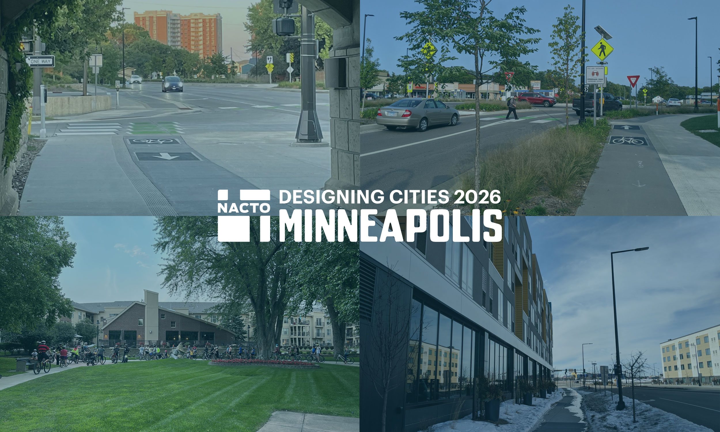
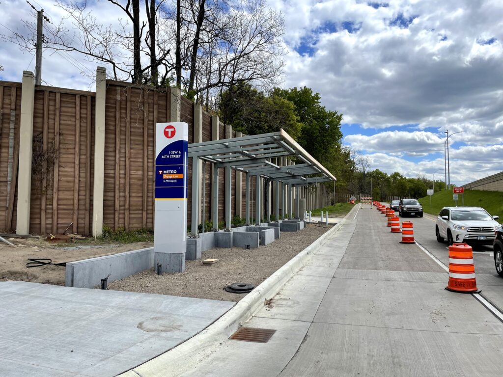
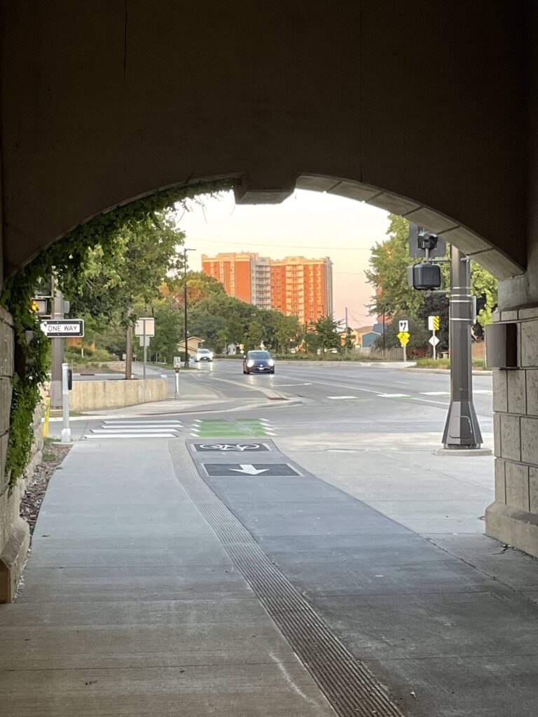
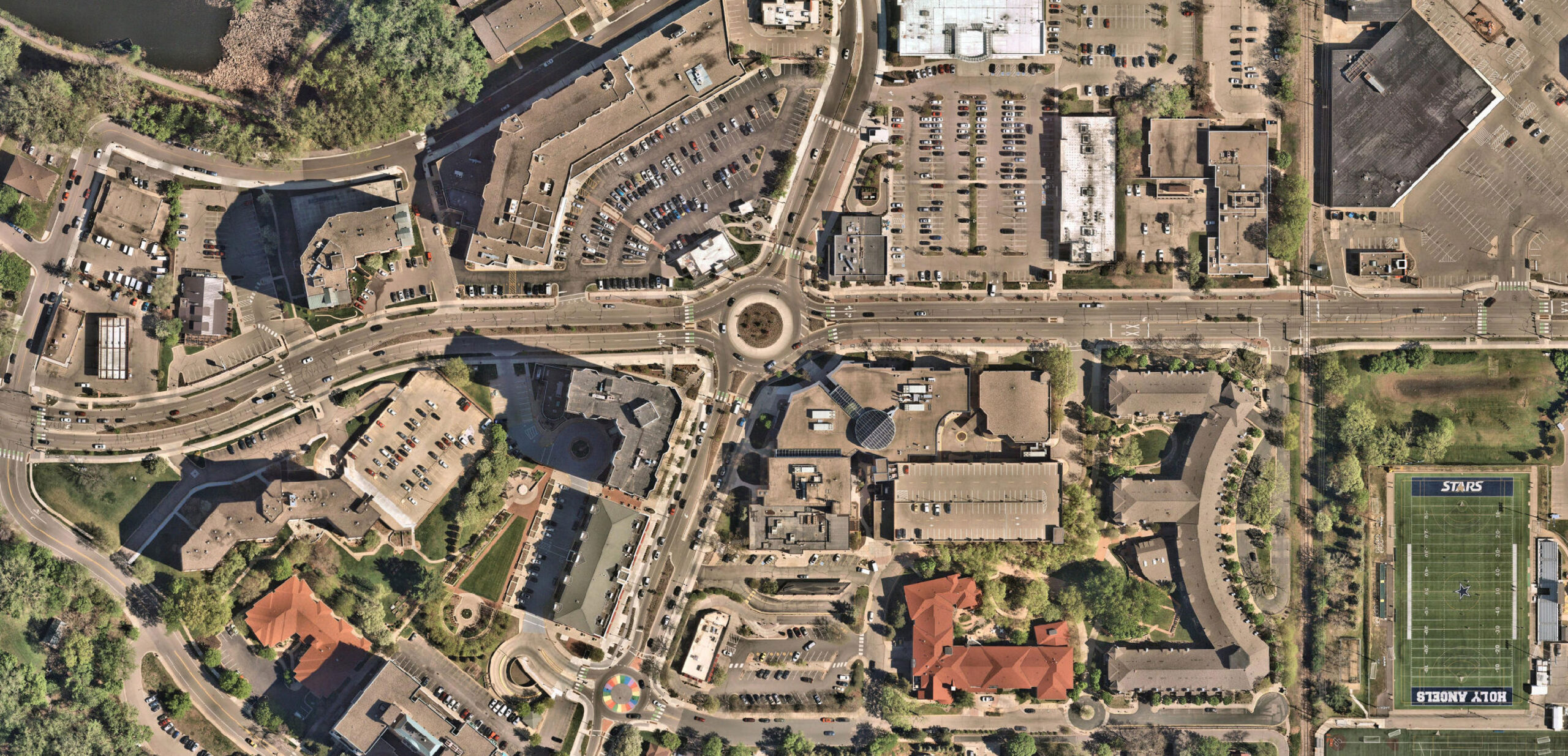
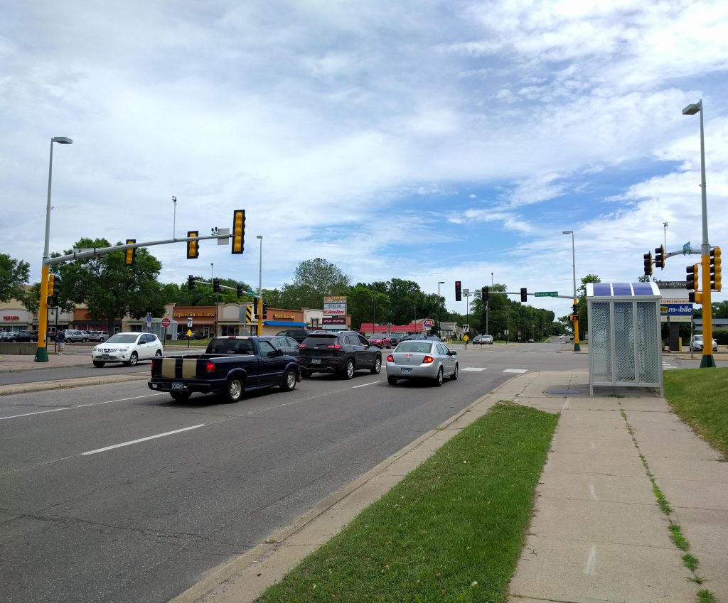
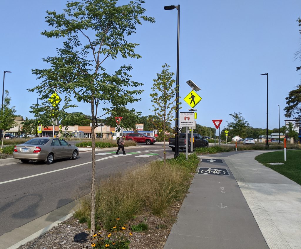
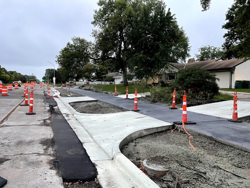
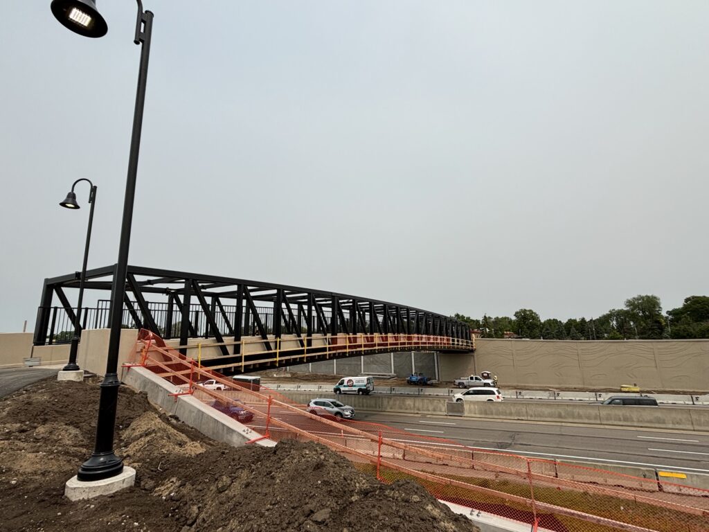
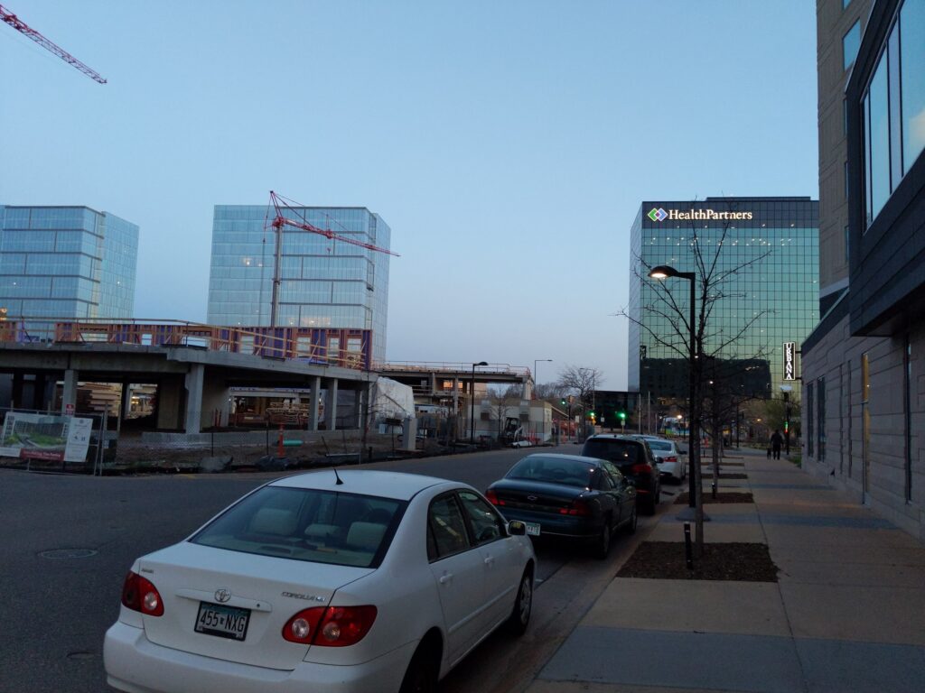
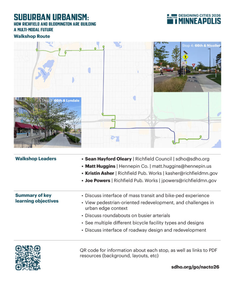
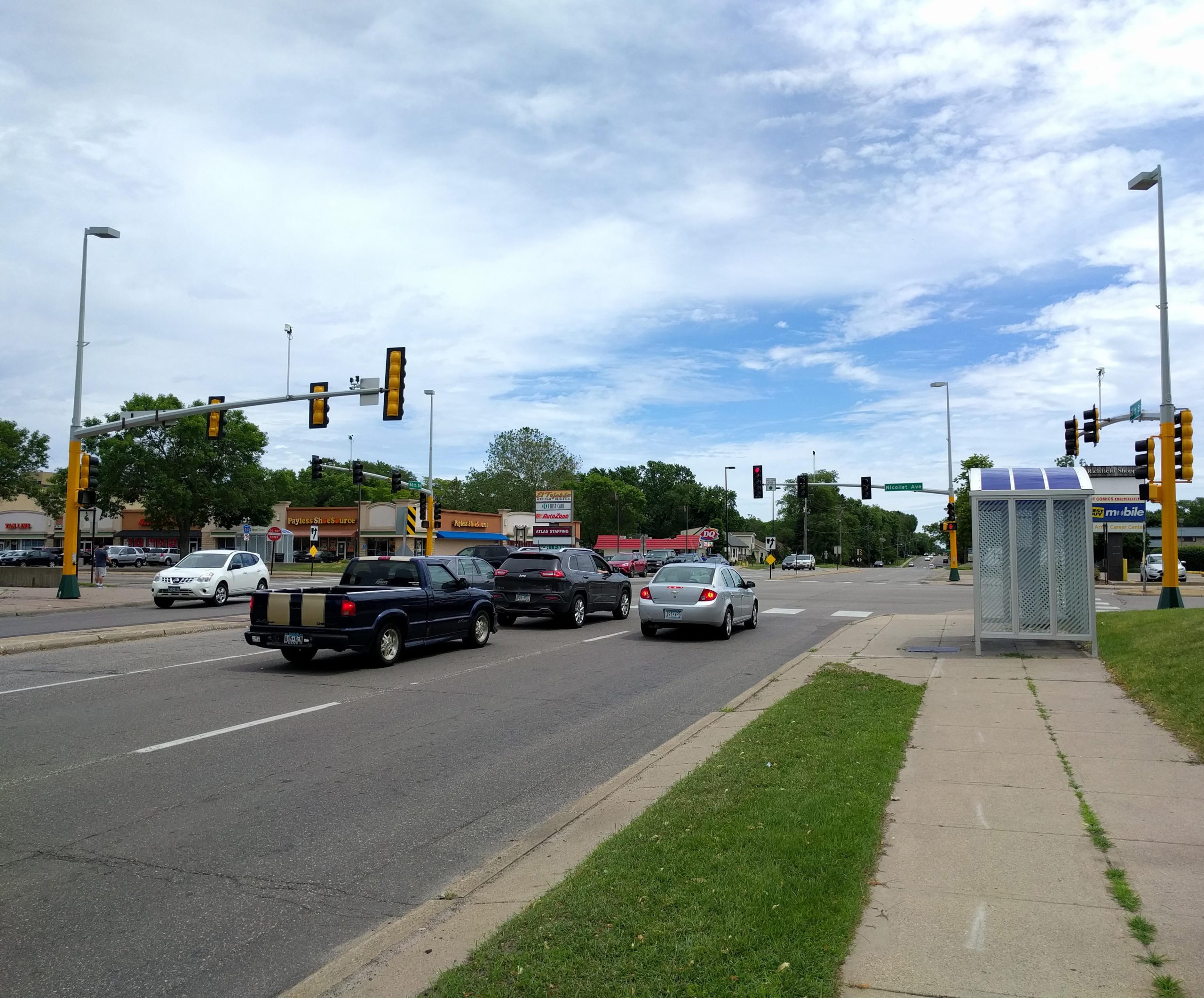
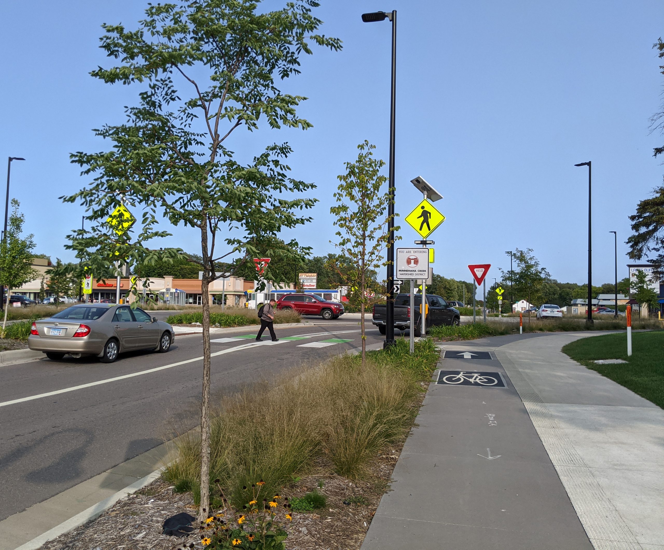
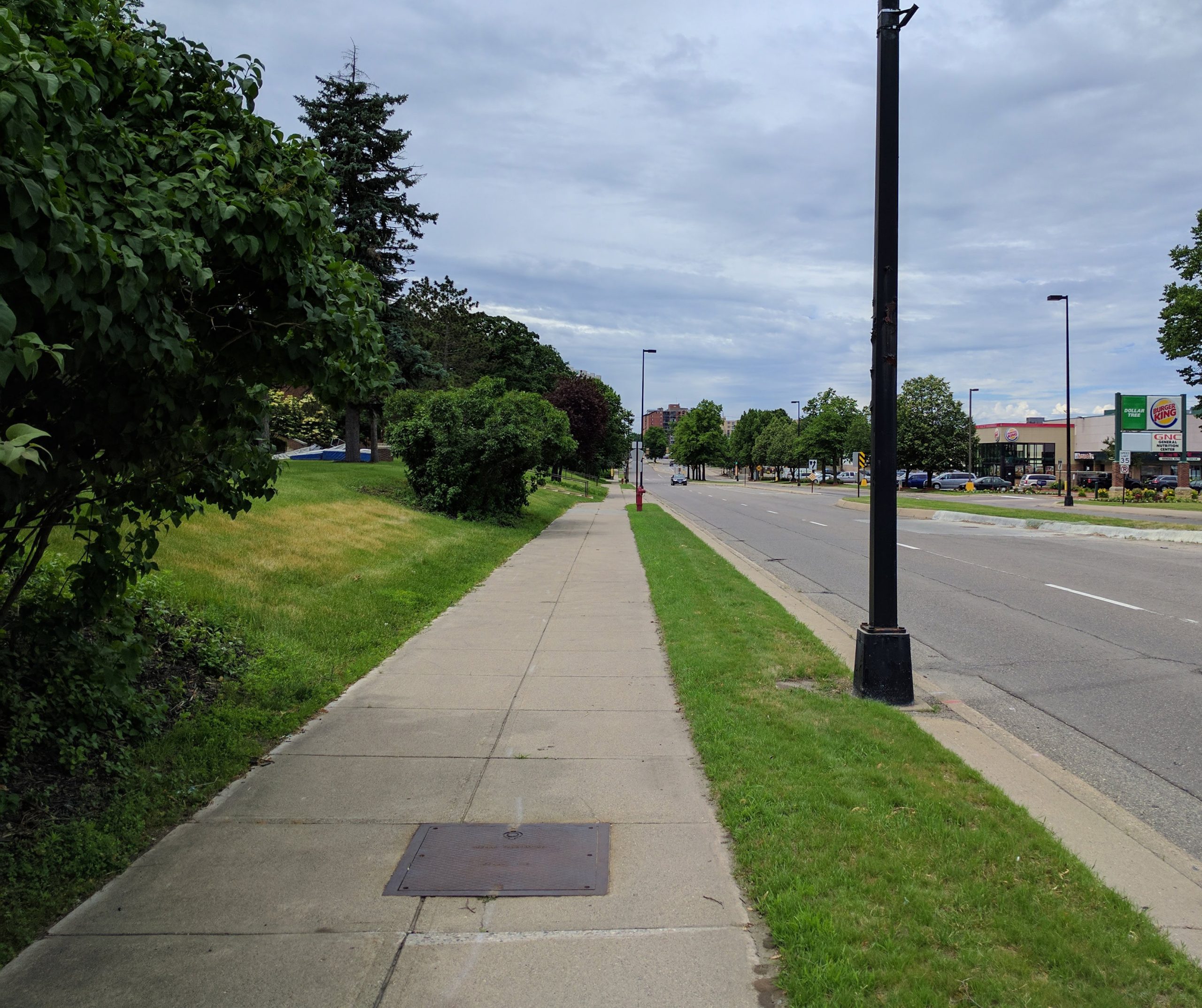
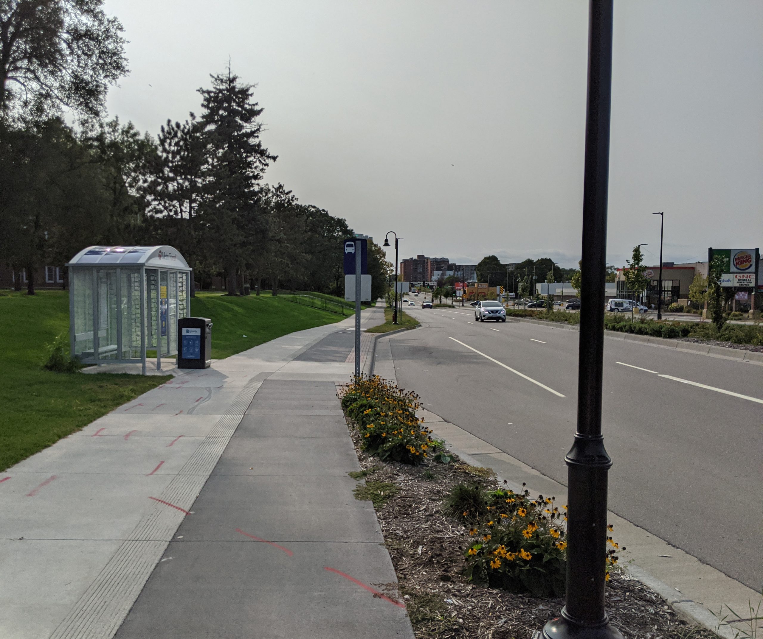
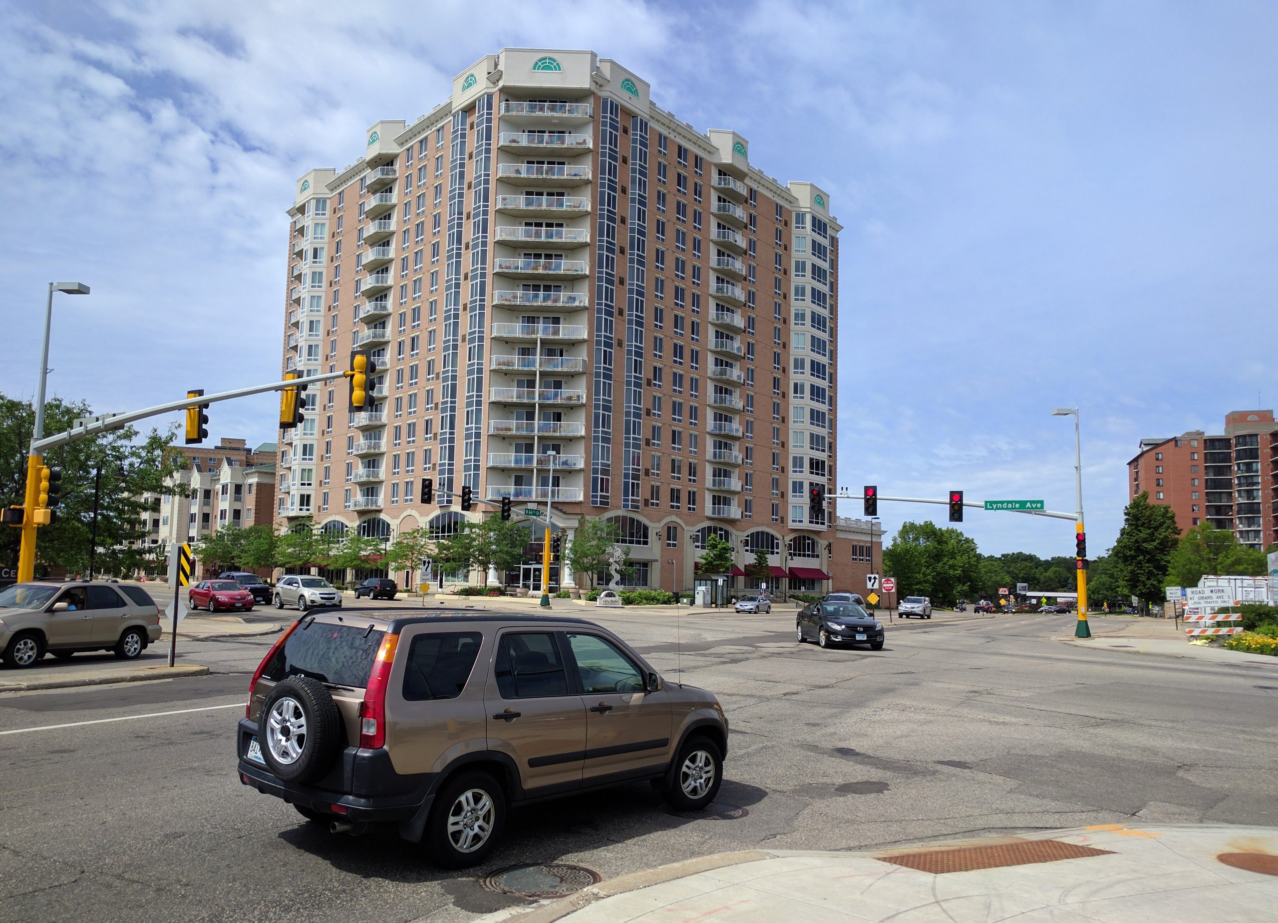
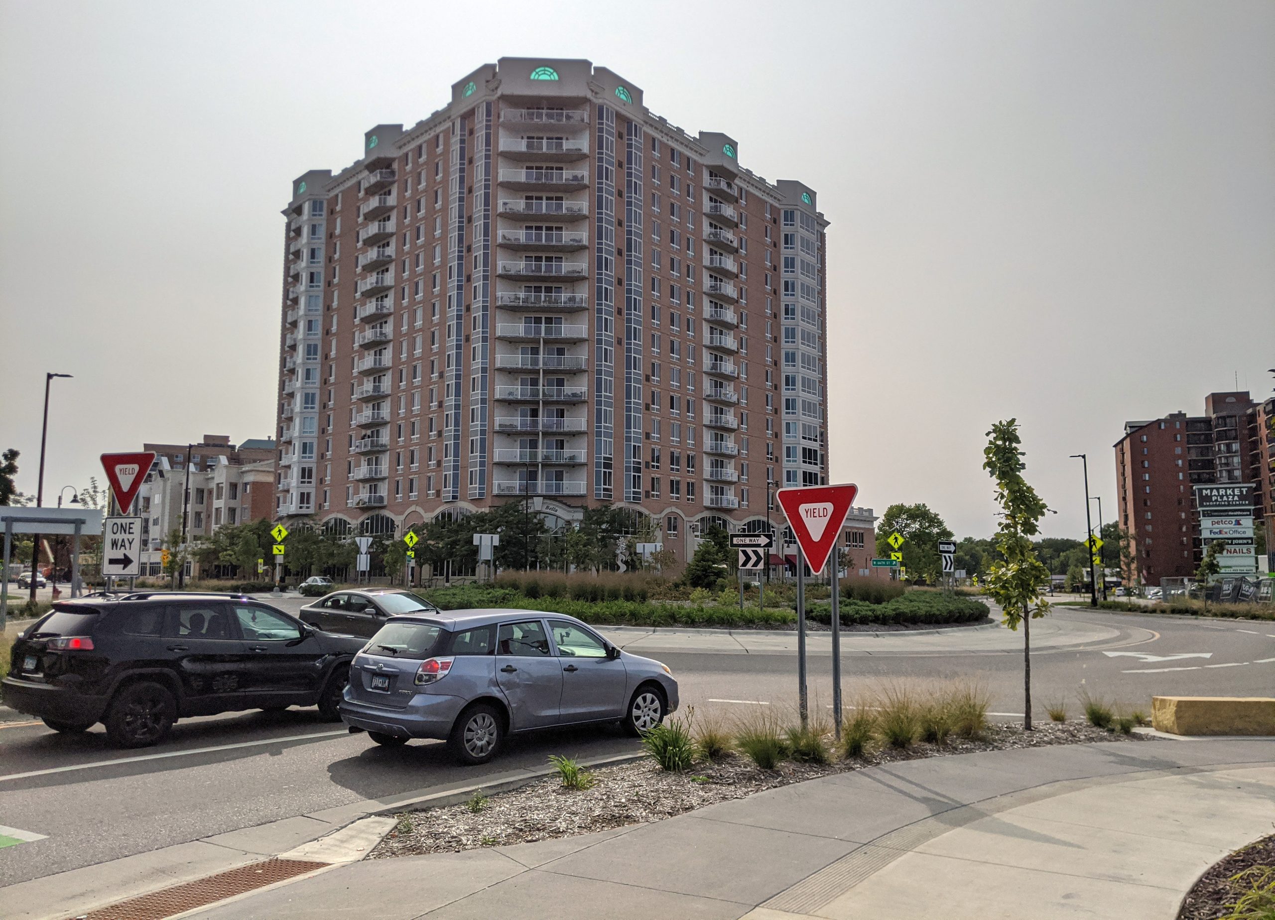
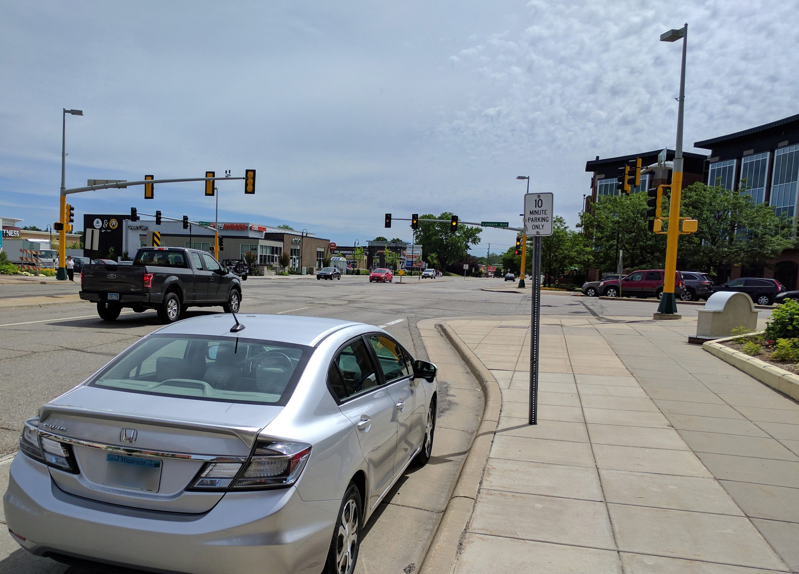
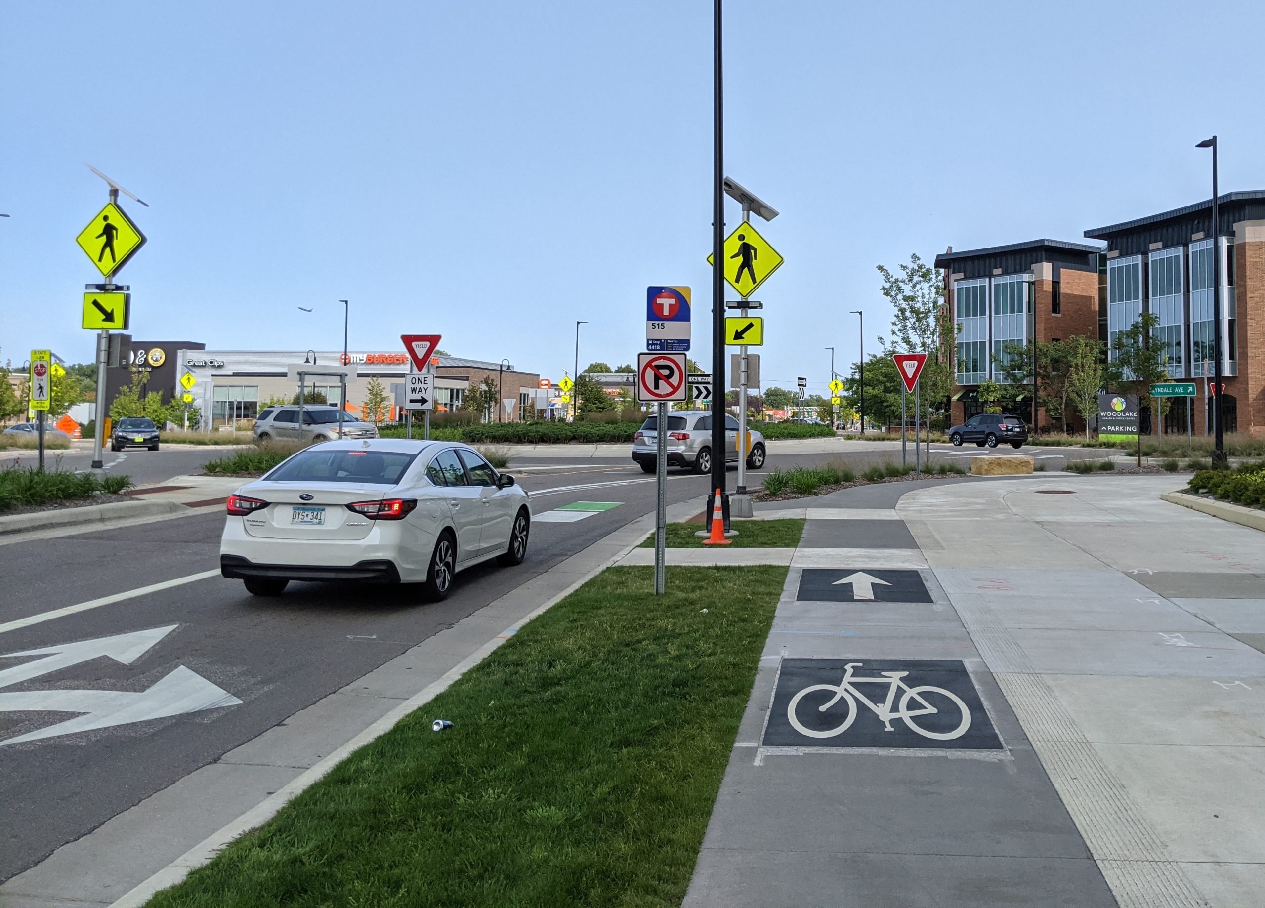
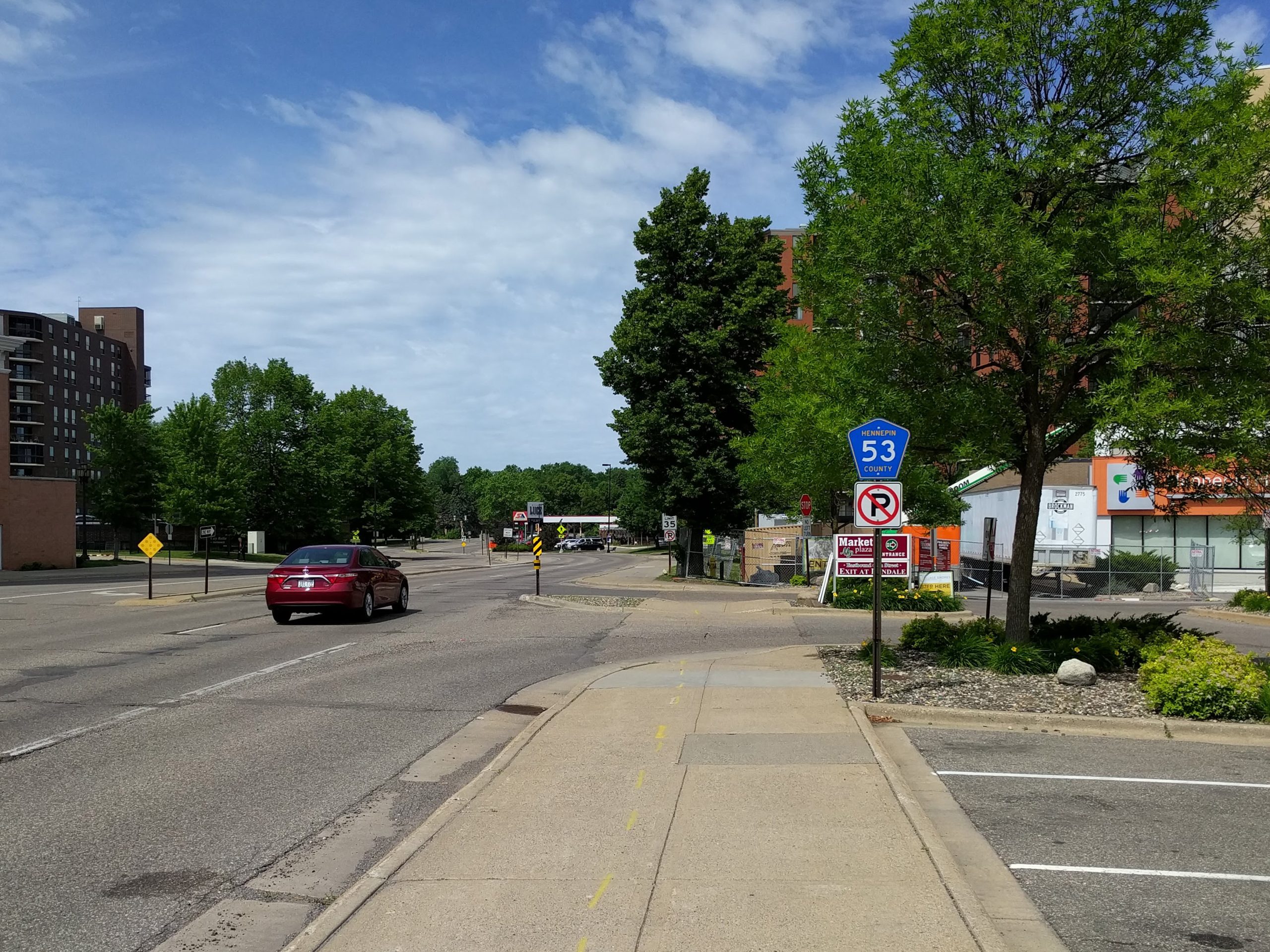
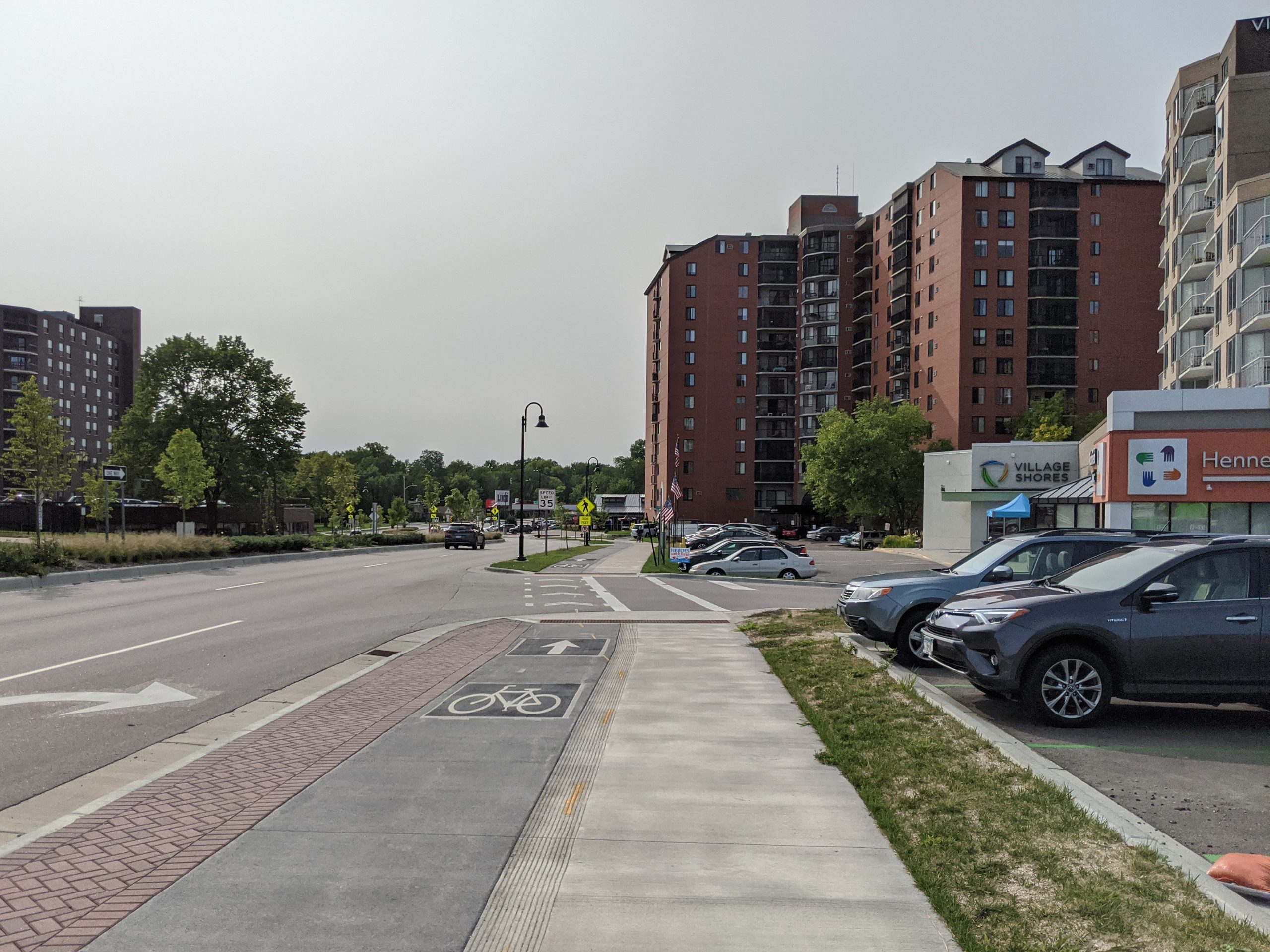
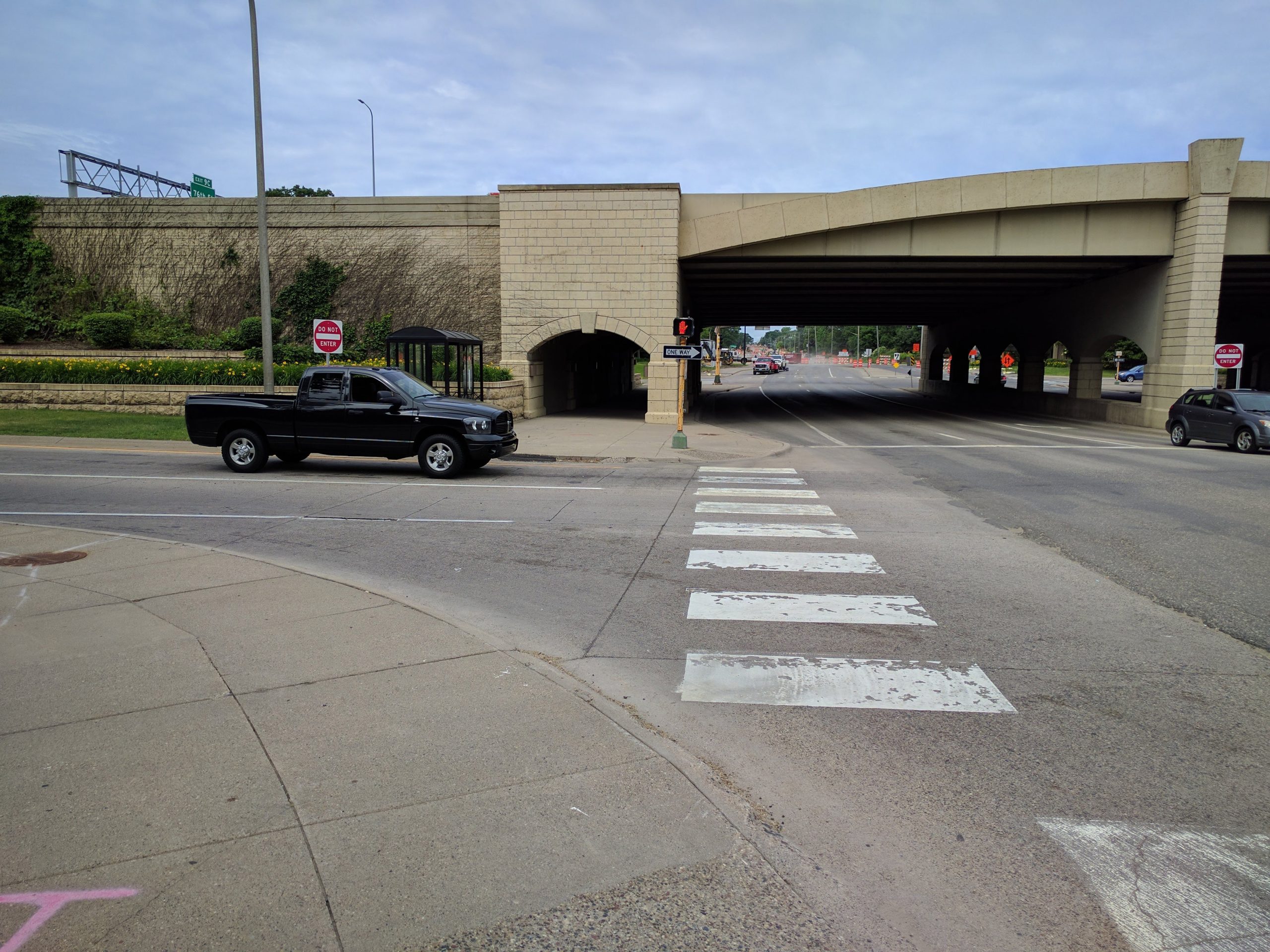
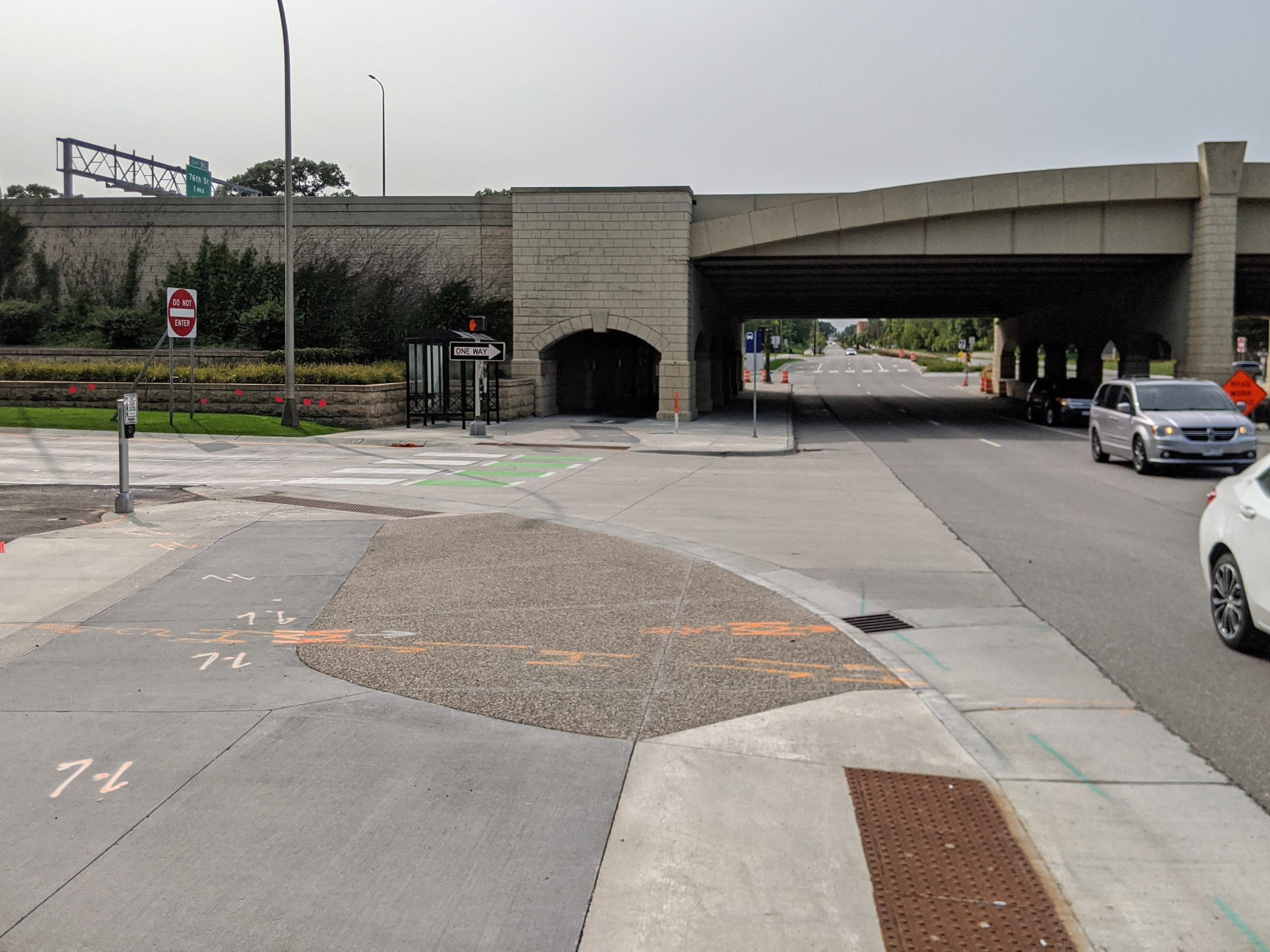
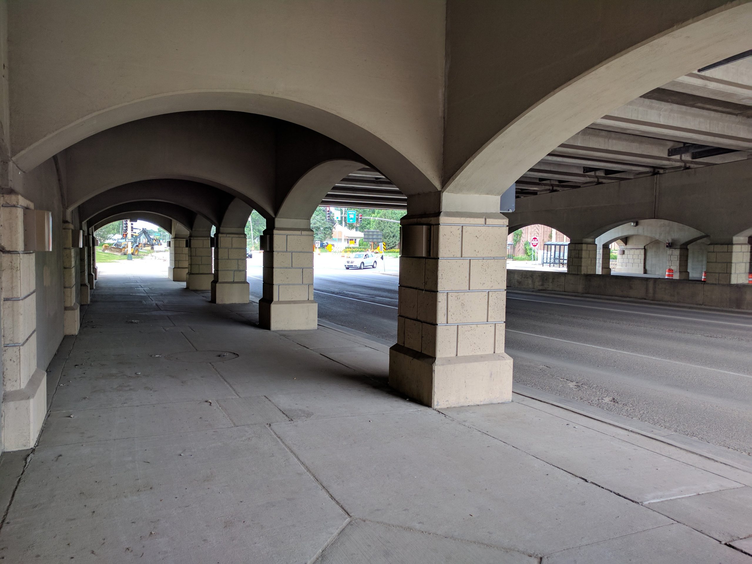
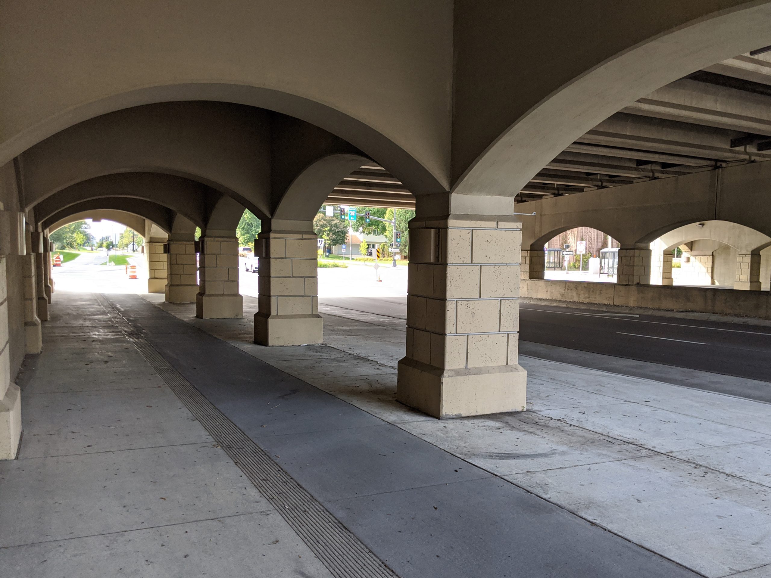
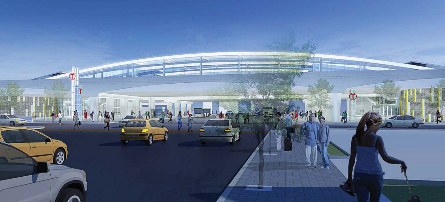
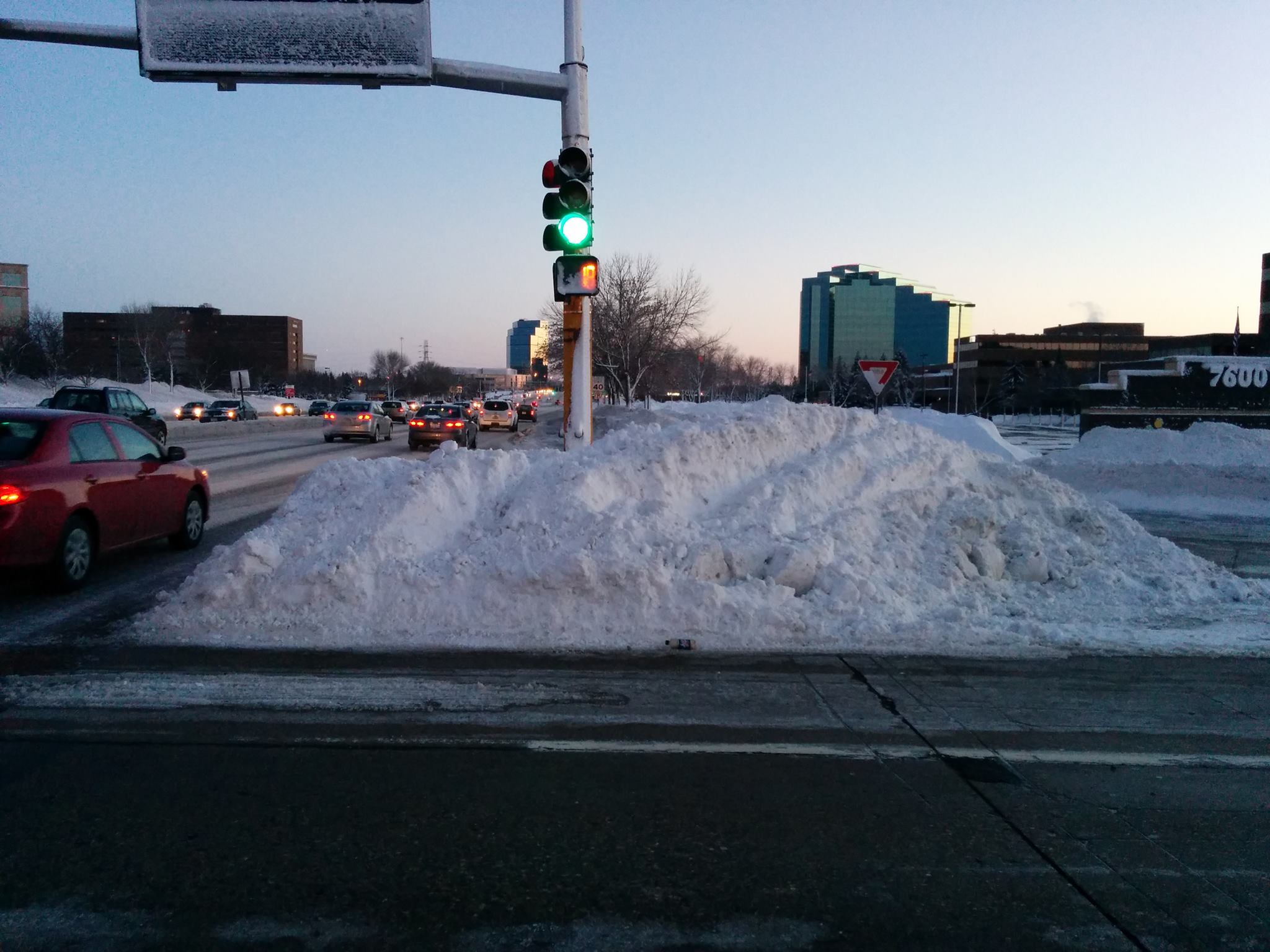
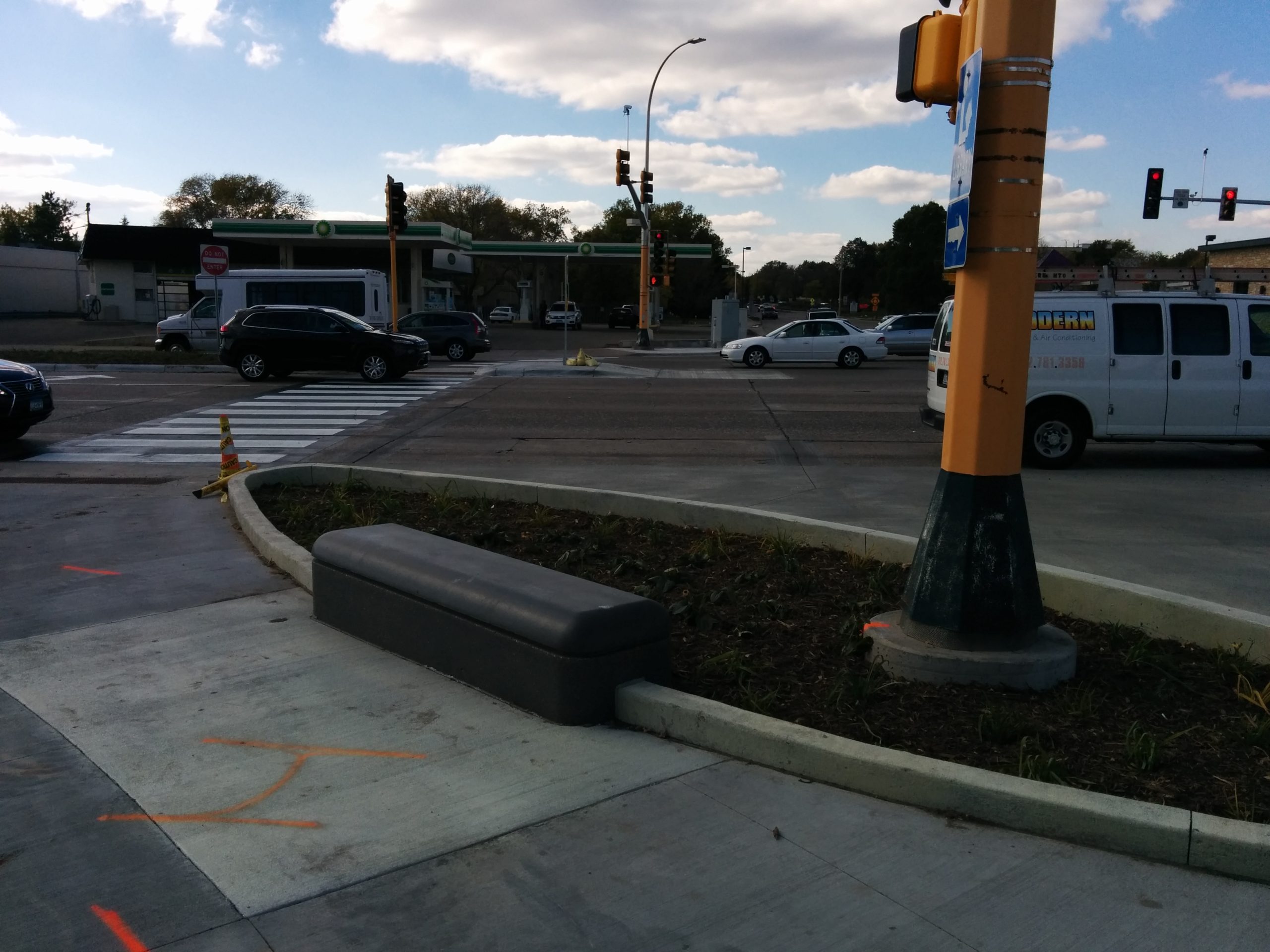
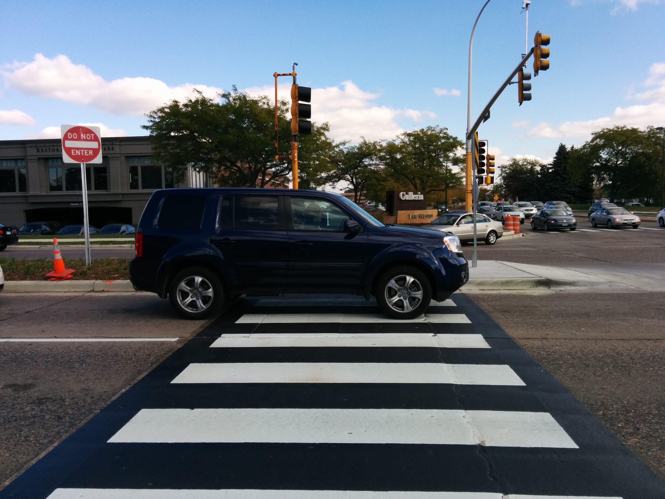
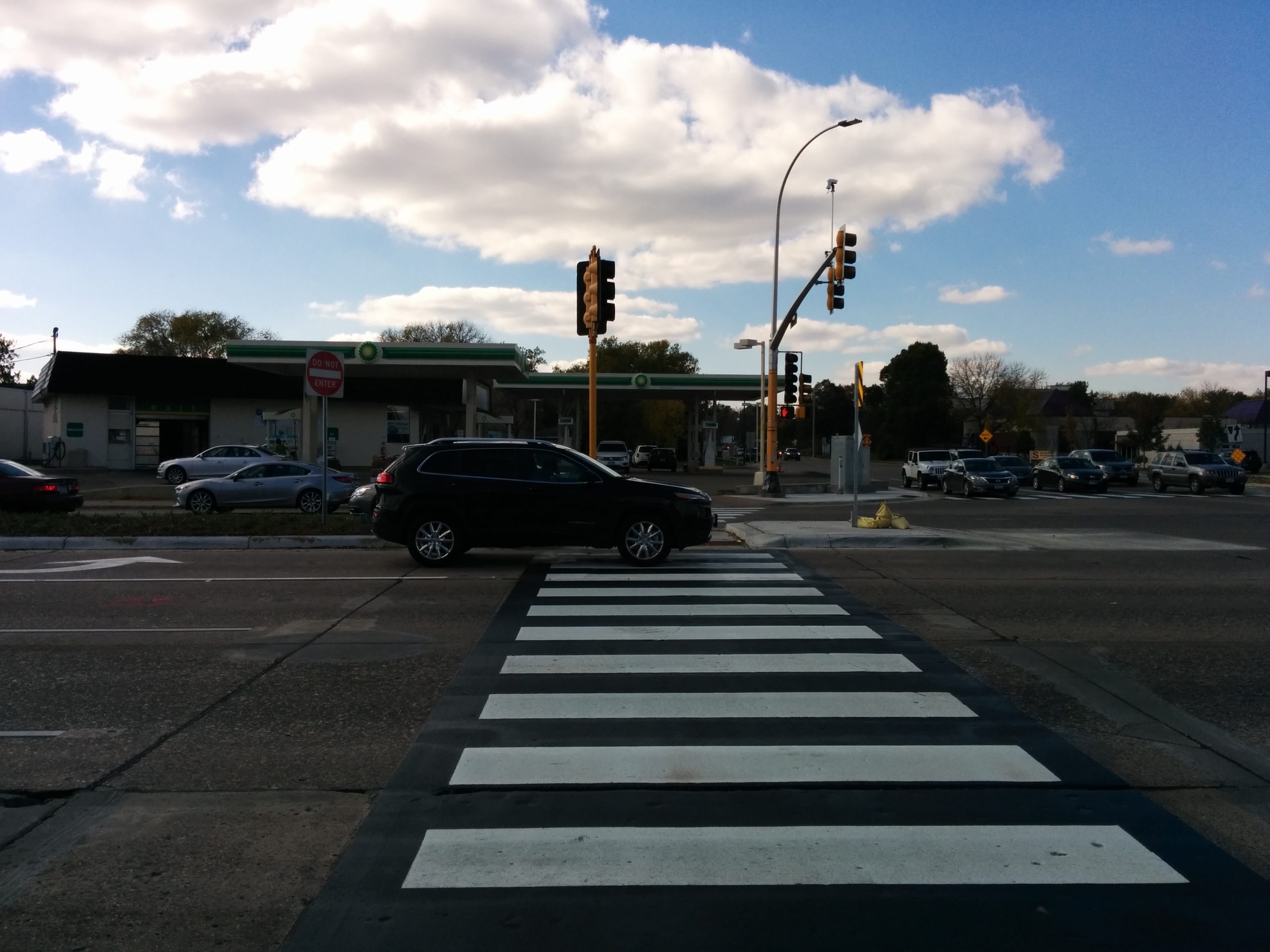
I-35W & 66th Street Orange Line Station, northbound platform during constructionProtected bikeway and sidewalk going under I-35W at 66th Street. Downtown Richfield in background.
Reflecting on the bus ride from downtown Minneapolis
Discussing history of Orange Line bus rapid transit and relationship to other bus routes (D Line, K Line, and local bus routes including 515)
66th Street & 35W underpass design, retrofitted for road project
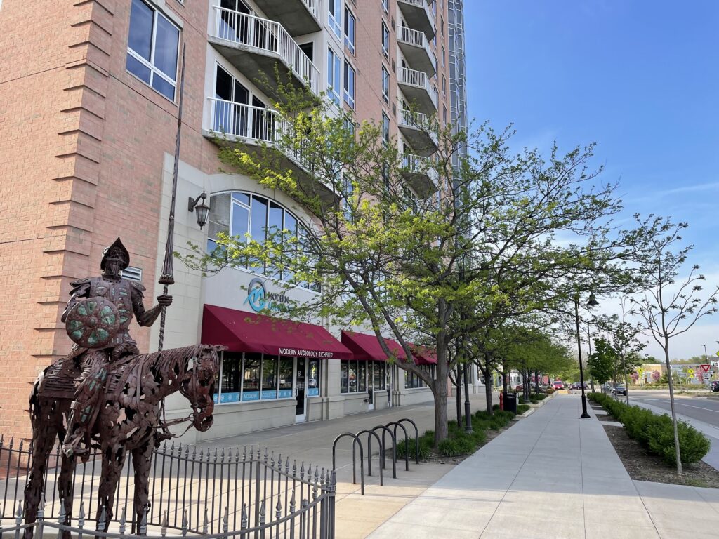
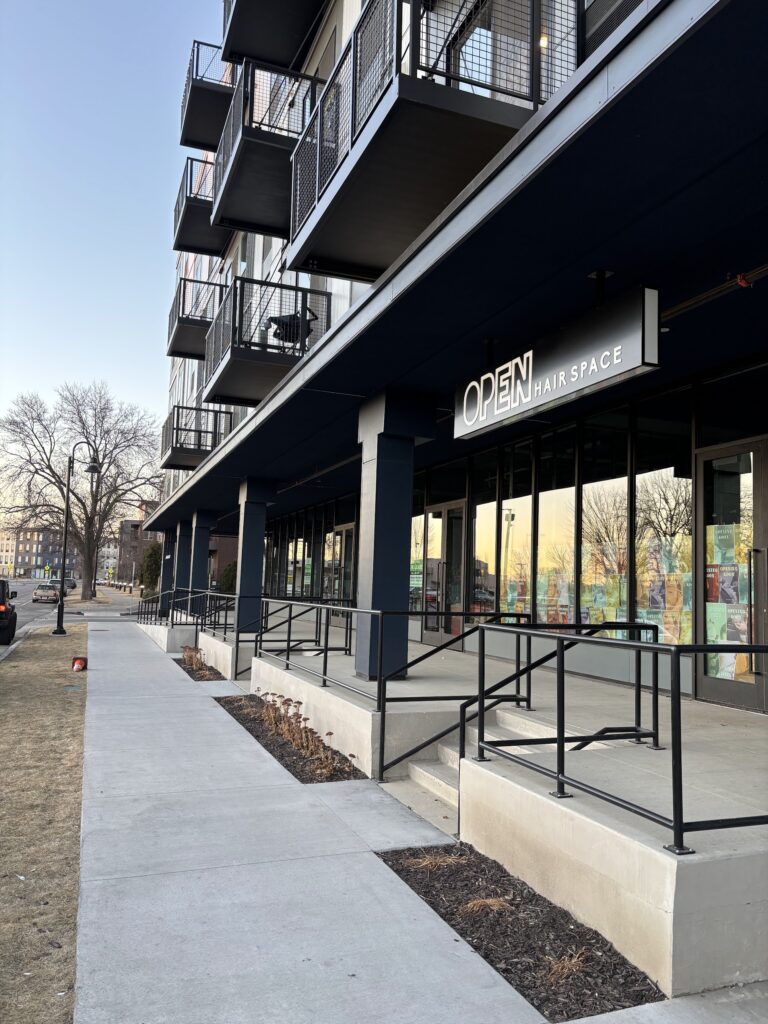
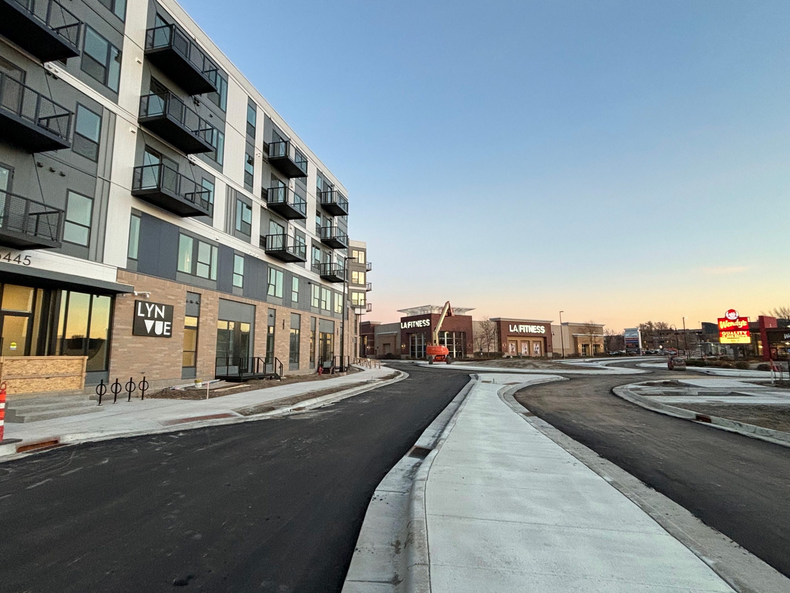
The 6600 block of Lyndale Avenue in downtown Richfield.Lynvue, a newer mixed-use rental project on the 6400 block of Lyndale
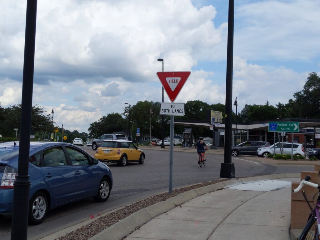
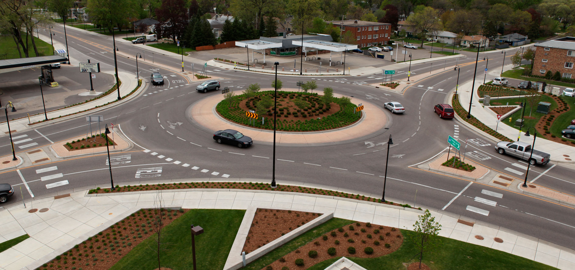
Richfield’s unique history of roundabouts — some of the busiest in the state. Check out the old Richfield Roundabouts website from when our first two opened!
Redevelopment, and challenges of creating great frontage in small urban-suburban downtown
Lyndale Avenue reconstruction to the south, and modifications to the north.
Protected bikeways and relationship between street design, maintenance, and building design (landscaping, bikeways, parking)
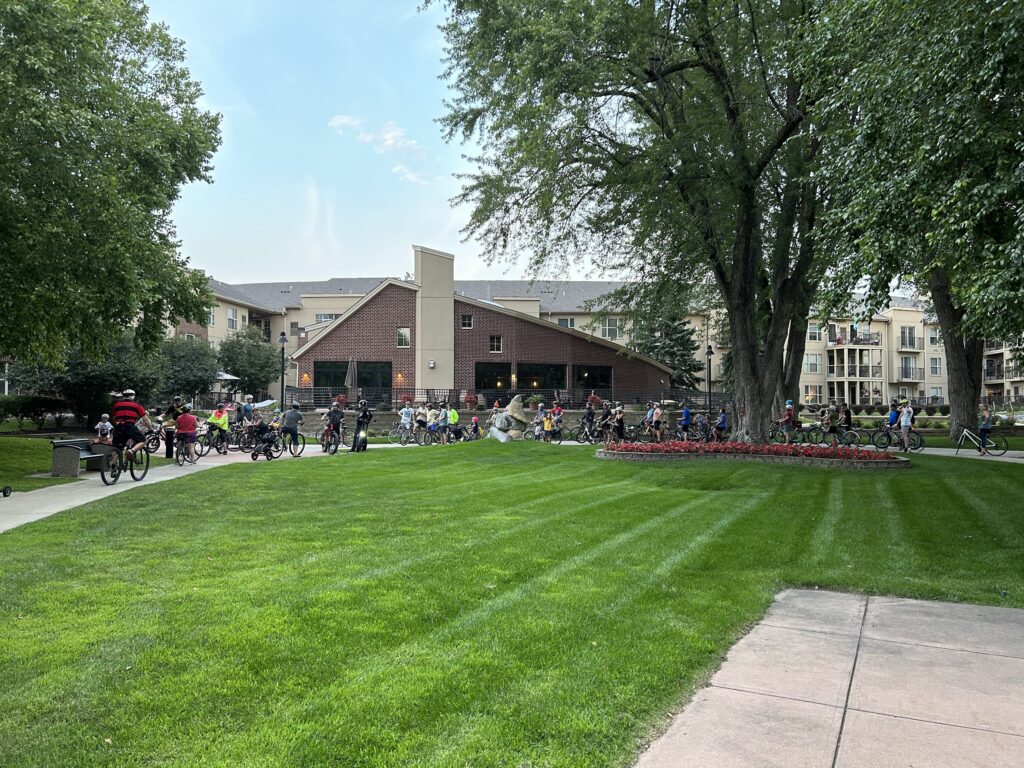
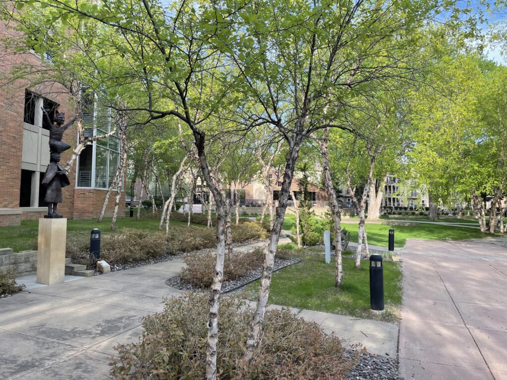
The lawn of the public-private Kirchbak Sculpture Garden in downtown Richfield, during a previous tour.The sculpture area of the public-private Kirchbak Sculpture Garden in downtown Richfield.
One of several “public-private” park spaces in downtown Richfield
Established as part of the massive “Richfield Urban Village” project
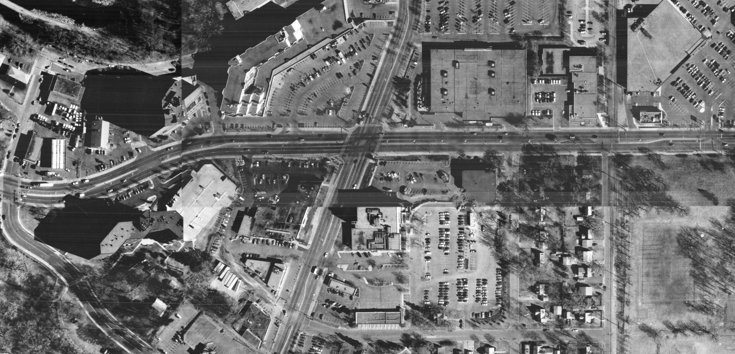
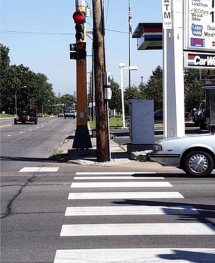
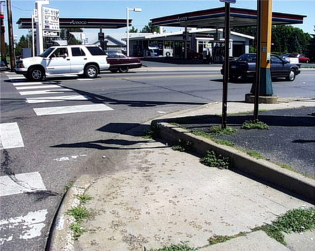
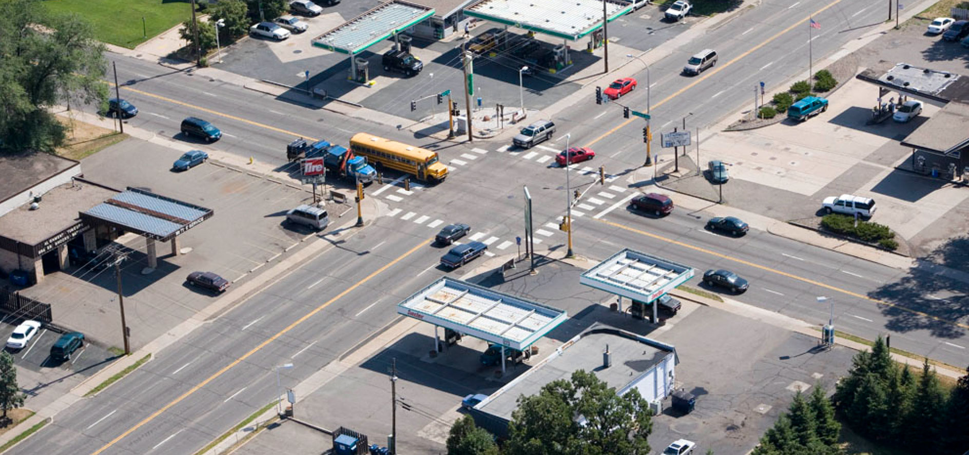
Portland & 66th pre-roundaboutNortheast corner of Portland and 66th before 2007, facing northView of the northeast corner of Portland and 66th before 2007, taken from southeast cornerView of the southwest corner of Portland and 66th before 2007, taken from the south leg crosswalk
Portland and 66th before and after rebuild — before is pre-2007, facing toward the northeast corner, after is post-2008, facing the southwest corner
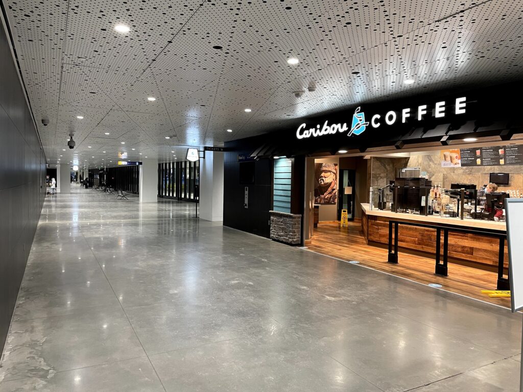
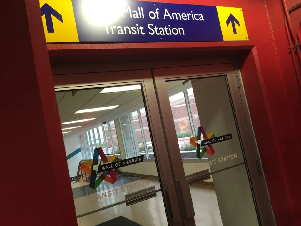
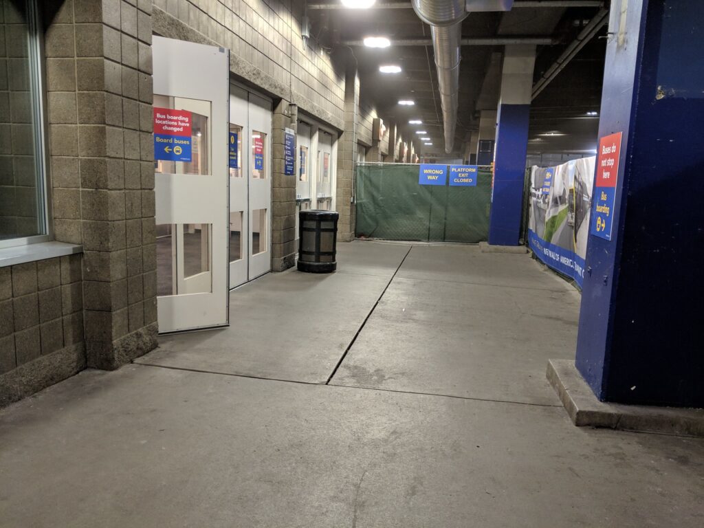
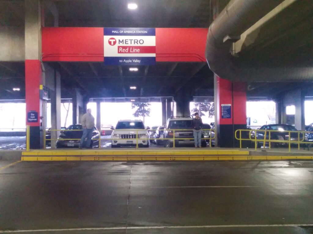
Connecting D Line, Blue Line, Red Line, and many local bus lines
Busiest transit station in the state
Significantly renovated 2020
Mall of America Station prior to 2020 renovationThe primary entrance to station used to be from parking ramp only, not mall interior (photo by LocalMN Interactive)Boarding area prior to 2020 (photo by Mike Hicks)The original Red Line boarding area at Mall of America Station prior to 2020
Minneapolis, Minn — The Minnesota Department of Transportation, the City of Minneapolis, and the Minneapolis Park and Recreation Board announced a new collaboration this morning: a complete reconstruction of St. Anthony Main, led by MnDOT.
“Who needs greenery when you’ve got the Green Book?” mused Minneapolis mayor Jacob Frey.
Commissioner Nancy Daubenberger, Mayor Jacob Frey, and local council member Michael Rainville cut the ribbon on the new project.
Low RQI informs reconstruction need
The current brick surface and granite curbing create significant maintenance and compliance issues on the existing roadway. Low ride quality index scores suggest a need for complete reconstruction of the roadway.
Context-sensitive solutions
“If there’s one thing MnDOT knows, it’s Main Street,” said transportation commissioner Nancy Daubenberger. “We’ve led several remarkable reconstructions of trunk highways that run on small town main streets throughout greater Minnesota.
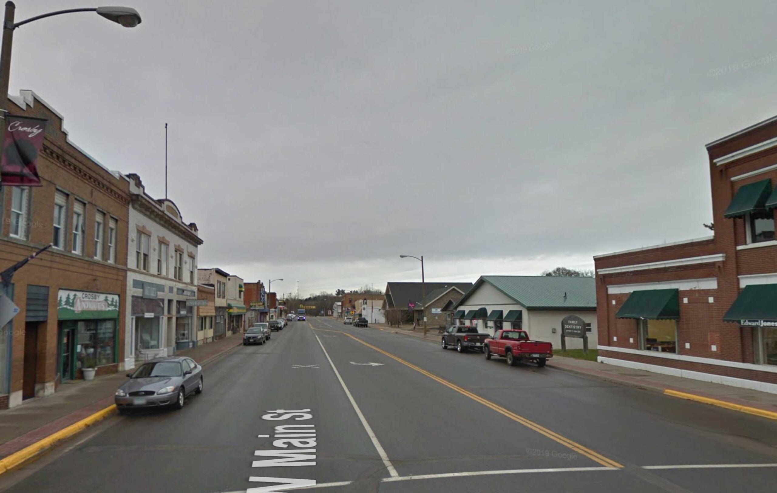
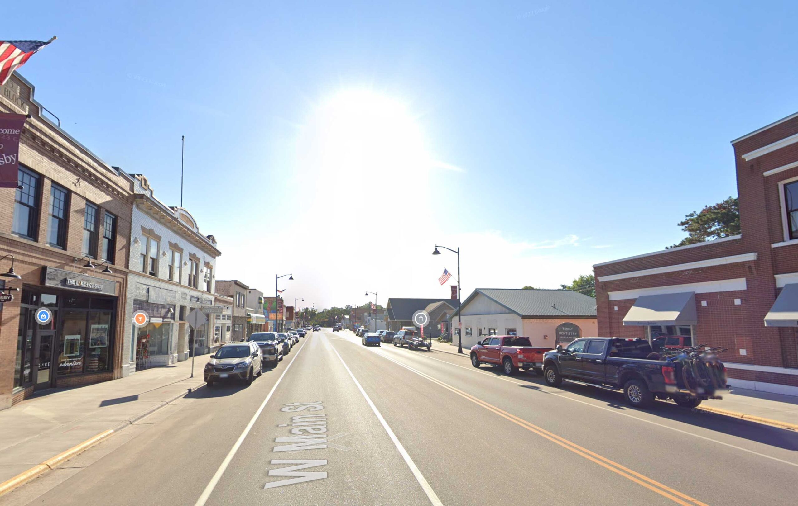
“In Crosby, Minn, in 2021, we transformed an unsightly old trunk highway — with two travel lanes, a continuous center turn lane, and narrow sidewalks — to a pedestrian-centered main street — with two travel lanes, a continuous center turn lane, and incrementally less narrow sidewalks.
“We’re thrilled to bring this skillset to the core of the Twin Cities.”
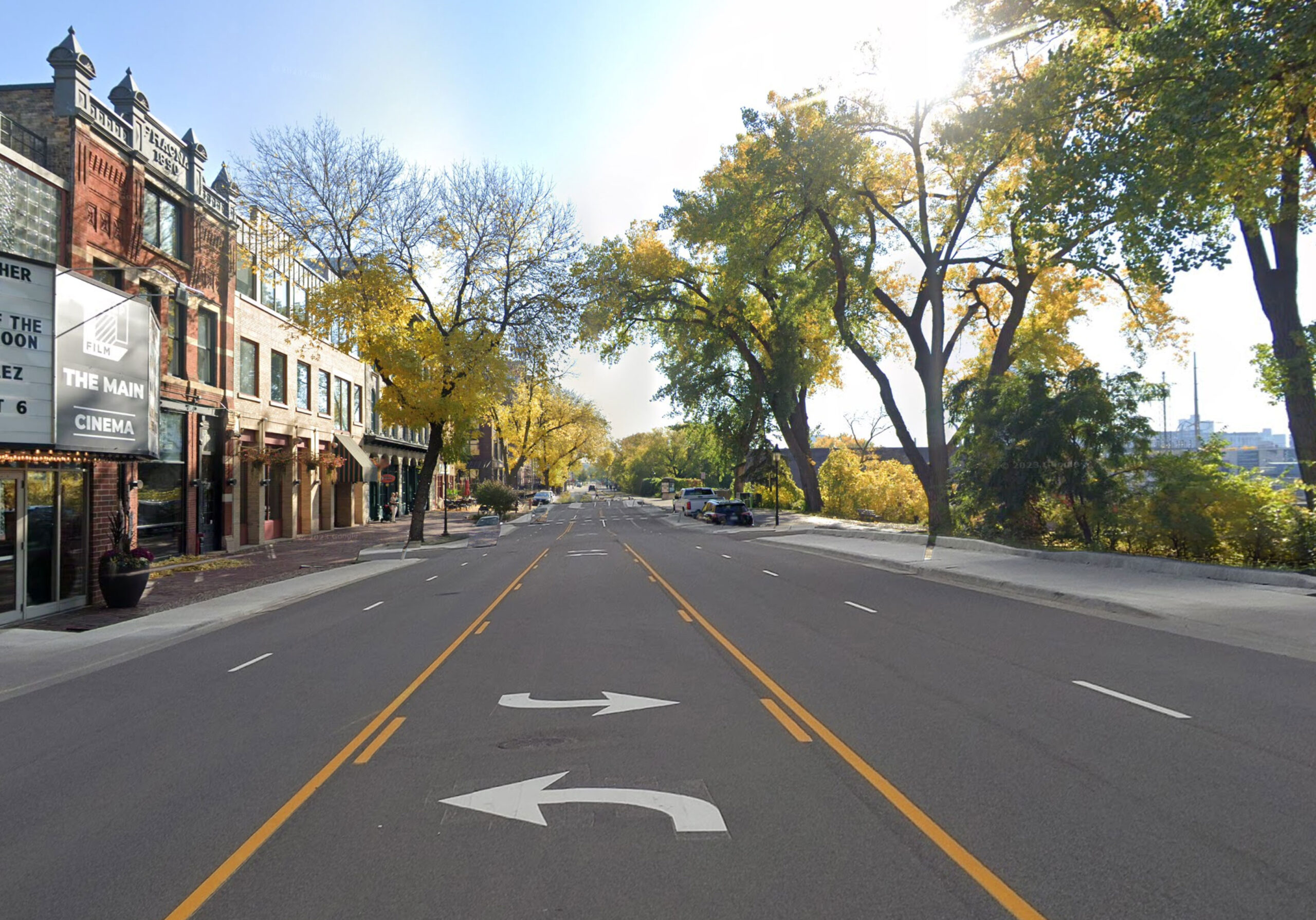
MnDOT led the transformative reconstruction of Crosby’s Main Street in 2021, changing a dilapidated trunk highway to a context-sensitive, pedestrian-oriented historical main street. These images are not altered. (Images: Google Street View)
Crosswalks create danger
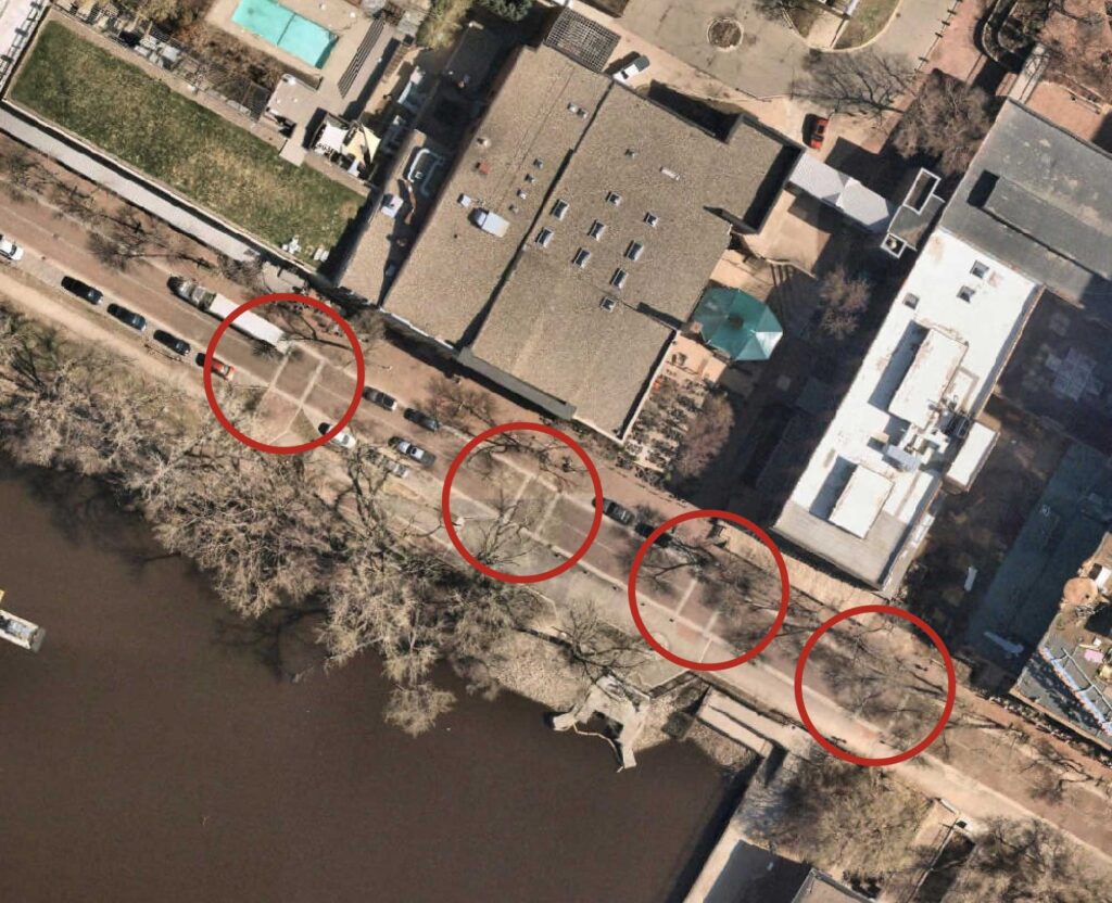
One of the most serious flaws of the current Main Street is the frequent marked pedestrian crossings that connect the restaurants and businesses to the Mississippi River.
“Now I know, common sense might tell ya, give a pedestrian a crosswalk and they’ll have a safe place to cross,” explained Mayor Frey in an interview with Streets.mn. “But our engineers down at MnDOT explained that inviting pedestrians to cross the street at all, ever, creates a false sense of security. Removing the crosswalks will help foster community and safety.”
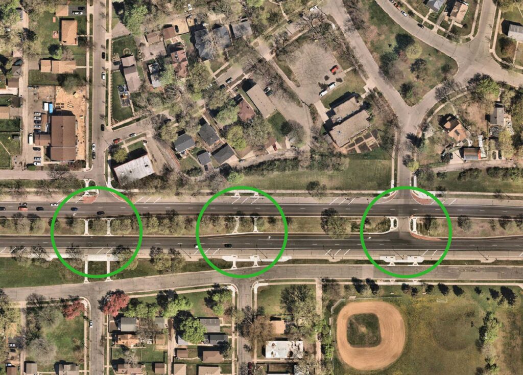
Current crosswalks on St. Anthony Main are frequent and create a false sense of security.On another widely admired MnDOT facility in Minneapolis, a safer approach is used: no markings are provided at all, and pedestrians are made to be too frightened to even attempt to cross.
Opportunity for placemaking
St. Anthony Main is home to many beloved businesses, some of which are expected to survive the three-year construction process.
Despite its poor condition, the roadway is widely used by professional photographers as a backdrop for portraits, from senior photos to wedding shoots.
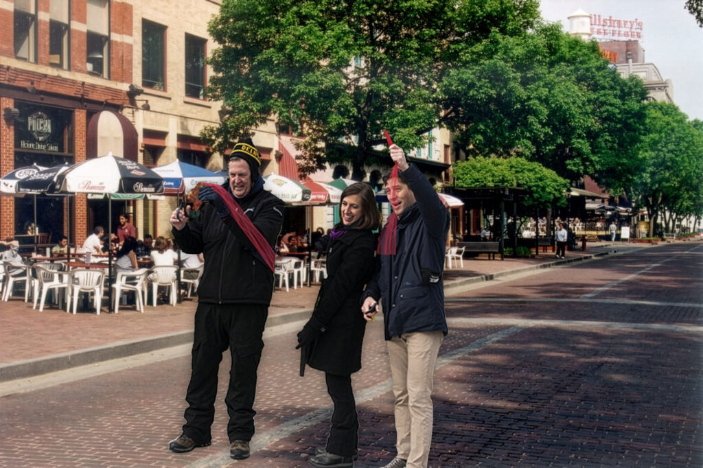
The author himself posed for a portrait on the roadway in 2011 under its previous condition:
The improved roadway is expected to be a much more popular setting for portraits:
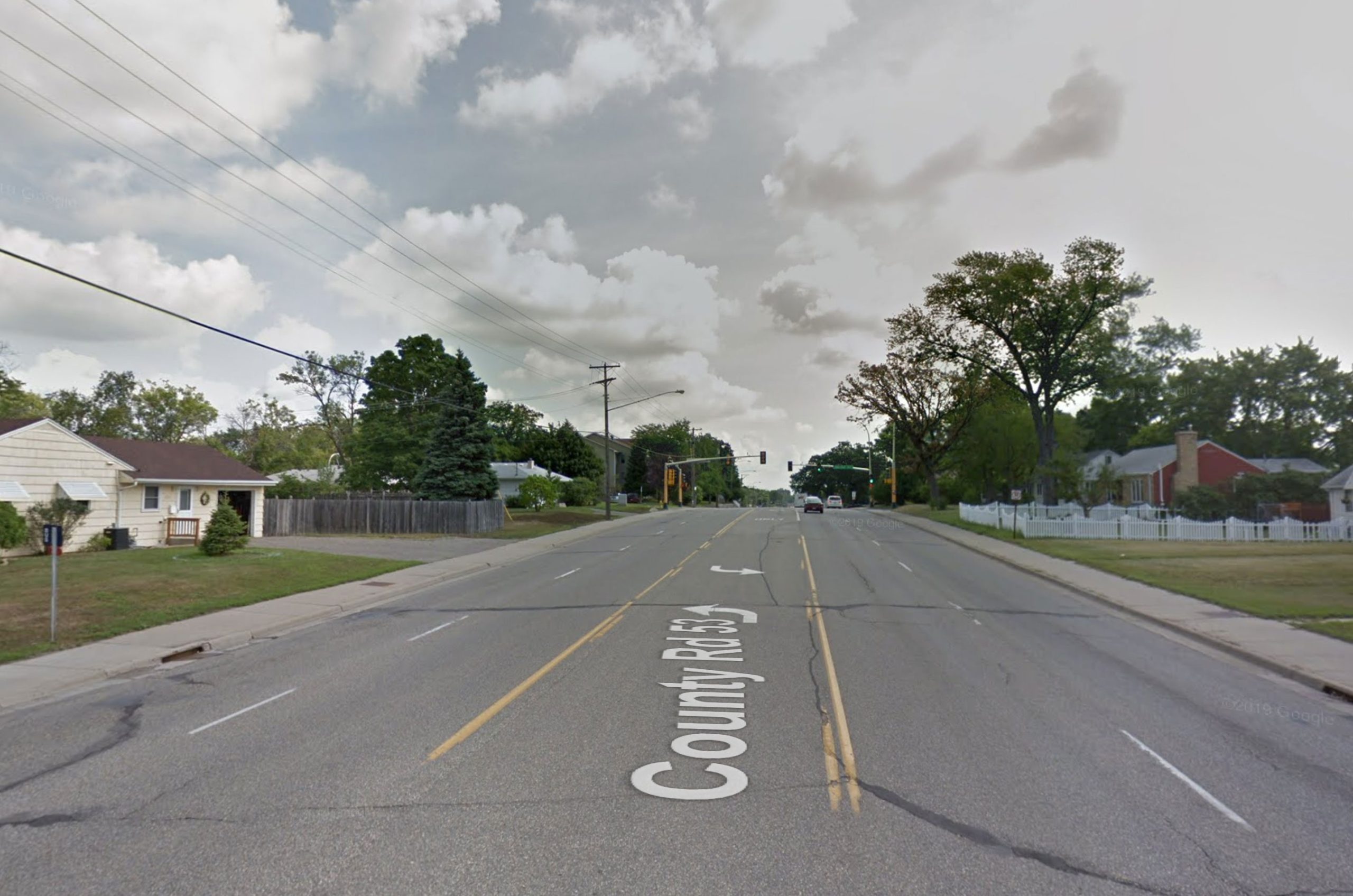
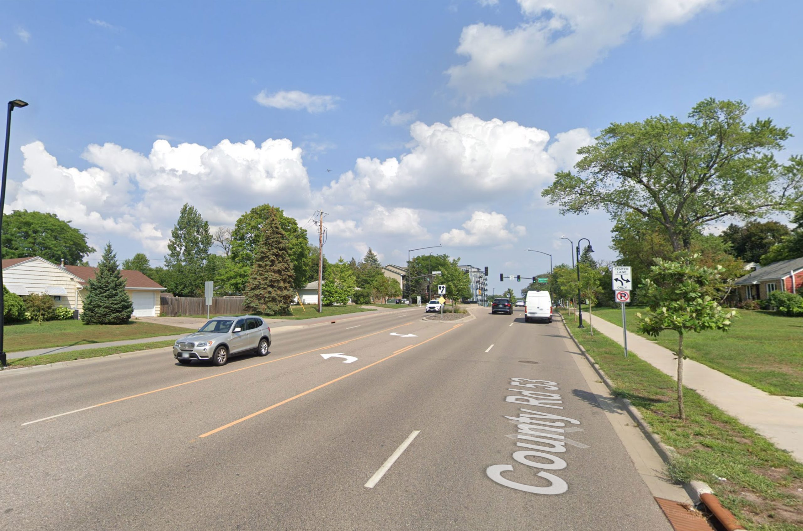
Note: this is from my personal perspective as a Richfielder and a supporter of the new 66th. It is not City of Richfield communication.
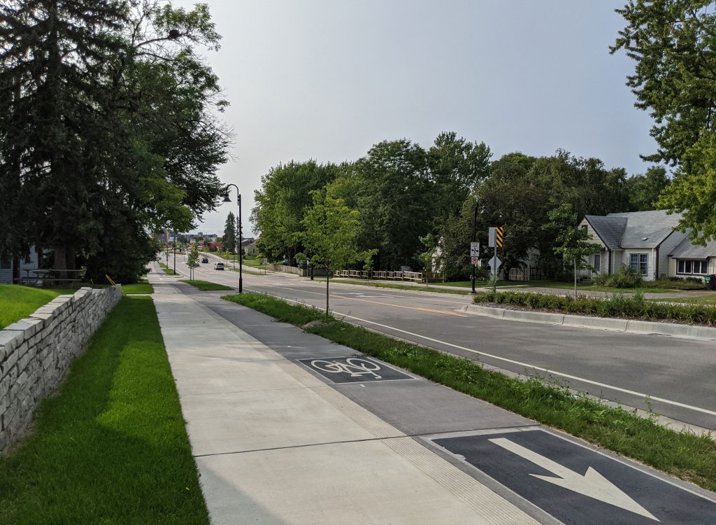
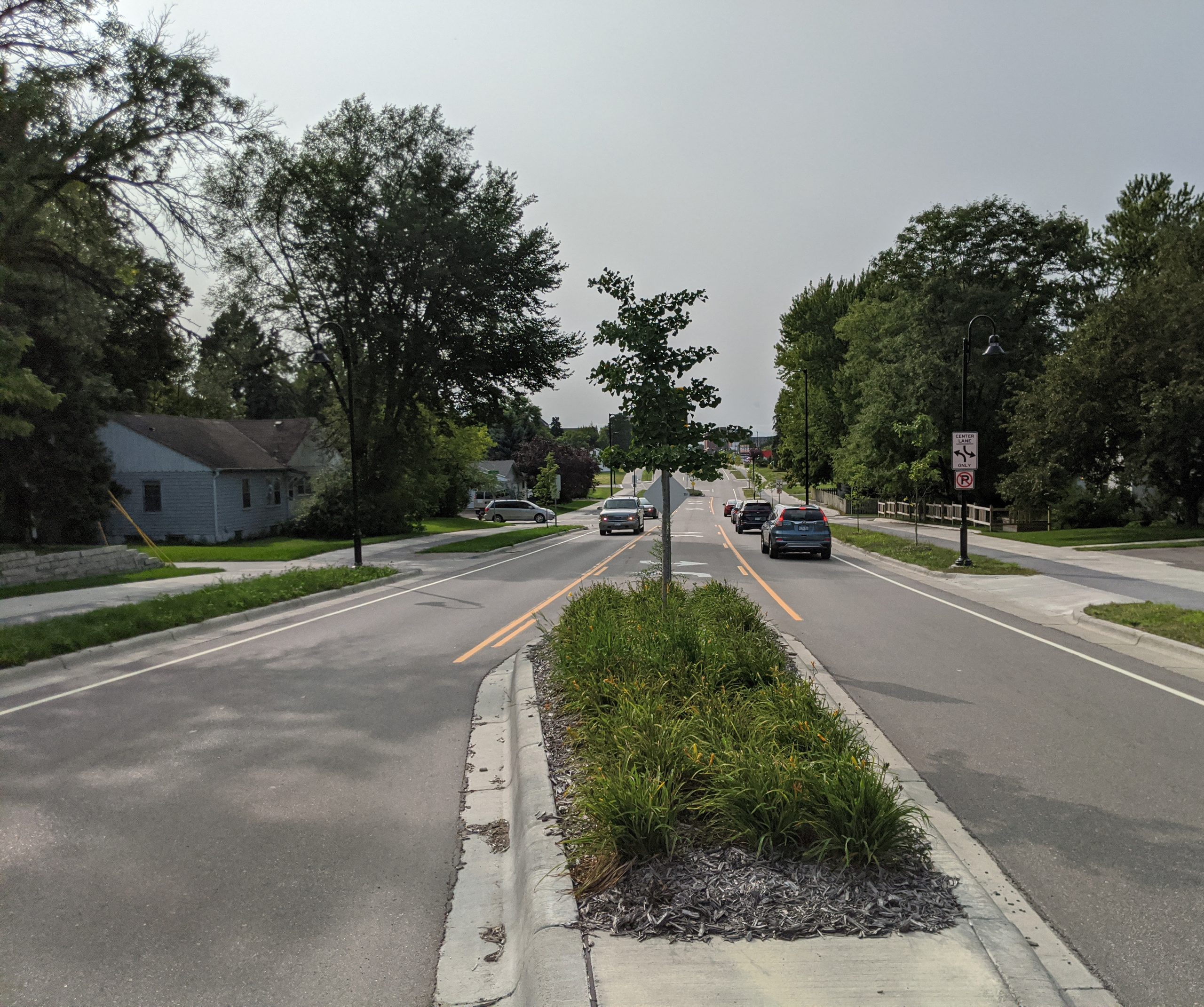
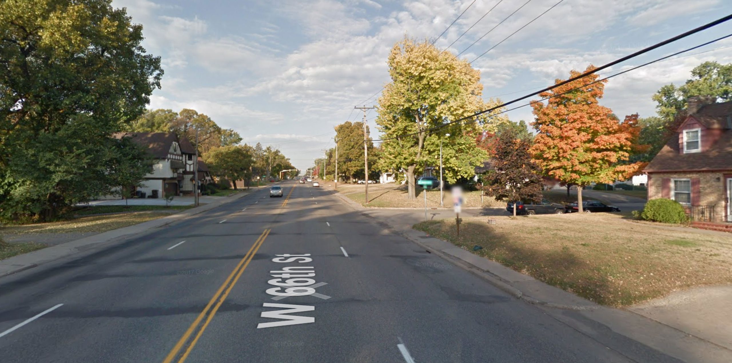
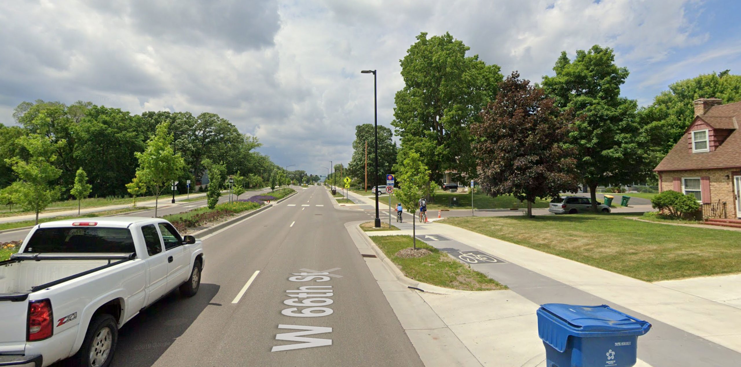
From 2016 to 2018, Richfield and Hennepin County rebuilt 66th Street, Richfield’s main street. The project was the most ambitious rebuild of an arterial Richfield had ever undertaken, and set precedent for the region — the first example of an extensive use of a sidewalk-level, one-way protected bikeway.
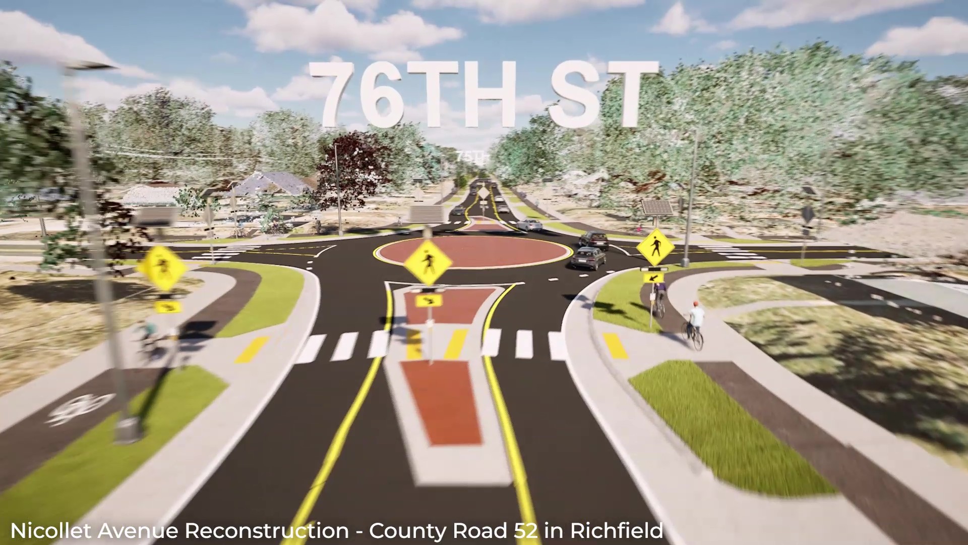
This design has been used in other cities since, and a similar design was selected for the 2026 rebuild of Nicollet Avenue in Richfield.
The project rebuilt 66th from Xerxes Avenue to 16th Avenue (near Cedar). Unfortunately, a small gap area around Portland Avenue was omitted from the project, creating a discontinuity for cyclists and pedestrians.
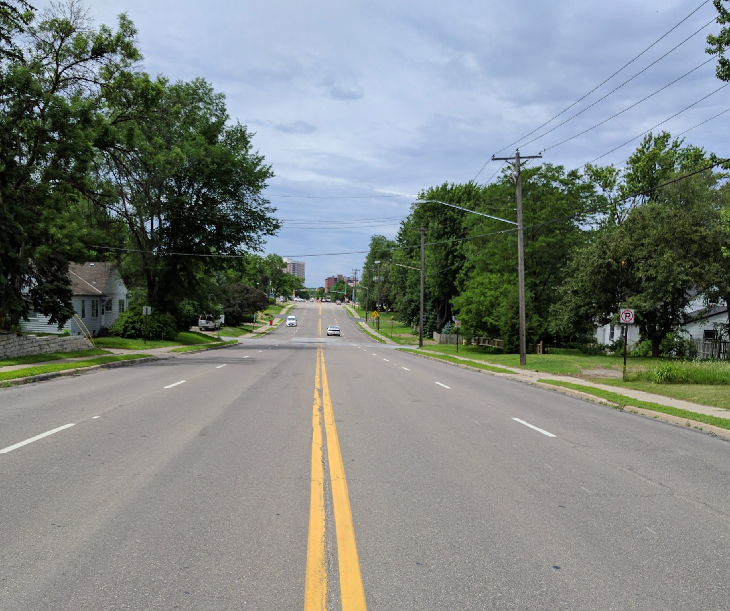
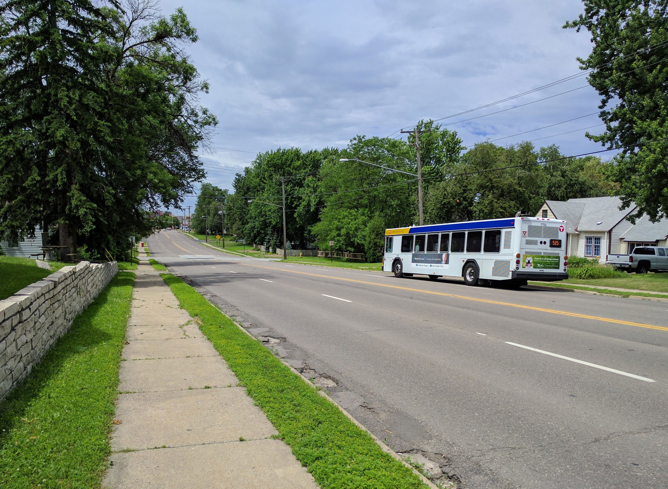
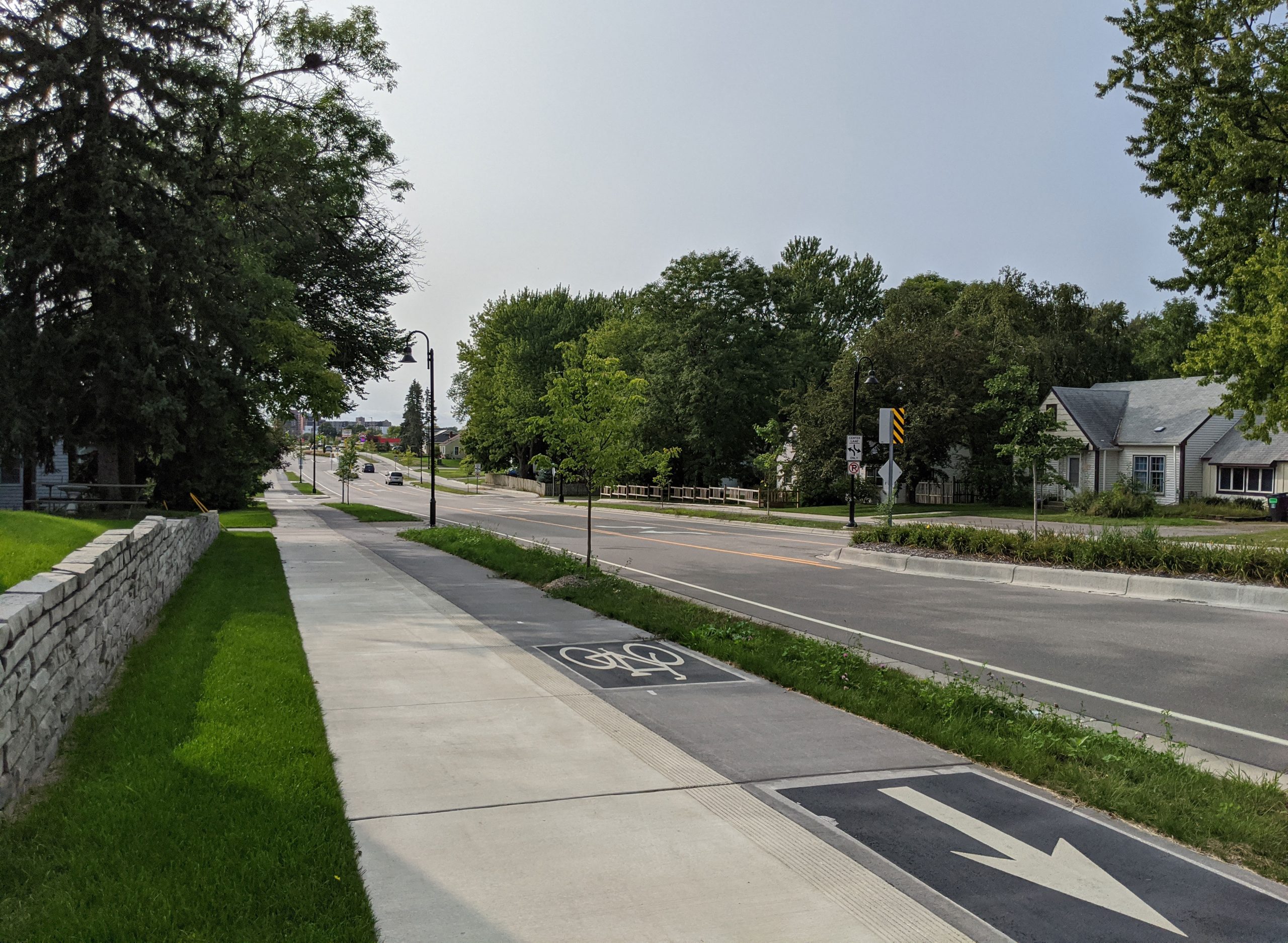
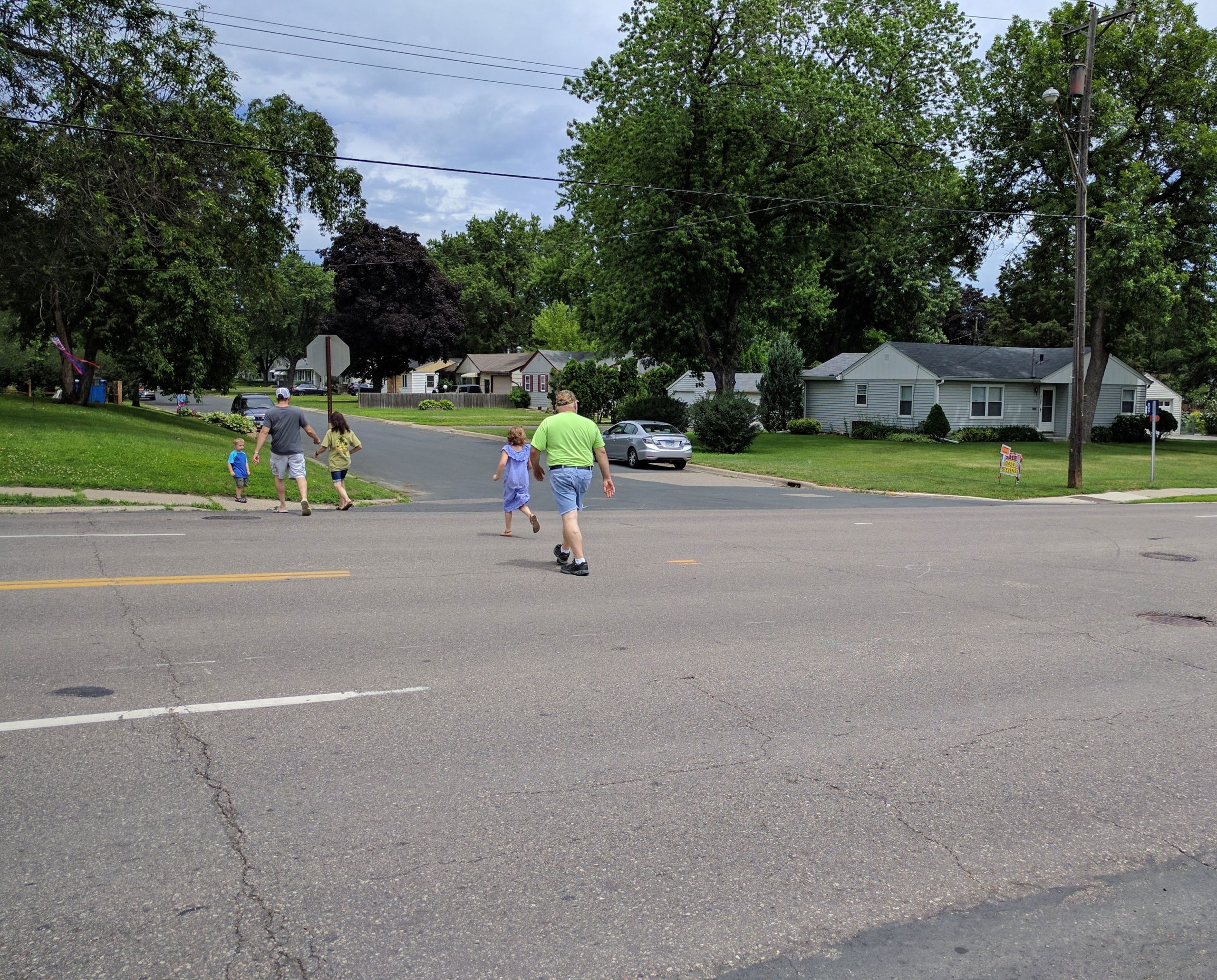
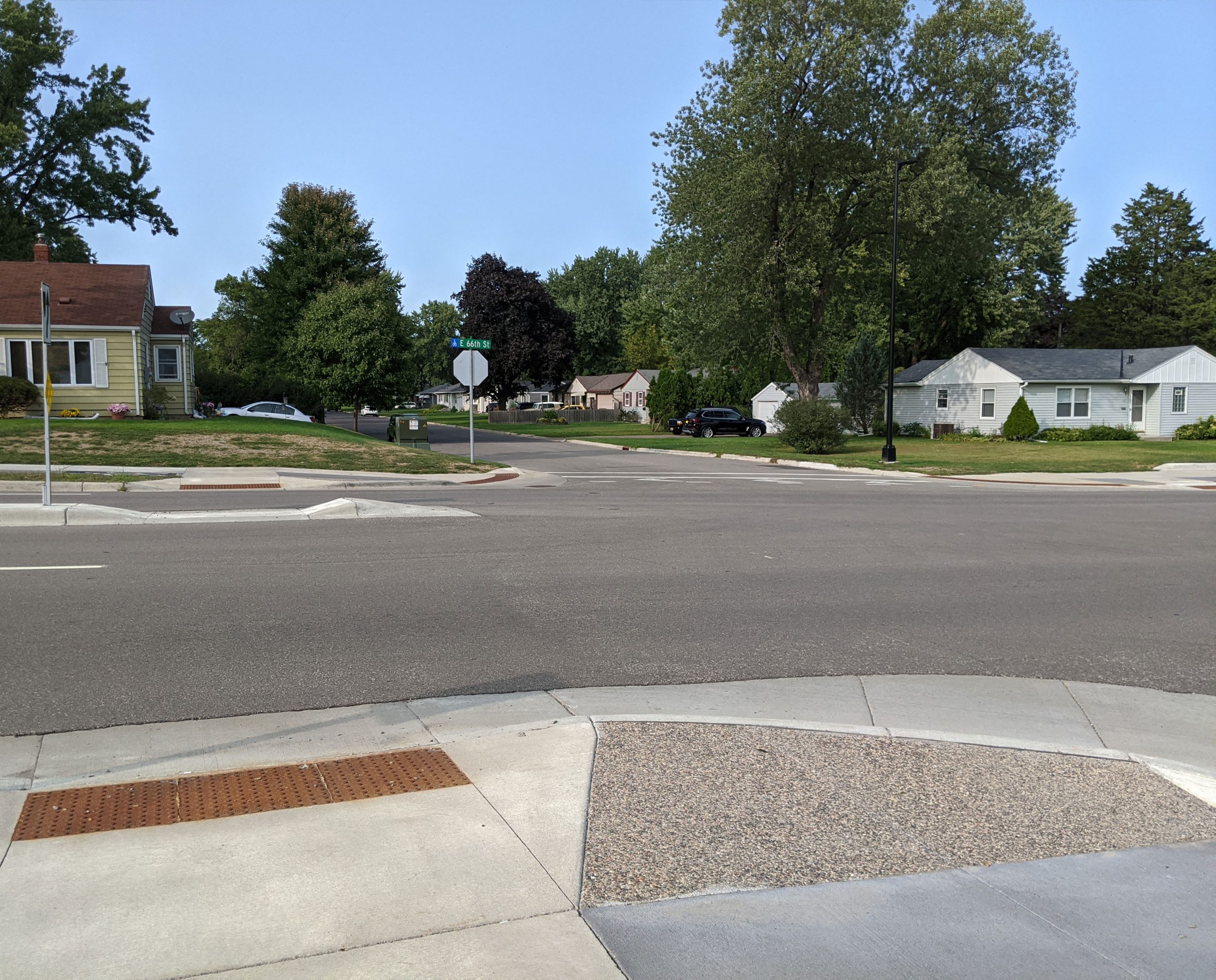
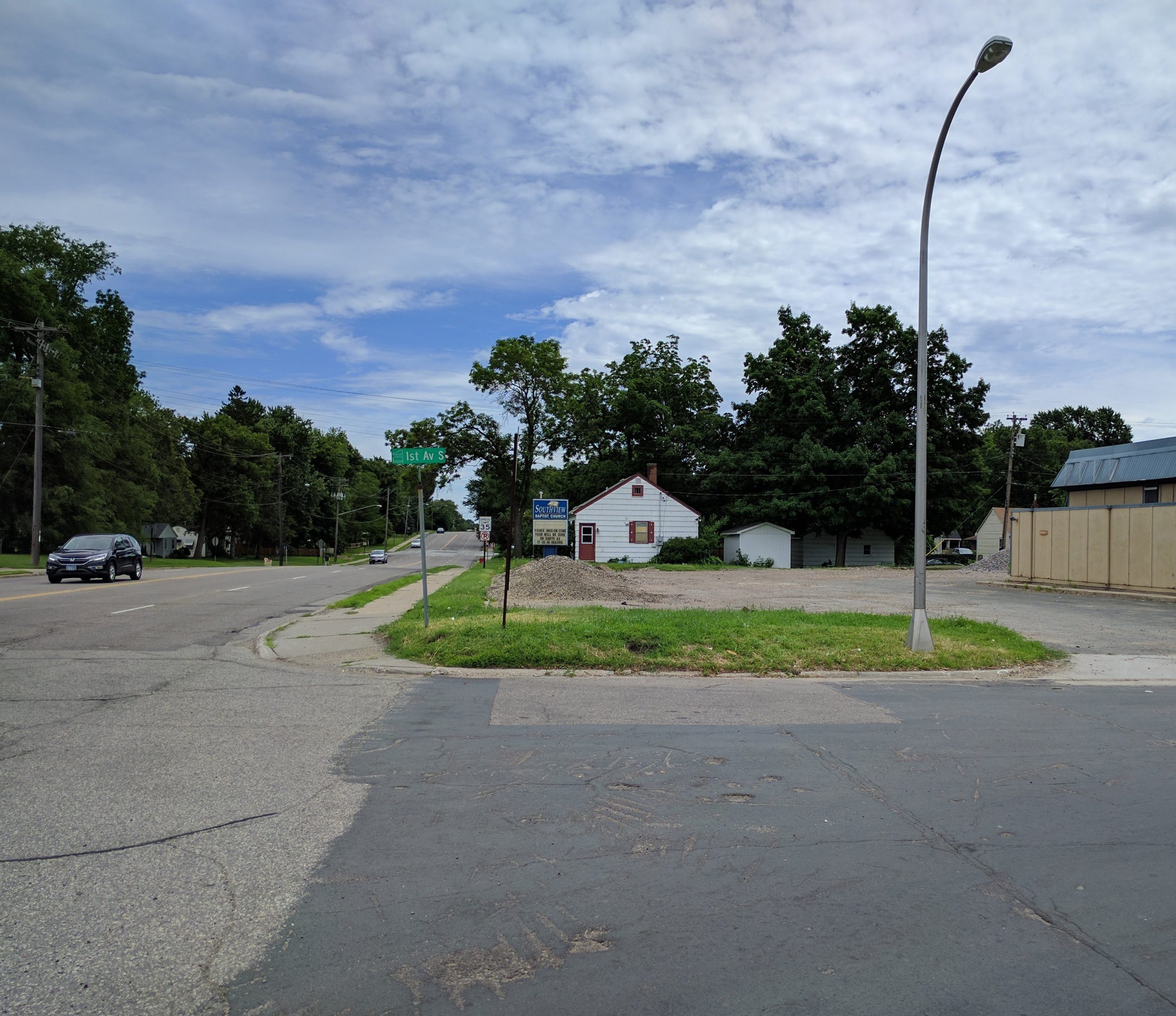
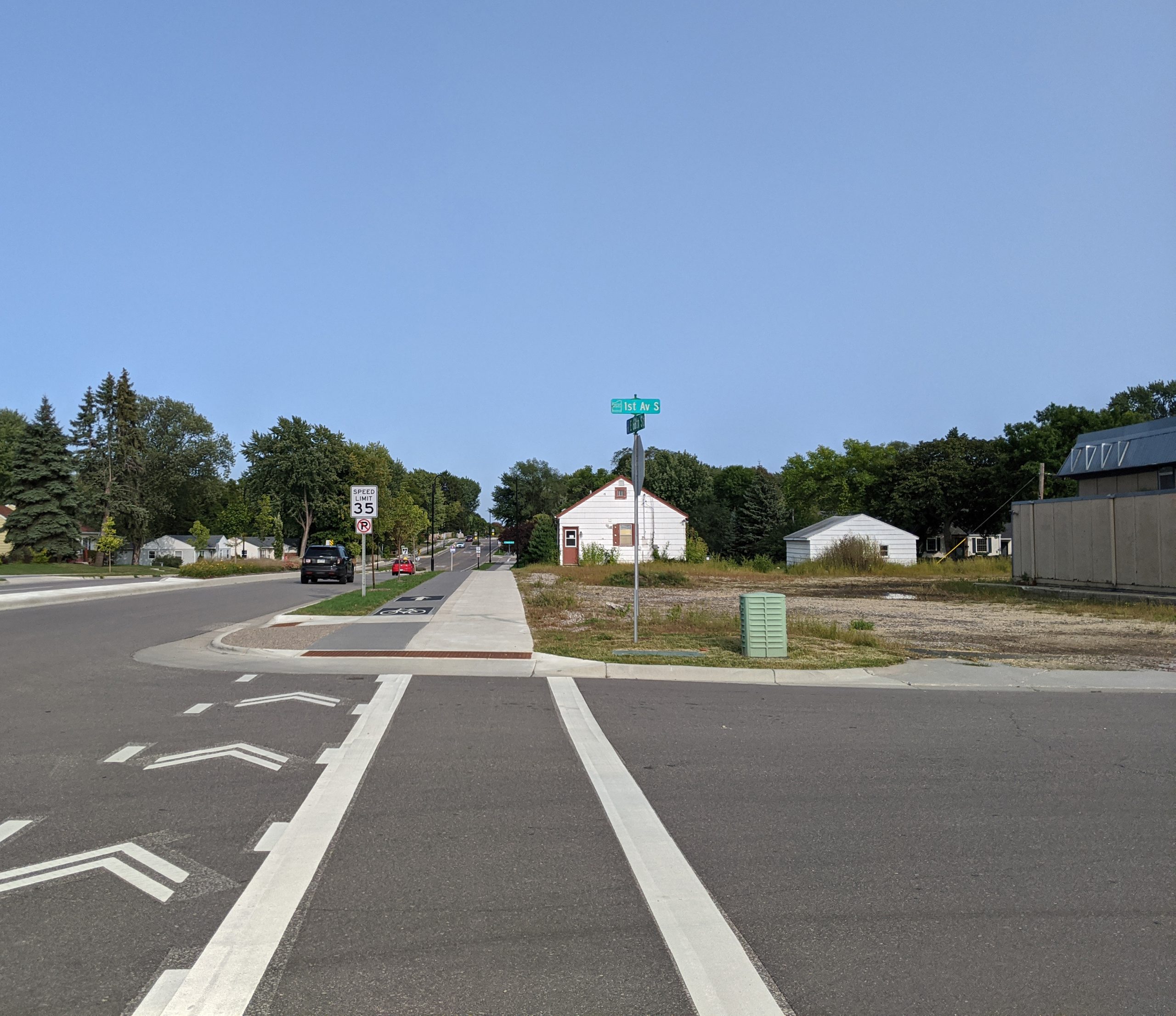
Before and after the rebuild, I took dozens of pictures of the conditions of the street, which I’m sharing now for easy comparison.
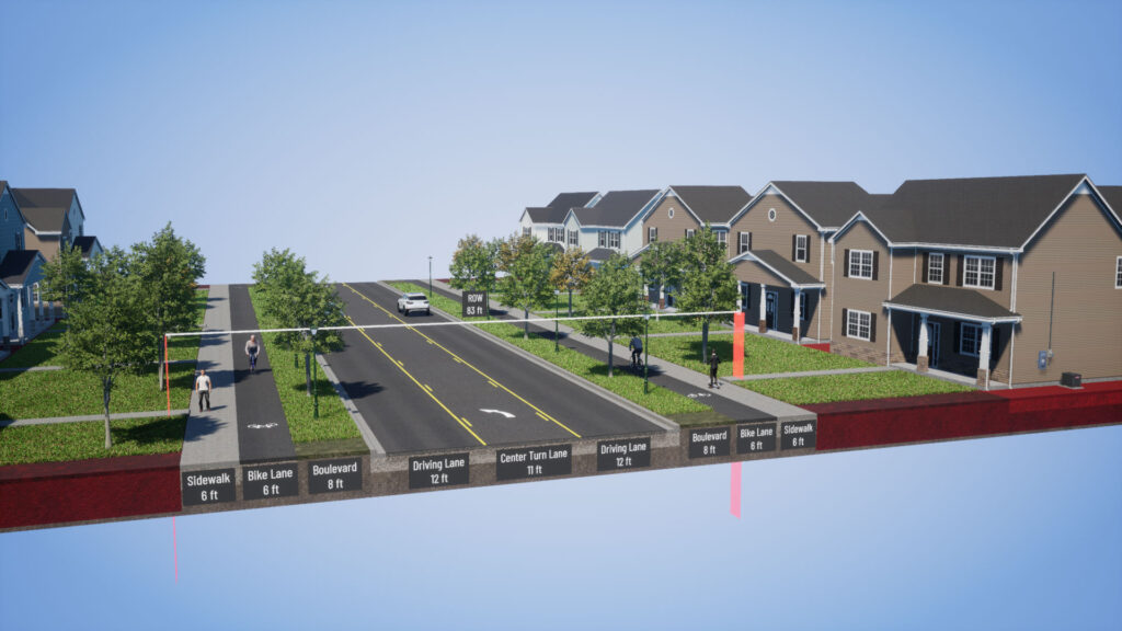
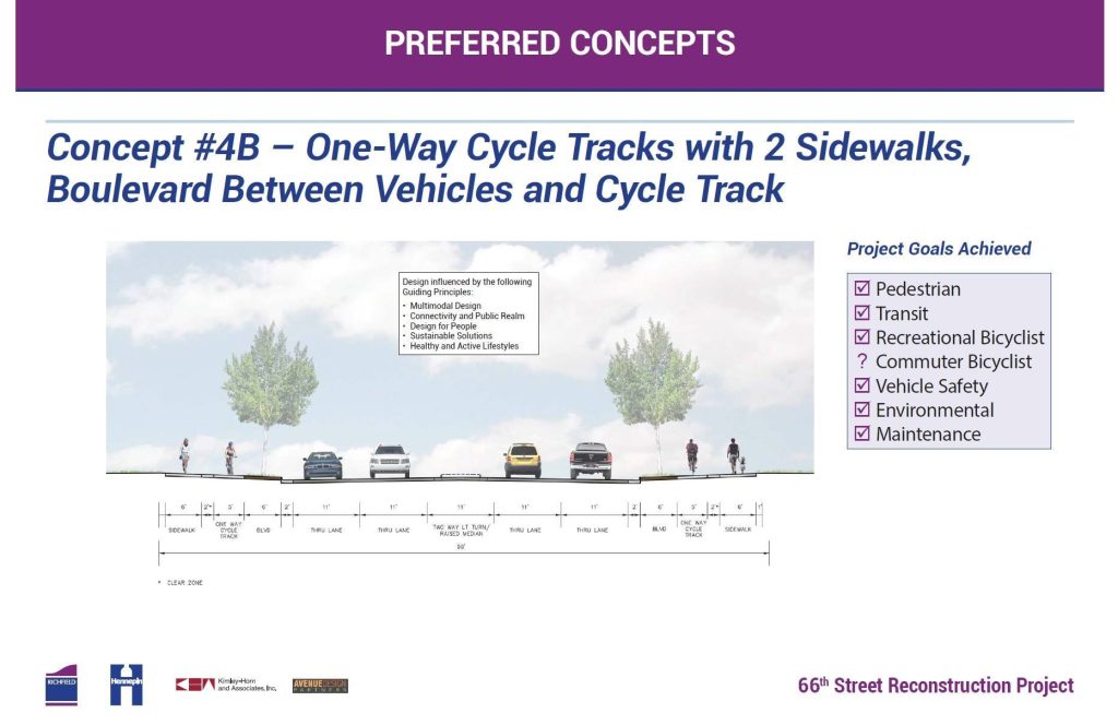
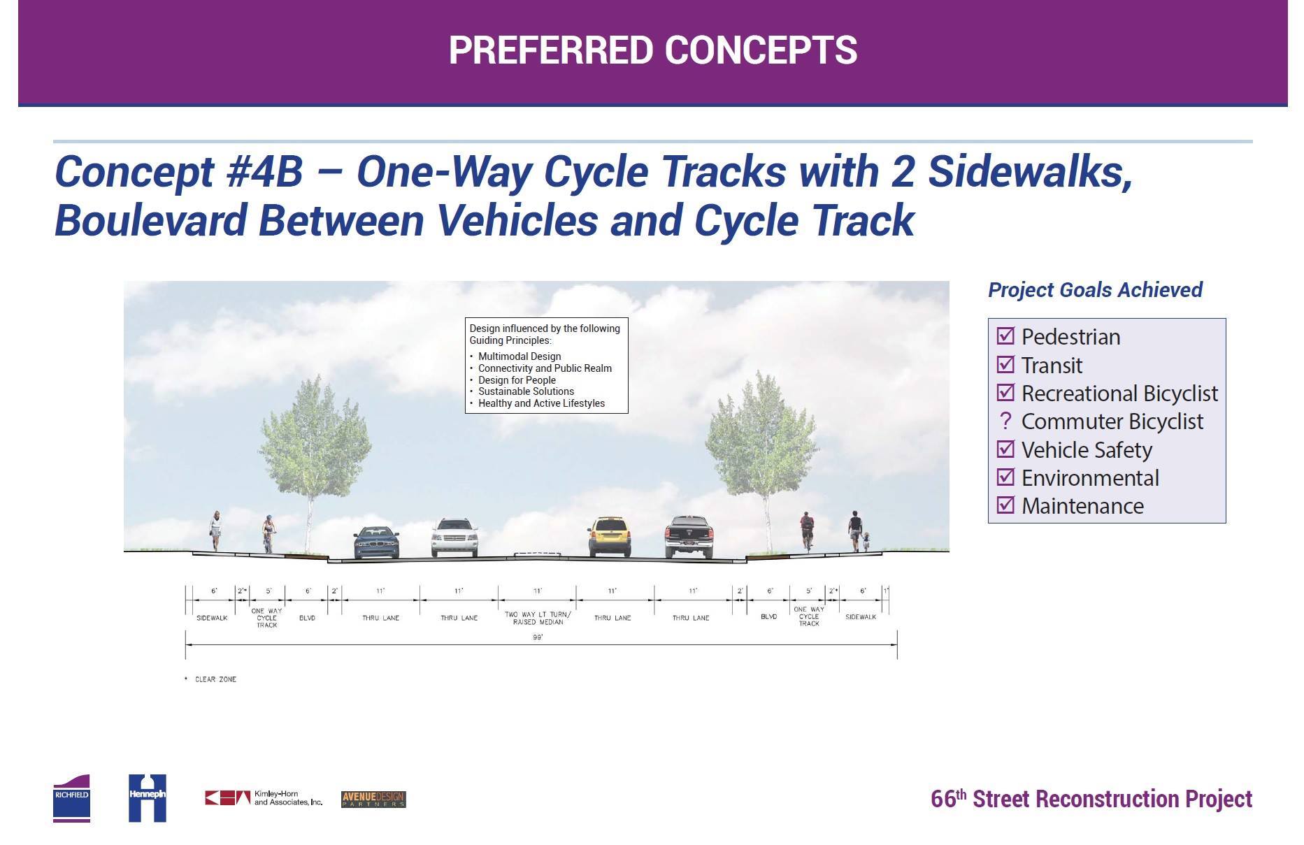
Concept 4B, which was the guiding design for most the new 66th. The roadway mimicks this design from Oliver Avenue to Nicollet Avenue.
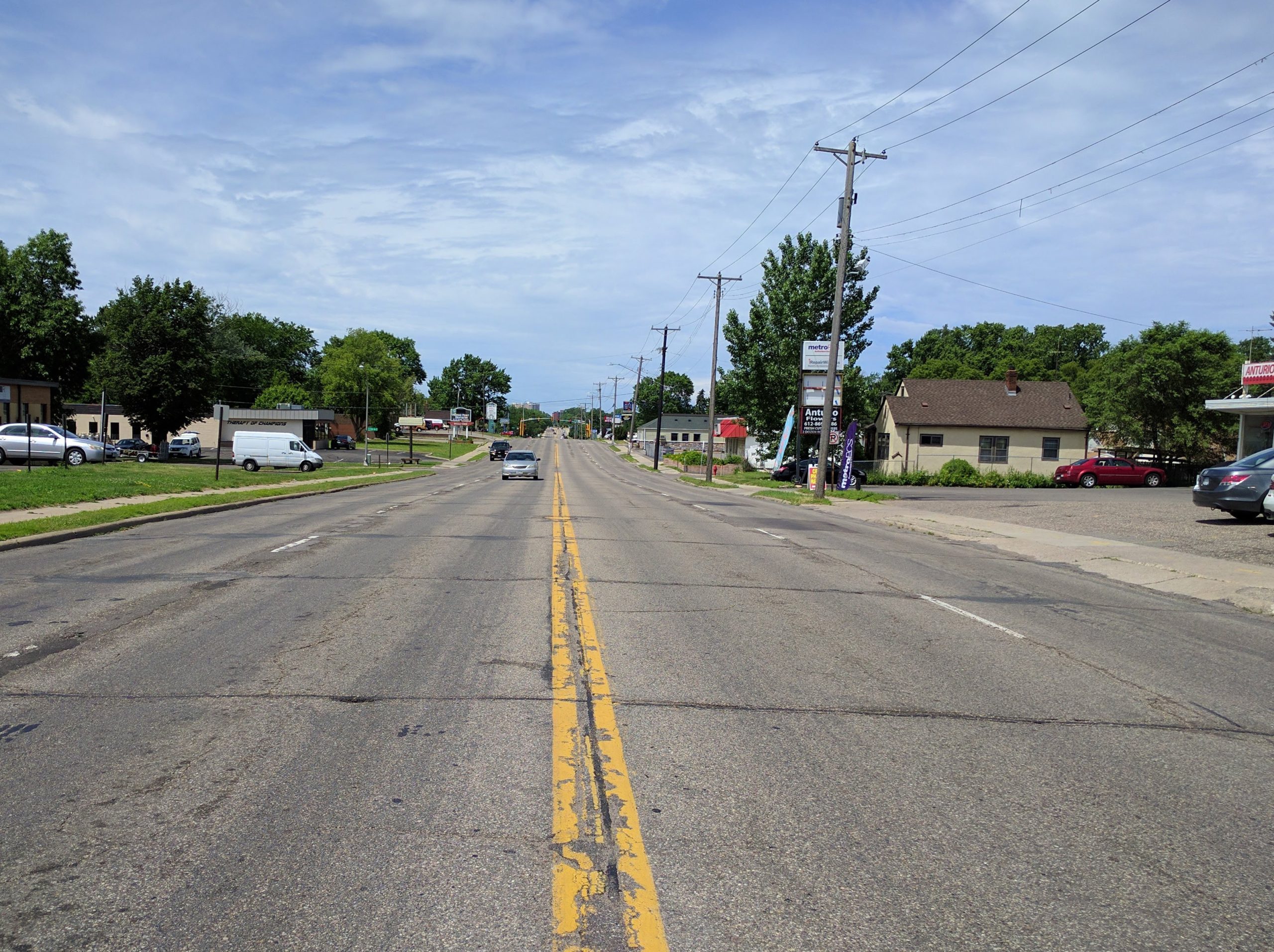
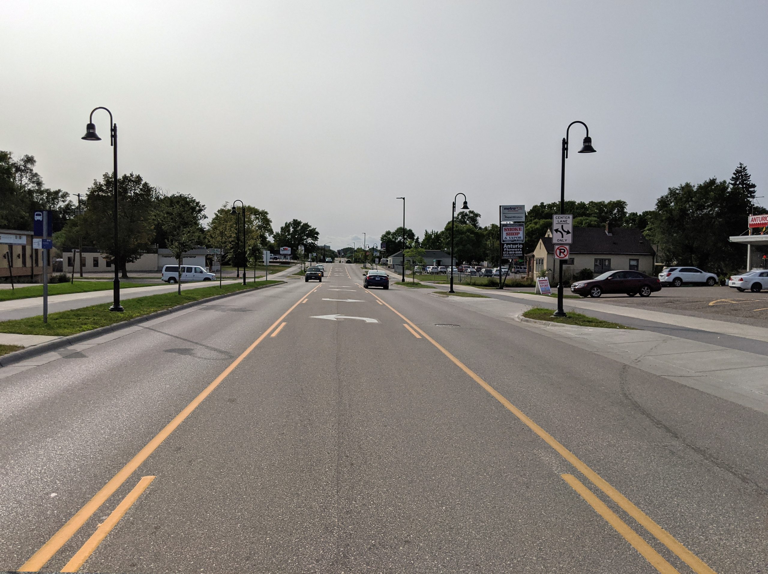
Before and After
16th Avenue to Nicollet Avenue
East of Nicollet Avenue, a 2/3-lane design was used. Medians were prioritized in the area of Veterans Park and the neighborhood to the west.
This area previously had a lot of unimproved right-of-way, which was better-utilized after the rebuild. Some additional right-of-way was also acquired.
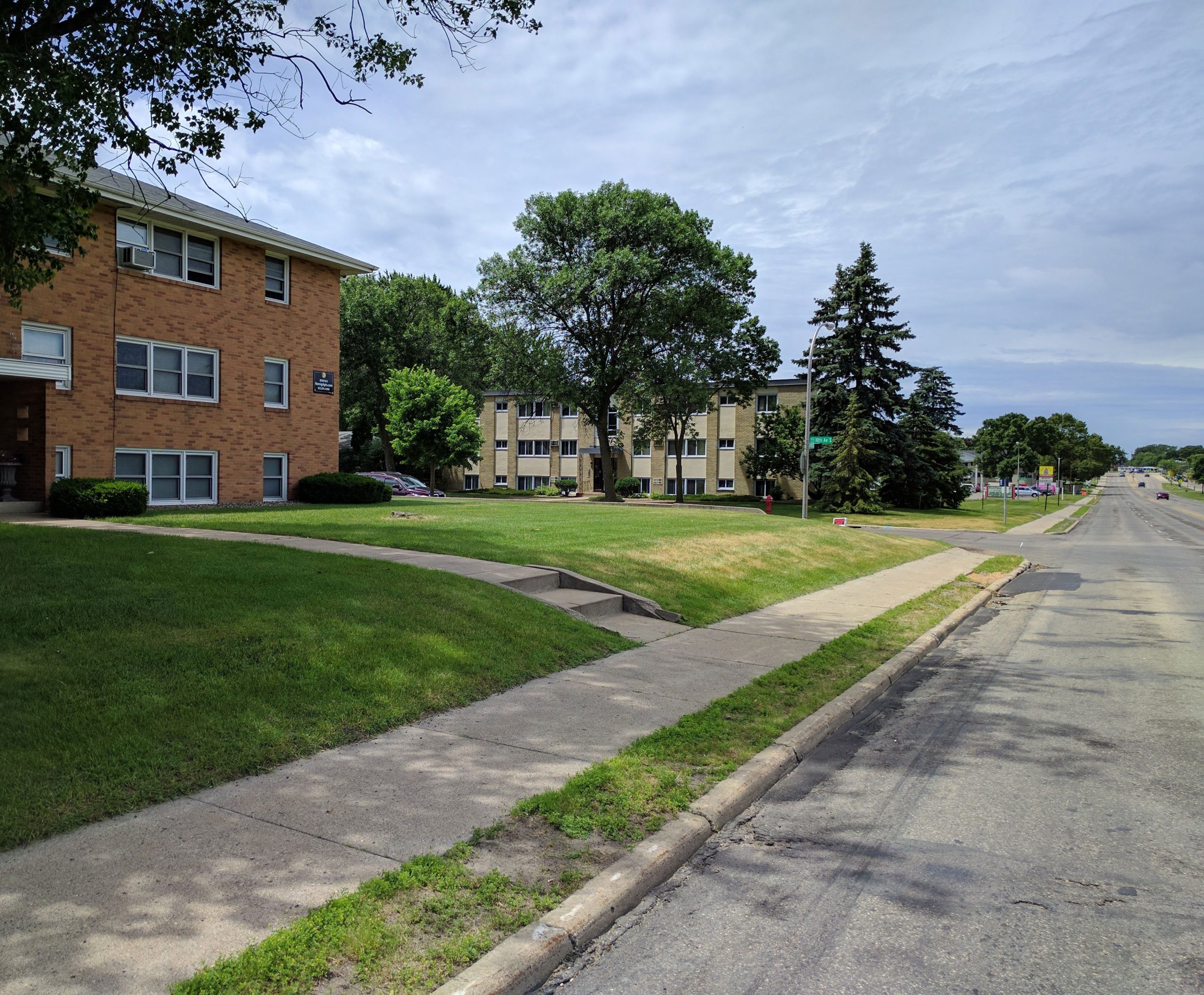
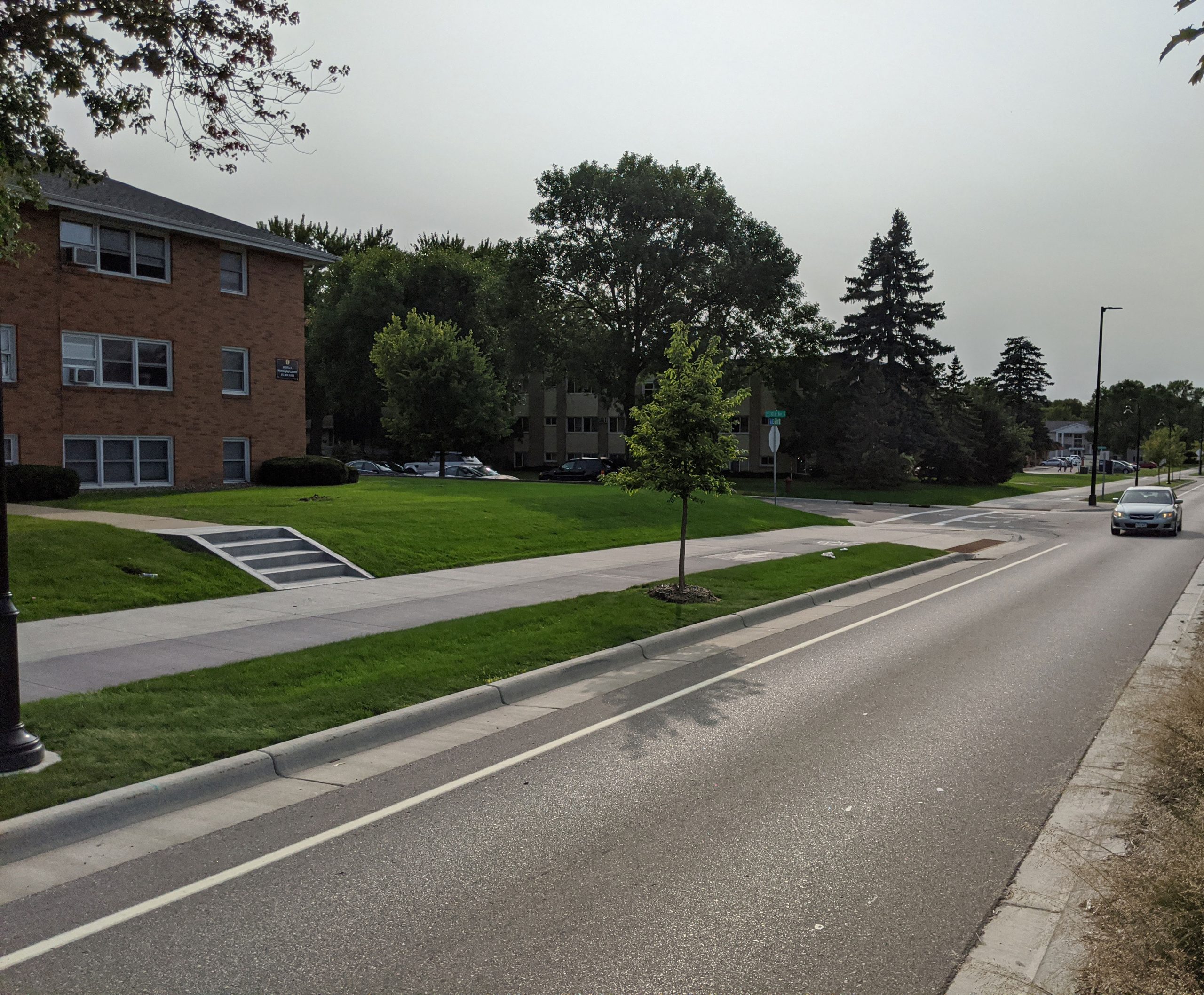
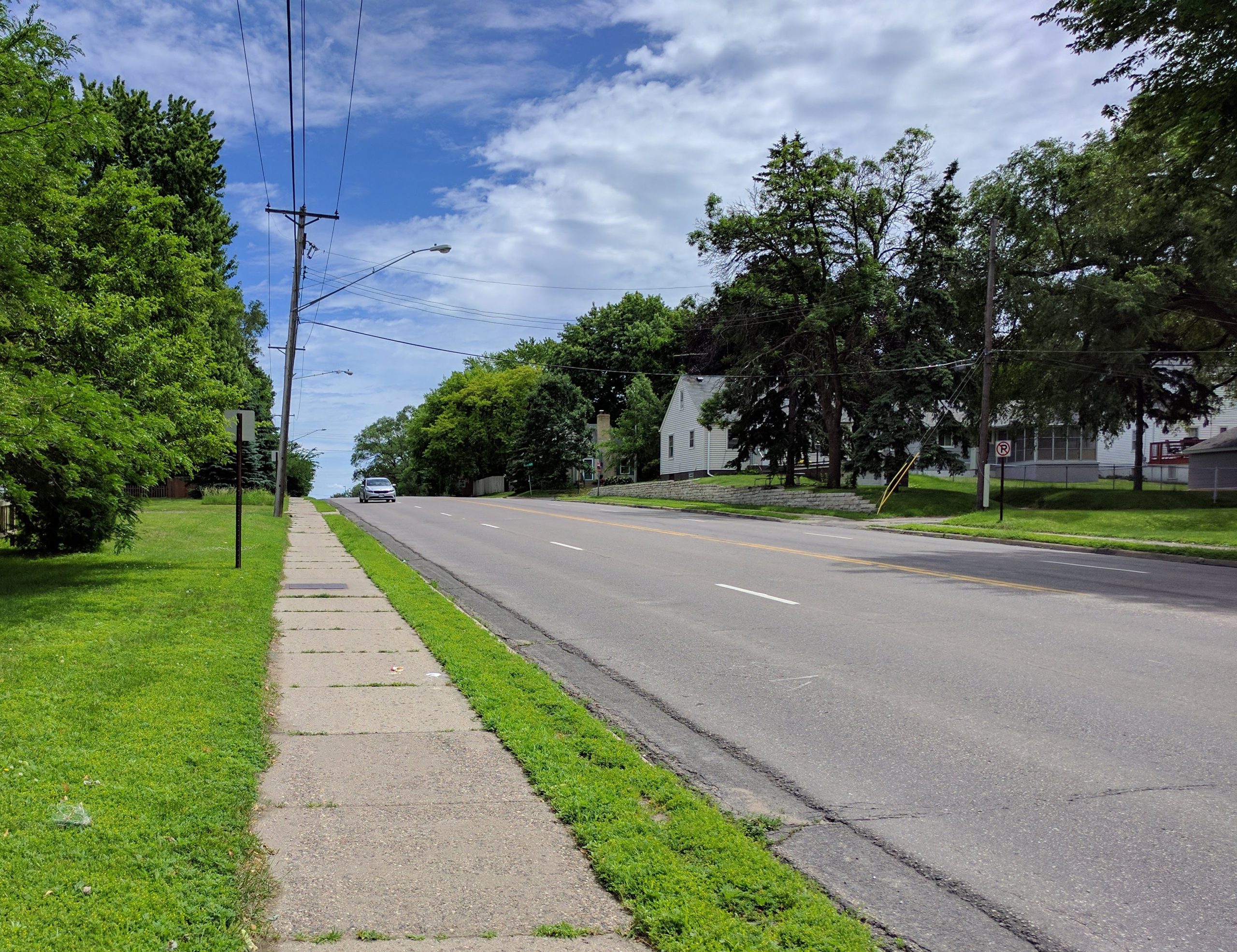
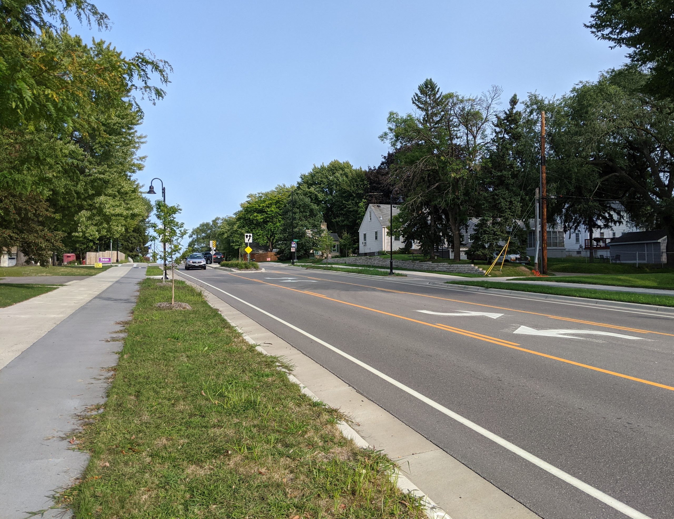
66th Street and 15th Ave: Looking west from the center line.
66th Street and 10th Ave: Looking west
66th Street and 3rd Ave S, as seen from the sidewalk. Utility lines running along 66th were buried as part of the project.
66th Street and 2nd Ave S, as seen from the center line. A mix of center turn lanes and medians were used in this section.
66th Street and 2nd Ave S, as seen from the sidewalk. The center line shifted north to use previously unimproved right-of-way.
66th Street and Stevens Avenue. Although crossing conditions have improved, this intersection like most lacks marked crosswalks.
66th Street and 1st Ave
Downtown Richfield — Nicollet Avenue to I-35W
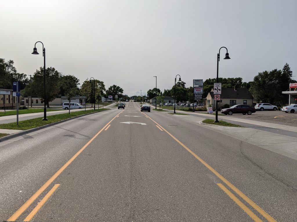
West of Nicollet Avenue, a divided 4/5-lane design was used. Note the significant change at Nicollet and Lyndale, where signals were replaced with roundabouts.
66th and Nicollet roundabout
66th and Nicollet looking west by Academy of Holy Angels.
66th and Lyndale looking west: Signal replaced with roundabout, and protected bikeway and green space added.
66th and Lyndale looking east: Signal replaced with roundabout, and protected bikeway and green space added.
66th just west of Lyndale: Looking west from the sidewalk.
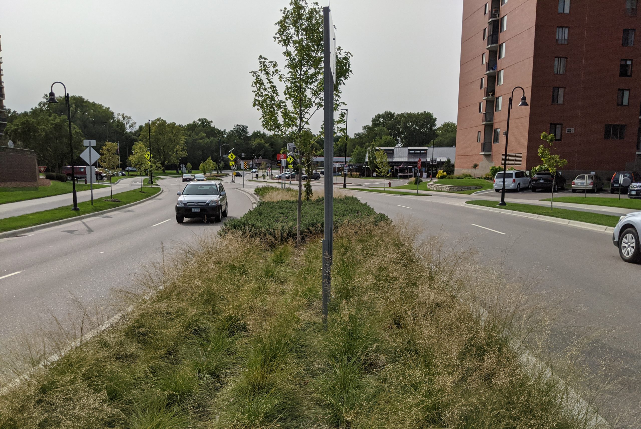
66th near Woodlake Drive: Looking west from middle of the roadway. Note the increased green space behind the curbs, as well as the median.
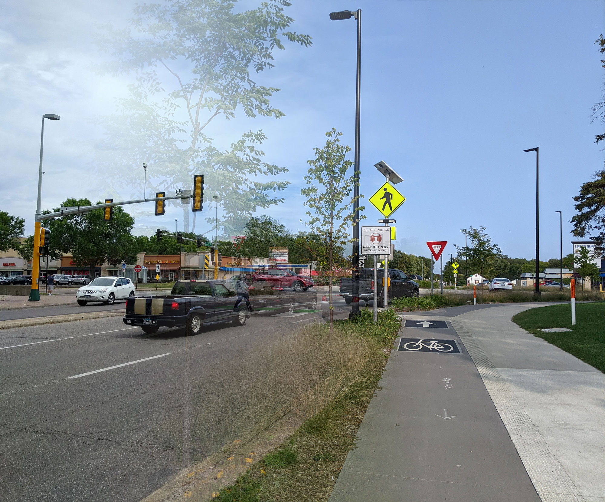
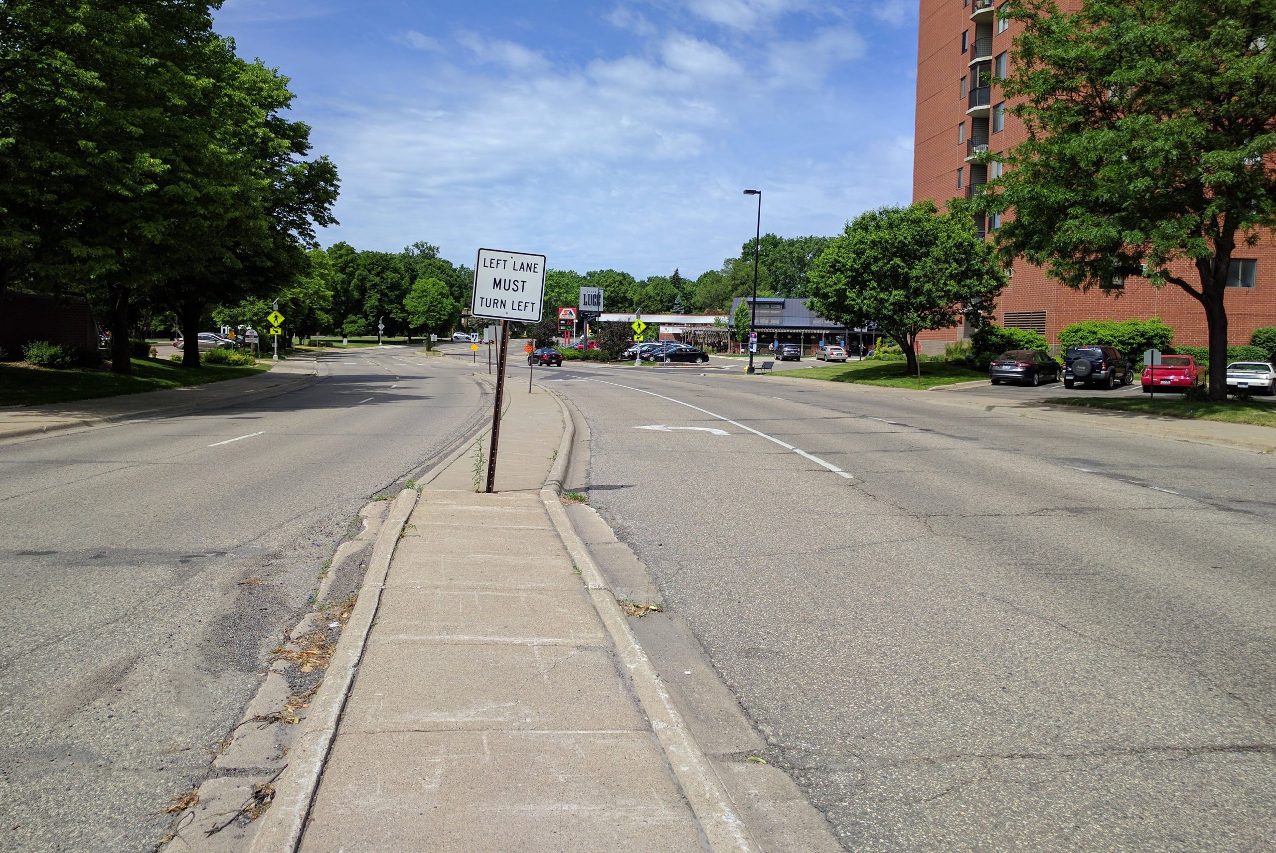
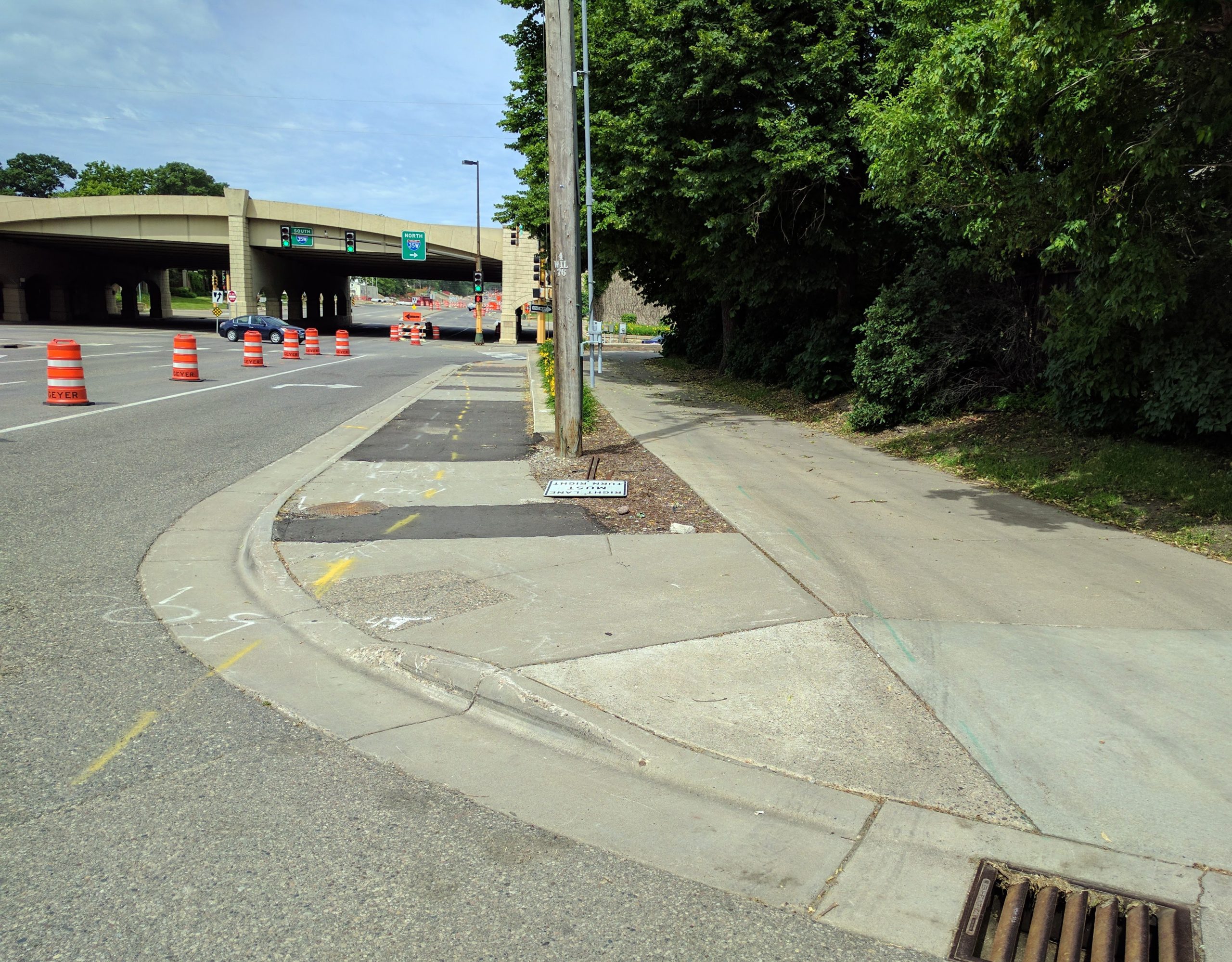
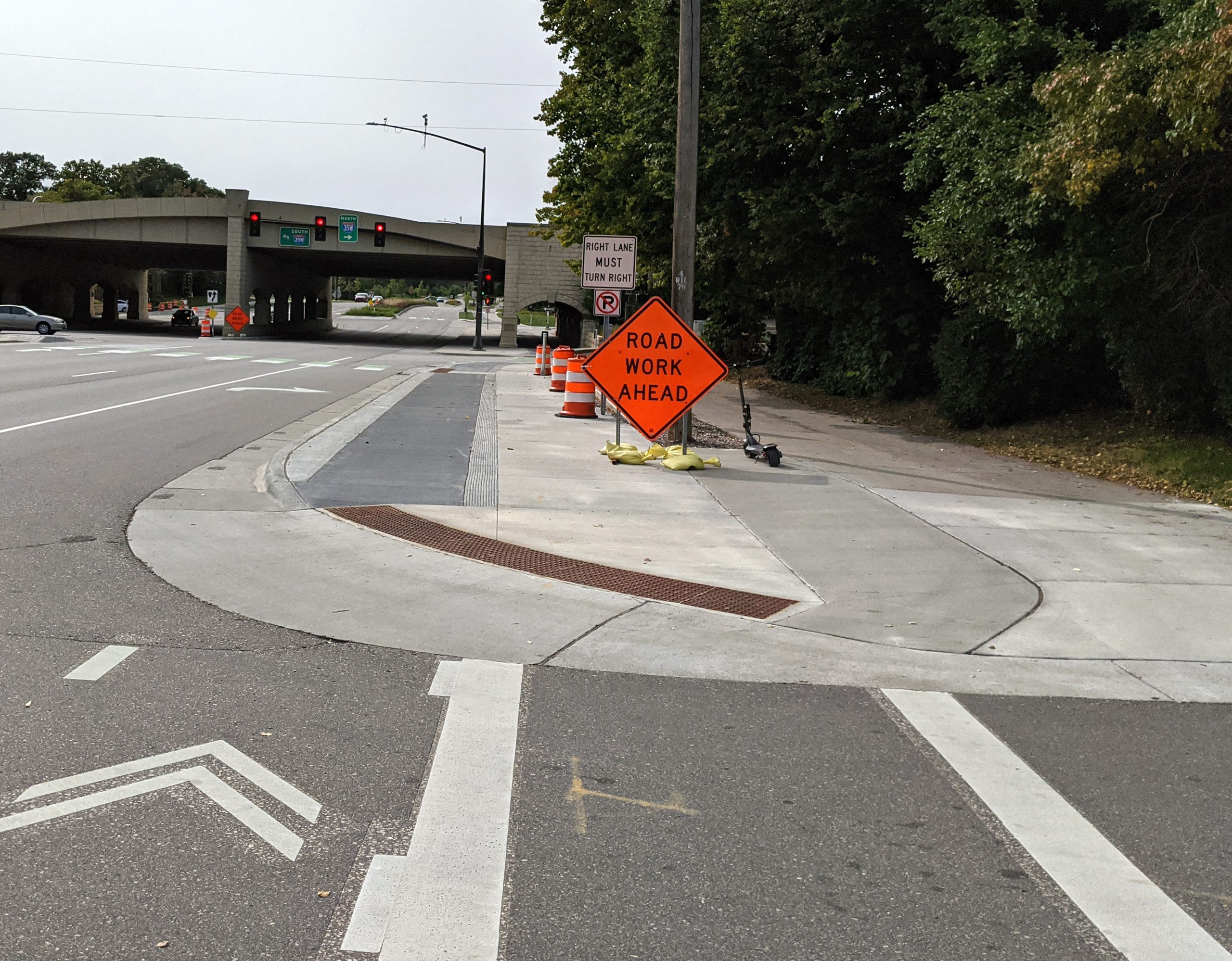
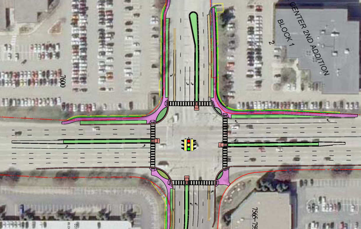
66th & 35W: Looking west on the north side sidewalk. Unfortunately, the right-turn lane was retained, which makes this transit location less pedestrian-friendly.
66th & 35W: Looking west on the south side sidewalk
66th & 35W: Under the bridge. The bridge was not rebuilt as part of this project, but the sidewalks were reconstructed to widen them and add the protected bike lane.
West of 35W
A divided 4/5 lane was used from 35W to Penn. In this section, 18 homes had to be removed to provide adequate right-of-way for the new street. This was by far the most controversial decision of the rebuild of 66th.
West of Penn, because the road had already been widened in the 1980s, a compromise with the neighborhood agreed to contain the new street within the existing right-of-way.
Unfortunately, the county prioritized maximizing car capacity over providing a dedicated bicycle facility in this section. As a result, the bicycle facility ends at Penn/Oliver Avenue. (West of Penn, the north side sidewalk is widened slightly from standard and serves as an 8′ sidepath to provide a limited off-street option for bikes.)
I took my before pictures in 2017, and so I did not capture this section personally before construction began. Instead, I am providing Google Street View imagery of a few key locations.
66th and James Avenue in 2014 and 2023. Note the homes that were removed to the left, on the south side. One benefit at this particular intersection was providing much better access to Monroe Park, which was previously hidden behind the houses. Imagery: Google Street View.
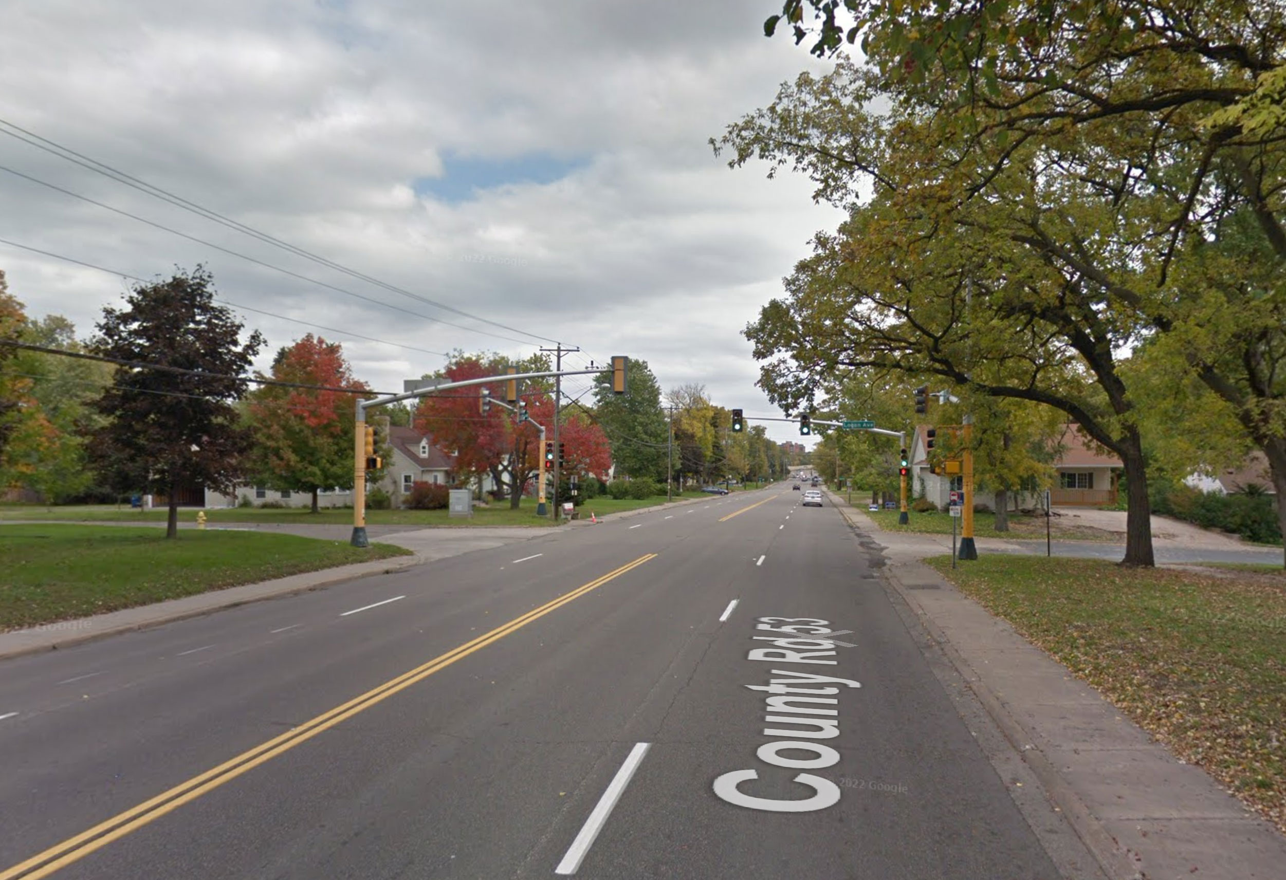
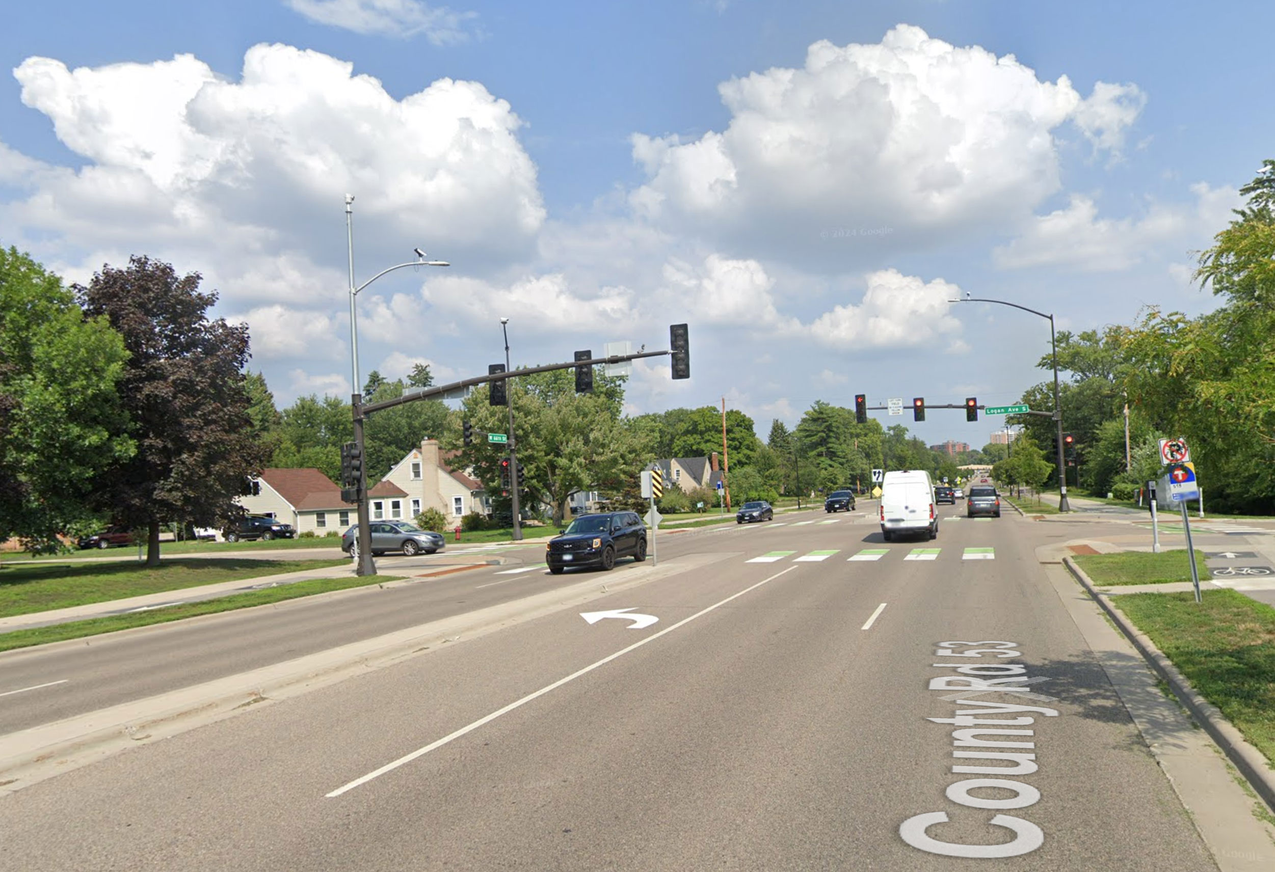
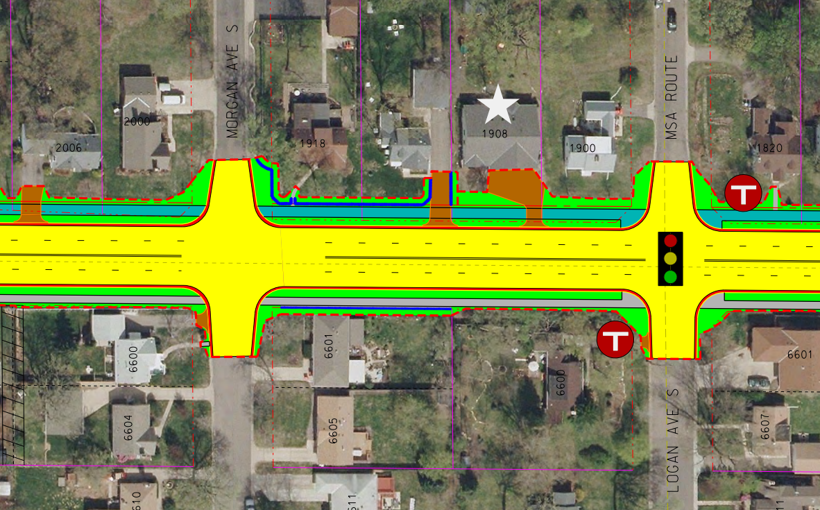
66th and Logan Avenue in 2014 and 2023. Signals along 66th attempted to use the protected intersection concept, although in an effort to reduce right-of-way needs, the intended effect wasn’t really achieved. For example, bicycles aren’t detected going north-south here, so a cyclist must go over to the sidewalk and press the pedestrian push button anyway. Imagery: Google Street View.
66th and Sheridan Avenue in 2014 and 2023. This was the section where right-of-way was limited, and the county prioritized additional car capacity over continuing the bicycle facility. Still, a boulevard was added, as well as improved lighting. Imagery: Google Street View.
Thanks to Kate Aitchison, Mary Supple, Katie Rodriguez, Melissa Poehlman, Julie Urban, Kristin Asher, and Karl Huemiller for their review and feedback!
A good street is a place where people can navigate among businesses, services and social spaces safely and comfortably. In addition to being pleasant and socially productive, these places are financially productive for towns, producing more tax revenue per acre than other development patterns. Unfortunately, many streets sacrifice safety in an effort to prioritize automobile travel at high speeds; this kind of bad street design is the primary cause of vehicle crashes involving fatalities and traumatic injuries. What are people in your city doing to build streets that prioritize people and merely accommodate automobiles — not the other way around?
A:
Richfield is a leader in street design that builds community and improves safety for people walking and biking. Richfield’s first generation of arterial streets were four-lane, undivided “stroads” with 35 mph speed limits, no bike space, and barely-usable sidewalks. Our resident-led Transportation Commission and professional engineering staff worked together to change this approach. We saw the first tangible results in 2010: rebuilding one of our city-owned streets from 4 lanes to a 2-lane roadway with bike lanes, grassy boulevards, and improved sidewalks.
Since then, our progress has accelerated — fully reconstructing 7.1 miles of arterial streets, and restriping, lowering speed limits, and doing other retrofits to an additional 7.7 miles of arterials. This has resulted in a high-quality network of bikeways and ever-improving pedestrian space. In 2016, Richfield installed the longest protected bike lane in the region, with 2.75 miles of 66th Street featuring one-way protected bike lanes. The new 66th provides safe access to 16 parks within a quarter-mile, including the city’s swimming pool. We plan to utilize a similar design in our city-county reconstruction of Nicollet Avenue in 2026.
Richfield has also been a leader in roundabouts, with eight roundabouts added on arterial streets since 2008, and an additional five planned by the end of this decade. This has reduced the need for multi-lane intersections, and improved safety for all users. We have also continually improved these designs to enhance pedestrian comfort based on user feedback.
We have done all of these arterial improvements without the use of special assessments — our arterial streets are shared amenities that benefit the whole community, and it has been our practice to avoid special assessments for these streets.
Q:
Excessive surface parking harms towns. It makes them less financially productive and prevents new local businesses from getting started. It forces land owners and developers to build more parking than they actually need, often at the expense of more housing. Still, most North American cities require this excessive parking in their codes in the form of parking minimum mandates. If you’ve had this experience in your place, you’re not alone, but we hope you’re taking steps to change that. What policies and approaches are people in your city using to decrease or eliminate parking minimum mandates and encourage development that is more productive than parking lots?
A:
Richfield continues to make progress on reducing surface parking requirements. Although we have not completely eliminated parking requirements, we have worked to ensure that they are at or below market norms. In addition, we impose parking maximums to dissuade excessive parking.
We continually review and reduce requirements in response to market changes. Within the last two years, we reduced our parking requirements for houses, for apartments, for restaurants, and for museums and libraries. In fact, the last change has allowed our local library to reduce its parking lot nearly in half, allowing for more green space in a major park — and less unsightly, unnecessary pavement. City leaders will be considering additional reductions to parking requirements — including the possibility of elimination — downtown and along major transit lines through policy work planned for 2025.
Our parking requirements do not only serve cars; in recent years we have expanded requirements for electric vehicle charging, and adopted a comprehensive bicycle parking strategy — including support for e-bikes, sheltered parking in new housing, and creating a standard that prioritizes parking at bikeable/walkable businesses.
Our mixed-use zoning districts discourage the use of excessive surface parking, and nearly every major redevelopment has included structured parking.
Q:
Your city’s housing market should be flexible enough to respond to evolving needs and capacity, yet most communities have rigid zoning laws that prevent even the simplest of changes. What are people in your town doing to promote the incremental and bottom-up development of more housing options and greater housing flexibility?
A:
Like many American cities, Richfield’s largest era of growth was post-World War II, where we expanded from a village with scattered housing developments to a fully developed, gridded, and dense city.
As late as the 1990s, Richfield’s zoning changes prioritized competition with newer suburbs, emphasizing suburban design features like large lots, multi-car garages, and allowing only single-family homes in the vast majority of the city. This was not a financially sustainable approach, since it meant fewer homes could be built in the same area, and at a higher cost for each one.
In the last 15 years, Richfield has diversified its approach, adding over 1000 new housing units, and updating our comprehensive plan and zoning code to allow a greater diversity of housing choices. This included “legalizing Richfield” — expanding areas where apartments can be built, re-allowing duplexes by-right, and allowing smaller lots that were already common in parts of the city. We also allow accessory dwelling units (ADUs), and were one of the first cities in the Twin Cities metro to do so.
Nearly all major redevelopment areas of the city use a flexible, mixed-use zoning that prioritizes attractive and human-centered design over specific edicts on use. In our downtown, we allow densities of up to 200 units per acre, and allow relatively high densities in all of our mixed-use districts.
The changes in Richfield’s approach on housing development aren’t only on the ground, but in philosophy: the most recent changes have prioritized having clear, universal rules for development by right. This contrasts with many peer cities that have highly restrictive zoning codes, and allow for most development only through extensive use of planned-unit developments (PUDs), or many variances. Simpler rules promote fairness and predictability, and allow smaller developers to develop in our city more easily.
Please answer all of the following 3 questions.
NOTE: These ended up being non-paragraph, single-line text fields. As a result I had to significantly shorten the answers.
Q:
In a truly strong town, elected officials and residents work together to prioritize their community’s needs. What does communication between elected officials and residents look like in your town? *
A as submitted:
Richfield uses resident boards to study policy changes in detail and engage with the City Council and the community at large. Many of these boards are unique to Richfield, like our Transportation Commission, that helps co-create new street designs with engineering staff and residents who use the street. We’ve worked to make more information about our meetings available online and ensured apartment residents receive the same information from the city as homeowners. And city staff and council members are present at many community events, both ones led by the city as well as privately organized festivals.
A (original full answer):
Richfield has worked to be increasingly transparent and engaged with the community. For decades, we have had resident boards that study specific areas in detail and advise the council in decisions. Some of these boards — such as the Planning Commission — are dictated by state law, but most were created at the discretion of the City. These allow resident input in a deep and meaningful way that most cities don’t have a structure for — like our Transportation Commission, that hosts community open houses and helps guide design for new streets alongside professional staff. Council members participate with these boards as well, allowing them to better represent these resident ideas, as well as to communicate Council work to these highly engaged residents.
In recent years, Richfield has made efforts to be more transparent and clear in council decision-making. A decade ago, nothing more than the time and date were posted online about council work sessions — now the full packet, slides, and even audio recordings are available for all to access. For public hearings for land-use applications, Richfield goes above and beyond state requirements by sending notices to each individual apartment resident, as opposed to only the building owner.
Richfield also engages residents informally — the City’s Richfield Recap newsletter has 4,000 subscribers who receive weekly updates, with a 75% engagement rate. Our social media pages update residents on Facebook and Instagram. And staff and elected officials actively participate in many community events, including our annual PennFest open streets festival, 4th of July celebration, National Night Out, and a Cinco de Mayo festival. Starting in fall 2025, the seasonal Parks and Recreation program guide — which is mailed to all households within the city — will contain four new pages of general city updates in addition to the normal recreation program offerings.
Q:
In a Strong Town, residents and leaders don’t wait years to improve their community; they see a problem and get right to work addressing it with whatever resources they have on hand. What’s one example of a time that people in your city (elected officials, business owners, residents, etc.) observed a struggle that some residents were having and took swift, ideally low-cost action to address that struggle? (Ex: In some communities that Strong Towns works with, residents noticed that key bus stops lacked benches for people to sit on while they wait for the bus, so they banded together to build and install new benches in a matter of weeks. In other communities, local leaders noticed that popular streets lacked bike lanes and went out immediately to paint lanes and delineate them with cones so that cyclists can travel more safely.) *
A as submitted:
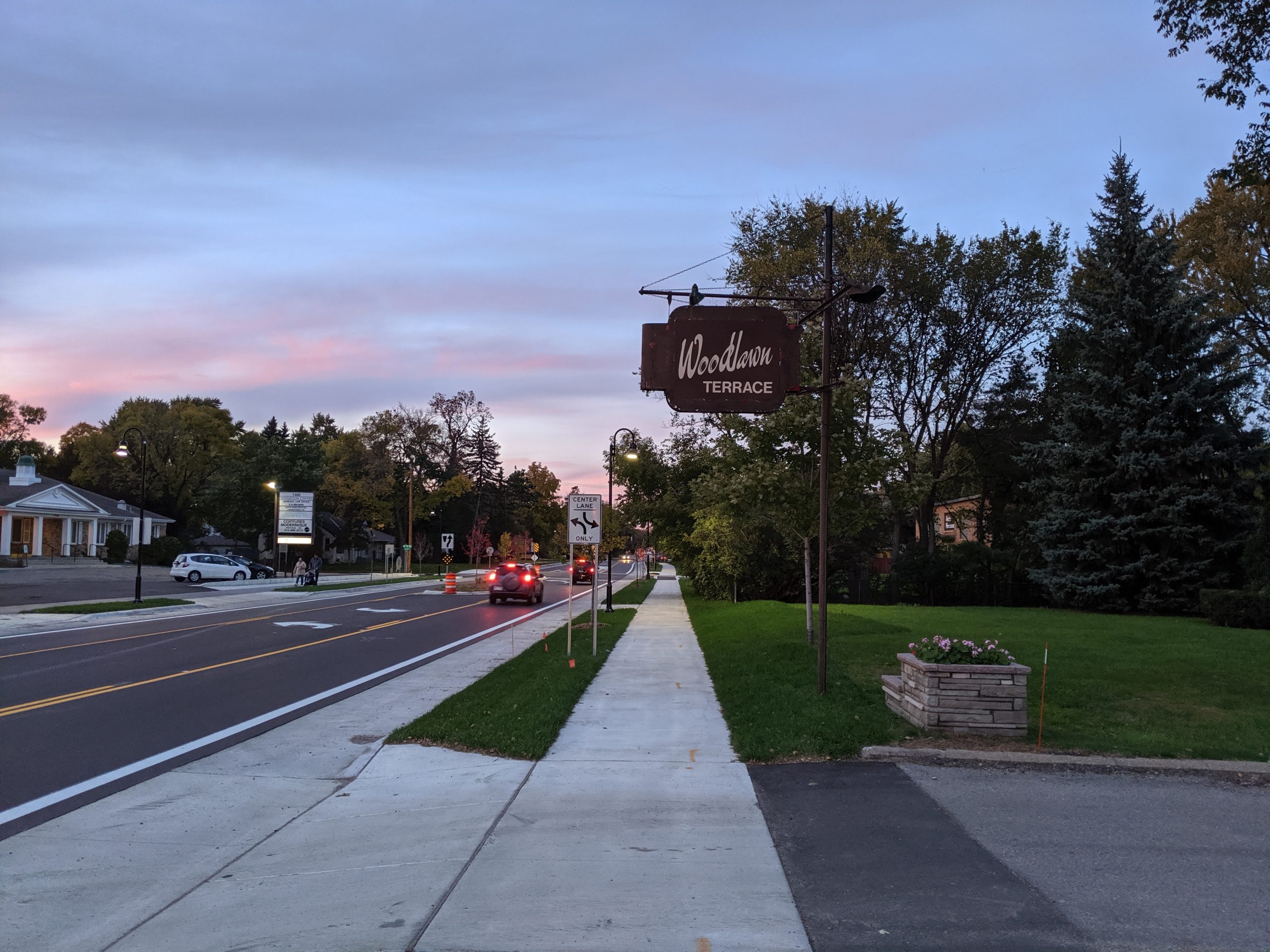
One of the best examples of Richfield working quickly to respond to a resident need was the work in 2021 to preserve the Woodlawn Terrace manufactured home park. While many of these parks have come under predatory ownership that priced out existing residents — or leveled entirely for redevelopment — residents and the park and the city worked together to preserve this unique for-sale ownership opportunity. The city committed $350,000 to utility improvements, and even revised its down payment assistance program to help residents buy a manufactured home. Now under cooperative ownership, land rent is stable and this community has been preserved for the future.
A (original full answer):
As a smaller city with a modest tax base, Richfield often has to be nimble to meet resident needs. A particularly proud accomplishment was the partnership to preserve the Woodlawn Terrace manufactured home community in 2021. Most similar manufactured home communities in the Twin Cities have been lost to redevelopment, losing affordable for-sale housing opportunities. Even more troubling, those that have remained have come under predatory ownership that takes advantage of the ground-lease structure to coerce residents into unreasonably high land rent.
Residents of Woodlawn Terrace banded together to form a cooperative to own the land in the future, in cooperation with the City of Richfield and Northcountry Cooperative Foundation. The City of Richfield committed $350,000 in utility upgrades, helping to connect the 53 lots to the city water system, and to rebuild the internal street system of the community. We also revised our down payment assistance program to allow manufactured housing to qualify for assistance.
Existing residents were able to stay in their homes, older trailers were removed, and efforts were made to bring the community to full occupancy. The conversion was so successful that the former owner of the park moved to a new unit on-site — staying with the property he held for decades. The city continues to support the project by providing a lease of a strip of adjacent park land, allowing larger-sized homes to fit and better serve families.
Q:
What about your town inspires you to keep working to make it stronger? What sets your town apart as truly special? *
A as submitted:
Like many communities across the country, we saw rapid growth after World War II, going from a largely farming community to a dense, gridded city with tens of thousands of residents. But our cycle of change didn’t end there: we’ve continued to change our city to fit our residents’ needs. When the Minneapolis Airport expanded and worsened noise impacts, the City worked to redevelop the areas most impacted. When our streets were no longer serving community needs for walking and biking, we set a new course. When residents demanded greater transparency at City Hall, we changed our procedures and opened the door for more residents to get involved. We’ve invested in important community amenities to help residents of all walks of life. And we’ve done this with broad community support — for example, our 2024 sales tax referendums for new park amenities passed with 2:1 voter approval. Richfield’s history is one of change for the good of our community — and our future is too. I’m proud to be a part of it.
A (original full answer):
Richfield is a community that truly embraces change. Like many communities across the country, we saw rapid growth after World War II, going from a farming community with isolated residential areas to a fully gridded city with tens of thousands of residents. But our cycle of change didn’t end there: we have embraced major redevelopment over the decades — changing our city to fit our residents’ needs. When the Minneapolis-St. Paul Airport expanded and worsened noise impacts to Richfielders, the City worked to redevelop the areas most impacted. When our streets were no longer serving community needs for walking and biking, we set a new course. When residents demanded greater transparency at City Hall, we changed our procedures and opened the door for more residents to get involved.
Richfield has charted a common-sense approach to equity, demonstrating a community commitment to building prosperity without exclusion. We’ve worked to preserve affordability, while embracing growth of our tax base. We’ve invested in important community amenities to help residents of all walks of life. And we’ve done this with broad community support — for example, our 2024 sales tax referendums for new park amenities passed with 2:1 voter approval.
Richfield’s history is one of change for the good of our community — and our future is too. I’m proud to be a part of it.
Gallery
Strong Towns requested 10 photos to represent Richfield. These were the selection:
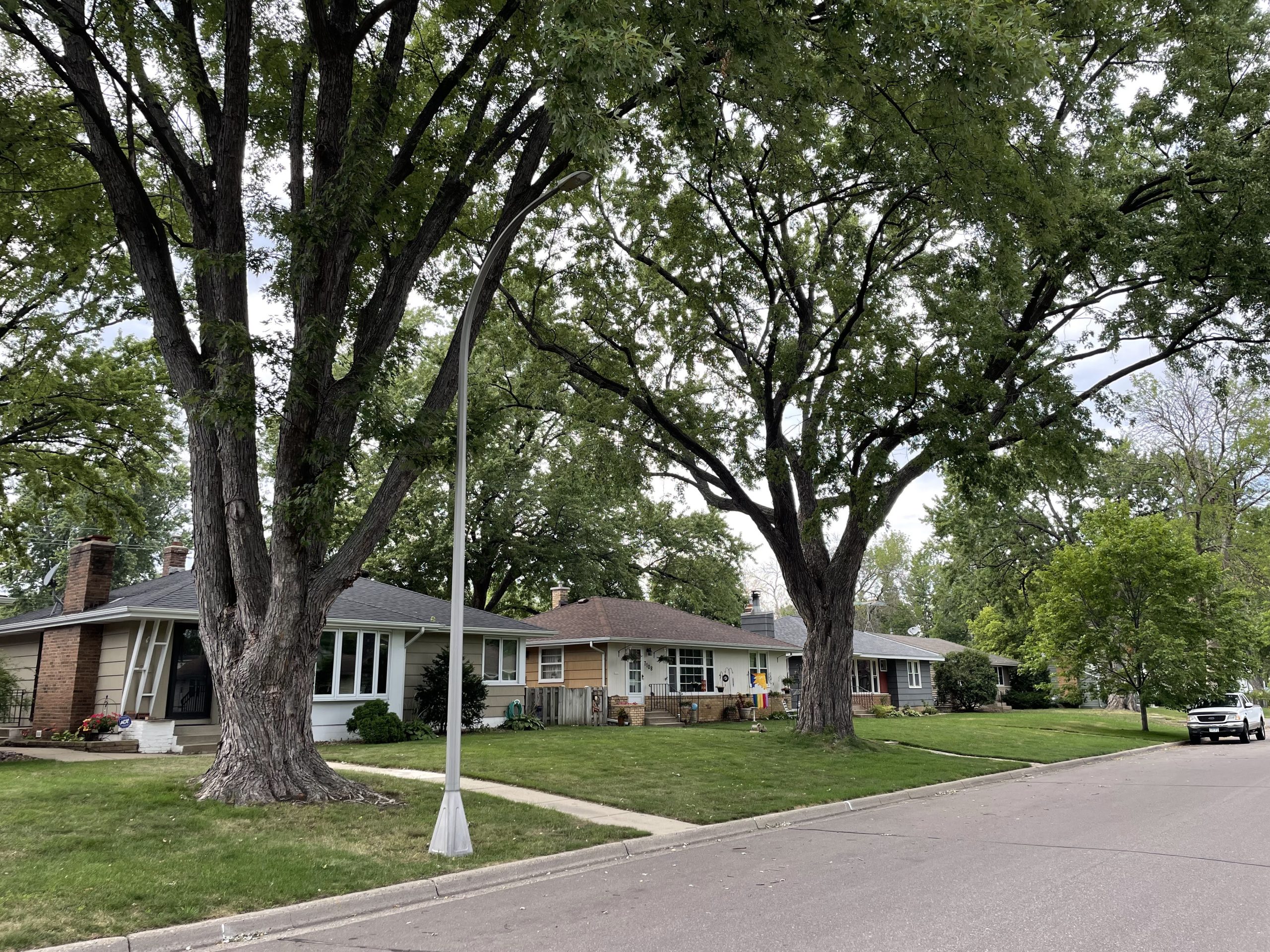
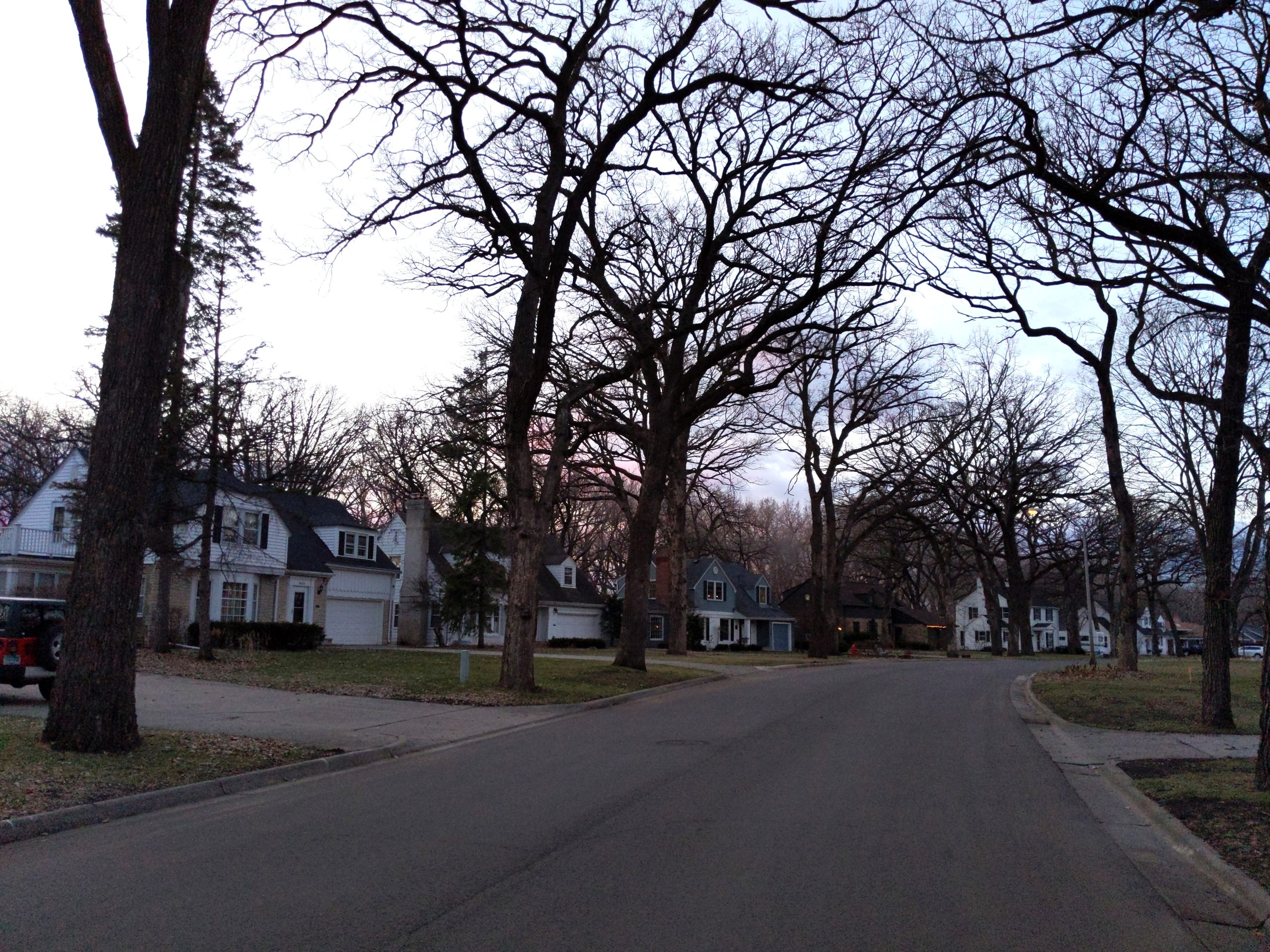
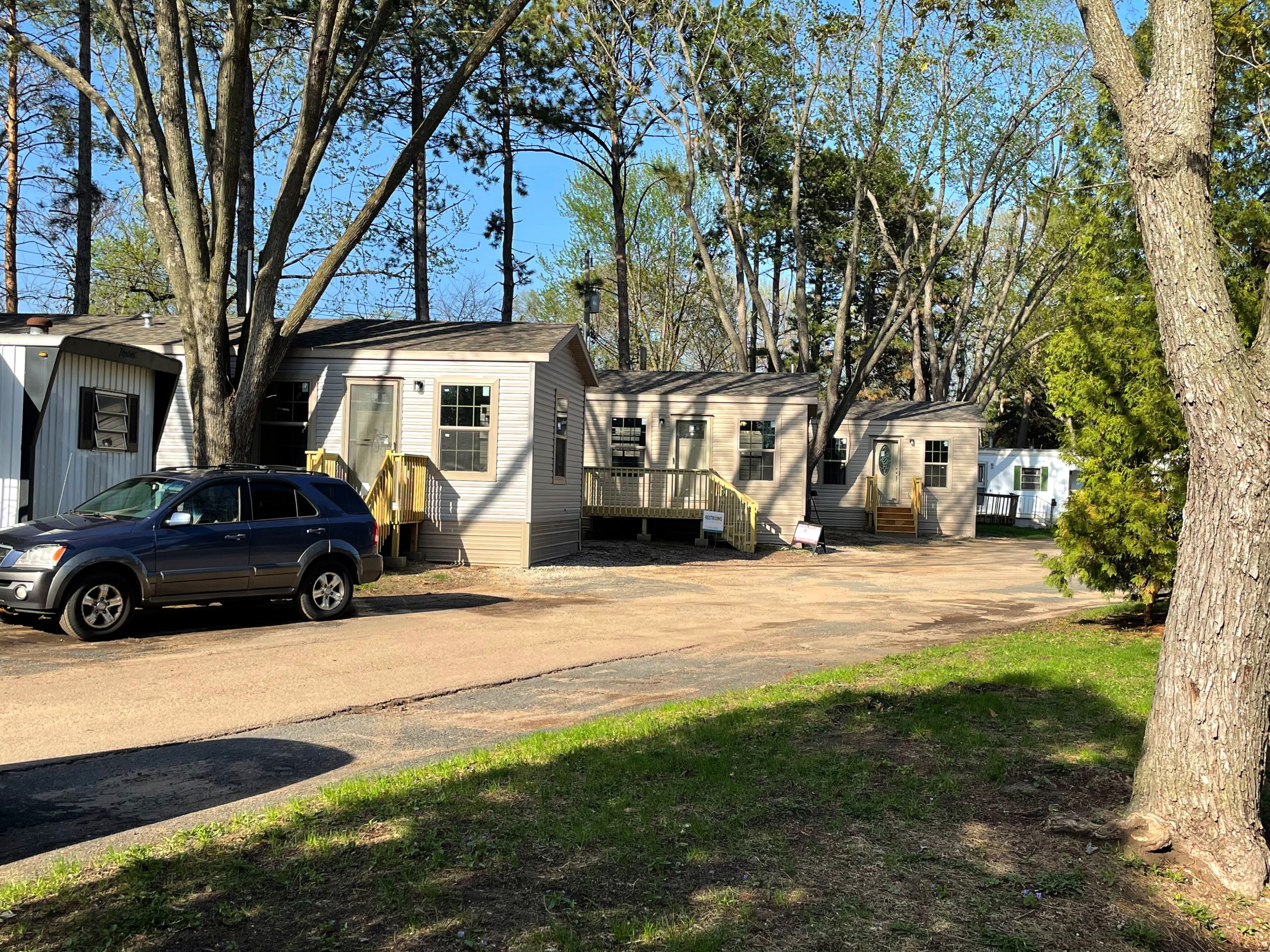
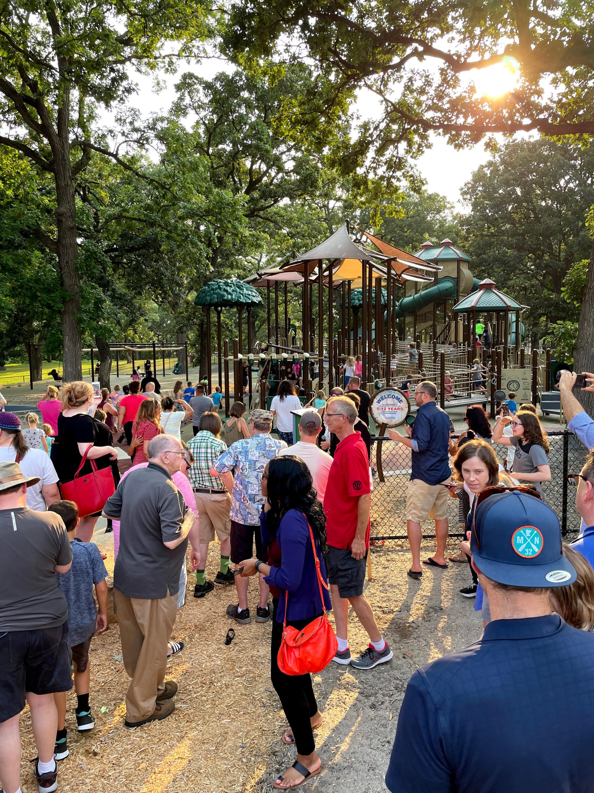
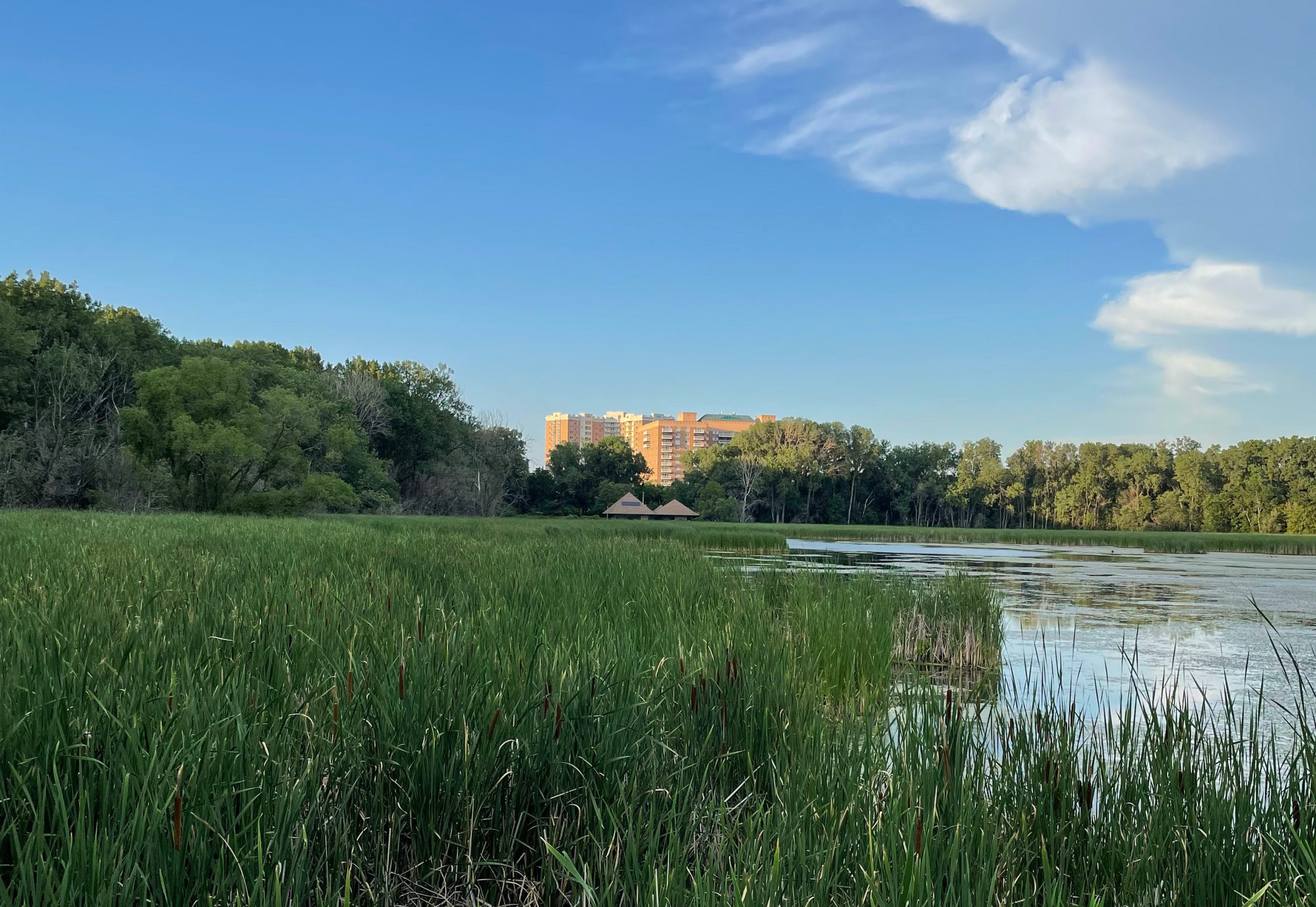
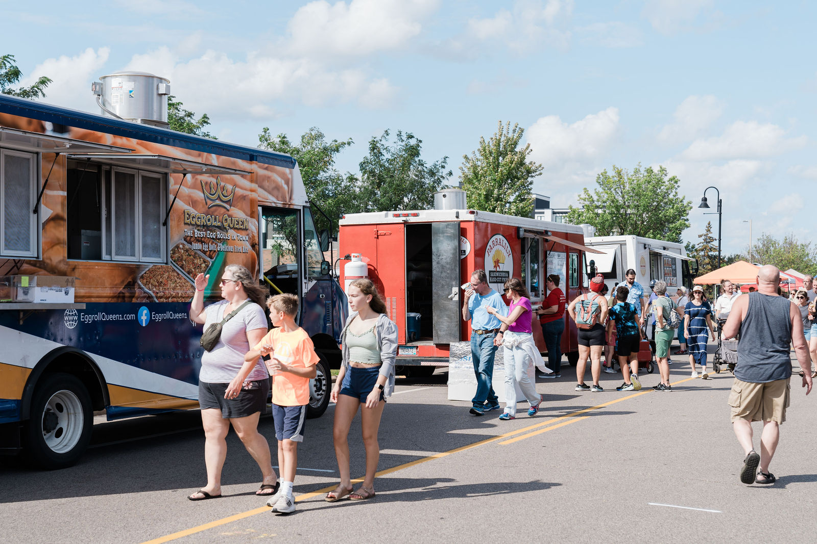
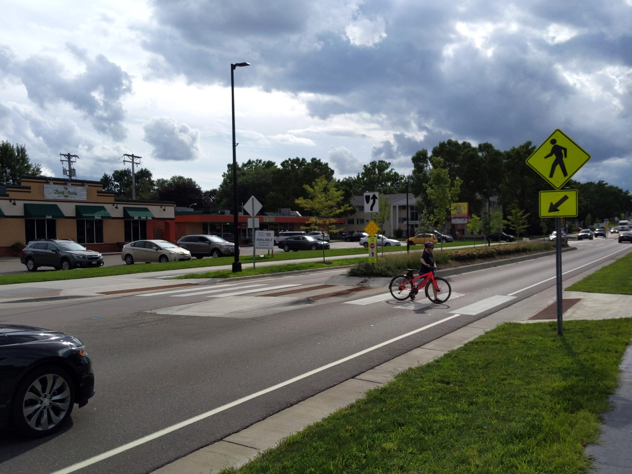
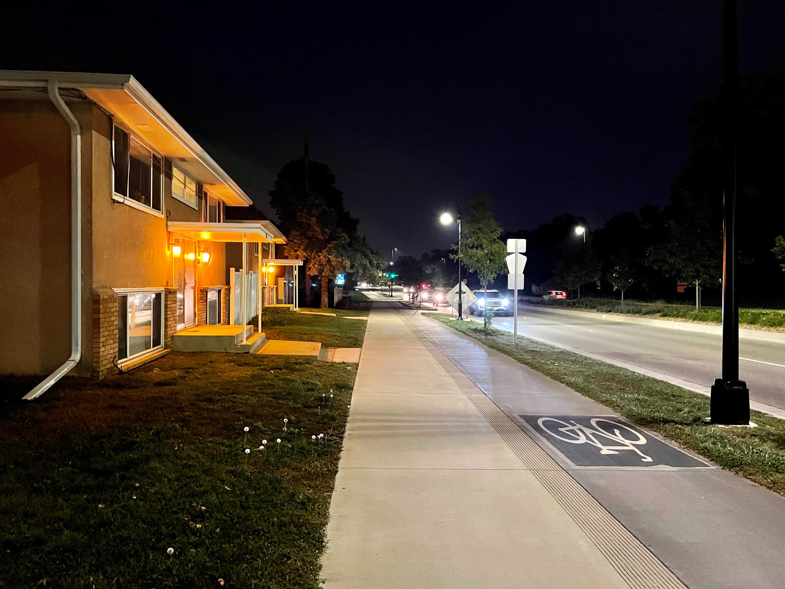
A block of post-World War II rambler/ranch houses, one of the most common housing types in Richfield.Prewar homes in the historic Oak Grove neighborhood.The Woodlawn Terrace manufactured home community along a newly rebuilt Lyndale AvenueNew manufactured homes inside the Woodlawn Terrace communityOpening of the Augsburg Adventure Park, a new fully accessible playground for all.Woodlake Nature Center — a 150-acre nature preserve on the edge of Richfield’s downtown. The nature center building is being rebuilt in 2025-2026, and the new design prioritizes walk-up access for the thousands of residents within walking distance, as well as the three major bus lines that serve the center.A new mixed-use apartment building downtown, alongside a reconstruction of a street for a new roundabout.PennFest, an annual open streets festival put on by the small business district on Penn Avenue. Photo: Rachael Larson.A pedestrian crosses at one of many pedestrian crossing islands on the new 66th Street. Adjacent to a major park, this section of road was previously 4 lanes with no medians, bike space, or greenery.A section of the 66th Street bikeway at night, providing pleasant walking and biking to existing apartment buildings.
Metro Red Line Bus. Orange Line buses will have a similar appearance.
Residents of South Minneapolis, Richfield, and Bloomington got some very bad news last week. In response to a move by Dakota County to leave the Counties Transit Improvement Board, CTIB is considering withdrawing its funding for the Orange Line Bus Rapid Transit. The Orange Line would be the metro’s first true bus rapid transit line, offering similar frequency to and better transit time than our Light Rail lines. Unlike our light rail lines, however, the Orange Line will cost only about $150 million — less than 1/1o the cost of Southwest LRT.
Although end-to-end, the line connects Dakota County to downtown Minneapolis, the vast majority of the capital investment, stops, and riders are within Hennepin County. Although I do not agree with Dakota County’s decision to leave CTIB, I am outraged that the CTIB board is playing political games with a much-needed, cost-effective transit line that will serve my community.
The Orange Line
Source: Metro Transit
The Orange Line would run along the 35W corridor from downtown Minneapolis, through South Minneapolis, Richfield, and Bloomington — each getting two stops — and terminating in Burnsville. A future extension is contemplated to Lakeville, but not included as part of this project.
Within the 494 beltway, the Orange Line is similar to the 535 bus line — however, the Orange Line will vastly improve on the 535, with improved frequency, station experience, and ride quality. Like the “A” line and LRT, the Orange Line will have off-board payment and ticket machines available at every station.
Infrastructure Improvements for Hennepin County
The capital improvements being done as part of the line will also significantly improve the speed and reliability of the ride, for both the Orange Line and other express buses. Lake Street Station will be rebuilt to a high-quality, accessible, sheltered station that will allow buses to pick up and drop off customers without having to cross five lanes of rush-hour traffic. At 494, the bus will exit 35W and go through a new underpass between a 76th St Station (serving offices of Best Buy and US Bank) and American Blvd Station (serving the Southtown and Penn-American District). The underpass will also provide an essential bike-ped connection where there is currently a one-mile gap between crossings.
This transit station may not happen, since some of the buses passing through will go to Dakota County. Source: Metro Transit
“A Dakota County Nexus”
In the presentation at the last CTIB meeting, the Orange Line funding was listed alongside projects benefitting solely Dakota County — like a rebuild of the Cedar Grove Transit Station. I was surprised to see the Orange Line framed as a Dakota County project — in part because I, myself, had planned to use it to go from Richfield to downtown, and in part because the majority of the stops and improvements are clearly within Hennepin County.
Orange Line as having a “Dakota County Nexus”. Source: CTIB/MN Rides
I spoke with Christina Morrison, the Metro Transit project manager for the Orange Line. According to Morrison, 92% of the 2040 Orange Line boardings are anticipated to be from Hennepin County. This is overwhelmingly a project that will serve Hennepin County residents and businesses.
What’s more, according to Morrison, CTIB’s $45 million contribution would come from the years 2016, 2017, and 2018 — and Dakota County’s payments to CTIB would not terminate until the end of 2018. Even with their withdrawal, Dakota County would still be paying their fair share toward this project.
Time to Act
CTIB will decide whether to move forward with Orange Line funding at their August meeting. I strongly encourage you to to contact your CTIB representatives to express your support for the project. For Hennepin County, those representatives are Peter McLaughlin <[email protected]> and Mike Opat <[email protected]>.
The Orange Line is an important, cost-effective project that will make 35W functional for all-day transit service. And residents of Hennepin County should not be punished, simply because they are on the way to Burnsville.
I was up in Brainerd this weekend, visiting my sister. I’ve been up there several times since she bought a house just south of downtown a year and a half ago.
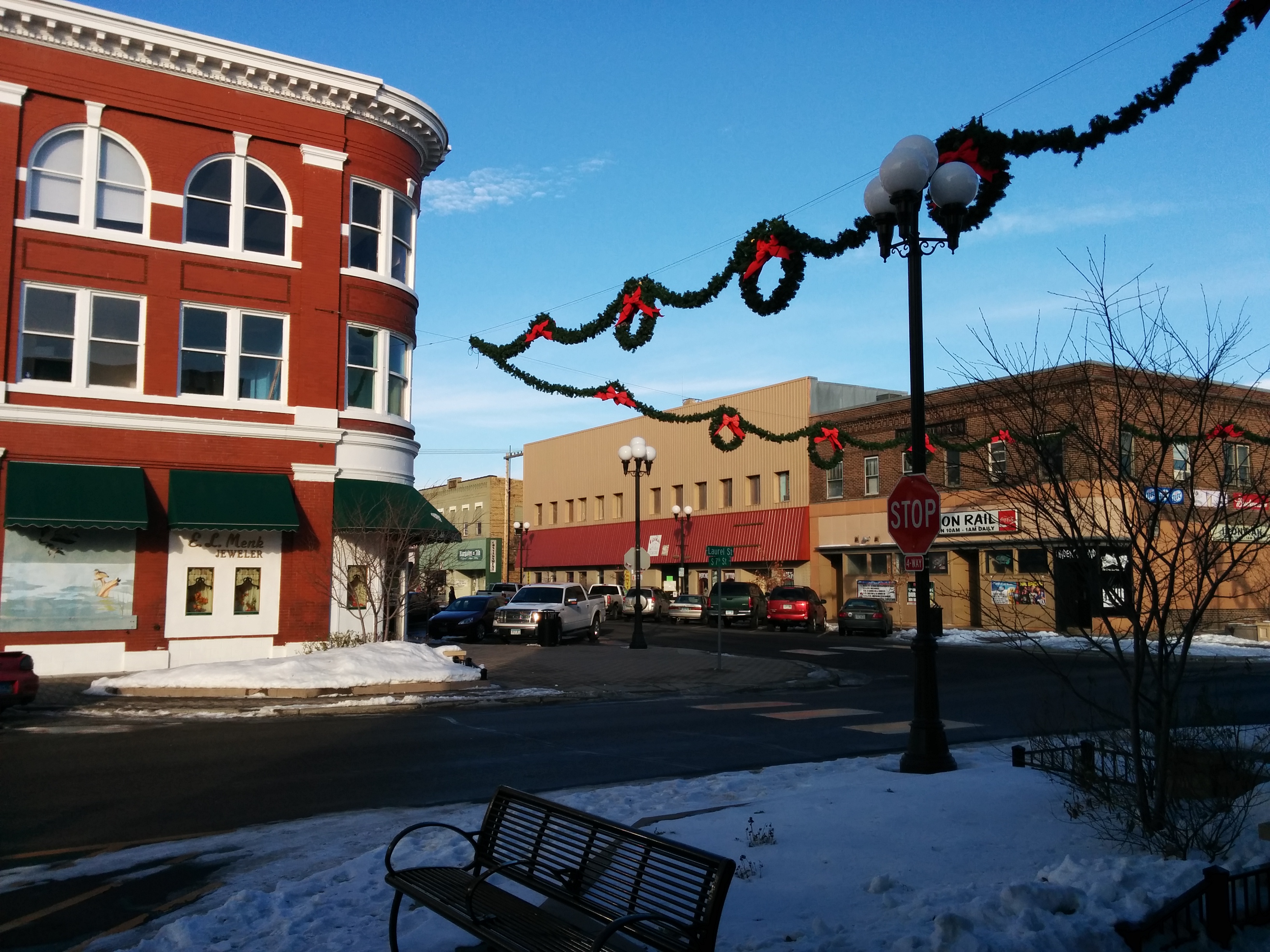
Downtown Brainerd in November 2014. Photo by author.
Brainerd has a nice, walkable downtown. It has wide sidewalks, trees and benches, and active storefronts. Compared to the neighboring Baxter strip, it’s a breath of fresh air. But how to get downtown?
Meet 6th Street
The main north-south spine of Brainerd is South 6th Street, which formerly carried Highway 371 (and still marked as “Business 371”). And it’s by far the most direct option to get downtown for anyone living in the south-central section of Brainerd:
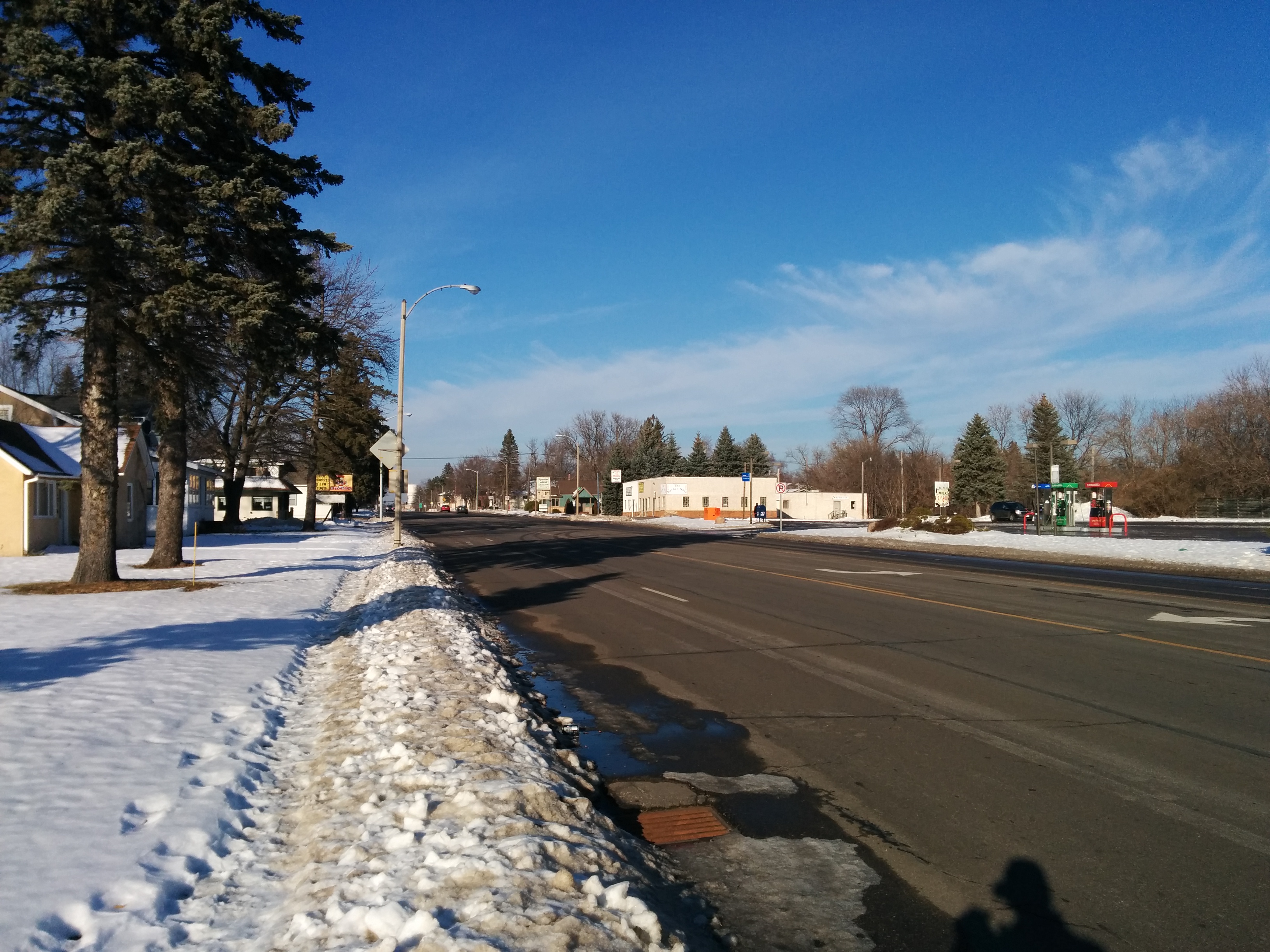
November 2014. Technically, there was a sidewalk underneath that snow. Photo by author.
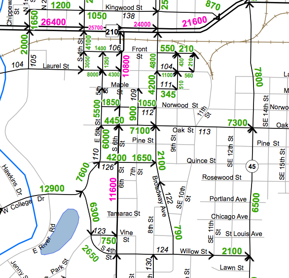
It’s a wide, five-lane stroad, with no parking, few trees, little lighting, and narrow sidewalks. It skimps on everything but number of lanes and width of those lanes. Currently, the four travel lanes are 12′ wide and the center turn lane is about 14′. All this for traffic volumes that barely scrape 10,000:
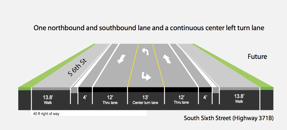
The bad news is Marohn’s efforts didn’t seem to be in line with the Brainerd City Council’s actions. For the most part, Brainerd chose the 5-lane section — widening the street out to 5 lanes and making it more pedestrian-hostile as it approaches downtown. Even the 3-lane section that is being built (south of Quince St) is shockingly unambitious. Despite many indications that 10-11′ lanes are the safest for calming traffic (and even very car-oriented engineers preferring 11′ lanes), MnDOT’s plan offered the community 12′ travel lanes and a thirteen foot center turn area.
6th Street 3-lane section
Opportunities for planting along the corridor appear to be unseized, but that could change. However, since the sidewalk narrows to 9′ north of Quince, trees likely could not be sustained near downtown.
Why would a city do this –throwing away an opportunity to transform one of its most important streets, all for nonexistent traffic?
I wrote the Brainerd City Council in November asking them to support a 3-lane design. The only response I received is revealing. After expressing concern about possible cut-through traffic from a calmed 6th Street, this Councilman went on to explain:
Business 371 is named for that very reason. For business.
We also have a lot of future growth to deal with. For a example [sic] there are 640 acres own by the Mills family for residential housing just southwest of Brainerd that will have high traffic counts when it gets developed.
Business 371 needs to be five lanes.
I won’t opine too much on the Councilman’s response, since just about everything I could say has been expressed many times by Strong Towns. But, in short: we should sacrifice the town we have today, in the hope that we will one day be able to encourage more traffic to serve new greenfield development. A symbolic gesture that I’m sure was intentional, he did not once refer to 6th Street by its local name — only as “Business 371”.
A larger failure
Wasting an opportunity to seriously improve 6th Street is disappointing for Brainerd, but I find it even more troubling about what it says for MnDOT.
Ostensibly, Minnesota has a Complete Streets policy. So does Brainerd (adopted slightly after the decision to support an incomplete 6th Street). So why would MnDOT even offer such a bloated option to a local community? And why would even the “road diet” version offer proportions that are dangerously wide and encourage speeding?
Unfortunately, I don’t know the answers. But I do know that this project represents nothing good about MnDOT’s ability to implement Complete Streets.
Note: I chair the Richfield Bike Advocates, and represent that group as a non-voting liaison to the Richfield Transportation Commission. However, I am not speaking on behalf of either group.
Tonight, the Richfield City Council will make a major design decision that will affect more than 20,000 people every day. The City Council will consider whether or not to approve Concept 4B for 66th Street between Penn Avenue and 35W (already approved from 35W to 16th Avenue). The design features wider sidewalks, boulevards, protected bike lanes, and (likely) planted medians.
Concept 4B, approved by Transportation Commission from Oliver Ave to 16th Ave
This concept represents community consensus of how our major streets should work, and also meets Hennepin County’s demands for auto capacity (four through lanes). But there’s a catch: it doesn’t fit. The new street would be about 100 feet from the the outside edges of the sidewalks, while the existing street fits tightly in the 66′ right-of-way. To make room for the new space, eighteen homes will have to come down on the south side of the street.
There are a lot of obvious conflicts here: Hennepin County demanding 4/5 auto lanes, while Richfield might find three acceptable. Bicyclists asking for dedicated space on a roadway, requiring width that doesn’t exist currently. Homeowners adjacent to the street, some of whom strongly wish to stay in their homes, while other groups vie for the land. But there’s an underlying conflict: the old school of thought, who likes 66th Street the way it is, and perceives its future as solely a piece of automotive infrastructure. The new school of thought isn’t satisfied with the 1958 design, and sees it as having potential for something more, as a space that serves everyone, and as a symbol of community.
Guiding Principles and a New Vision
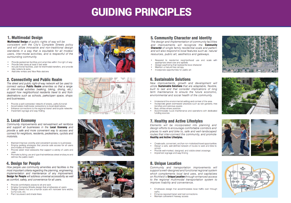
The Transportation Commission recommended approval of Concept 4B in their November meeting, but that was only the most recent decision in a public process that has lasted over two years. The first step was a task force that developed “Guiding Principles” for street reconstruction — the first of which was multimodal design.
Richfield guiding principles
The Guiding Principles are a terrific vision, but they lack balance with the auto infrastructure concerns. Not a thing in the Guiding Principles document mentions automotive capacity. Is this because we’re designing it first as a public space, and only as the very last consideration taking cars into account? Probably not. Rather than addressing how the two might interact, the Guiding Principles seemed to have an implicit understanding that any and all of these community priorities may be overridden as needed for the flow of automobiles.
Yet the Transportation Commission and city staff have stood behind the Guiding Principles throughout the project. There has also been a second set of goals they’ve stood behind, that the proposed street should be safe and practical for pedestrians, transit, recreational bicyclists, commuter (transportation) bicyclists, (motor) vehicles, environmental concerns, and roadway maintenance. Commissioners have repeatedly emphasized that the street built today will likely outlive most of the people making these decisions, and that we must see this as a 50-year-plus commitment.
Practical, Cynical, or Barebones?
Not everyone has been as eager to rebuild 66th as a complete street. Around last summer, criticism came in heavily toward the possibility of removing 18 homes to make way for a wider 66th. Homeowners west of Penn Avenue — who would have had right-of-way impacts, but would not have had any risk of their homes being taken — were particularly strongly organized against the widening. (They were ultimately successful, in that the proposed design does not include a bikeway west of Penn.) Homeowners whose homes were on the line between Penn and 35W were also concerned. One of those stories was even documented in the Star Tribune.
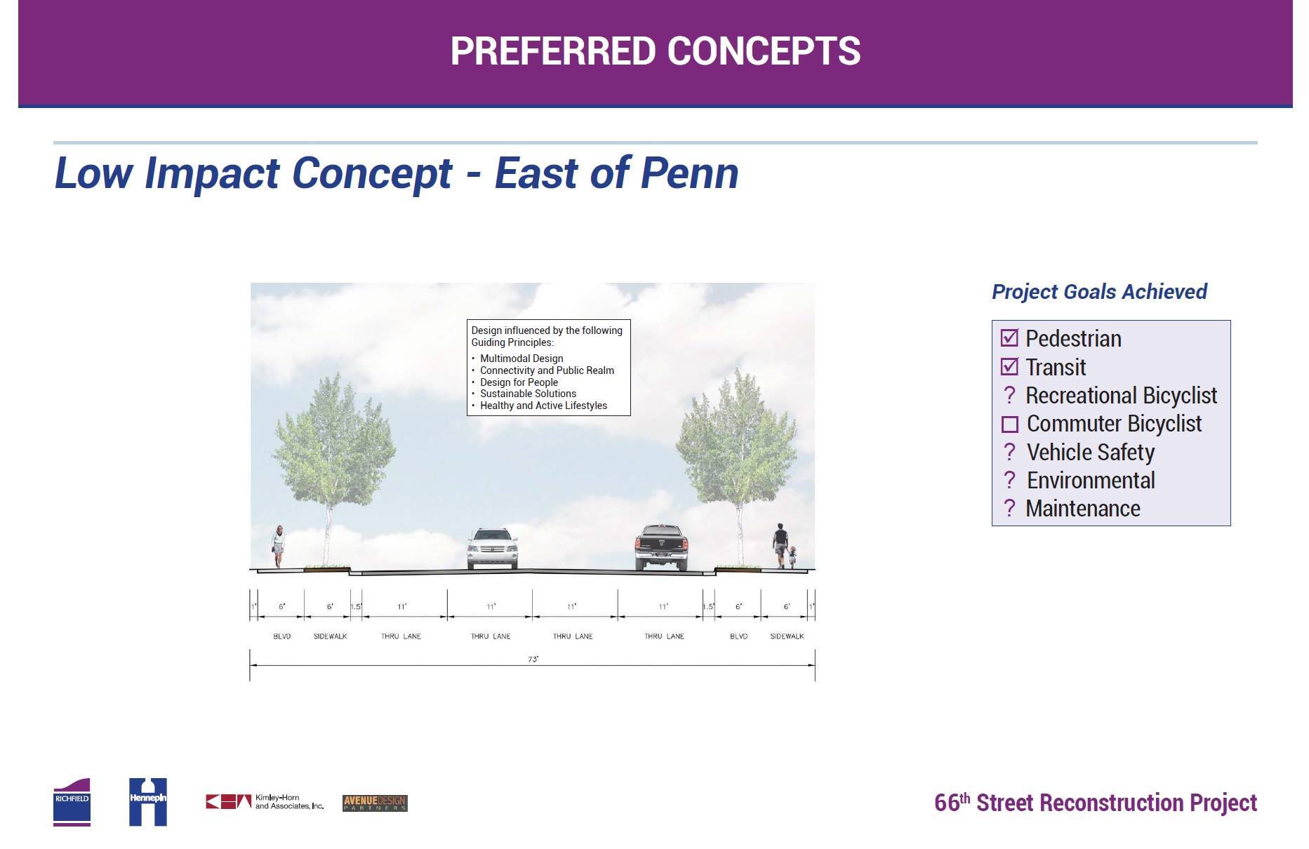
City staff came up with a concept they called “low-impact”, which was essentially a copy-and-paste of the current street, plus some trees:
Low Impact Concept for 66th
Some city leaders initially praised the concept, as did local reporting. And city leadership’s support for keeping the street more-or-less the same didn’t stand alone. A homeowner who lives west of Penn on 66th Street — apparently not considering bike or pedestrian safety improvement to be safety improvements at all — said in a letter to the editor:
The terms “safety,” “green space,” “maintenance” and “planning for the future” have been used to justify this $40 million project. Safety is a subject everyone is concerned with. […] Instead of addressing that problem we are going to reduce lane size, add cycle tracks, walking paths and biking paths.
Since property has been taken from residents twice when the road was previously widened, further possession for bikes, boulevard and wider sidewalks would encroach upon the privacy of taxpaying residential owners.
I’m disappointed that Mayor Goettel and Councilmember Elliott are supporting a plan for the reconstruction of 66th Street west of Nicollet [sic] with no option for bicycles. This isn’t a frivolous extra for a few people to get exercise; 66th is a vital corridor for the north half of Richfield. It’s the only place to cross 35W north of 76th Street, and right now it might as well be a stream of lava as far as bike safety is concerned. I don’t see anything in the “scaled-back” plan to fix that.
After five open houses, comments solicited from the general public seem to follow similar trends. Many wanting major improvements to change the way the street works for all users, while some truly believe the best approach is to fix what’s in place. One resident writes:
I support the proposed concept to bring the best for all modes – pedestrians, motorists, bicyclists and think this is a very forward looking plan which will serve Richfield for many years into the future.
Is Tearing Down Homes Consistent With Goals?
One of the criticisms of the project that seems the most profound and simple is this:
I agree that a 66th Street for All at the expense of your neighbors is baffling and wrong.
Is it? It certainly could be. But if it is baffling and wrong, who’s to blame? The 20,000 cars, many of whom use 66th as a reliever for the Crosstown Highway? The engineers who say that there is no way the cars can function in three lanes? The bicyclists who want to be able to ride along the sides? The pedestrians who require sidewalks?
Despite going into the 66th Street project knowing that homes would have to be torn down to make improvements, this issue was never addressed in the goal-setting. Nor was the more general issue about balancing automotive demands and community demands.
So for now, we’re left between two camps. One who sees the purpose of the street only to move cars, and who thinks it basically works well today. And the other that sees the street as drastically deficient, a relic of a bygone time that will not serve a multimodal future.
Tonight, for at least this one segment of one street, we will see with which camp Richfield’s leaders most align.
If you are interested in attending:
Richfield City Council Meeting — December 9th, 7:00pm Richfield City Hall 6700 Portland Ave S Richfield MN 55423
The City of Edina is finishing up an ambitious project to help remake France Avenue through the Southdale District into less of a highway, and more of an urban boulevard.
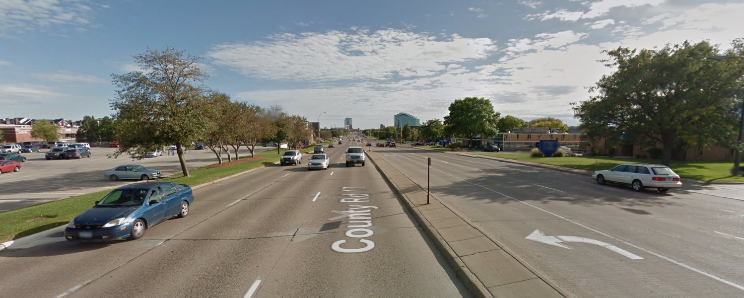
To the unfamiliar, France Avenue through the Southdale District is a 40 MPH, 7+ lane divided megastroad. Prior to this project, there was a sidewalk on only one side, nearly every intersection had a porkchop island (free right turn), and there was not a single crosswalk marking between the Crosstown (TH 62) and the Bloomington city line at Minnesota Drive.
Southdale’s France Avenue has long been seen as a barrier to neighborhoods. It divides the largely residential area on the west to the core of the Southdale District, including Southdale Center, Centennial Lakes, Galleria, and several office and housing complexes. The original solution to this problem was an expensive pedestrian bridge that would have spanned France at a single point. Instead, the project was reworked to focus on bike-ped accommodations at three critical intersections–76th, 70th, and 66th–and to make general improvements along the whole corridor. As density and housing continuetoincrease in the Southdale District, this change in focus is in line with the larger transformation of the area into something of a third downtown. Rather than being a barrier to cross, France Avenue should be a primary focus of the area.
The process and concept of this design are terrific. Our metro area is filled with stroads like France Avenue, and there is simply not always the budget or need to tear them up and reconstruct them from scratch. This was a unique attempt to improve the corridor for pedestrians as a retrofit, with a relatively small price tag.
However, the result of this process has been underwhelming. I did a walk-through this week, and was disappointed to find that, although it appeared pedestrian-friendly at 40 mph and a few meaningful improvements were made, the on-foot and on-bike experience was still pretty lacking.
(Note: Although technically owned and maintained by Hennepin County as CSAH 17, this project was administered by the City of Edina.)
Farewell to Pork Chops
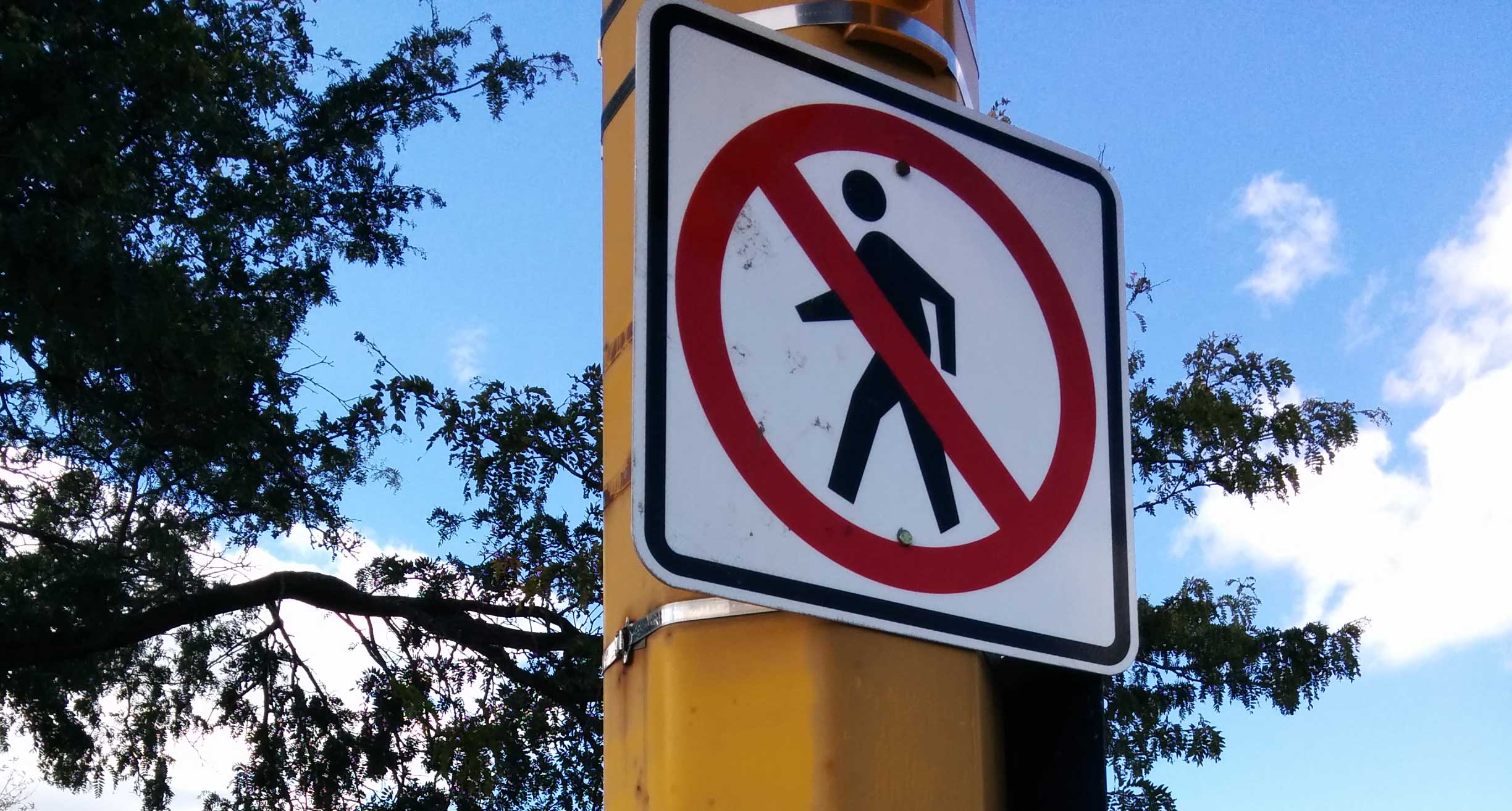
Porkchops–the triangular islands used in conjunction with free right turns–formerly littered France Avenue. This right turn design encourages motorists to make high-speed right turns on red, and can pose a real barrier for pedestrians crossing the street. At best, a pedestrian must cross the street three times instead of once. At worst, the pedestrian must play “chicken” with a right-turning motorist to assert their right-of-way.
Occasionally, porkchops pose an inconvenience to pedestriansA more humane way to cross the street
The removal of porkchops along France was a great improvement. Unfortunately, the curb radius used is still quite large–almost as large as a small free right, and substantially larger than nearby county roads use. This encourages higher-speed turns across the crosswalk.
Refuge Islands
One mixed blessing is the refuge islands placed at the major intersections. On the one hand, it really does increase the comfort of crossing the busy street. Although I was caught in the middle while crossing, I did not find it at all unpleasant to wait there for another cycle.
However, since the engineers did not want to create a tighter turn for left-turning motorists, the crosswalks are now set way back from the intersection. This means a slight detour to cross the street, and it also means this:
And, on my return trip, this…
Cross Street Bike Lanes
One detail intended to improve bicycle safety was short stubs of bike lanes on either end of the three major intersections. The idea is that by providing a designated space for bicyclists at the intersection, they will make it across France Avenue more safely, and be less likely to ride in the right-turn lane. This makes sense at first whiff, except to consider bicyclists are generally going farther than half a block past France. Assuming they wish to proceed on the street, they are now forced to merge back into busy traffic, where they have just been coaxed to give up their space.
The vanishing bike lane
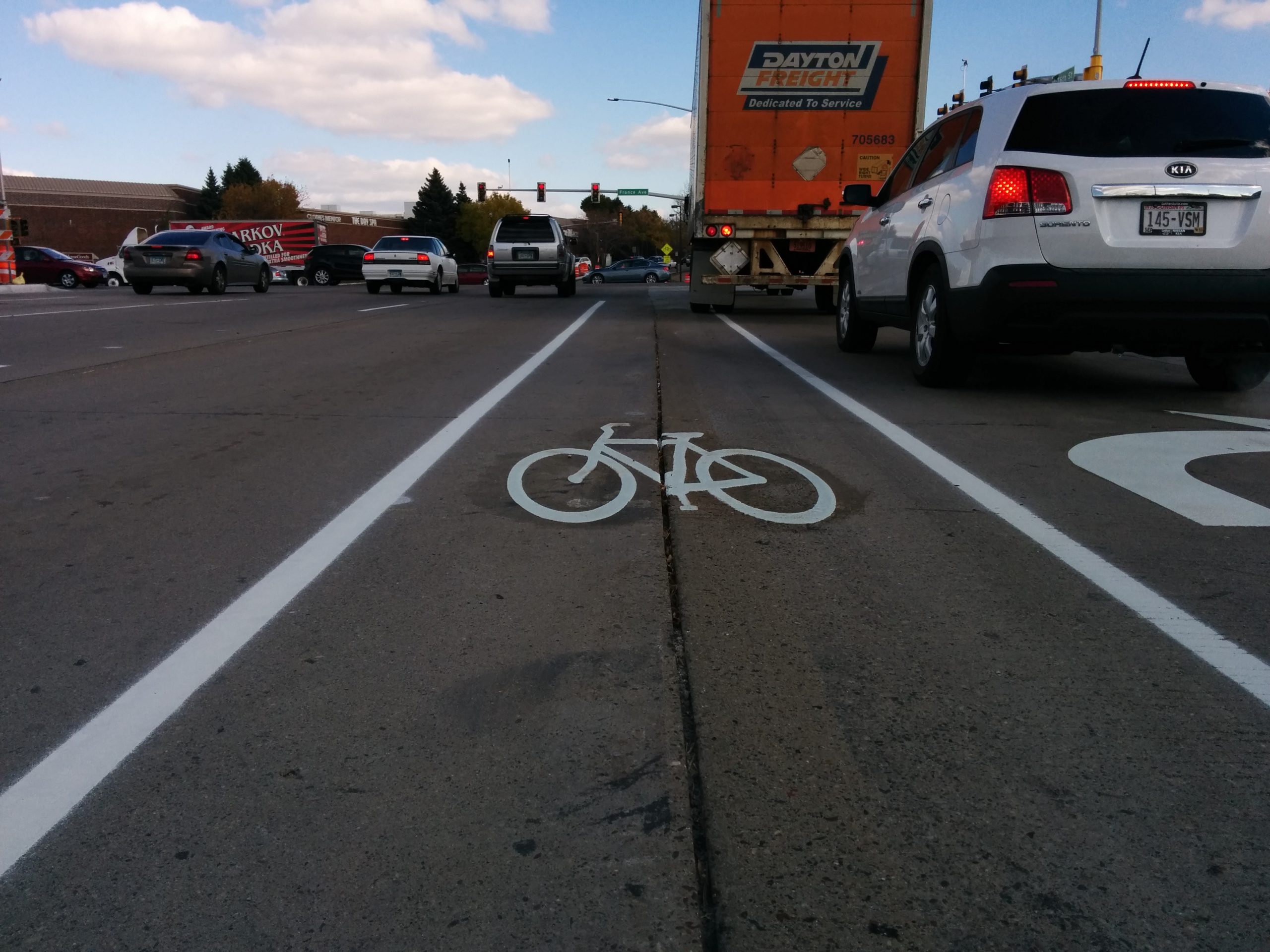
I objected to this design before it was striped, but was rebuffed by the consultant on the project. Seeing the actual striping down, the situation gets even worse: at 70th and 76th, the lane was striped over a substantial longitudinal gap. Nearly everyone who rides a bike knows the danger of longitudinal cracks: they can easily grab a narrow tire and cause the cyclist to lose control of their bike. If the cyclist manages to stay upright, they’ll still have to merge back into traffic–on 76th, they’ll do so in the middle of a signalized intersection, going up a hill.
Mind the gap
Pedestrians As Clear Zone
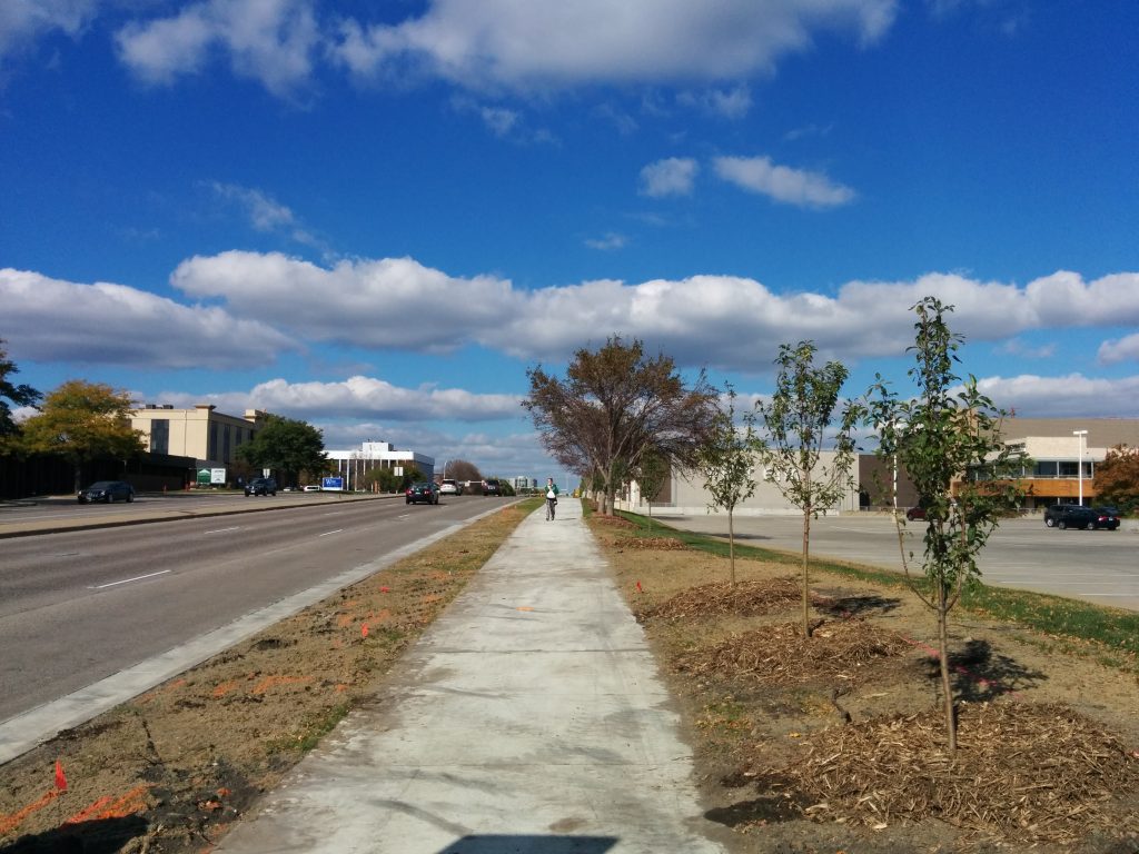
The project included installation of a much-needed sidewalk along the east side of France. In terms of construction quality, this is a great sidewalk: it’s at least eight feet wide, saw-cut, with a six-foot boulevard. The project also included landscaping for this project, including boulevard trees to shade pedestrians and calm traffic.
This human being will cause far less damage to an errant car than a mature tree would.
Unfortunately, these boulevard trees have been placed behind the sidewalk, at least 15′ back from the curb. This means that they will not shade the street for at least a decade, and will never provide a buffer from moving traffic. They also give the compelling feeling to pedestrians that they, too, are part of the clear zone of high-speed France Avenue.
Needless Restrictions on Pedestrians
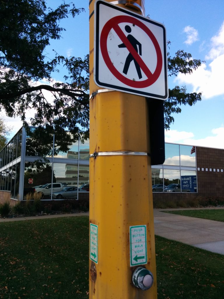
The signals do not include an automatic pedestrian phase on any legs, for any intersection, even though most lights for France are more than long enough to accommodate such a phase without any adjustment. And although the project did add several new crosswalks, there is at least one mysterious removal. At Parklawn Avenue, an existing crossing at the north leg was removed. There was no cost savings to this removal, as the project would not have required any new construction or new push buttons at this location. By eliminating the crossing, pedestrians on the north side sidewalk must cross the intersection through three legs instead of one.
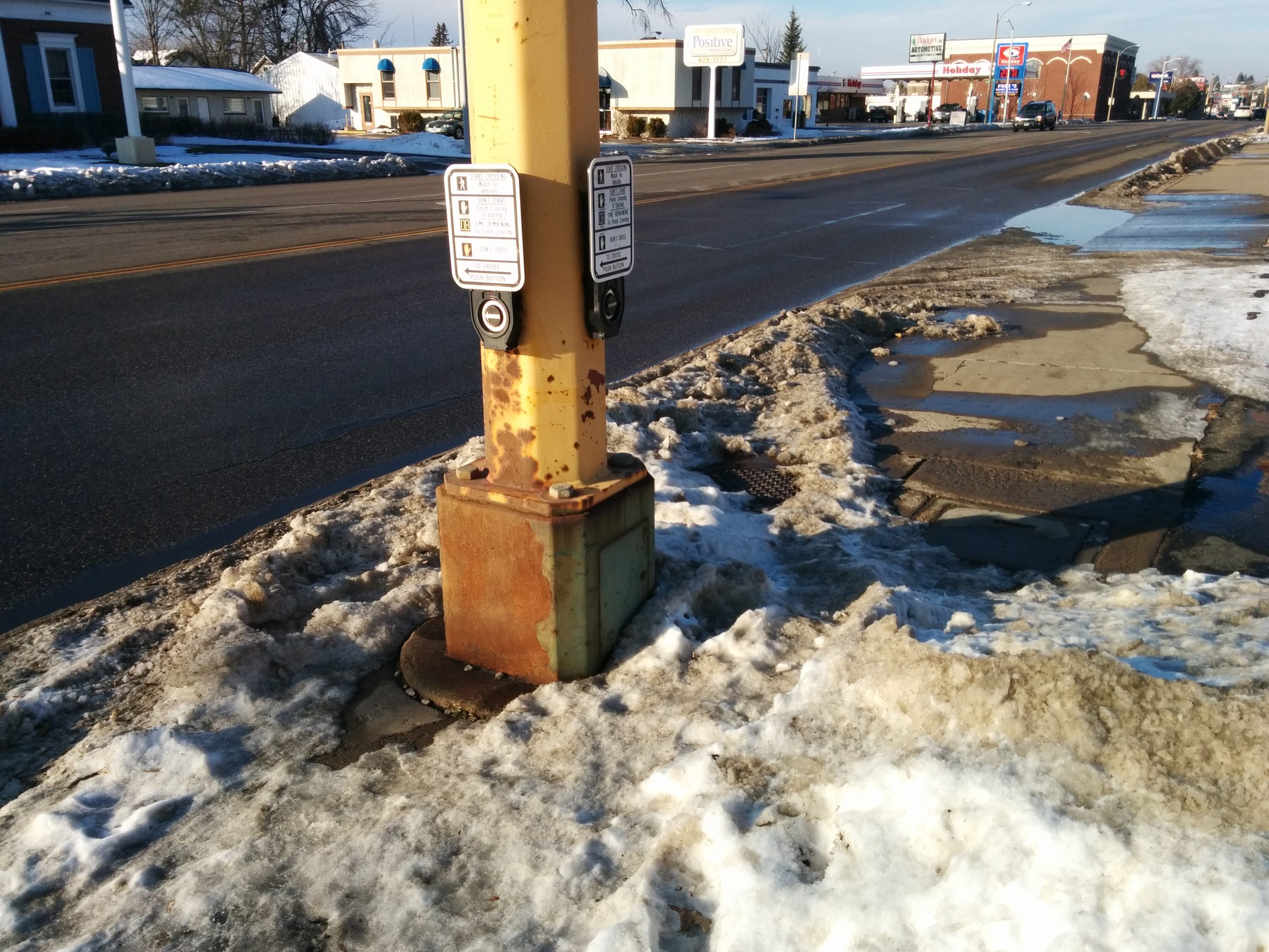
Rusted-out scar of a removed beg button.
A Work In Progress
Although there are many disappointments in this year’s France Avenue project, I do not think this is a sign of the hopelessness of the Southdale District. Rather, it is a sign of just how much we must do and just how differently we must approach our streets in order to turn a high-speed stroad environment into a meaningful street for people.
I grew up in Northfield, and Cedar Avenue was a common route from Northfield into the Twin Cities. The name isn’t signed between the Northfield border and Eureka Township, but I knew it by no other name. In fact, I remember my parents having to explain to me, when I was first learning to drive: “just follow the signs for 23… 23 is Cedar.”
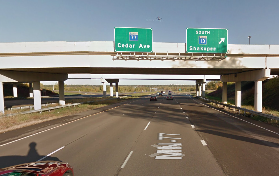
So it’s caused me almost endless frustration, since moving north of the Minnesota River, that folks nearly always refer to the freeway portion of Cedar as “Highway 77”. Although as an urbanist I naturally lend more value to a city street than a freeway, it seemed to be awfully Minneapolis-centric to only lend the name of this long-established route to the street within the city limits.
Since first noticing the differences in usage of 77 versus Cedar Avenue, I’ve also taken note of many other differences in local names versus signage on freeways and other major trunk highways. Other than Cedar/77, the most established appear to be TH 62 Crosstown and TH 55 Hiawatha Avenue.
Does giving a highway a local name enhance community identity? Or does it dilute the value of a name?
And now, my list, based entirely on my own impressions and findings. Please add comments if you know of others, or find any errors.
Highway number
Historical or current name
Usage?
MN-3
S Robert St / Robert Tr
Name seems to be used north of Dakota County Road 42.
MN-5
Fort Rd / W 7th St
W 7th St name is used heavily in the City of St. Paul. Freeway portion through Fort Snelling, and through the concurrency with I-494, does not seem to be called Fort Road. Note that the TH 5 freeway bridge is called the Fort Road Bridge.
MN-13
Sibley Memorial Highway
Name is signed in City of Eagan and Mendota. Only appears to be used actively in Mendota.
I-35/35W
Lyndale Avenue (Historical) / Bloomington Fwy
Runs concurrent with Lyndale Avenue south of the Minnesota River, but I have never heard anyone refer to 35/W as Lyndale.
US-52
Lafayette Freeway
Used extensively locally, especially to describe the Lafayette Bridge. Freeway was built prior to US 52 being routed on it. Not signed on freeway.
MN-55
Hiawatha Avenue / Olson Memorial Highway
Signed heavily on Hiawatha Avenue segment. Olson Highway name is signed in North Minneapolis and Golden Valley. Hiawatha name is heavily used; Olson Highway less-so, especially outside Minneapolis.
MN-62
Crosstown Highway / The Crosstown
Not signed on freeway. Name used on some local signs, as well as Mn/DOT press releases. Used extensively locally.
MN-47
University Avenue
Signed heavily within City of Minneapolis. Highway 47 seems to be more common name in highway-like portions.
MN-65
NE Central Avenue
Signed heavily, especially inside 694. Central Avenue name seems more common, especially through Minneapolis and Columbia Heights. Central Avenue diverges from TH 65 north of 694.
MN-77
Cedar Avenue
Signed at all junctions except 66th St, Diagonal Blvd, and Mall of America Junction. Cedar Avenue name seems to be used more extensively south of the Minnesota River. Extends as Cedar Avenue both north and south of freeway portion.
MN-100
Normandale Road / Beltline Highway / Lilac Drive
Normandale Road (Blvd) is used south of I-494, but this highway seems to be mainly referred to as Highway 100. Google Maps does call it Beltline Highway.
MN 149
Dodd Road
Name seems to used, at least in Mendota Heights. Signed at interchange with 494.
I-394/US-12
Wayzata Blvd
No signage on freeway. No significant local usage (except for frontage roads) that I am aware of.
Streets.mn Editor’s Note September 2020: The article below has been referenced in a political flyer in a Richfield city council race. The flyer has the headline of “Tear down the 77th Street Sound Wall?” The article does not propose tearing down the 77th Street sound wall. Questions can be directed to either candidate.
If there were tenets of belief of urbanists, renunciation of stroads would surely be one of them. As transportation facilities, stroads are ugly, dangerous, and create incentives to drive a car, with disincentives to do anything else. As a tool of development, they fail to create value in their corridor in the same way a street would.
One block north of the I-494/MN-5 commons, Richfield’s 77th Street is a stroad unlike many others. On the one hand, the stroad is quite aesthetic, and provides a relatively good pedestrian experience. On the other, it’s further divided the community it runs through, and failed to promote desired development along the corridor.
The Stroad
The roadway itself is unremarkable. It’s a 35-40 mph 5-lane divided stroad. But just beyond the curbs, there are some important differences The north side has a tall, freeway-style sound wall (behind which lies single-family homes). The south side has a conventional sidewalk and business frontage, as well as Richfield’s largest concentration of low-income, high-density housing.
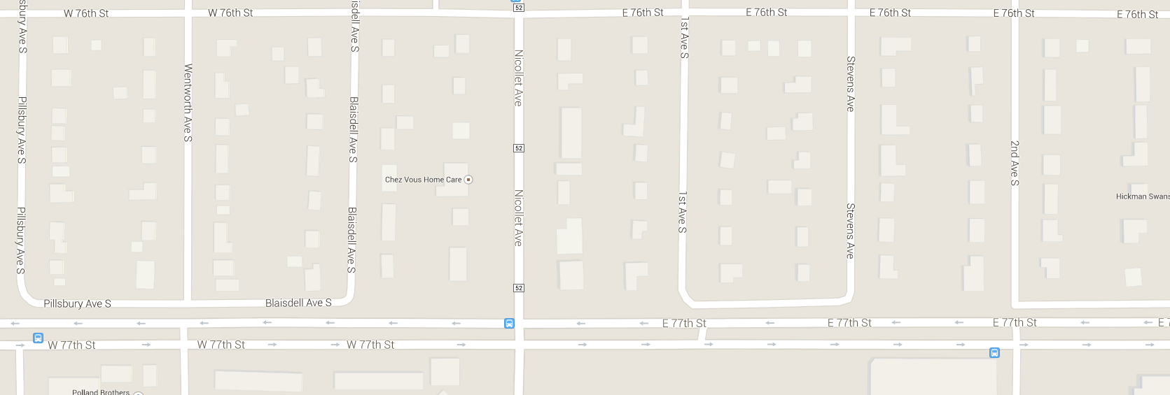
The grid stops short of 77th Street.
The other major difference is that this stroad was built in a traditionally developed context. To the north, the Minneapolis grid runs almost intact. This means at least 12 intersections per mile — and more conflict points if you consider possible alleys or driveways. To create a safe and pleasant environment for cars, this had to be addressed. Richfield’s Director of Public Works Mike Eastling, who was also with the City at the time of the 77th Street project, gave me background on the project. In the 1980s and early 90s, the City of Richfield purchased more than 50 properties along the north side of 77th, to create room to widen the street and a loop system of frontage roads. The actual road construction occurred in 1993.
The road has a nicely planted median, and is ornately planted on the roadway side of the sound wall. These plantings are maintained by the city, paid for by special assessments to businesses along the corridor.
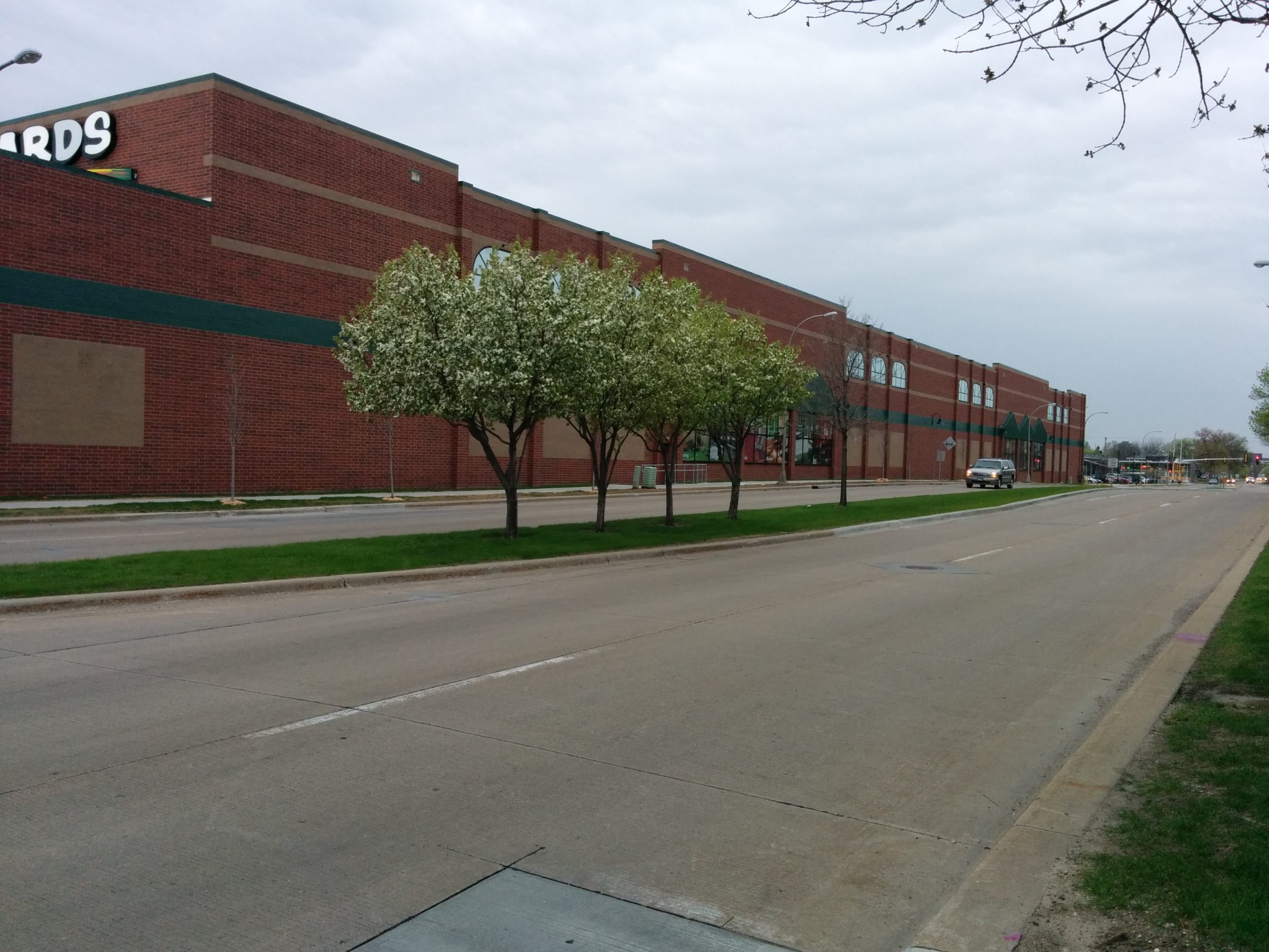
The view from the bus stop. Flowering trees in bloom by Menards.
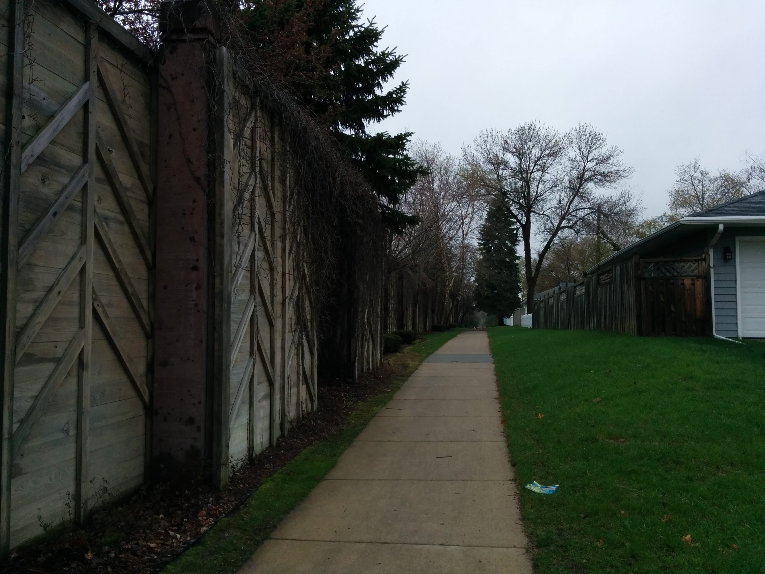
Along the north side of the sound wall, sidewalks connect between the “loop” frontage roads, so there is a continuous path for pedestrians. Unfortunately, pedestrians must walk in the roadway where the frontage road is present — and pedestrians go down to roadway level, rather than creating a more obvious shared space. Pedestrians are considered, but the experience is discontinuous, at best. There is also a conventional sidewalk with a 6′ boulevard on the south side of the street.
Sidewalk along the back side of the sound wall
The People
According to Eastling, the sound wall and removal of access for minor north-south streets were necessary to balance a city pursuing large, highway-scale development and resident concerns. Unfortunately, the only resident concerns accounted for were those of longer-term, single-family-home residents on the north side of the street. No attempt was made to manage sound or other impacts on the multi-family housing, either from I-494 or 77th.
This isn’t troubling just to consider the differences in the types of housing, but also the types of residents. Richfield’s median household income overall was $50,000 in 2011 — with one census tract as high as $105,000. In the main residential area south of 77th Street, the median income is $27,000 — half the city’s median. While Richfield is about 60% white, this area represents about 70% persons of color.
The wall is not an absolute divide between these worlds. There are periodic crosswalks, in addition to the major through streets. (One can cross at about every third or fouth block.) But it is a troubling symbol of divide between two very different communities.
The Lost Urban Village
77th was designed to serve freeway-oriented business, and it does a good job of this. Eastling actually made a good argument on this point, arguing that — while Richfield is a generally urban community — this is a very suburban, freeway-oriented corridor. And it needs a suburban, car-oriented street to serve it well.
Other issues with 77th notwithstanding, this is a reasonable way to approach the question. Maybe 77th Street does work. Maybe it keeps traffic off of 76th, a recognized new Complete Street. And maybe the value it creates is enabling highway-oriented business to efficiently transfer auto-driving customers.
Unfortunately, this is not the official vision of the community. Enter the I-494 Corridor Land Use Plan, a part of the adopted Richfield Comprehensive Plan, and probably the most universally ignored planning document in the city’s history. The plan strives to promote high-density, mixed-use development, that both serves cars but also creates a “pedestrian-friendly environment” in a “vibrant urban village.”
The closest development to the plan is Kensington Park and Mainstreet Village at Lyndale and 77th. On their face, they do a pretty good job. Kensington Park in particular has well-concealed parking, a mix of different housing types, and excellent frontage along Lyndale Ave and 77th.
However, the details show something else:
Chipotle (in Kensington Park) lays out the red carpet for pedestrians entering from the vibrant urban village.
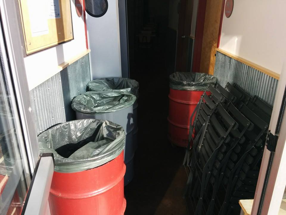
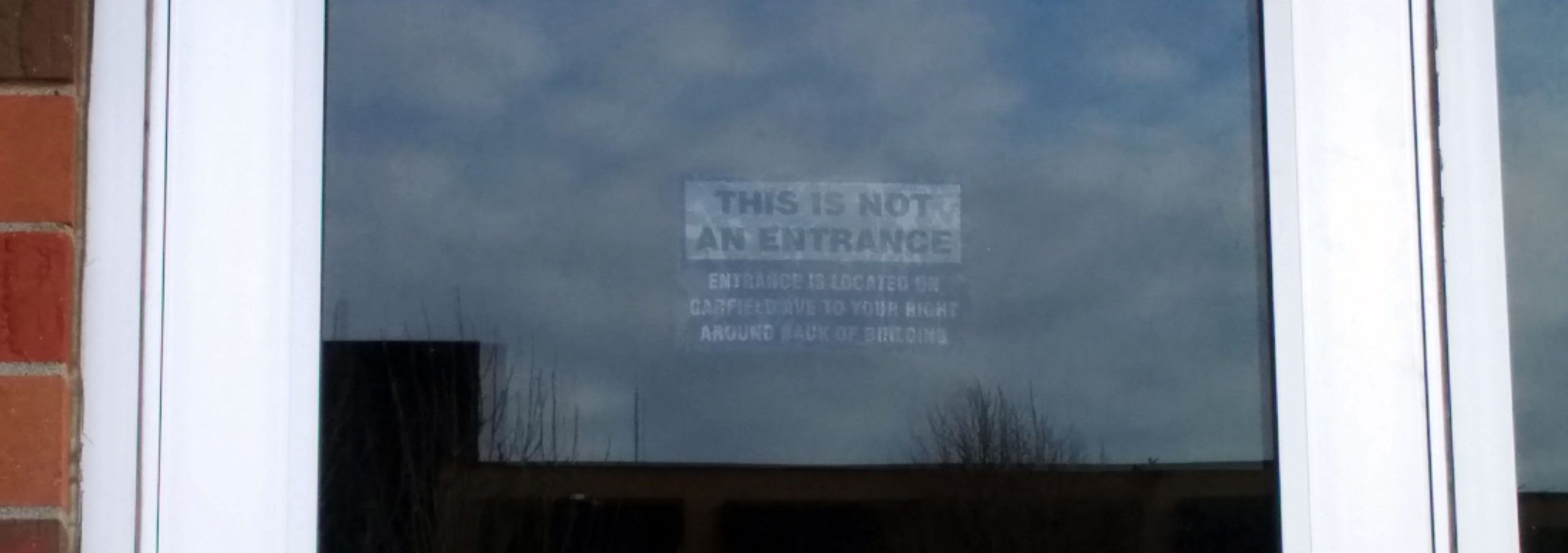
Street entranceNot Entrance to the Mainstreet Village office.
Even when the planning and orientation are done well, the businesses occupying the space still focus almost exclusively on cars and parking entrances.
On the other hand, sometimes the planning and orientation are also terrible:
Corridor Plan: “While parking is critical to the success of any future development in the corridor, it should not be a dominant land use seen from the public environment.”
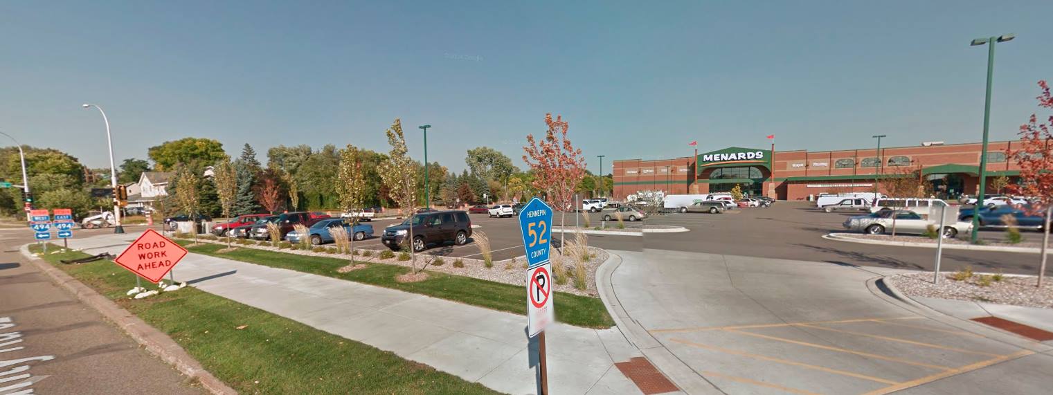
The Menards at 77th and Nicollet — constructed several years after adoption of the 494 plan — contributes nothing to the goal of the “vibrant urban village”. It is a single land use that occupies nearly three full blocks, including a block of parking at the one of 77th’s most important corners. In deference to the 494 Corridor Plan, Menards did install some (now-dead) trees along the edges of the parking lot, and some billboards along 77th to avoid a blank wall.
Eastling may be right — the 494 corridor is inherently suburban and auto-oriented. In this case, 77th Street is doing a fine job, and the development along the corridor is acceptable. On the other hand, if we are to believe in the vision of a “vibrant urban village”, development along the corridor has failed dramatically, and 77th Street is contributing the failure. Either way, the street creates a distinctive divide — between different demographic groups, between different street grids, and between different eras of the way we build our cities.