Category: Streets.mn article

  • The Orange Line Defunding is a Crisis for Hennepin County

    The Orange Line Defunding is a Crisis for Hennepin County

    Metro Red Line Bus. Orange Line buses will have a similar appearance.
    Metro Red Line Bus. Orange Line buses will have a similar appearance.

    Residents of South Minneapolis, Richfield, and Bloomington got some very bad news last week. In response to a move by Dakota County to leave the Counties Transit Improvement Board, CTIB is considering withdrawing its funding for the Orange Line Bus Rapid Transit. The Orange Line would be the metro’s first true bus rapid transit line, offering similar frequency to and better transit time than our Light Rail lines. Unlike our light rail lines, however, the Orange Line will cost only about $150 million — less than 1/1o the cost of Southwest LRT.

    Although end-to-end, the line connects Dakota County to downtown Minneapolis, the vast majority of the capital investment, stops, and riders are within Hennepin County. Although I do not agree with Dakota County’s decision to leave CTIB, I am outraged that the CTIB board is playing political games with a much-needed, cost-effective transit line that will serve my community.

    The Orange Line

    METRO Orange Line Route Map
    Source: Metro Transit

    The Orange Line would run along the 35W corridor from downtown Minneapolis, through South Minneapolis, Richfield, and Bloomington — each getting two stops — and terminating in Burnsville. A future extension is contemplated to Lakeville, but not included as part of this project.

    Within the 494 beltway, the Orange Line is similar to the 535 bus line — however, the Orange Line will vastly improve on the 535, with improved frequency, station experience, and ride quality. Like the “A” line and LRT, the Orange Line will have off-board payment and ticket machines available at every station.

    Infrastructure Improvements for Hennepin County

    The capital improvements being done as part of the line will also significantly improve the speed and reliability of the ride, for both the Orange Line and other express buses. Lake Street Station will be rebuilt to a high-quality, accessible, sheltered station that will allow buses to pick up and drop off customers without having to cross five lanes of rush-hour traffic. At 494, the bus will exit 35W and go through a new underpass between a 76th St Station (serving offices of Best Buy and US Bank) and American Blvd Station (serving the Southtown and Penn-American District). The underpass will also provide an essential bike-ped connection where there is currently a one-mile gap between crossings.

    Lake Street 35W Transit Station
    This transit station may not happen, since some of the buses passing through will go to Dakota County. Source: Metro Transit


    “A Dakota County Nexus”

    In the presentation at the last CTIB meeting, the Orange Line funding was listed alongside projects benefitting solely Dakota County — like a rebuild of the Cedar Grove Transit Station. I was surprised to see the Orange Line framed as a Dakota County project — in part because I, myself, had planned to use it to go from Richfield to downtown, and in part because the majority of the stops and improvements are clearly within Hennepin County.

    Orange Line as having a "Dakota County Nexus"
    Orange Line as having a “Dakota County Nexus”. Source: CTIB/MN Rides

    I spoke with Christina Morrison, the Metro Transit project manager for the Orange Line. According to Morrison, 92% of the 2040 Orange Line boardings are anticipated to be from Hennepin County. This is overwhelmingly a project that will serve Hennepin County residents and businesses.

    What’s more, according to Morrison, CTIB’s $45 million contribution would come from the years 2016, 2017, and 2018 — and Dakota County’s payments to CTIB would not terminate until the end of 2018. Even with their withdrawal, Dakota County would still be paying their fair share toward this project.

    Time to Act

    CTIB will decide whether to move forward with Orange Line funding at their August meeting. I strongly encourage you to to contact your CTIB representatives to express your support for the project. For Hennepin County, those representatives are Peter McLaughlin <[email protected]> and Mike Opat <[email protected]>.

    The Orange Line is an important, cost-effective project that will make 35W functional for all-day transit service. And residents of Hennepin County should not be punished, simply because they are on the way to Burnsville.
  • (April Fools) Hennepin County To Relocate Central Library to Geographic Center of Hennepin County

    (April Fools) Hennepin County To Relocate Central Library to Geographic Center of Hennepin County

    Medina, Minn — The Hennepin County Board of Commissioners has announced a strategic relocation of the Hennepin County Central Library, to join the ideal location of Hennepin County Public Works in Medina, near the exact geographic center of the County. Since the Minneapolis Library Board merged with Hennepin County eight years ago, Central Library has sat at an extreme southeastern location in congested downtown Minneapolis

    “There’s nothing ‘Central’ about downtown Minneapolis for the County,” observed Commissioner Jeff Johnson, who led the charge to move Central Library to his own District 7. “It’s really about equity. All square feet of all parcels of Hennepin County deserve equal access to all services. I’m tired of this Minneapolis-centric mindset.”

    Johnson noted that Hennepin County Public Works has functioned well at its Medina site, and says he expects similar results and “exciting synergies” from the Central Library relocation.

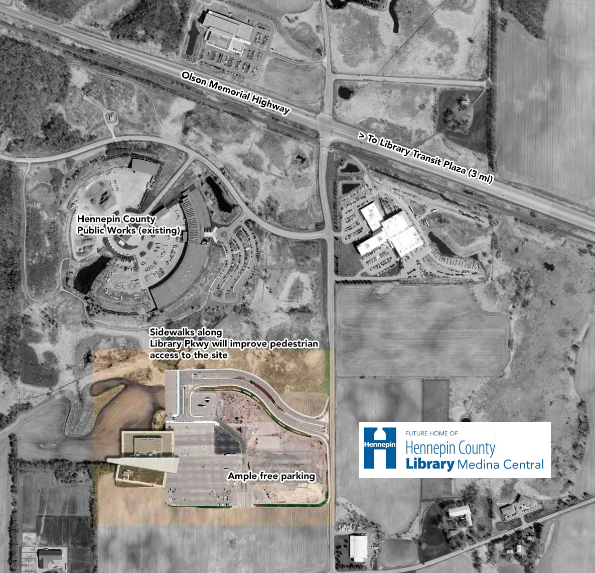
    The Library site plan was presented on April 1, 2016 The Library site plan was presented on April 1, 2016

    A Library for All Modes

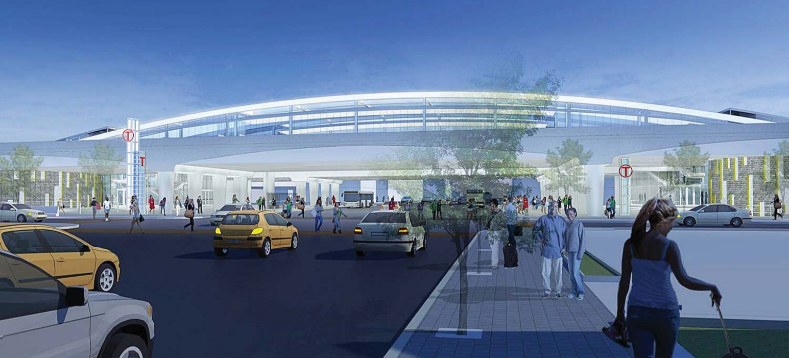
    Like Hennepin County Public Works, the new Central Library will benefit from Medina’s excellent public transportation options. At any time between 3:29 pm and 5:59 pm, Minneapolis residents may take the 776 or 777 bus a short 51-minute ride from downtown Minneapolis to the Peonie Lane bus stop. From there, patrons need only walk 3.4 miles along the the shoulder of the Olson Memorial Highway to access the site. Those who catch the 3:29 pm bus are expected to be able to make the 2-hour journey with at least 30 minutes to spare before the Central Library closes at 6pm.

    Buses will be available to return to downtown Minneapolis starting at 5:43 am the next morning.

    Transit to the site will be multimodal in nature
    Transit access to the site will be multimodal in nature

    Jim Grube, Hennepin County Engineer, stressed the importance of safe, dignified access to county facilities for people using all modes of transportation. “We felt that providing a sidewalk along the Olson Highway might give patrons a false sense of security. To improve pedestrian safety, we’ll be recommending they walk along the shoulder, with appropriate attire. Safety is a shared responsibility.” Noting concerns about access to the library

    APS Box MnDOT
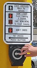
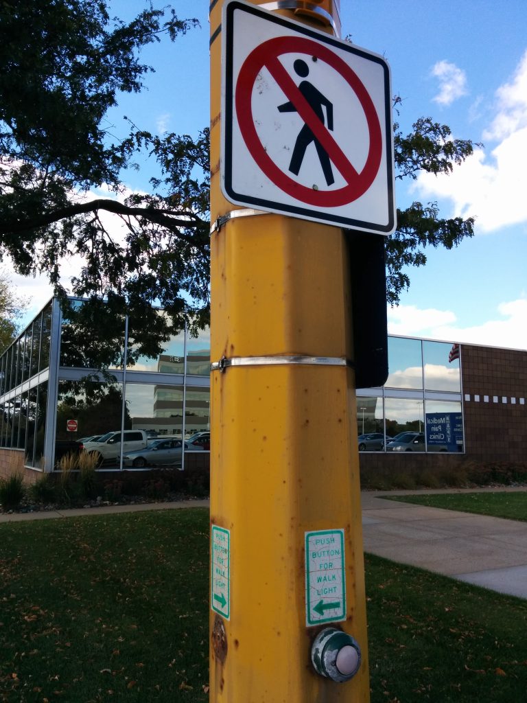
    Accessible Pedestrian Signals will make a hostile pedestrian environment equally accessible to persons with disabilities

    for persons with disabilities, Grube described the installation of Accessible Pedestrian Signals at the intersection of the Olson Memorial Highway and Arrowhead Drive. “TH 55 is going to be a whole different place with those new beeping buttons,” Grube added.

    Additional Parking

    One of the greatest critiques of the current Central Library is its inadequate and overpriced parking. “Government takes my income tax through the state, my property tax from the county, and then they ask me to pay for parking when I’ve already paid twice?” questioned Johnson. “Hennepin County residents deserve to get what they paid for, the first time.”

    The new library will feature at least 30 acres of surface parking, with additional space to expand as demand increases. Access to the lot will be provided by 7-lane Library Parkway.

    Users Critique

    Some existing library users were dissatisfied with the relocation, claiming that — despite ample transit options — access to the new library would be inconvenient without a car. However, County officials note that the main benefit will be the expansion of library services to more patrons. Bessie, a 4-year-old dairy cow from Greenfield, agreed. “Too long have I endured the tyranny of having to travel downtown for basic services,” Bessie said while chewing her cud. “I deserve to have as convenient access to the library as I do to Public Works.”

    Timeline and Future Projects

    Hennepin County Library, Medina Central is expected to be complete by summer 2018. The former Minneapolis site will be razed to make way for luxury rentals, to be anchored by a Target Express.

    At their next meeting, County Commissioners will discuss timeline and funding for relocating Government Center to the new Medina campus by 2020.

    Commissioners Mike Opat and Peter McLaughlin toast to the announcement from the median of the Olson Memorial Highway.
    Commissioners Mike Opat and Peter McLaughlin toast to the announcement of the new Central Library from the median of the Olson Memorial Highway.
  • On the Cedar Lake Trail, St. Louis Park Rewrites the Law

    On the Cedar Lake Trail, St. Louis Park Rewrites the Law

    The City of St. Louis Park has a problem — a pretty good problem to have. They have two spectacular east-west trails, running through pleasant natural corridors, on their own rights-of-way. Those trails are the North Cedar Lake Regional Trail and the Cedar Lake Trail (this is often called the “Greenway”, since it becomes the Midtown Greenway at the Minneapolis city limits). But the real issue the City is having is that these trails intersect city streets and private drives at multiple points throughout the community. Unfortunately, these trail intersections have been home to serious crashes. Something had to be done.

    How to make things safer? There are many solutions. You could install RRFBs or HAWK signals, to provide for safe crossing. You could install wide refuge islands, like Minneapolis did on E 28th St (below). More traditionally, you could just install crosswalk striping and signage to indicate that bikes and pedestrians may be crossing. Or, if you’re St. Louis Park, you could remove striping and demand even more emphatically that bikes and pedestrians yield to crossing traffic. And when that isn’t sufficient, you could make a video condescending to vulnerable users trying to cross legally.

    28th St and Midtown Greenway
    One approach: clearly demarcate that trail users have right-of-way, and offer physical protection. Permanent crosswalk striping has since been installed. Image: Google Street View.
    Crosswalk signage on Cedar Lake Trail
    A St. Louis Park approach: blame the more vulnerable user and try to deny their legal safe crossing.

    Callous, Ineffective Policy

    Bill Lindeke provided an excellent write-up of the issues in his MinnPost article earlier this week. From a local policy perspective, I think BikeMN’s Nick Mason hit the nail on the head:

    “If our answer to safety is that people with limited mobility have no right to cross a less-than-safe roadway, we need to pause and consider that it’s inherently problematic. By removing those crossings [St. Louis Park] didn’t increase safety; they decreased their liability.

    For anyone who’s ridden these trails, it’s clear that the methods aren’t just callous to the needs of pedestrians and cyclists — they’re completely ineffective. In my experiences, well over 90% of bicycles roll through the trail stop signs. Riding the N Cedar Lake Trail a few weekends ago, I did not see a single cyclist or pedestrian come to a complete stop at any of its many stop signs. So it’s clear that St. Louis Park’s methods to improve safety are questionable, and probably ineffective. But are they legally based? For cyclists, this is a sticky question I won’t get into at this point. But for pedestrians, the answer seems to be a resounding “No.”

    Looking at MN Traffic Law

    Most of the issues lie in the definitions in Chapter 169 of the state traffic code.

    The definition of vehicle is actually an important place to start. 169.011, subd. 92:

    Subd. 92.Vehicle. “Vehicle” means every device in, upon, or by which any person or property is or may be transported or drawn upon a highway, excepting devices used exclusively upon stationary rails or tracks.

    Street vs. Hwy
    I Am Traffic’s diagram showing a highway and its different (typical) components.

    This is in contrast to motor vehicle, which is defined as a special class of vehicle (self-propelled). “Vehicle” is a broader category that would include trailers, buggies, and bicycles.

    Next, let’s look at what makes something a “highway”. 169.011, subd. 81:

    Subd. 81. Street or highway. “Street or highway” means the entire width between boundary lines of any way or place when any part thereof is open to the use of the public, as a matter of right, for the purposes of vehicular traffic.

    Notably, “highway” is a much broader term in statute than it is in daily use. It refers to all types of streets or ways — and it refers to the entire area between the right-of-way lines, including the roadway, sidewalks, ditches, etc. Because we know bicycles are vehicles, and because we know regional trails are intended for their use, a trail in its own right-of-way is a “highway”.

    But what about an intersection? 169.011, subd. 36:

    Subd. 36. Intersection. (a) “Intersection” means the area embraced within the prolongation or connection of the lateral curb lines or, if none, then the lateral boundary lines of the roadways of two highways which join one another at, or approximately at, right angles or the area within which vehicles traveling upon different highways joining at any other angle may come in conflict.

    So, we know that bicycles are vehicles, and a trail intended for their vehicular use is a highway. A crossing of two such highways is an “intersection”. This all seems fairly straightforward. But what difference does that make for pedestrians crossing, without a crosswalk?

    169.21, subd. 2 (emphasis added):

    Subd. 2.Rights in absence of signal. (a) Where traffic-control signals are not in place or in operation, the driver of a vehicle shall stop to yield the right-of-way to a pedestrian crossing the roadway within a marked crosswalk or at an intersection with no marked crosswalk.

    Understanding the St. Louis Park Position

    So, knowing that the trail crossing is an intersection, and knowing that pedestrians have right-of-way at intersections with no marked crosswalk, I wanted to understand what the legal basis was for St. Louis Park claiming they did not have right-of-way. I wrote to Engineering Director Debra Heiser to ask these very questions. Heiser defended the video, and responded to me in some detail, but didn’t provide specific statutes on which she bases her understanding. She writes:

    The Cedar Lake Road Regional Trails are considered a Bicycle path intended for use by Bicycles and pedestrians.  It is designed for exclusive or preferential use by persons using bicycles and constructed or developed separately from the roadway or shoulder.    The Cedar Lake Regional trails are operated by Three Rivers Park District.

    Presumably, she is referring to 169.011, subd. 6, which defines “bicycle path”. But a bicycle path is clearly a component of a larger highway, the definition noting that it is “constructed or developed separately from the roadway or shoulder.” In fact, if you read the full chapter, “bicycle path” is not something that addresses right-of-way questions at all — most references refer to the right of people in motorized wheelchairs to use such paths. But being developed “for exclusive or preferential use of bicycles” (vehicles), it sure sounds like a highway, doesn’t it?

    Heiser referred me to a Three Rivers officer, to clarify the Park District’s position on these matters, but after two calls and a message left, I have not been able to reach him. Marketing manager Jacqueline Larson also reached out to me, to clarify that the video was not discouraging motorists from yielding to pedestrians when common sense dictated.

    In the end, though, I feel I need to let the video speak for itself:

    St. Louis Park "wrong" video

  • In Brainerd, Business 371 is for Business

    In Brainerd, Business 371 is for Business

    I was up in Brainerd this weekend, visiting my sister. I’ve been up there several times since she bought a house just south of downtown a year and a half ago.

    Downtown Brainerd in November 2014
    Downtown Brainerd in November 2014. Photo by author.

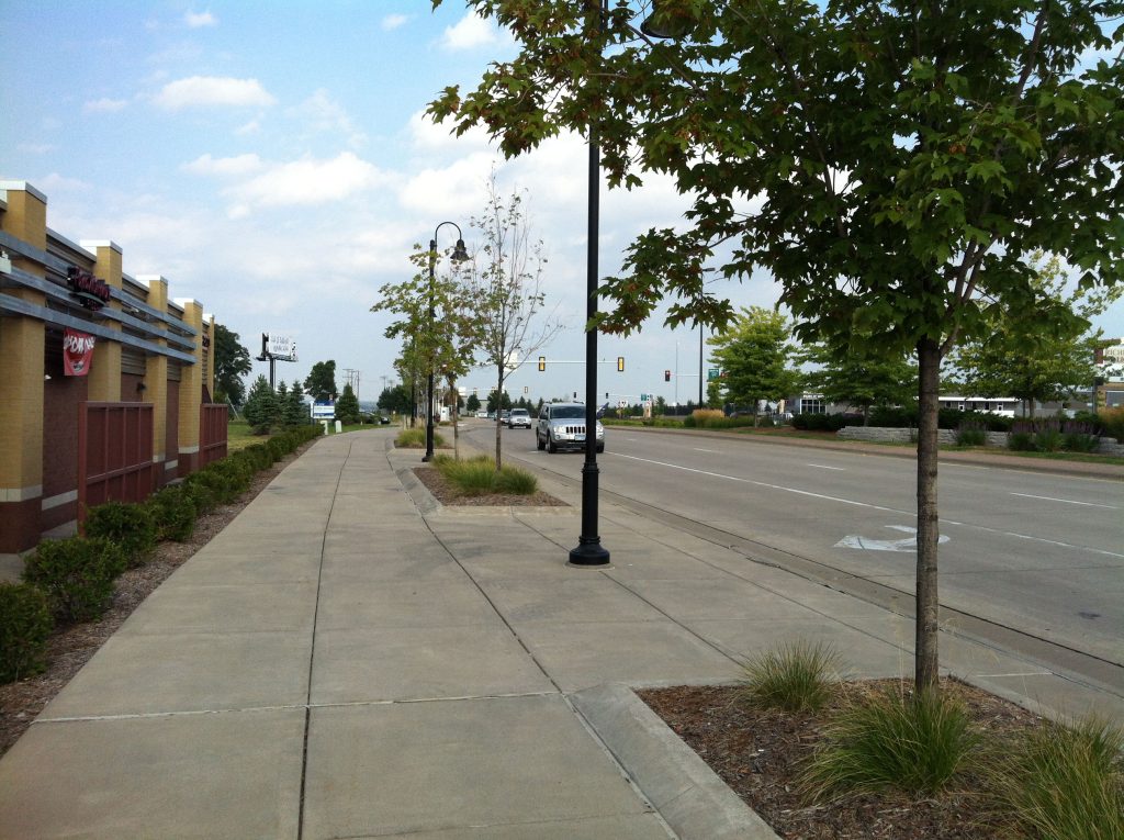
    Brainerd has a nice, walkable downtown. It has wide sidewalks, trees and benches, and active storefronts. Compared to the neighboring Baxter strip, it’s a breath of fresh air. But how to get downtown?

    Meet 6th Street

    The main north-south spine of Brainerd is South 6th Street, which formerly carried Highway 371 (and still marked as “Business 371”). And it’s by far the most direct option to get downtown for anyone living in the south-central section of Brainerd:

    6th Street Brainerd in November 2014. Death road with snow on sidewalk
    November 2014. Technically, there was a sidewalk underneath that snow. Photo by author.

    It’s a wide, five-lane stroad, with no parking, few trees, little lighting, and narrow sidewalks. It skimps on everything but number of lanes and width of those lanes. Currently, the four travel lanes are 12′ wide and the center turn lane is about 14′. All this for traffic volumes that barely scrape 10,000:

    MnDOT Traffic volumes on S 6th St
    MnDOT traffic volumes on South 6th St., Brainerd

    A new opportunity

    The good news is that Brainerd had an opportunity to have the street reconstructed by MnDOT in 2017. MnDOT offered the community the choice of a 3-lane section or simply rebuilding, as is, in a 5-lane section. Local advocate and Strong Towns founder Chuck Marohn pushed for designs similar to the three-lane, with a more context-sensitive approach in the different sections.

    The bad news is Marohn’s efforts didn’t seem to be in line with the Brainerd City Council’s actions. For the most part, Brainerd chose the 5-lane section — widening the street out to 5 lanes and making it more pedestrian-hostile as it approaches downtown. Even the 3-lane section that is being built (south of Quince St) is shockingly unambitious. Despite many indications that 10-11′ lanes are the safest for calming traffic (and even very car-oriented engineers preferring 11′ lanes), MnDOT’s plan offered the community 12′ travel lanes and a thirteen foot center turn area.

    6th Street 3-lane section
    6th Street 3-lane section

    Opportunities for planting along the corridor appear to be unseized, but that could change. However, since the sidewalk narrows to 9′ north of Quince, trees likely could not be sustained near downtown.

    Why would a city do this –throwing away an opportunity to transform one of its most important streets, all for nonexistent traffic?

    I wrote the Brainerd City Council in November asking them to support a 3-lane design. The only response I received is revealing. After expressing concern about possible cut-through traffic from a calmed 6th Street, this Councilman went on to explain:

    Business 371 is named for that very reason. For business.

    We also have a lot of future growth to deal with. For a example [sic] there are 640 acres own by the Mills family for residential housing just southwest of Brainerd that will have high traffic counts when it gets developed.

    Business 371 needs to be five lanes.

    I won’t opine too much on the Councilman’s response, since just about everything I could say has been expressed many times by Strong Towns. But, in short: we should sacrifice the town we have today, in the hope that we will one day be able to encourage more traffic to serve new greenfield development. A symbolic gesture that I’m sure was intentional, he did not once refer to 6th Street by its local name — only as “Business 371”.

    A larger failure

    Wasting an opportunity to seriously improve 6th Street is disappointing for Brainerd, but I find it even more troubling about what it says for MnDOT.

    Ostensibly, Minnesota has a Complete Streets policy. So does Brainerd (adopted slightly after the decision to support an incomplete 6th Street). So why would MnDOT even offer such a bloated option to a local community? And why would even the “road diet” version offer proportions that are dangerously wide and encourage speeding?

    Unfortunately, I don’t know the answers. But I do know that this project represents nothing good about MnDOT’s ability to implement Complete Streets.


  • (April Fools) Southdale to Rebrand, Establish Stroaddale Preservation District

    (April Fools) Southdale to Rebrand, Establish Stroaddale Preservation District

    Edina logo stroadEdina, Minn — The City of Edina today announced ambitious plans to rebrand the aging Southdale District as “Stroaddale”, and to establish strict historic preservation guidelines to ensure that its low-density, stroad-oriented development is cherished for future generations. Stroaddale District is named for Stroaddale Center, and is roughly bounded by Crosstown to the north, Valley View Stroad to the west, 494/5 to the south, and Xerxes Avenue to the east.

    “If there’s one thing we’ve heard loud and clear from residents, it’s that they want lower density of housing, and higher density of cars,” mayor Jim Hovland said at a press conference Wednesday. “Edina’s density is about 3,000 folks per square mile, roughly half that of our first-ring neighbor Richfield and a solid 25% less than St. Louis Park,” Hovland acknowledged when asked by Streets.mn. “But it’s just not low enough. Preserving stroad character is one of the best things we can do to keep these dangerous numbers down.”

    Early Beginnings

    The beginnings of the Stroaddale District in 1956
    The beginnings of the Stroaddale District in 1956. Image: MHAPO

    The Stroaddale District began with Stroaddale Center, built in the late 1950s. At the time, Stroaddale was a radical departure from the form of surrounding built areas. The only immediate neighbor at the time was to the east, Richfield’s Lincoln Hills, which was built with small blocks, narrow lots, and alleys. But the new Stroaddale super-block was seven blocks wide and three blocks high. Big blocks meant big stroads, built with all the grandeur of rural expressways.

    Stroaddale was a quick success, and set the stage for future stroads throughout the Twin Cities. Engineers and landscape architects responsible for Hiawatha Avenue, Virginia Triangle, and the Olson Memorial Stroad in Minneapolis — as well as Richfield’s 77th Street — have acknowledged that they drew inspiration from the seas of pavement in the Stroaddale District.

    New Competition and Loss of Stroad Character

    Despite initial success, interest in Edina’s stroads waned in the decades that followed. The 1990s in particular was a difficult decade for the Stroaddale District. 1990 saw the opening of the Mall of America, one of the most ambitious stroad projects the Twin Cities has ever seen. Stroads were built as seamless extensions of the regional freeways, with none of the bordering streets under seven lanes. “When it comes to creating a pedestrian-repellant urban form, it’s tough to beat Bloomington,” acknowledged Cary Teague, Edina’s director of Community Development. “I mean, they made it illegal to cross the street! By comparison, meager 5-lane York Avenue might as well be a dirt path in the countryside.”

    Porkchop covered in snow
    Porkchops were a popular pedestrian amenity

    Unrest came from within, too. Centennial Lakes was a large public-private project that developed gravel pits to the south of Stroaddale Center. Although the design was careful to preserve roadway character on France Avenue — with parking garages and surface lots facing the stroad — the interior design posed serious risk to the character of the District. A spectacular public park surrounded recreational ponds, including many public amenities. “Centennial Lakes was a big risk, and I think we’ve learned our lesson,” said Teague, acknowledging that the creation of attractive, actually public space was not in-line with the vision for the area.

    Recent Assaults on Stroadiness

    Unfortunately, Centennial Lakes wasn’t the end to decisions that would jeopardize the Stroaddale District. In recent years, neighbors to the west have consistently fought against attractive, mixed-use buildings along France Avenue.

    “7200 France is really a bellwether project,” said Wilford Nimbybotham III, chairman of Cornelia Residents Uninterested in Density (CRUD). “If we have people living in apartments, going to a corner shop on the first floor… what will become of our neighborhood?” Despite not being asked about the matter, Nimbybotham further volunteered that the presence of Section 42 workforce housing in the project was not a factor in CRUD’s opposition. “I have many workforce friends,” he said.

    Even more contentious was a proposal for a homeless youth shelter to the north of Stroaddale Center. The project plans to turn a small site of an old TCF Bank into 39 studio apartments for homeless youth. An group of unnamed citizens sued in an attempt to block the project, but ultimately failed. The leader of this group agreed to speak only under the condition of keeping their identity totally anonymous.

    One of the biggest concerns was the proximity to a Montessouri school. “Criminal activity and children are not compatible,” said the group’s leader, using homelessness and criminal activity synonymously. “Safety is an issue for the female employees of the school.”

    “But really, this is about what’s best for the community as a whole. We even funded our own detailed parcel-by-parcel analysis determining where a homeless youth site might be better located.” The results of that study were provided to Streets.mn:

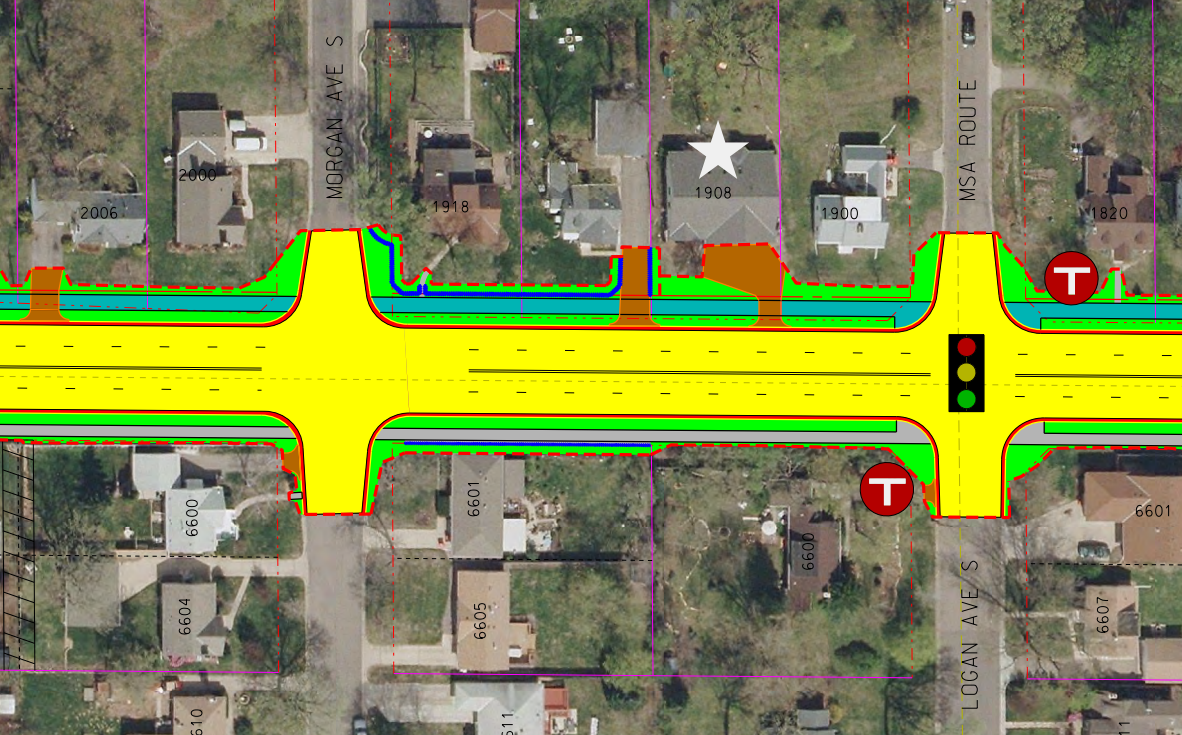
    Detailed analysis of suitable sites for homeless youth shelter
    Detailed analysis of suitable sites for homeless youth shelter provided by group suing to prevent 66 West. Base map: Hennepin County

    A New Plan Forward

    New standards will be drafted by Edina city planners to ensure adequate parking visibility, single-use zoning, and sufficiently low Floor Area Ratio (FAR), and are expected to be adopted by the City Council in late 2015. But public improvements to the Stroaddale District have already begun, starting with a pedestrian improvement project last summer along France Avenue.

    “The key with the France Avenue project was to make it safer for pedestrians, while still making sure it was an environment no one would ever choose to walk in.” said Chad Millner, Edina’s city engineer. “We took a lot of flak from national stroadscape architects for removing all those free right turns, but they miss some of the finer details — we removed crosswalks, left the boulevard barren of trees. We’re dedicated to making sure the character of France is preserved.”

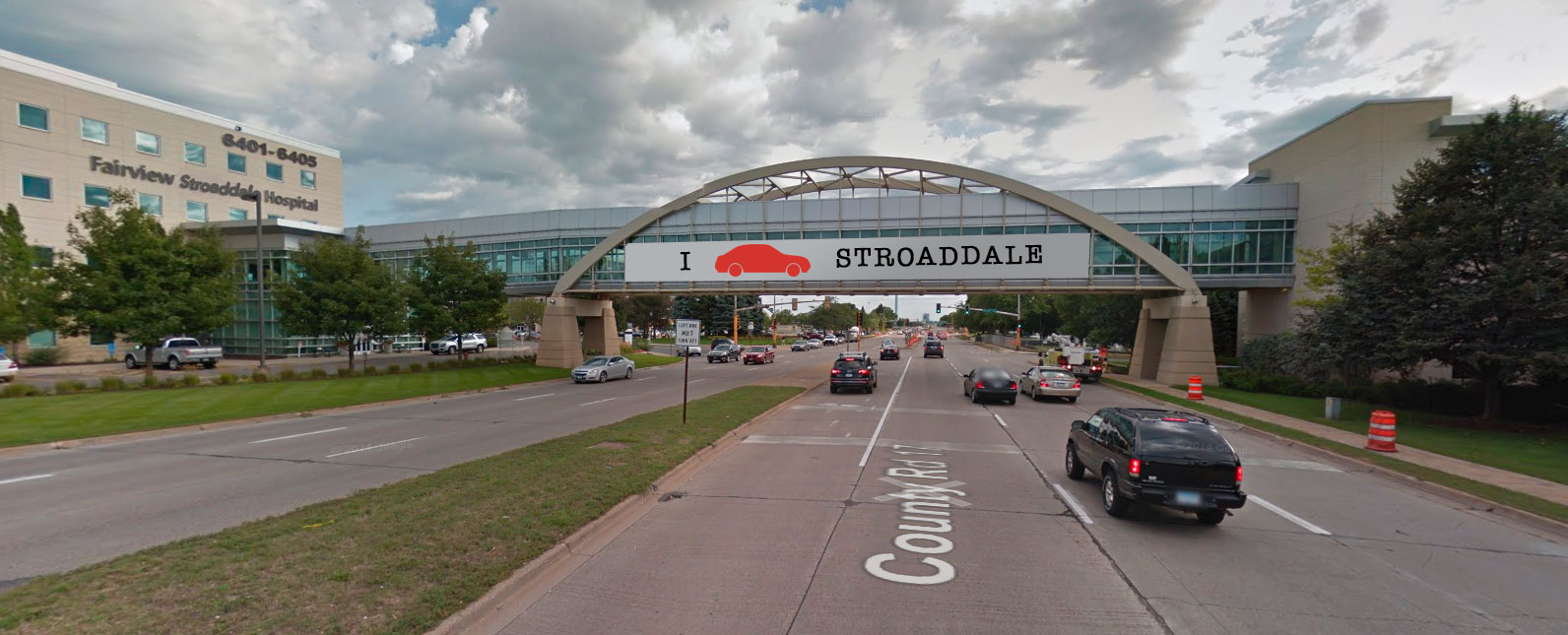
    Gateway signage will be installed in early May, and will be modally specific. The welcome message for motorists will be displayed across the Fairview Stroaddale skyway, while pedestrians will be greeted by orange construction barrels, located in roughly the middle of the sidewalk.

    Stroaddale gateway signage
    Rendering of proposed gateway signage. Base image: Google Street View
  • Rethinking 66th Street

    Rethinking 66th Street

    Note: I chair the Richfield Bike Advocates, and represent that group as a non-voting liaison to the Richfield Transportation Commission. However, I am not speaking on behalf of either group.

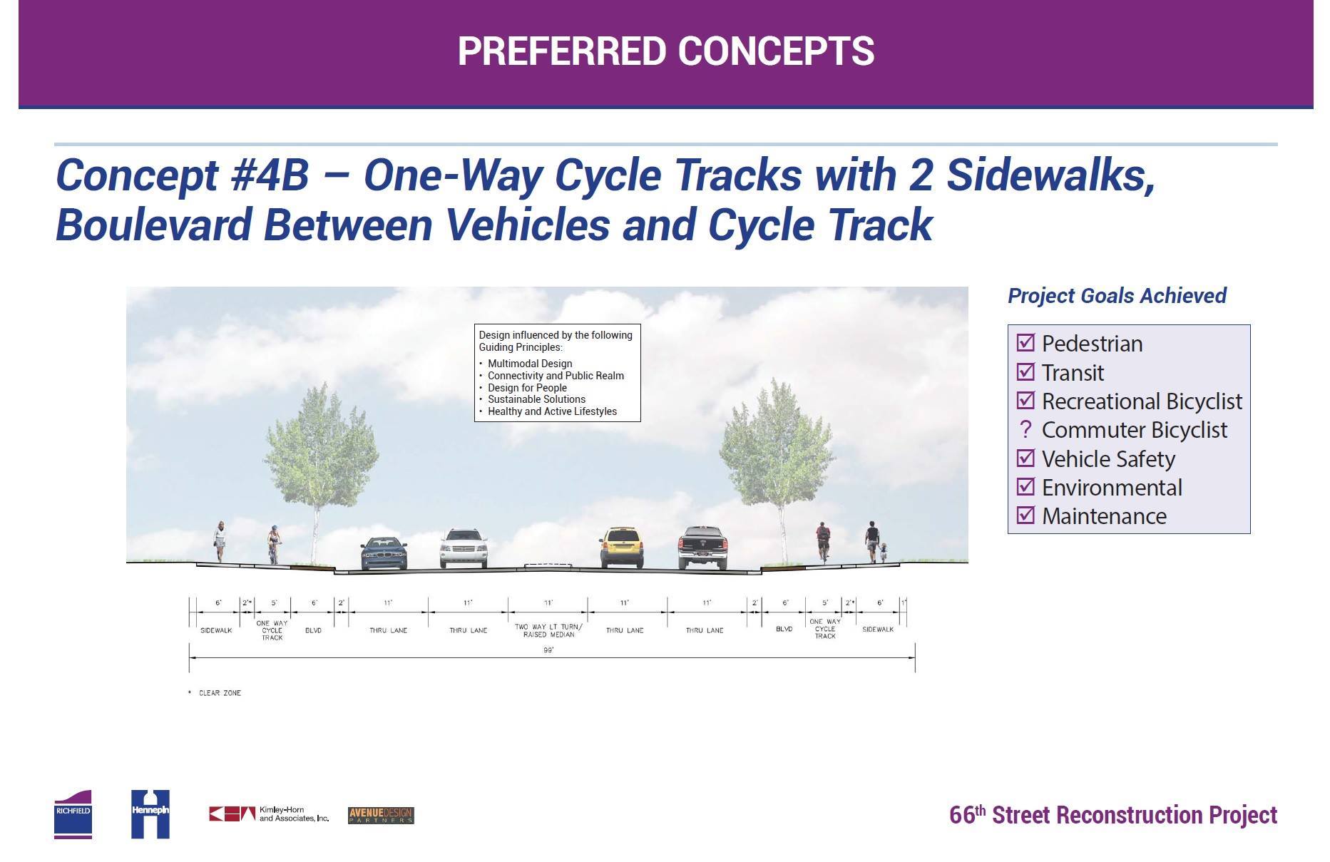
    Tonight, the Richfield City Council will make a major design decision that will affect more than 20,000 people every day. The City Council will consider whether or not to approve Concept 4B for 66th Street between Penn Avenue and 35W (already approved from 35W to 16th Avenue). The design features wider sidewalks, boulevards, protected bike lanes, and (likely) planted medians.

    This concept represents community consensus of how our major streets should work, and also meets Hennepin County’s demands for auto capacity (four through lanes). But there’s a catch: it doesn’t fit. The new street would be about 100 feet from the the outside edges of the sidewalks, while the existing street fits tightly in the 66′ right-of-way. To make room for the new space, eighteen homes will have to come down on the south side of the street.

    There are a lot of obvious conflicts here: Hennepin County demanding 4/5 auto lanes, while Richfield might find three acceptable. Bicyclists asking for dedicated space on a roadway, requiring width that doesn’t exist currently. Homeowners adjacent to the street, some of whom strongly wish to stay in their homes, while other groups vie for the land. But there’s an underlying conflict: the old school of thought, who likes 66th Street the way it is, and perceives its future as solely a piece of automotive infrastructure. The new school of thought isn’t satisfied with the 1958 design, and sees it as having potential for something more, as a space that serves everyone, and as a symbol of community.

    Guiding Principles and a New Vision

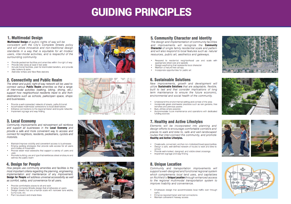
    The Transportation Commission recommended approval of Concept 4B in their November meeting, but that was only the most recent decision in a public process that has lasted over two years. The first step was a task force that developed “Guiding Principles” for street reconstruction — the first of which was multimodal design.

    The Guiding Principles are a terrific vision, but they lack balance with the auto infrastructure concerns. Not a thing in the Guiding Principles document mentions automotive capacity. Is this because we’re designing it first as a public space, and only as the very last consideration taking cars into account? Probably not. Rather than addressing how the two might interact, the Guiding Principles seemed to have an implicit understanding that any and all of these community priorities may be overridden as needed for the flow of automobiles.

    Yet the Transportation Commission and city staff have stood behind the Guiding Principles throughout the project. There has also been a second set of goals they’ve stood behind, that the proposed street should be safe and practical for pedestrians, transit, recreational bicyclists, commuter (transportation) bicyclists, (motor) vehicles, environmental concerns, and roadway maintenance. Commissioners have repeatedly emphasized that the street built today will likely outlive most of the people making these decisions, and that we must see this as a 50-year-plus commitment.

    Practical, Cynical, or Barebones?

    Not everyone has been as eager to rebuild 66th as a complete street. Around last summer, criticism came in heavily toward the possibility of removing 18 homes to make way for a wider 66th. Homeowners west of Penn Avenue — who would have had right-of-way impacts, but would not have had any risk of their homes being taken — were particularly strongly organized against the widening. (They were ultimately successful, in that the proposed design does not include a bikeway west of Penn.) Homeowners whose homes were on the line between Penn and 35W were also concerned. One of those stories was even documented in the Star Tribune.

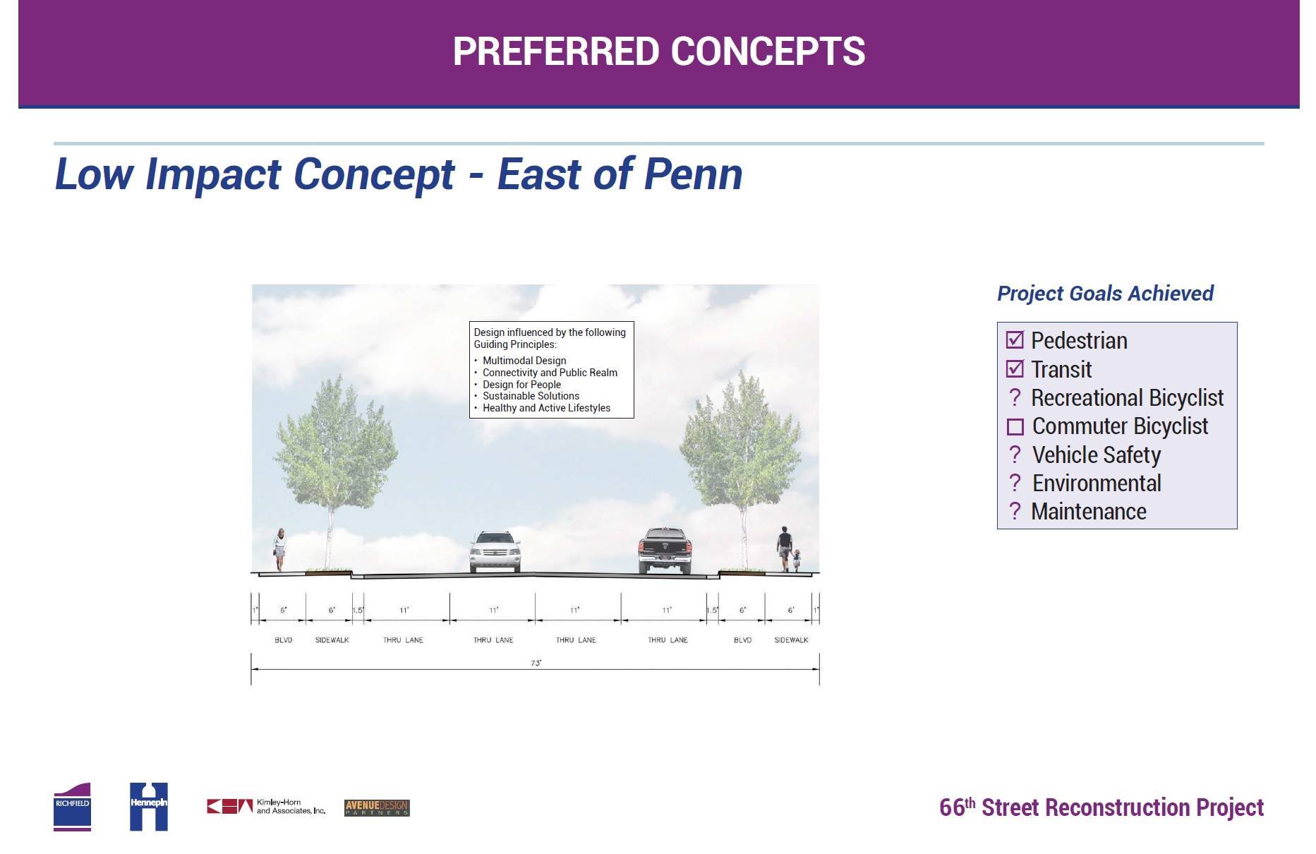
    City staff came up with a concept they called “low-impact”, which was essentially a copy-and-paste of the current street, plus some trees:

    Some city leaders initially praised the concept, as did local reporting. And city leadership’s support for keeping the street more-or-less the same didn’t stand alone. A homeowner who lives west of Penn on 66th Street — apparently not considering bike or pedestrian safety improvement to be safety improvements at all — said in a letter to the editor:

    The terms “safety,” “green space,” “maintenance” and “planning for the future” have been used to justify this $40 million project. Safety is a subject everyone is concerned with. […] Instead of addressing that problem we are going to reduce lane size, add cycle tracks, walking paths and biking paths.

    Another homeowner complained that increasing public space was not worth the impact on private homeowners:

    Since property has been taken from residents twice when the road was previously widened, further possession for bikes, boulevard and wider sidewalks would encroach upon the privacy of taxpaying residential owners.

    Yet not everyone stood in favor of rebuilding the existing street as is. One west-side homeowner wrote:

    I’m disappointed that Mayor Goettel and Councilmember Elliott are supporting a plan for the reconstruction of 66th Street west of Nicollet [sic] with no option for bicycles. This isn’t a frivolous extra for a few people to get exercise; 66th is a vital corridor for the north half of Richfield. It’s the only place to cross 35W north of 76th Street, and right now it might as well be a stream of lava as far as bike safety is concerned. I don’t see anything in the “scaled-back” plan to fix that.

    After five open houses, comments solicited from the general public seem to follow similar trends. Many wanting major improvements to change the way the street works for all users, while some truly believe the best approach is to fix what’s in place. One resident writes:

    I support the proposed concept to bring the best for all modes – pedestrians, motorists, bicyclists and think this is a very forward looking plan which will serve Richfield for many years into the future.

    Is Tearing Down Homes Consistent With Goals?

    One of the criticisms of the project that seems the most profound and simple is this:

    I agree that a 66th Street for All at the expense of your neighbors is baffling and wrong.

    Is it? It certainly could be. But if it is baffling and wrong, who’s to blame? The 20,000 cars, many of whom use 66th as a reliever for the Crosstown Highway? The engineers who say that there is no way the cars can function in three lanes? The bicyclists who want to be able to ride along the sides? The pedestrians who require sidewalks?

    Despite going into the 66th Street project knowing that homes would have to be torn down to make improvements, this issue was never addressed in the goal-setting. Nor was the more general issue about balancing automotive demands and community demands.

    So for now, we’re left between two camps. One who sees the purpose of the street only to move cars, and who thinks it basically works well today. And the other that sees the street as drastically deficient, a relic of a bygone time that will not serve a multimodal future.

    Tonight, for at least this one segment of one street, we will see with which camp Richfield’s leaders most align.

    If you are interested in attending:

    Richfield City Council Meeting — December 9th, 7:00pm
    Richfield City Hall
    6700 Portland Ave S
    Richfield MN 55423

  • France Avenue: Pedestrian-Friendly at 40 MPH

    France Avenue: Pedestrian-Friendly at 40 MPH

    The City of Edina is finishing up an ambitious project to help remake France Avenue through the Southdale District into less of a highway, and more of an urban boulevard.

    France Avenue

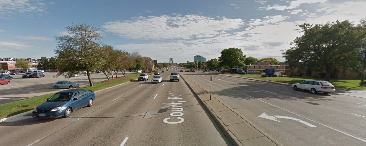
    To the unfamiliar, France Avenue through the Southdale District is a 40 MPH, 7+ lane divided megastroad. Prior to this project, there was a sidewalk on only one side, nearly every intersection had a porkchop island (free right turn), and there was not a single crosswalk marking between the Crosstown (TH 62) and the Bloomington city line at Minnesota Drive.

    Southdale’s France Avenue has long been seen as a barrier to neighborhoods. It divides the largely residential area on the west to the core of the Southdale District, including Southdale Center, Centennial Lakes, Galleria, and several office and housing complexes. The original solution to this problem was an expensive pedestrian bridge that would have spanned France at a single point. Instead, the project was reworked to focus on bike-ped accommodations at three critical intersections–76th, 70th, and 66th–and to make general improvements along the whole corridor. As density and housing continue to increase in the Southdale District, this change in focus is in line with the larger transformation of the area into something of a third downtown. Rather than being a barrier to cross, France Avenue should be a primary focus of the area.

    The process and concept of this design are terrific. Our metro area is filled with stroads like France Avenue, and there is simply not always the budget or need to tear them up and reconstruct them from scratch. This was a unique attempt to improve the corridor for pedestrians as a retrofit, with a relatively small price tag.

    However, the result of this process has been underwhelming. I did a walk-through this week, and was disappointed to find that, although it appeared pedestrian-friendly at 40 mph and a few meaningful improvements were made, the on-foot and on-bike experience was still pretty lacking.

    (Note: Although technically owned and maintained by Hennepin County as CSAH 17, this project was administered by the City of Edina.)

    Farewell to Pork Chops

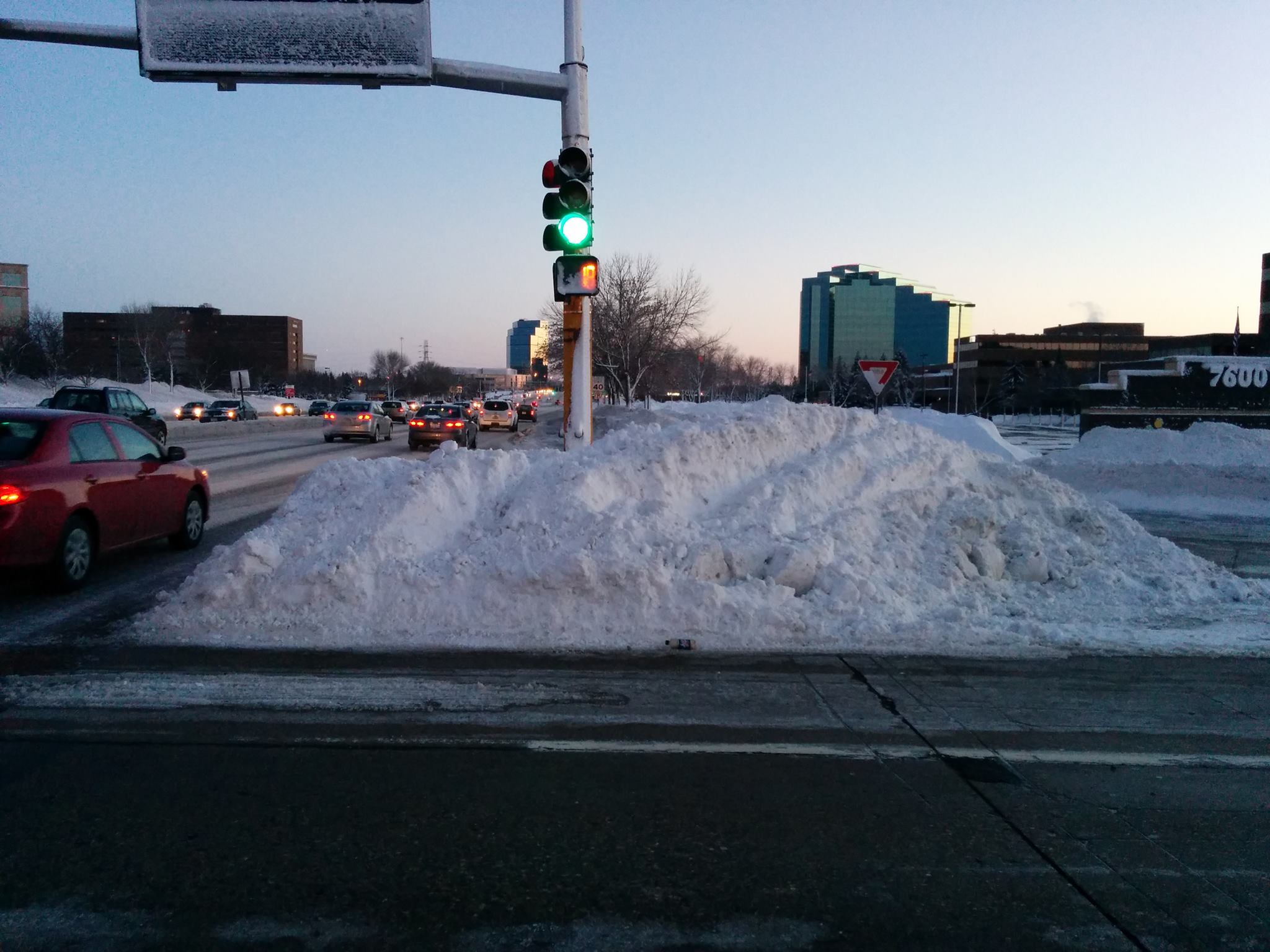
    Porkchops–the triangular islands used in conjunction with free right turns–formerly littered France Avenue. This right turn design encourages motorists to make high-speed right turns on red, and can pose a real barrier for pedestrians crossing the street. At best, a pedestrian must cross the street three times instead of once. At worst, the pedestrian must play “chicken” with a right-turning motorist to assert their right-of-way.

    Porkchop covered in snow
    Occasionally, porkchops pose an inconvenience to pedestrians
    A more humane way to cross the street
    A more humane way to cross the street

    The removal of porkchops along France was a great improvement. Unfortunately, the curb radius used is still quite large–almost as large as a small free right, and substantially larger than nearby county roads use. This encourages higher-speed turns across the crosswalk.

    Refuge Islands

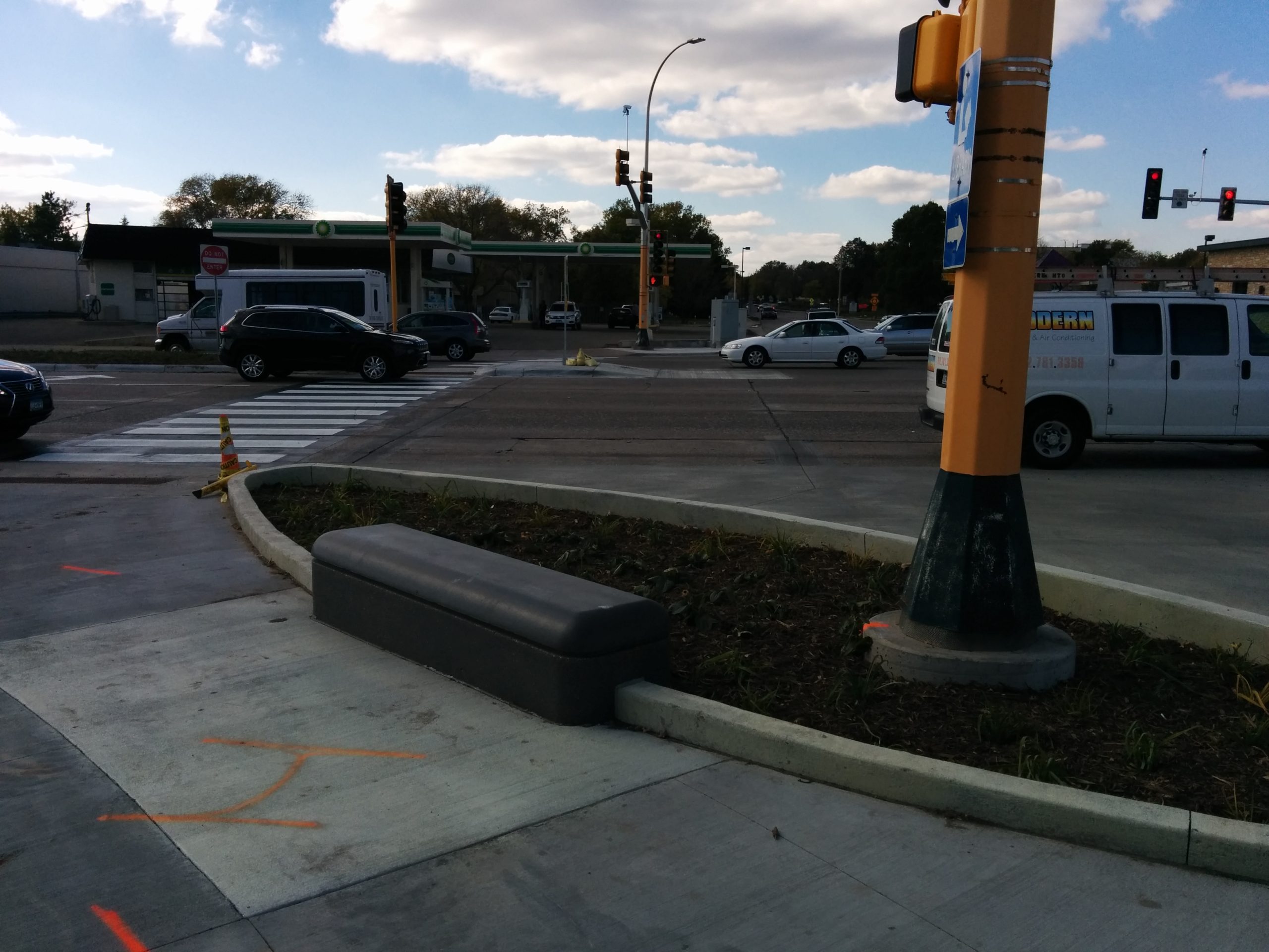
    One mixed blessing is the refuge islands placed at the major intersections. On the one hand, it really does increase the comfort of crossing the busy street. Although I was caught in the middle while crossing, I did not find it at all unpleasant to wait there for another cycle.

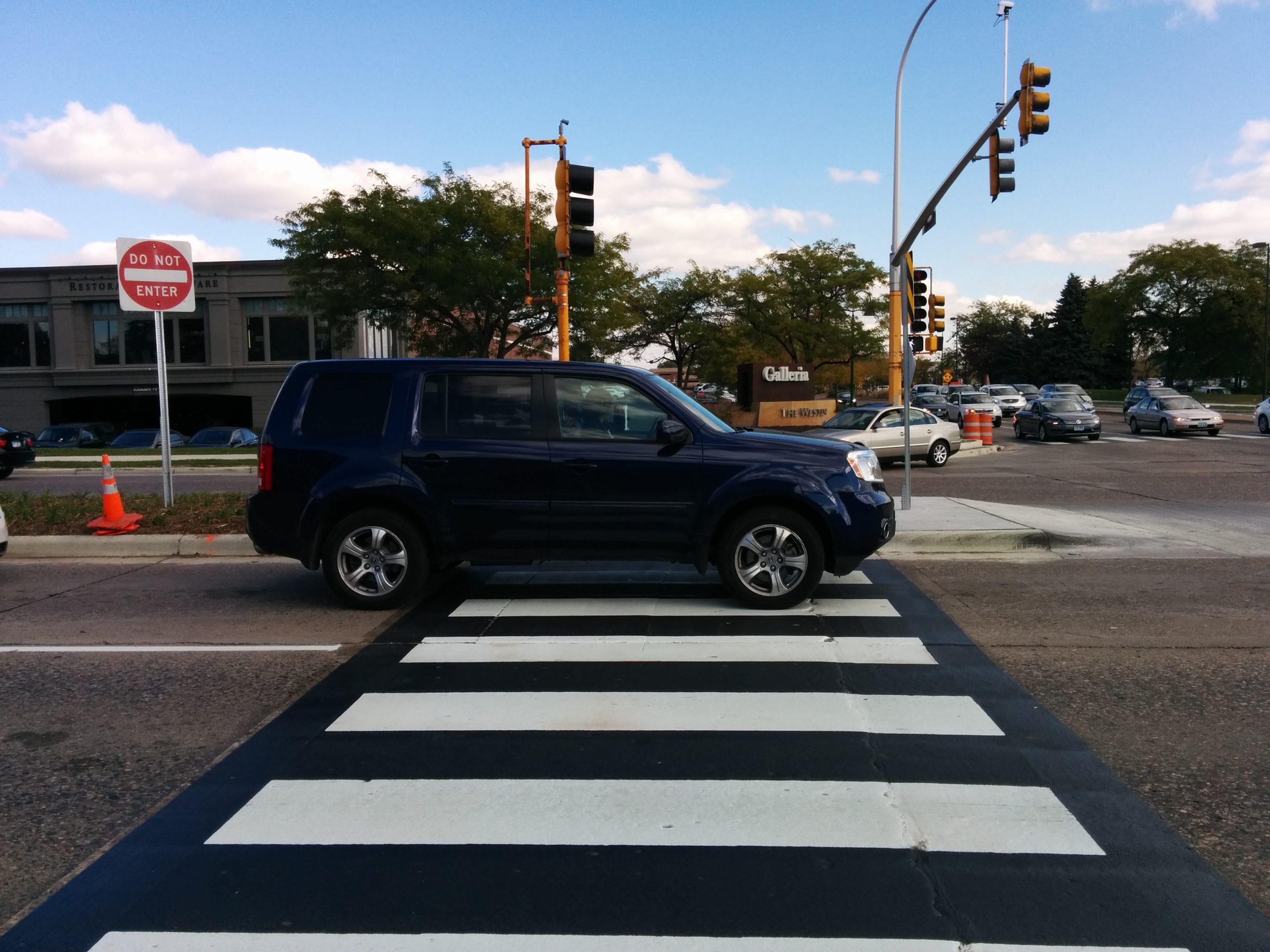
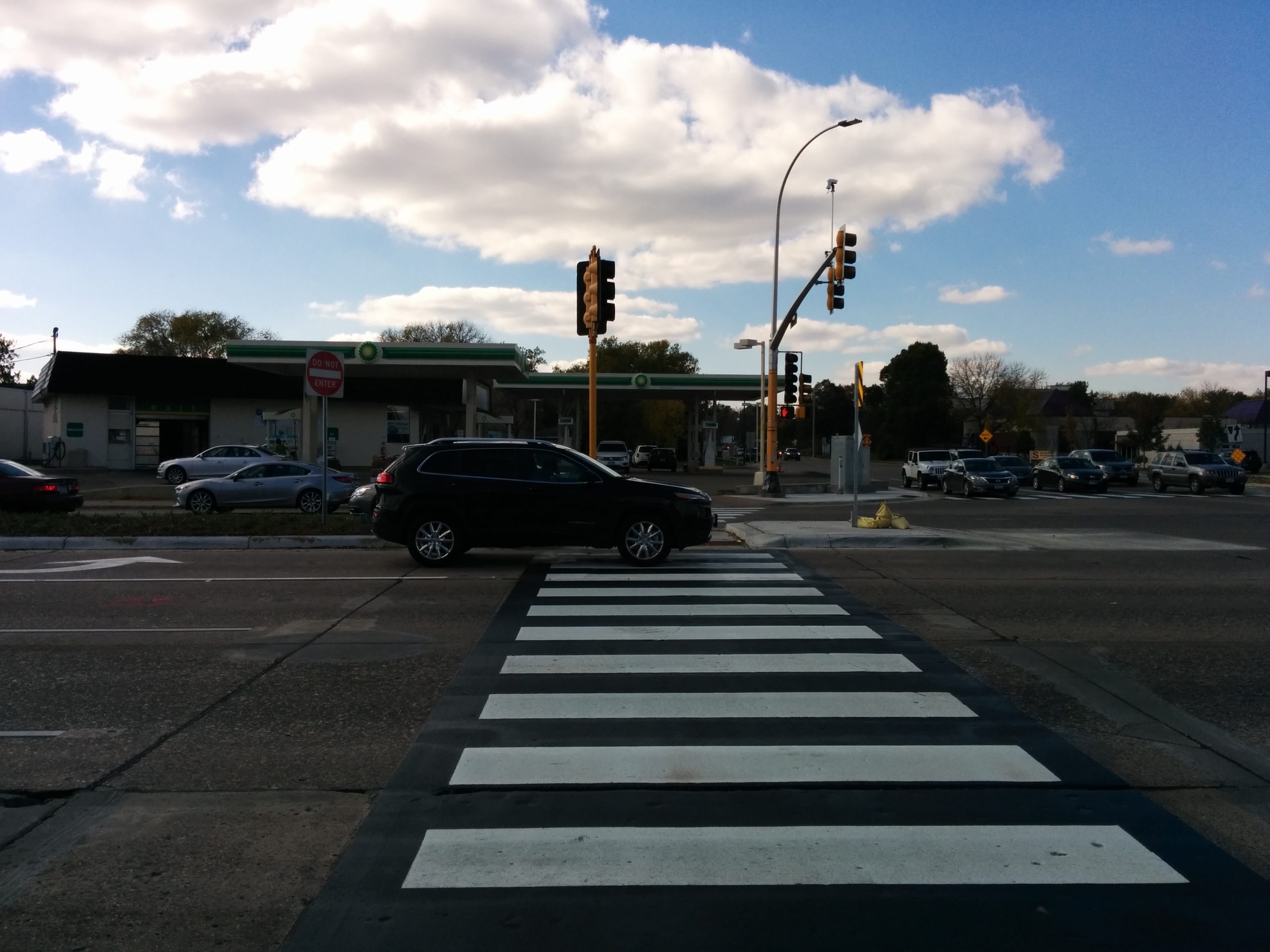
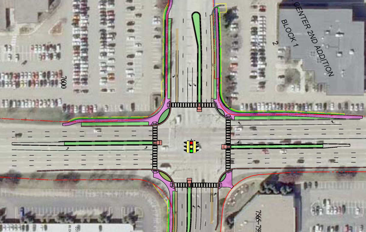
    However, since the engineers did not want to create a tighter turn for left-turning motorists, the crosswalks are now set way back from the intersection. This means a slight detour to cross the street, and it also means this:

    Motorist blocks the crosswalk on France Avenue

    And, on my return trip, this…

    Motorist blocks the crosswalk on France Avenue

    Cross Street Bike Lanes

    One detail intended to improve bicycle safety was short stubs of bike lanes on either end of the three major intersections. The idea is that by providing a designated space for bicyclists at the intersection, they will make it across France Avenue more safely, and be less likely to ride in the right-turn lane. This makes sense at first whiff, except to consider bicyclists are generally going farther than half a block past France. Assuming they wish to proceed on the street, they are now forced to merge back into busy traffic, where they have just been coaxed to give up their space.

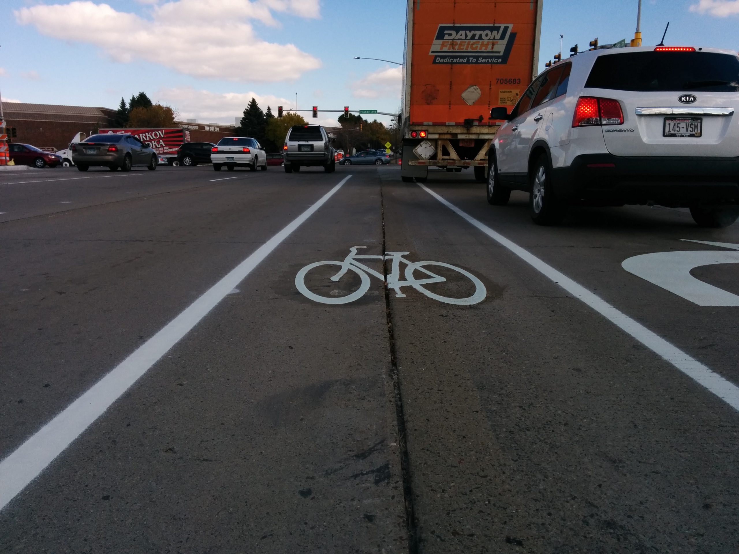
    The vanishing bike lane
    The vanishing bike lane

    I objected to this design before it was striped, but was rebuffed by the consultant on the project. Seeing the actual striping down, the situation gets even worse: at 70th and 76th, the lane was striped over a substantial longitudinal gap. Nearly everyone who rides a bike knows the danger of longitudinal cracks: they can easily grab a narrow tire and cause the cyclist to lose control of their bike. If the cyclist manages to stay upright, they’ll still have to merge back into traffic–on 76th, they’ll do so in the middle of a signalized intersection, going up a hill.

    Mind the gap
    Mind the gap

    Pedestrians As Clear Zone

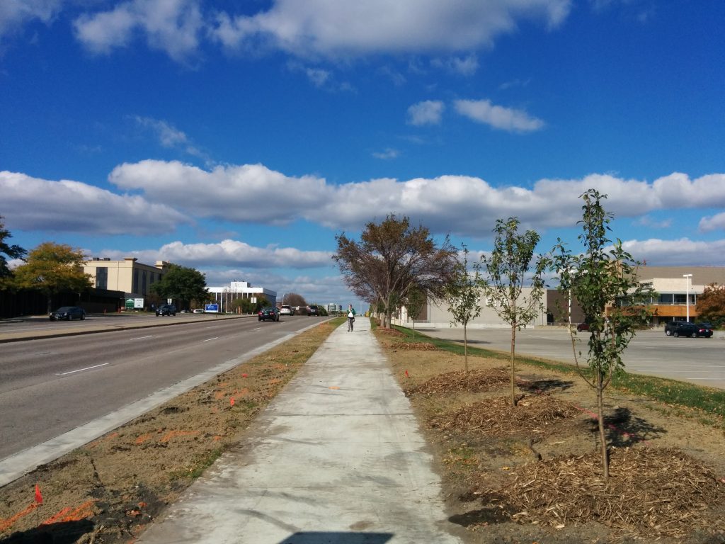
    The project included installation of a much-needed sidewalk along the east side of France. In terms of construction quality, this is a great sidewalk: it’s at least eight feet wide, saw-cut, with a six-foot boulevard. The project also included landscaping for this project, including boulevard trees to shade pedestrians and calm traffic.

    Pedestrian walks on new sidewalk
    This human being will cause far less damage to an errant car than a mature tree would.

    Unfortunately, these boulevard trees have been placed behind the sidewalk, at least 15′ back from the curb. This means that they will not shade the street for at least a decade, and will never provide a buffer from moving traffic. They also give the compelling feeling to pedestrians that they, too, are part of the clear zone of high-speed France Avenue.

    Needless Restrictions on Pedestrians

    The signals do not include an automatic pedestrian phase on any legs, for any intersection, even though most lights for France are more than long enough to accommodate such a phase without any adjustment. And although the project did add several new crosswalks, there is at least one mysterious removal. At Parklawn Avenue, an existing crossing at the north leg was removed. There was no cost savings to this removal, as the project would not have required any new construction or new push buttons at this location. By eliminating the crossing, pedestrians on the north side sidewalk must cross the intersection through three legs instead of one.

    No ped sign replaces crossing
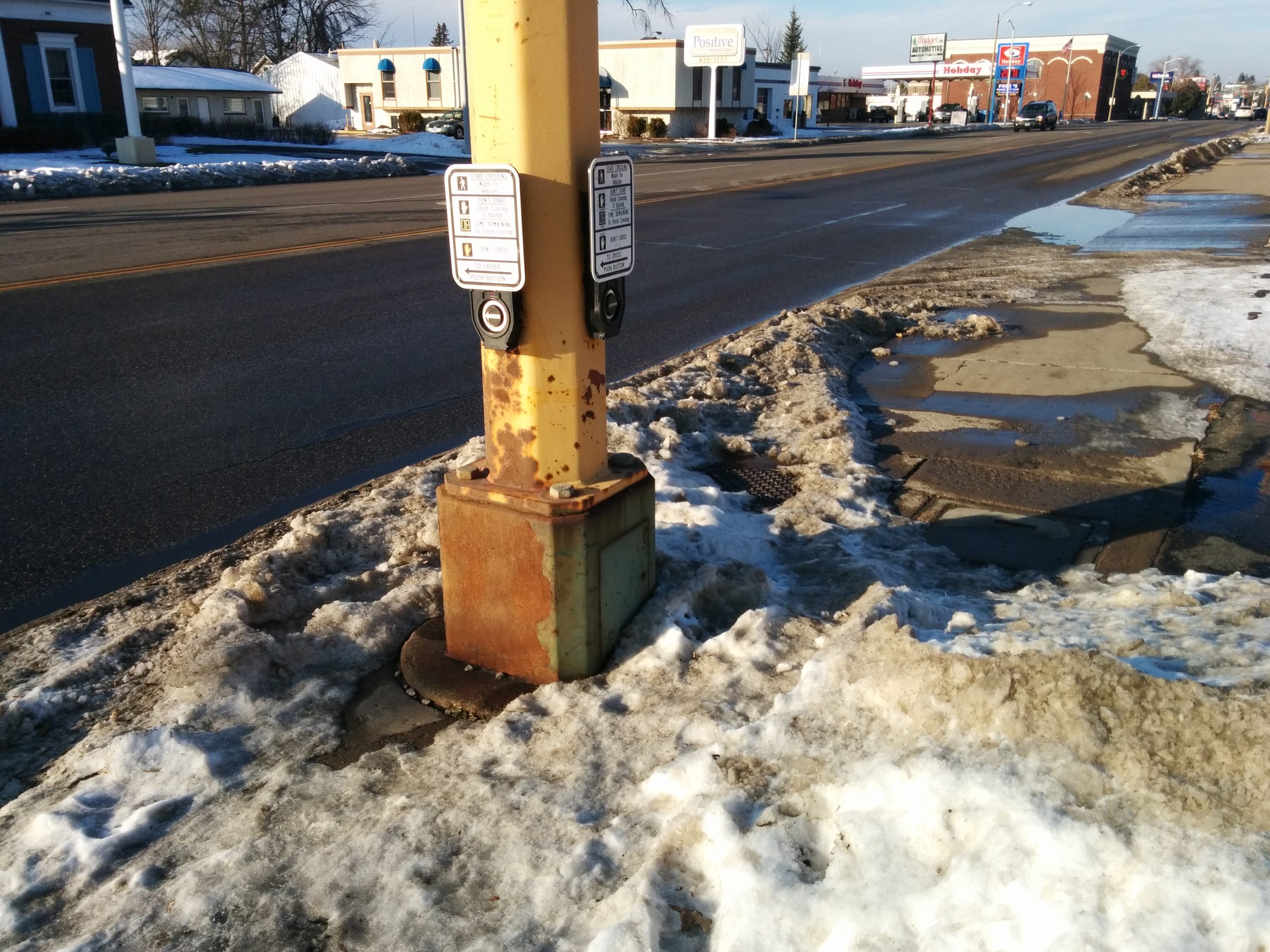
    Rusted-out scar of a removed beg button.

    A Work In Progress

    Although there are many disappointments in this year’s France Avenue project, I do not think this is a sign of the hopelessness of the Southdale District. Rather, it is a sign of just how much we must do and just how differently we must approach our streets in order to turn a high-speed stroad environment into a meaningful street for people.

    This time, it seems, we didn’t do quite enough.

  • Naming our Highways

    Naming our Highways

    I grew up in Northfield, and Cedar Avenue was a common route from Northfield into the Twin Cities. The name isn’t signed between the Northfield border and Eureka Township, but I knew it by no other name. In fact, I remember my parents having to explain to me, when I was first learning to drive: “just follow the signs for 23… 23 is Cedar.”

    So it’s caused me almost endless frustration, since moving north of the Minnesota River, that folks nearly always refer to the freeway portion of Cedar as “Highway 77”. Although as an urbanist I naturally lend more value to a city street than a freeway, it seemed to be awfully Minneapolis-centric to only lend the name of this long-established route to the street within the city limits.

    Since first noticing the differences in usage of 77 versus Cedar Avenue, I’ve also taken note of many other differences in local names versus signage on freeways and other major trunk highways. Other than Cedar/77, the most established appear to be TH 62 Crosstown and TH 55 Hiawatha Avenue.

    Does giving a highway a local name enhance community identity? Or does it dilute the value of a name?

    And now, my list, based entirely on my own impressions and findings. Please add comments if you know of others, or find any errors.

    Highway numberHistorical or current nameUsage?
    MN-3S Robert St /
    Robert Tr
    Name seems to be used north of Dakota County Road 42.
    MN-5Fort Rd /
    W 7th St
    W 7th St name is used heavily in the City of St. Paul. Freeway portion through Fort Snelling, and through the concurrency with I-494, does not seem to be called Fort Road. Note that the TH 5 freeway bridge is called the Fort Road Bridge.
    MN-13Sibley Memorial HighwayName is signed in City of Eagan and Mendota. Only appears to be used actively in Mendota.
    I-35/35WLyndale Avenue
    (Historical) /
    Bloomington Fwy
    Runs concurrent with Lyndale Avenue south of the Minnesota River, but I have never heard anyone refer to 35/W as Lyndale.
    US-52Lafayette FreewayUsed extensively locally, especially to describe the Lafayette Bridge. Freeway was built prior to US 52 being routed on it. Not signed on freeway.
    MN-55Hiawatha Avenue /
    Olson Memorial Highway
    Signed heavily on Hiawatha Avenue segment. Olson Highway name is signed in North Minneapolis and Golden Valley. Hiawatha name is heavily used; Olson Highway less-so, especially outside Minneapolis.
    MN-62Crosstown Highway /
    The Crosstown
    Not signed on freeway. Name used on some local signs, as well as Mn/DOT press releases. Used extensively locally.
    MN-47University AvenueSigned heavily within City of Minneapolis. Highway 47 seems to be more common name in highway-like portions.
    MN-65NE Central AvenueSigned heavily, especially inside 694. Central Avenue name seems more common, especially through Minneapolis and Columbia Heights. Central Avenue diverges from TH 65 north of 694.
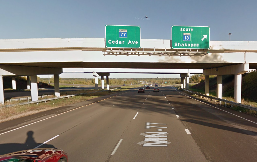
    MN-77Cedar AvenueSigned at all junctions except 66th St, Diagonal Blvd, and Mall of America Junction. Cedar Avenue name seems to be used more extensively south of the Minnesota River. Extends as Cedar Avenue both north and south of freeway portion.
    MN-100Normandale Road /
    Beltline Highway /
    Lilac Drive
    Normandale Road (Blvd) is used south of I-494, but this highway seems to be mainly referred to as Highway 100. Google Maps does call it Beltline Highway.
    MN 149Dodd RoadName seems to used, at least in Mendota Heights. Signed at interchange with 494.
    I-394/US-12Wayzata BlvdNo signage on freeway. No significant local usage (except for frontage roads) that I am aware of.

    Note: Updated table based on comments.

  • 77th Street: The Stroad, the People, and the Lost Urban Village

    77th Street: The Stroad, the People, and the Lost Urban Village

    Streets.mn Editor’s Note September 2020: The article below has been referenced in a political flyer in a Richfield city council race. The flyer has the headline of “Tear down the 77th Street Sound Wall?” The article does not propose tearing down the 77th Street sound wall. Questions can be directed to either candidate.

    If there were tenets of belief of urbanists, renunciation of stroads would surely be one of them. As transportation facilities, stroads are ugly, dangerous, and create incentives to drive a car, with disincentives to do anything else. As a tool of development, they fail to create value in their corridor in the same way a street would.

    One block north of the I-494/MN-5 commons, Richfield’s 77th Street is a stroad unlike many others. On the one hand, the stroad is quite aesthetic, and provides a relatively good pedestrian experience. On the other, it’s further divided the community it runs through, and failed to promote desired development along the corridor.

    The Stroad

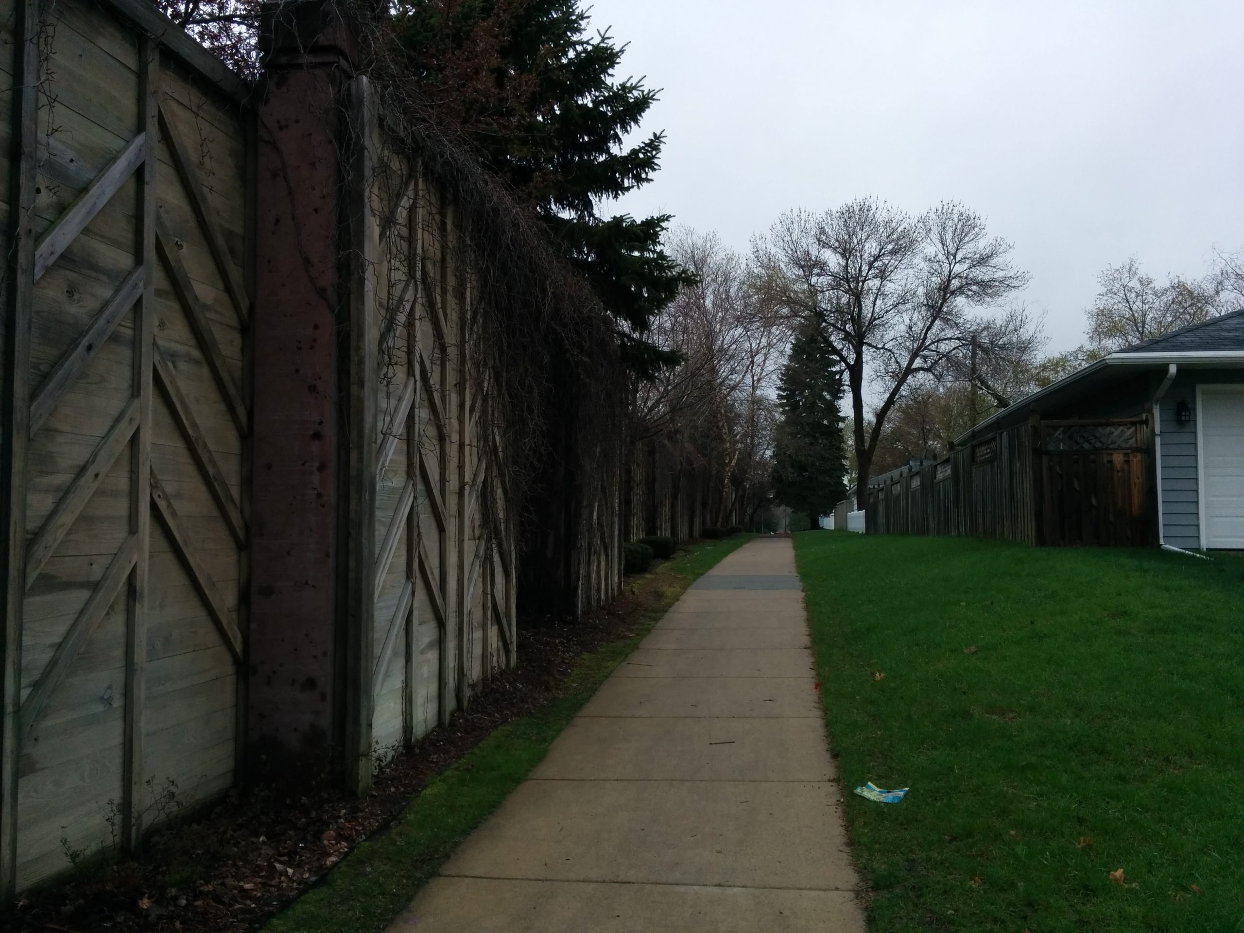
    The roadway itself is unremarkable. It’s a 35-40 mph 5-lane divided stroad. But just beyond the curbs, there are some important differences  The north side has a tall, freeway-style sound wall (behind which lies single-family homes). The south side has a conventional sidewalk and business frontage, as well as Richfield’s largest concentration of low-income, high-density housing.

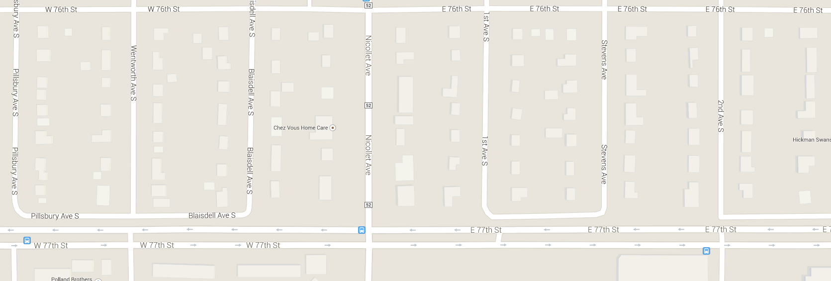
    The other major difference is that this stroad was built in a traditionally developed context. To the north, the Minneapolis grid runs almost intact. This means at least 12 intersections per mile — and more conflict points if you consider possible alleys or driveways. To create a safe and pleasant environment for cars, this had to be addressed. Richfield’s Director of Public Works Mike Eastling, who was also with the City at the time of the 77th Street project, gave me background on the project. In the 1980s and early 90s, the City of Richfield purchased more than 50 properties along the north side of 77th, to create room to widen the street and a loop system of frontage roads. The actual road construction occurred in 1993.

    The road has a nicely planted median, and is ornately planted on the roadway side of the sound wall. These plantings are maintained by the city, paid for by special assessments to businesses along the corridor.

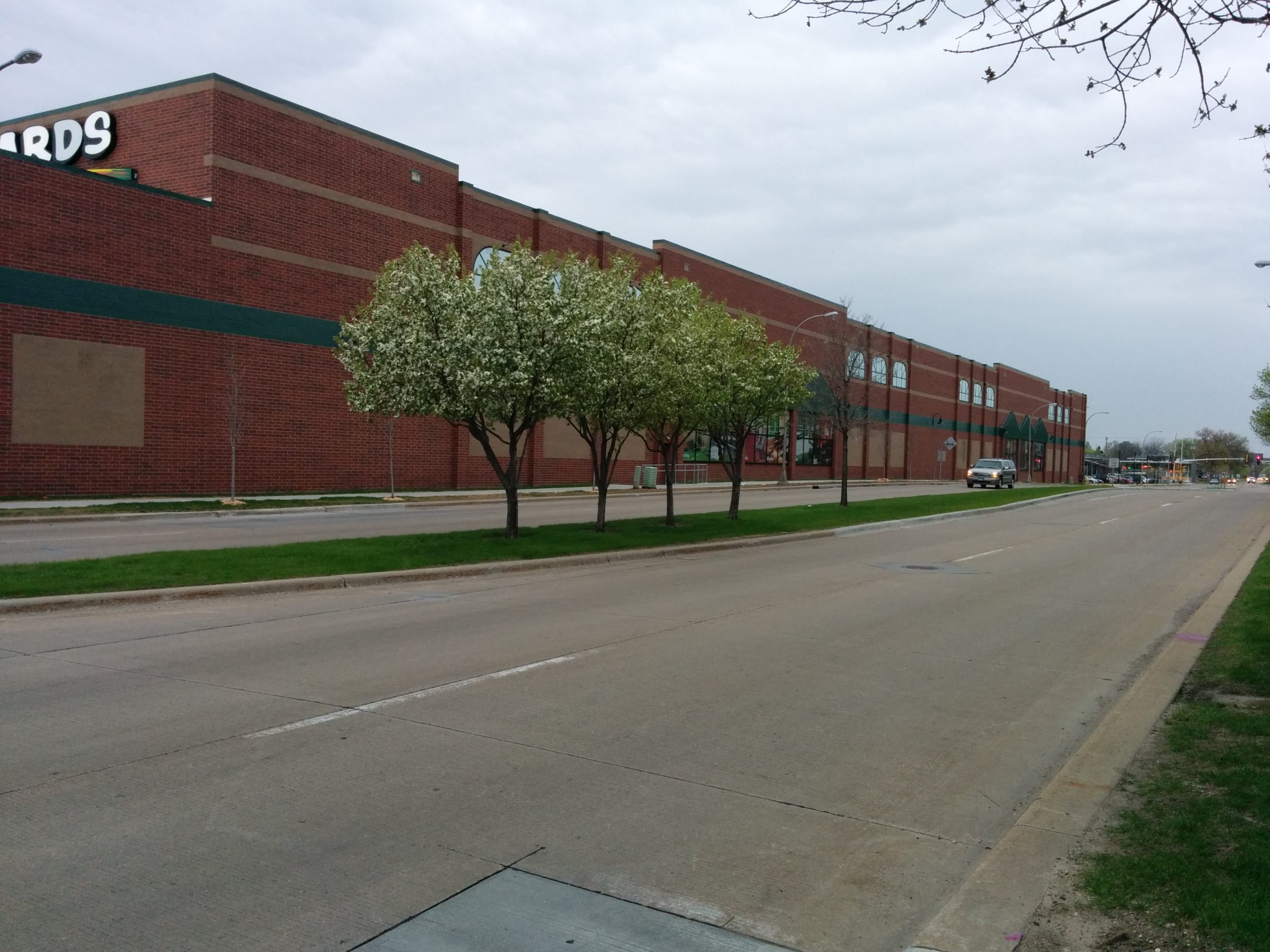
    Flowering trees in bloom by Menards
    The view from the bus stop. Flowering trees in bloom by Menards.

    Along the north side of the sound wall, sidewalks connect between the “loop” frontage roads, so there is a continuous path for pedestrians. Unfortunately, pedestrians must walk in the roadway where the frontage road is present — and pedestrians go down to roadway level, rather than creating a more obvious shared space. Pedestrians are considered, but the experience is discontinuous, at best. There is also a conventional sidewalk with a 6′ boulevard on the south side of the street.

    The People

    According to Eastling, the sound wall and removal of access for minor north-south streets were necessary to balance a city pursuing large, highway-scale development and resident concerns.  Unfortunately, the only resident concerns accounted for were those of longer-term, single-family-home residents on the north side of the street. No attempt was made to manage sound or other impacts on the multi-family housing, either from I-494 or 77th.

    This isn’t troubling just to consider the differences in the types of housing, but also the types of residents. Richfield’s median household income overall was $50,000 in 2011 — with one census tract as high as $105,000. In the main residential area south of 77th Street, the median income is $27,000 — half the city’s median. While Richfield is about 60% white, this area represents about 70% persons of color.

    The wall is not an absolute divide between these worlds. There are periodic crosswalks, in addition to the major through streets. (One can cross at about every third or fouth block.) But it is a troubling symbol of divide between two very different communities.

    The Lost Urban Village

    77th was designed to serve freeway-oriented business, and it does a good job of this. Eastling actually made a good argument on this point, arguing that — while Richfield is a generally urban community — this is a very suburban, freeway-oriented corridor. And it needs a suburban, car-oriented street to serve it well.

    Other issues with 77th notwithstanding, this is a reasonable way to approach the question. Maybe 77th Street does work. Maybe it keeps traffic off of 76th, a recognized new Complete Street. And maybe the value it creates is enabling highway-oriented business to efficiently transfer auto-driving customers.

    Unfortunately, this is not the official vision of the community. Enter the I-494 Corridor Land Use Plan, a part of the adopted Richfield Comprehensive Plan, and probably the most universally ignored planning document in the city’s history. The plan strives to promote high-density, mixed-use development, that both serves cars but also creates a “pedestrian-friendly environment” in a “vibrant urban village.”

    The closest development to the plan is Kensington Park and Mainstreet Village at Lyndale and 77th. On their face, they do a pretty good job. Kensington Park in particular has well-concealed parking, a mix of different housing types, and excellent frontage along Lyndale Ave and 77th.

    However, the details show something else:


    Even when the planning and orientation are done well, the businesses occupying the space still focus almost exclusively on cars and parking entrances.

    On the other hand, sometimes the planning and orientation are also terrible:

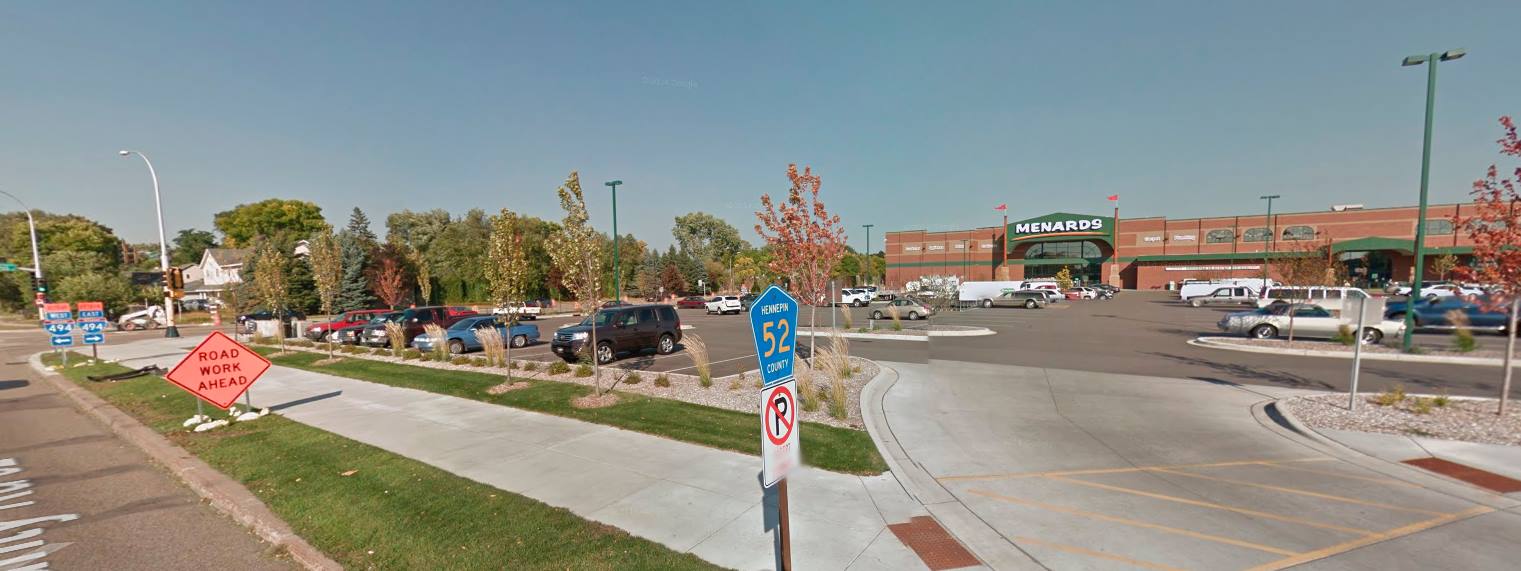
    The Menards at 77th and Nicollet — constructed several years after adoption of the 494 plan — contributes nothing to the goal of the “vibrant urban village”. It is a single land use that occupies nearly three full blocks, including a block of parking at the one of 77th’s most important corners. In deference to the 494 Corridor Plan, Menards did install some (now-dead) trees along the edges of the parking lot, and some billboards along 77th to avoid a blank wall.

    Eastling may be right — the 494 corridor is inherently suburban and auto-oriented. In this case, 77th Street is doing a fine job, and the development along the corridor is acceptable. On the other hand, if we are to believe in the vision of a “vibrant urban village”, development along the corridor has failed dramatically, and 77th Street is contributing the failure. Either way, the street creates a distinctive divide — between different demographic groups, between different street grids, and between different eras of the way we build our cities.

  • On 66th Street, Frontage Matters

    On 66th Street, Frontage Matters

    66th Street is Richfield’s main street, and with a planned reconstruction of 3.5 miles in 2016-17, it has the power to transform this first-ring city. It also has an enormous influence on adjacent South Minneapolis: 66th Street is the longest east-west street south of Lake Street, as well as home to the only major bus line south of Lake. (That bus line also happens to be the only Hi Frequency bus line that does not enter Minneapolis or St. Paul.) Although these transportation aspects are important, the most important aspect in terms of Richfield’s future success is not a question of how many cars, bikes, or buses move on 66th Street. Rather, the most important aspect is something that’s been overlooked in the street planning process so far: the quality of the frontage along it.

    Before I go any further, I will note that you have a major opportunity to help create a vital, urban 66th Street by attending the upcoming open house, which will help determine bicycle facilities for the new roadway:

    Thursday, May 1, 2014
    4:30p-6:30p
    Woodlake Nature Center
    6710 Lakeshore Dr
    (walking distance from buses 4 and 515, and only 3 blocks away from the Bryant Avenue bikeway)

    A Postwar World

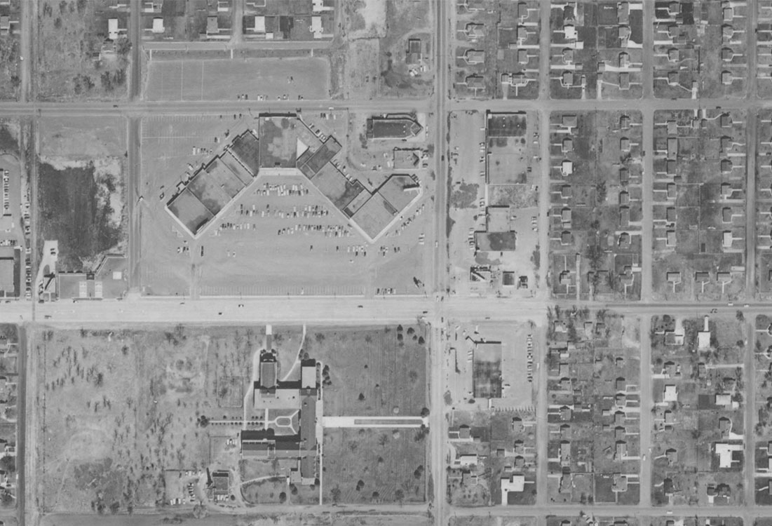
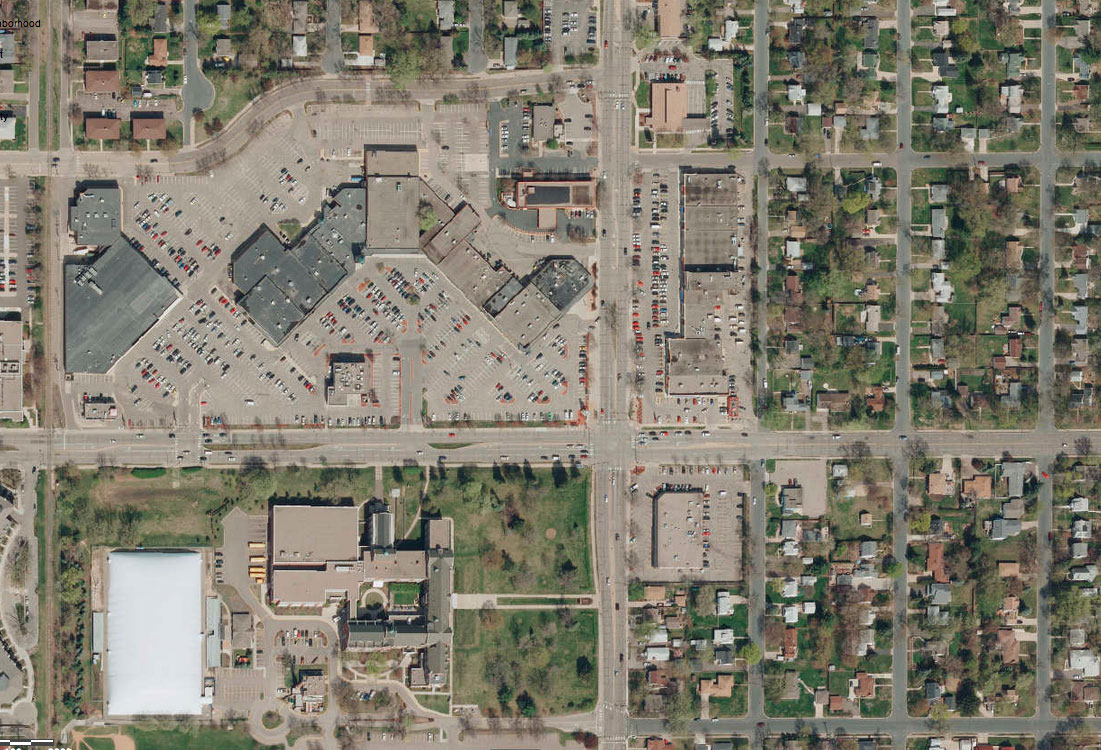
    Although Richfield is laid out on a prewar grid, the majority of its development came after 1950. Remarkably, some areas haven’t changed since. Behold, 66th and Nicollet, home to the Hub:

    The roadway has changed slightly, but you’ll notice the basic function of it has not changed. New turn lanes were added, and some additional trees were planted, but the basic function to move users (mostly cars) from A to B remains. Large parking lots flank all three corners (and may soon cover the fourth). Despite being a major transit node, no development at the intersection actively appeals to transit users.

    Newer Attempts

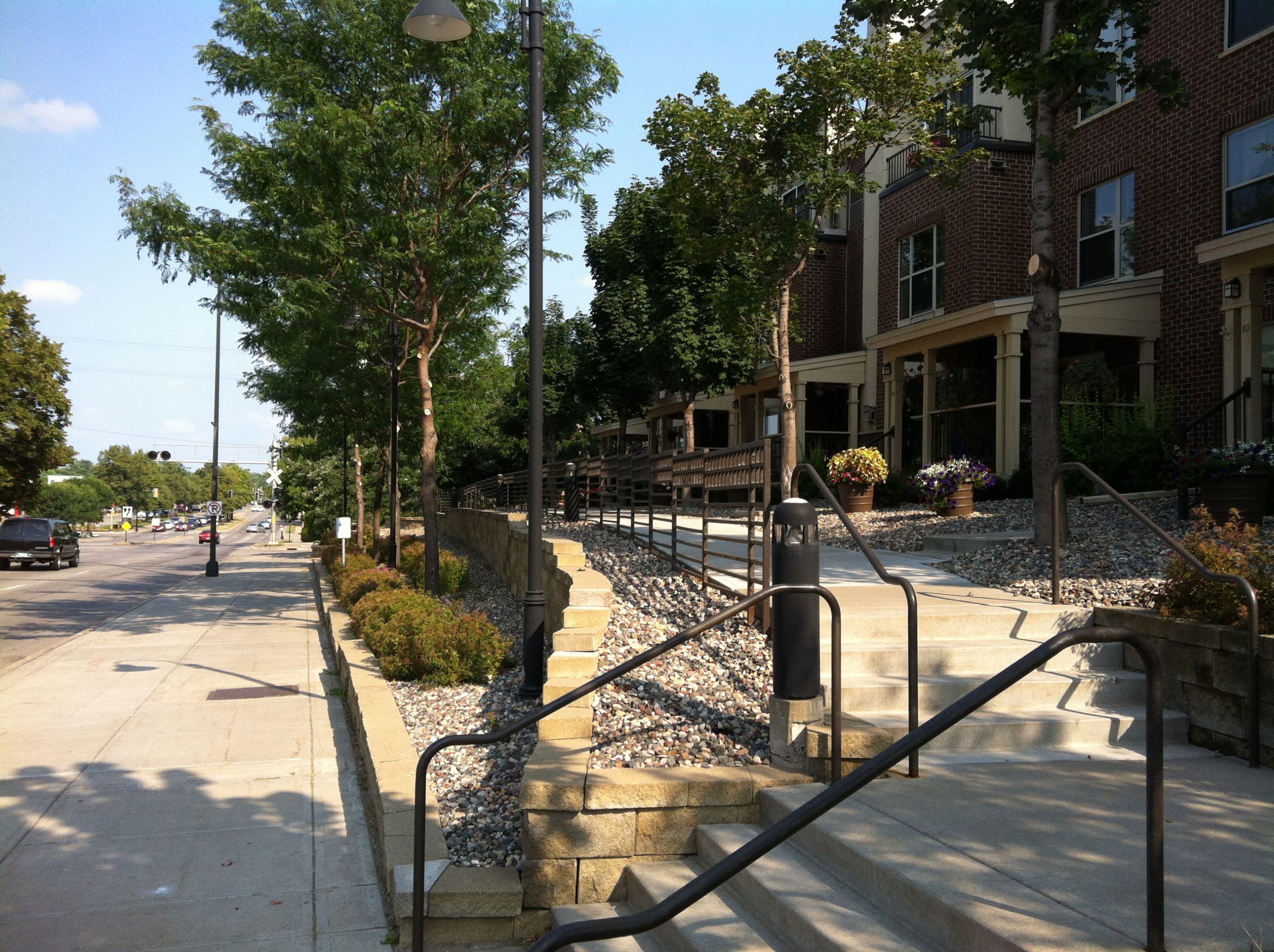
    Although 66th and Nicollet remains stagnant, other portions of 66th have seen redevelopment of varying quality. One of the better redevelopments is Woodlake Center and the adjacent Oaks on Pleasant apartments, which have townhome-style frontage on 66th:

    It’s unclear how useful these entrances are to residents, as most appear to access the units from structured parking behind the buildings. While it’s pleasantly built, the public-facing spaces appear underutilized.

    One of the largest redevelopment projects along 66th is Cedar Point Commons, home to Target and Home Depot. This complex is also one of the worst in terms of frontage. This small, far-eastern portion of 66th was reconstructed more recently, and is much more attractive than older portions. It includes boulevard trees, pedestrian-scale lighting, wider sidewalks, and landscaped medians. If you don’t think very hard about it, it’s a pleasant street.

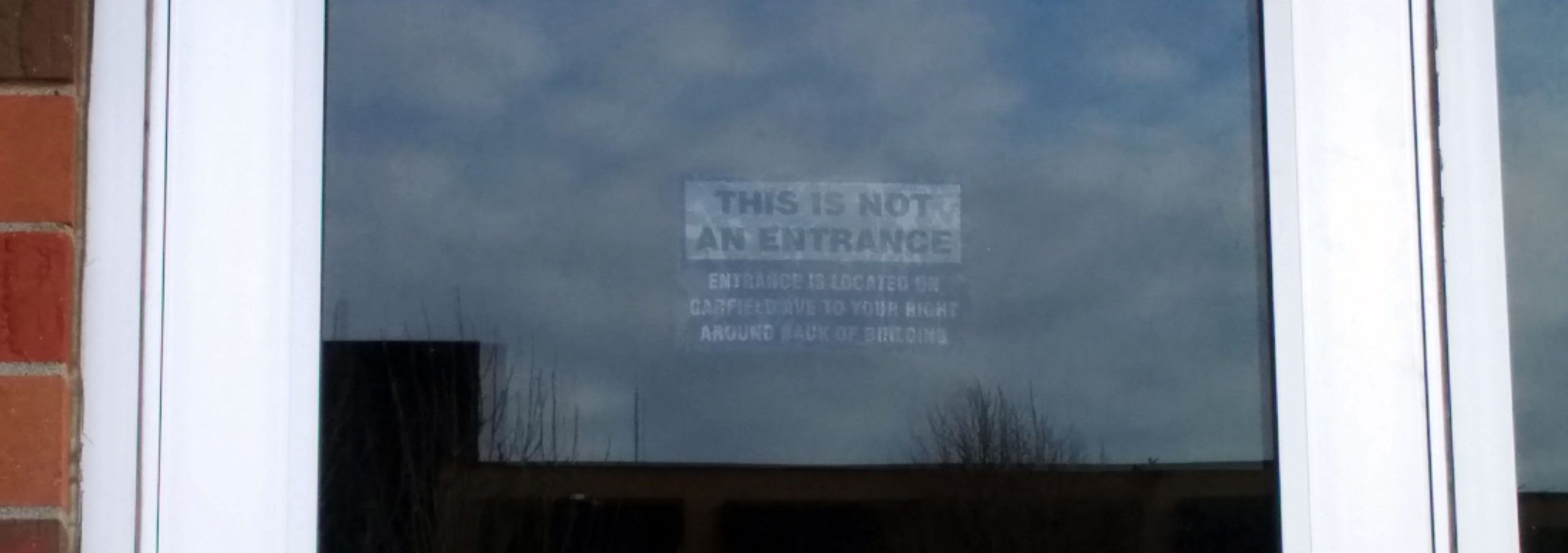
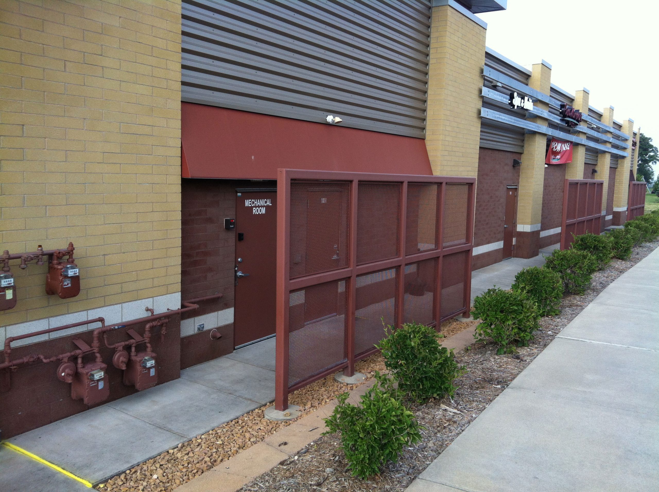
    Unfortunately, if you do think hard about it — or turn your head slightly to the left — you see the problem: the frontage is made up of fire exit doors and gas meters.

    Why would a business do this — place its most unpleasant features on permanent display to the public realm? For a simple reason: from the developer’s perspective, customers come from the parking lot. When the street exists only to move people (cars) from A to B, minimal cost and effort should be expended on creating appealing frontage or entrances from that street. The developer made a rational choice, and the city planning code failed to prevent the negative consequences of that choice.

    Overcoming the choice

    So what is one to do, when the rational choice — to favor cars — comes at the expense of pedestrians, cyclists, and transit users? The long-term answer is to increase the popularity of other modes, by building high-quality bikeways and improving transit along the corridor. But there is an important step to help achieve that long-term goal: align the interests of motorists with those of other street users. Or, put more simply, install on-street parking.

    Thus far, on-street parking has been treated like a difficult burden on the 66th Street project. Small areas are being considered for it, but engineers have focused on the ways in which it complicates accesses (driveways) and requires more land acquisition. The influence on future redevelopment has been largely ignored, at least as presented to the public.

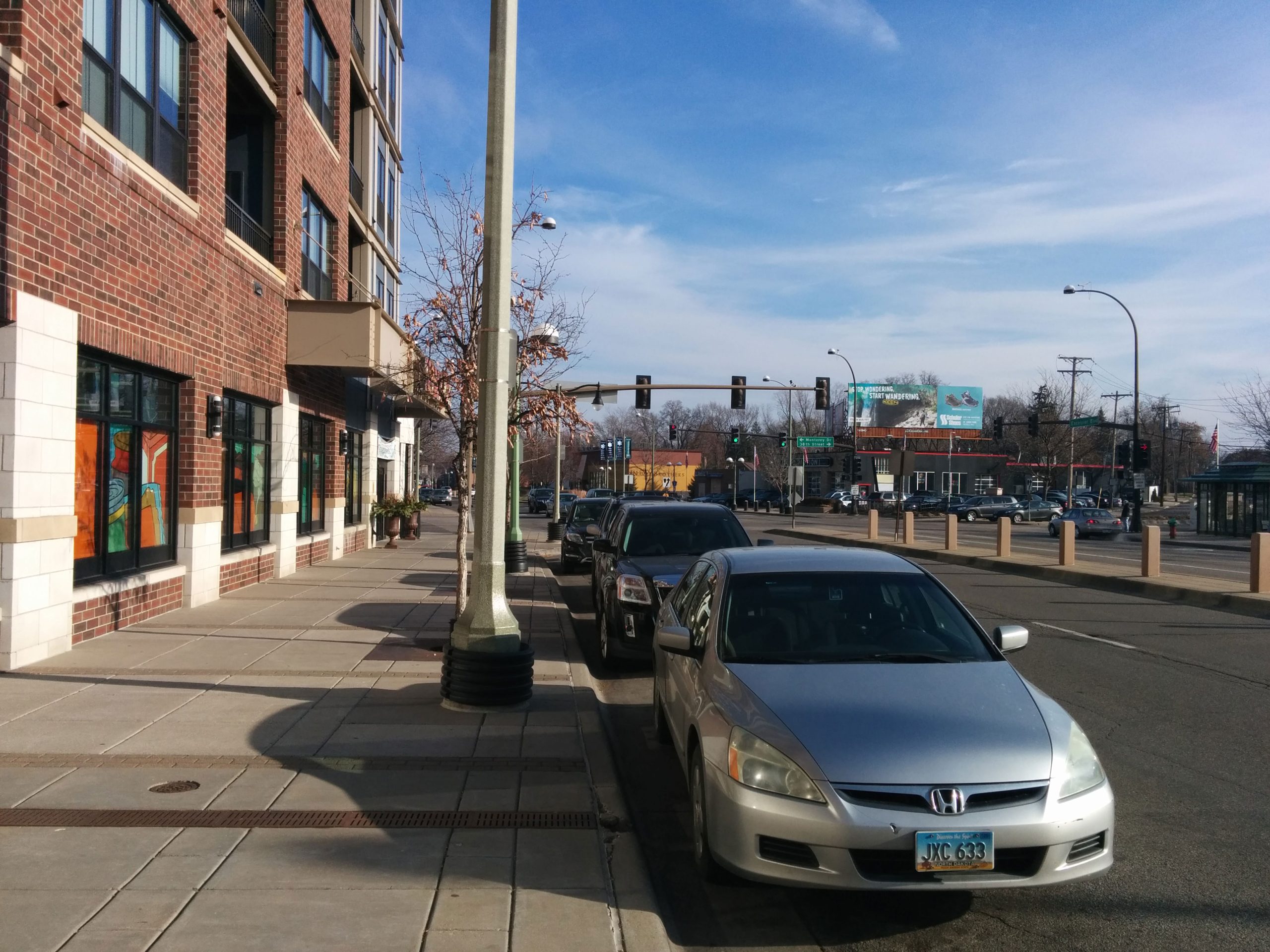
    In other projects, on-street parking is often touted for other urban benefits, including calming traffic and providing a pedestrian buffer from moving cars. But perhaps the most important benefit is that it promotes meaningful frontage. This can be clearly seen on Excelsior Boulevard in St. Louis Park, a similar county road with development of a similar age as Cedar Point Commons. For the businesses — including “small-box” chain Trader Joe’s — the most convenient location to park a car is also the best entrance for pedestrians, cyclists, and transit users.

    This serves as an immediate benefit to motorists, and it also makes walking and biking more viable, by providing more destinations that are bike/walk-friendly. In the long term, it also helps us reduce our need for low-value off-street parking.

    Excelsior Boulevard has an attractive streetscape. But the decorative lighting and patterned concrete are insignificant compared to the roadway feature of on-street parking. This parking has helped to bring the most important street feature of all: meaningful frontage, and destinations that serve all users well. We must strive for the same result in planning for a new 66th Street.