Category: Streets.mn article

  • On 66th Street, Frontage Matters

    On 66th Street, Frontage Matters

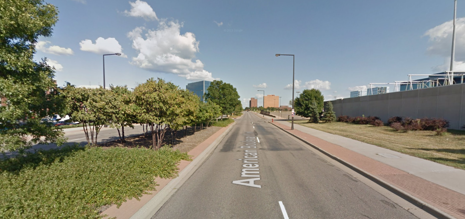
    66th Street is Richfield’s main street, and with a planned reconstruction of 3.5 miles in 2016-17, it has the power to transform this first-ring city. It also has an enormous influence on adjacent South Minneapolis: 66th Street is the longest east-west street south of Lake Street, as well as home to the only major bus line south of Lake. (That bus line also happens to be the only Hi Frequency bus line that does not enter Minneapolis or St. Paul.) Although these transportation aspects are important, the most important aspect in terms of Richfield’s future success is not a question of how many cars, bikes, or buses move on 66th Street. Rather, the most important aspect is something that’s been overlooked in the street planning process so far: the quality of the frontage along it.

    Before I go any further, I will note that you have a major opportunity to help create a vital, urban 66th Street by attending the upcoming open house, which will help determine bicycle facilities for the new roadway:

    Thursday, May 1, 2014
    4:30p-6:30p
    Woodlake Nature Center
    6710 Lakeshore Dr
    (walking distance from buses 4 and 515, and only 3 blocks away from the Bryant Avenue bikeway)
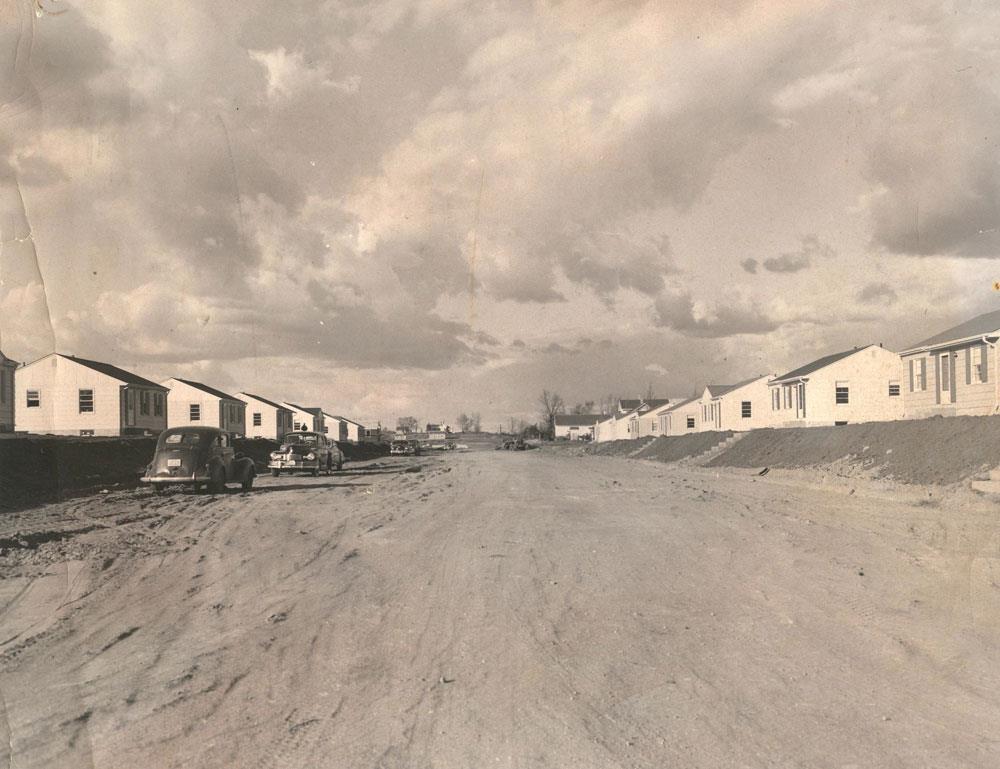
    A Postwar World

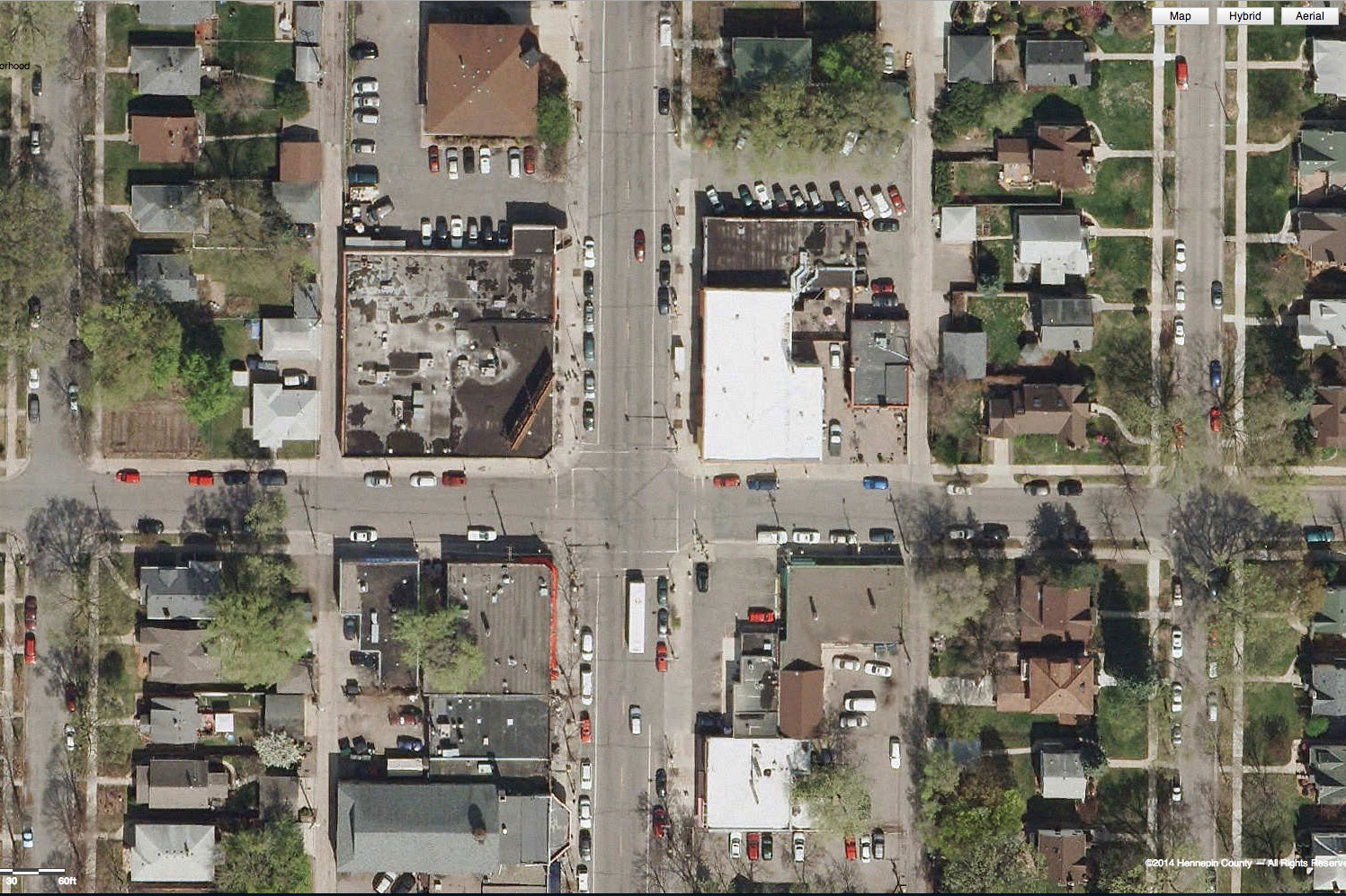
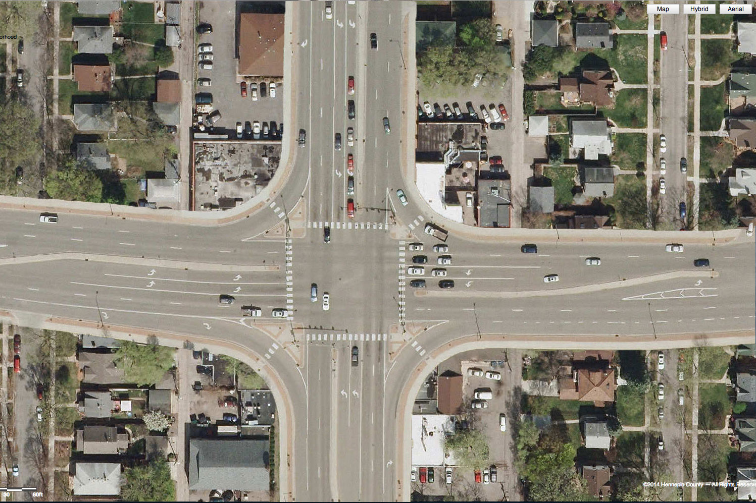
    Although Richfield is laid out on a prewar grid, the majority of its development came after 1950. Remarkably, some areas haven’t changed since. Behold, 66th and Nicollet, home to the Hub:

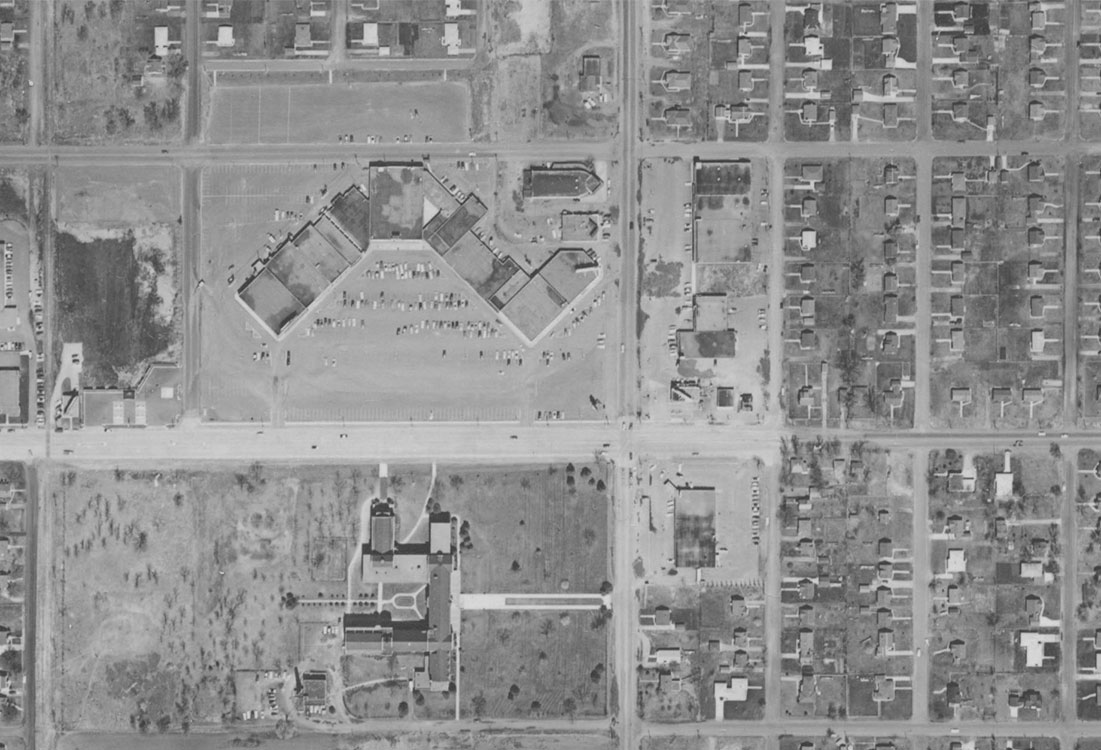
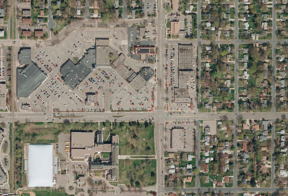
    The roadway has changed slightly, but you’ll notice the basic function of it has not changed. New turn lanes were added, and some additional trees were planted, but the basic function to move users (mostly cars) from A to B remains. Large parking lots flank all three corners (and may soon cover the fourth). Despite being a major transit node, no development at the intersection actively appeals to transit users.

    Newer Attempts

    Although 66th and Nicollet remains stagnant, other portions of 66th have seen redevelopment of varying quality. One of the better redevelopments is Woodlake Center and the adjacent Oaks on Pleasant apartments, which have townhome-style frontage on 66th:

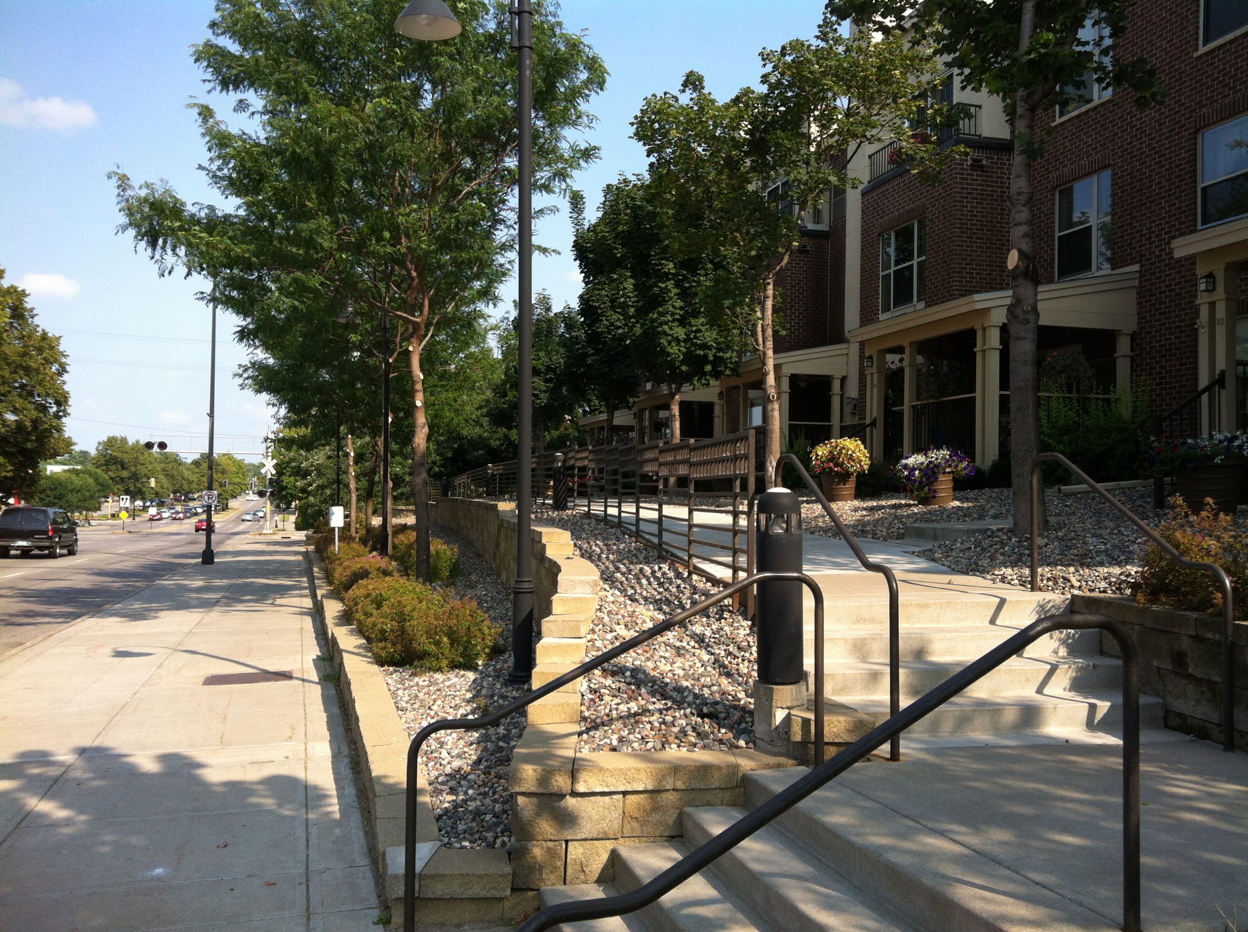
    It’s unclear how useful these entrances are to residents, as most appear to access the units from structured parking behind the buildings. While it’s pleasantly built, the public-facing spaces appear underutilized.

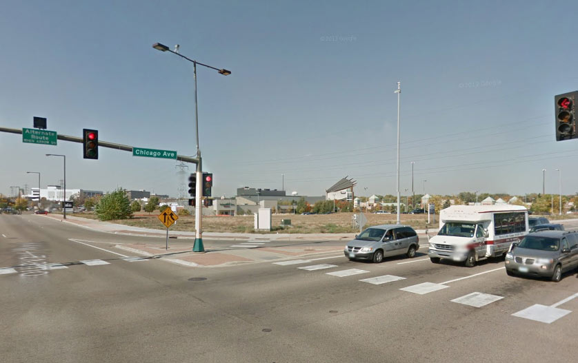
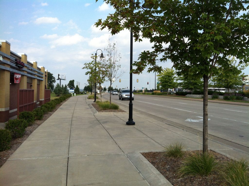
    One of the largest redevelopment projects along 66th is Cedar Point Commons, home to Target and Home Depot. This complex is also one of the worst in terms of frontage. This small, far-eastern portion of 66th was reconstructed more recently, and is much more attractive than older portions. It includes boulevard trees, pedestrian-scale lighting, wider sidewalks, and landscaped medians. If you don’t think very hard about it, it’s a pleasant street.

    Unfortunately, if you do think hard about it — or turn your head slightly to the left — you see the problem: the frontage is made up of fire exit doors and gas meters.

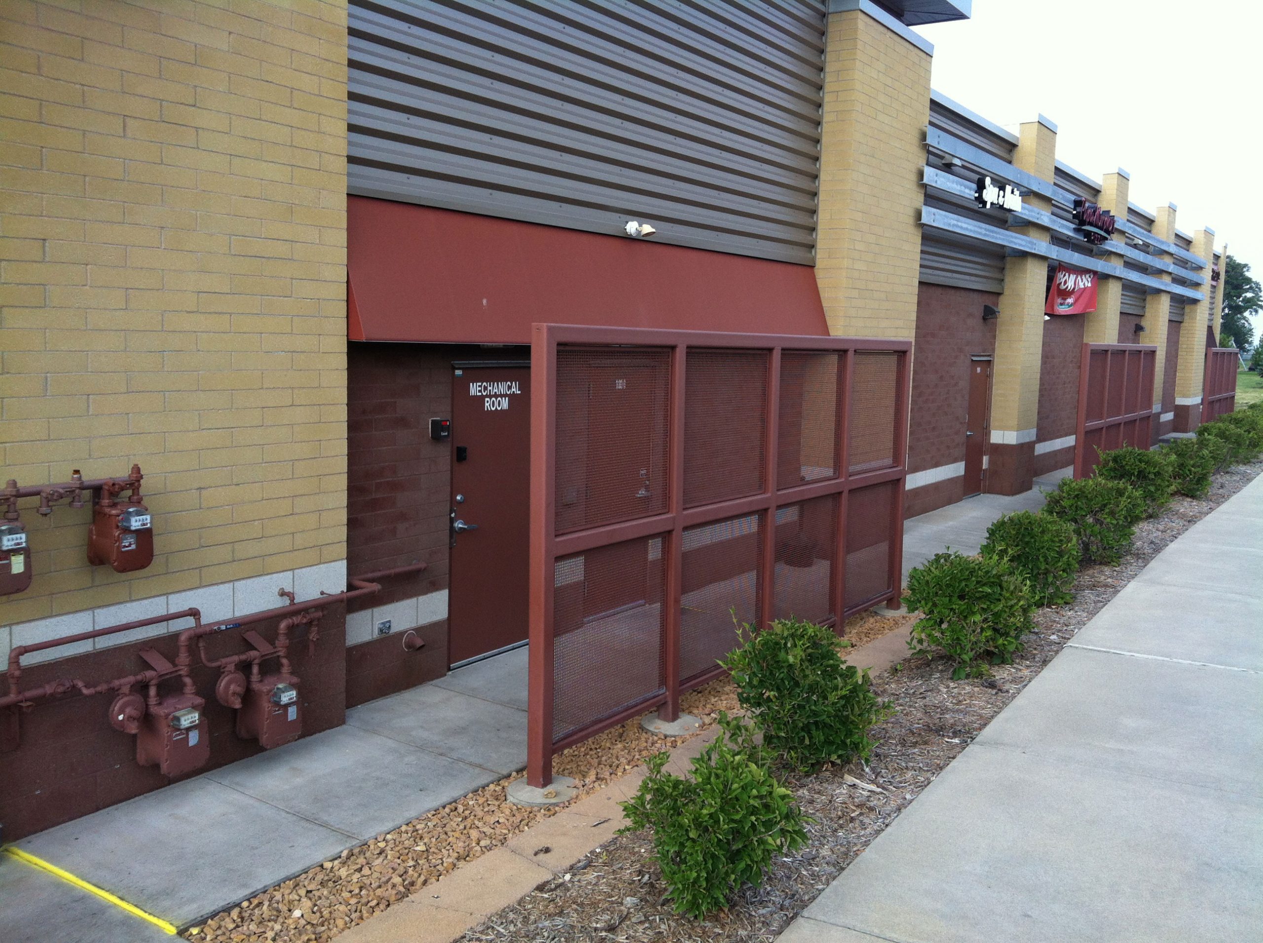
    Why would a business do this — place its most unpleasant features on permanent display to the public realm? For a simple reason: from the developer’s perspective, customers come from the parking lot. When the street exists only to move people (cars) from A to B, minimal cost and effort should be expended on creating appealing frontage or entrances from that street. The developer made a rational choice, and the city planning code failed to prevent the negative consequences of that choice.

    Overcoming the choice

    So what is one to do, when the rational choice — to favor cars — comes at the expense of pedestrians, cyclists, and transit users? The long-term answer is to increase the popularity of other modes, by building high-quality bikeways and improving transit along the corridor. But there is an important step to help achieve that long-term goal: align the interests of motorists with those of other street users. Or, put more simply, install on-street parking.

    Thus far, on-street parking has been treated like a difficult burden on the 66th Street project. Small areas are being considered for it, but engineers have focused on the ways in which it complicates accesses (driveways) and requires more land acquisition. The influence on future redevelopment has been largely ignored, at least as presented to the public.

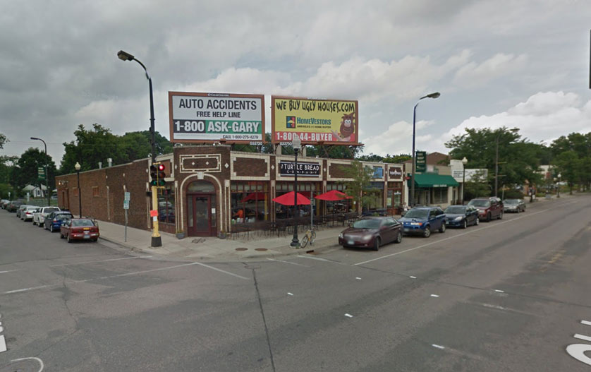
    In other projects, on-street parking is often touted for other urban benefits, including calming traffic and providing a pedestrian buffer from moving cars. But perhaps the most important benefit is that it promotes meaningful frontage. This can be clearly seen on Excelsior Boulevard in St. Louis Park, a similar county road with development of a similar age as Cedar Point Commons. For the businesses — including “small-box” chain Trader Joe’s — the most convenient location to park a car is also the best entrance for pedestrians, cyclists, and transit users.

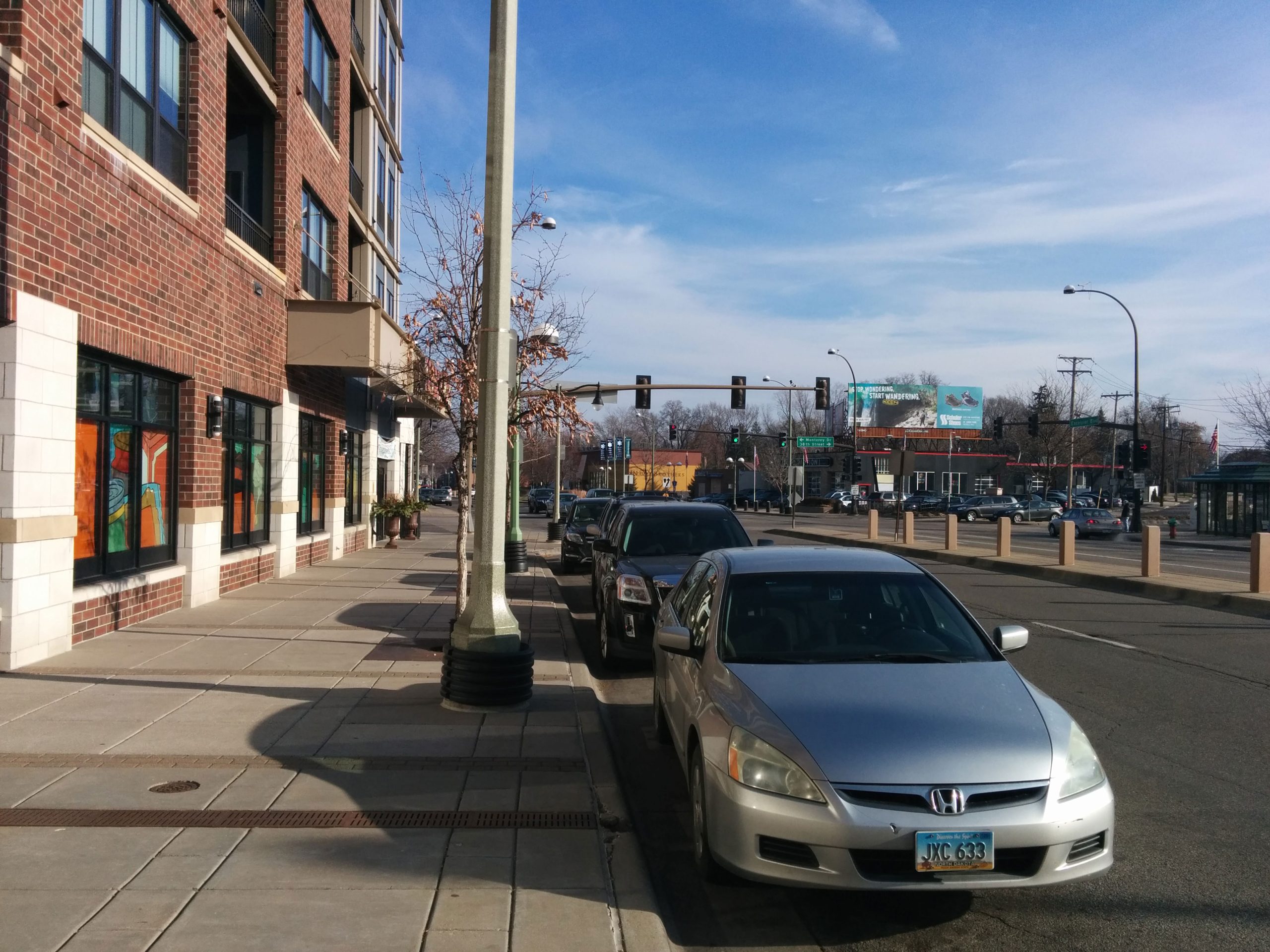
    This serves as an immediate benefit to motorists, and it also makes walking and biking more viable, by providing more destinations that are bike/walk-friendly. In the long term, it also helps us reduce our need for low-value off-street parking.

    Excelsior Boulevard has an attractive streetscape. But the decorative lighting and patterned concrete are insignificant compared to the roadway feature of on-street parking. This parking has helped to bring the most important street feature of all: meaningful frontage, and destinations that serve all users well. We must strive for the same result in planning for a new 66th Street.

  • (April Fools) Minneapolis Announces Adoption of Bloomington Pedestrian Plan

    (April Fools) Minneapolis Announces Adoption of Bloomington Pedestrian Plan

    Minneapolis announced today that they will be adopting the City of Bloomington Alternative Transportation Plan, as well as many engineering practices of Bloomington, to enhance pedestrian safety and comfort along Minneapolis roadways. Bloomington has long been known as a regional leader in pedestrian-friendly roadway design and planning.

    “Ever since the opening of the Hiawatha Line, we’ve watched scores of Minneapolitans drive to their nearest park-and-ride and take the train down to East Bloomington’s distinctive urban center, just to experience the sublime pedestrian environment of 8-lane, 40+ mph roadways,” mayor Betsy Hodges said in a press conference Tuesday. “It’s time to bring that kind of distinctiveness to Minneapolis.”

    New Campaign Launched, 48th and Chicago Selected as Pilot

    The new campaign will be called, “Yesterday’s Stroads, Tomorrow’s Innovation.” It will begin with a pilot project at 48th and Chicago, an intersection that the Star Tribune once called a “pedestrian hellscape.” On-street parking will be eliminated, and additional right-of-way will be acquired at all four corners of the intersection.

    The improvements will include one of Bloomington’s most treasured features: the free right turn. Rather than simply crossing the street at a right angle, pedestrians will detour slightly out of their way to cross at a 45° angle. After reaching the porkchop-shaped refuge island, they can press a beg button and eventually receive a walk signal. After making it across eight lanes, they’re just another 45° detour and free flow of traffic away from their destination.

    “Finally, we were able to answer the age-old question: Why did the pedestrian cross the stroad?” chuckled Gene Winstead, Bloomington mayor, explaining the pedestrian enhancement to Streets.mn. “So they could cross it two more times!”

    Artists' rendering of NW corner after proposed improvements
    Artist’s rendering of NW corner after proposed improvements


    Boulevard Trees Removed

    Plantings will also be reworked along most streets in Minneapolis. “It’s never made much sense, but someone somewhere in our history thought that it made sense to plant trees between the sidewalk and the street. Now we know that pedestrians far prefer stamped concrete. Trees belong in the median, where they can be appreciated by cars,” explained Hodges. Starting in 2015, city crews will begin removing boulevard trees and widening Minneapolis roadways to accommodate planted medians.

    American Boulevard's innovative pedestrian treatment
    Actual, unphotoshopped image of American Boulevard’s innovative pedestrian treatment


    Residential Improvements, Too

    Pedestrian improvements won’t be limited to major streets, either. Over the next five years, most residential sidewalks will be removed, except in select areas where there are no possible walkable destinations. “If there’s one thing we’ve learned as an older suburb,” Winstead said, “it’s that people really like walking in the gutter. Sidewalks, boulevard trees, outdoor dining… no, none of it compares to that authentic feeling of mashed-up leaves stuck to your shoe, or of pulling your 5-year-old out of the way of a fast-moving car. Our pedestrian innovations help people feel truly alive.”

    The remaining sidewalks will be cleared at city expense, since homeowners’ ability to clear snow has suddenly been limited to their own driveway and walks.

  • Completing Richfield’s Streets

    Completing Richfield’s Streets

    The City of Richfield has all the bones of a good place to walk. It has higher density than any other major suburb. It has a nearly intact urban grid. It has better transit service than any other suburb, and in some regards, better than most of South Minneapolis. But as almost anyone who has walked in Richfield knows, it certainly doesn’t always feel like a good place to walk. Sidewalks on major streets are disheveled and unbuffered, and there are virtually no sidewalks to be found on residential streets.

    The story behind this is a typical for a municipality caught between urban and suburban: Richfield expanded rapidly after World War II. There was not time nor money to build full streets at the time — the roads were mostly unpaved, and certainly had no curbing or sidewalks. In the 1970s, the City of Richfield embarked on an ambitious campaign, called “Richfield Permanent Streets,” in which almost all of today’s streets were built. Despite being relatively integrated with Minneapolis, the 1970s Richfield went for the same design that was being popularized in newer suburbs at the time: broad streets, and sidewalks only where there was a high volume of traffic.

    And that’s where we’ve been ever since. The 1970s was not all that long ago, and thanks to shade, low traffic, and routine maintenance, the streets haven’t even been repaved since. That initial lifecycle of those streets seems to be coming to a close, as the Public Works and Engineering departments now want to pursue a $20 million plan to mill-and-overlay all of Richfield’s residential streets. This is being wrapped into a larger campaign — “Better Roads, Better Richfield” — to promote both the mill-and-overlay project, as well as full reconstructions of Portland Avenue and 66th Street.

    I applaud Richfield for taking good care of their streets for four decades, and I don’t oppose spending the $20 million to repave them. But when we’re talking about “Better Roads, Better Richfield,” shouldn’t those roads be better for everyone?

    There is no doubt that Richfield’s 100 miles of sidewalk-less streets are leaving people out in the cold. As of the 2010 census, more than half of Richfield households have one car or no car at all — that’s more vehicle ownership than Minneapolis as a whole, but notably less car ownership than the Minneapolis zip codes immediately to the north. And simply looking at cars per household doesn’t begin to address those too young or too old to drive. In 2009, Richfield conducted a Safe Routes to School Study, and found that 64 of the 65 parents surveyed — 98% — felt that continuous sidewalks were “somewhat important” or “very important” in their decision to let their child walk to school or not.

    So why is Richfield in the situation that it’s in? As far as I’ve been able to tell, it’s simply inertia. I have talked to dozens of Richfielders, and I hear the same thing every time: “well I don’t really have a problem with sidewalks, but other people are really not going to like that.” I have no doubt that these feared sidewalk curmudgeons do exist, but they may not be nearly as pervasive as we might think.

    Yet this mill-and-overlay project is a unique opportunity for Richfield, easily the largest public works project since the original street construction in the 1970s. It will involve a $20 million bill being passed to the citizens. It involves extensive public outreach. And it will affect nearly every street in town.

    So my proposal is simple: we can’t completely undo a bad decision made 40 years ago, but we can make it much better for a fair cost. I want to see a sidewalk on at least one side of every residential street in Richfield. City staff have been receptive to the idea, and have assisted in rough cost estimates: the general ballpark is that it will cost $10 million to build the 100 miles of sidewalk that this would require. Sidewalks on both sides of the street would cost about double, $20 million. The idea of including sidewalks was first discussed with the Transportation Commission (a board to which I am a bike-ped liaison) last week. While it was not a ringing endorsement, the Commission did direct staff to continue to examine the viability of such a project, and begin to broach the subject with the City Council. Believe it or not, that may be the biggest progress toward sidewalks in Richfield in four decades.

    Creating a network of sidewalks on every street in Richfield will be an opportunity for us to attract more young homeowners and families. It would be an opportunity to be a leader in the first ring for pedestrian safety and walkability (as we already have for bicycling). And most important of all: it would be an opportunity to make walking safer and more comfortable in Richfield.