Category: Land Use

  • Penn & 66th is the best small business district in Richfield. Why replace it?

    Penn & 66th is the best small business district in Richfield. Why replace it?

    Last spring, at a voter forum for Richfield’s west-side City Council seat, there were a number of questions about the mid-century commercial development that lines Penn Avenue between the Crosstown and 68th Street. Voters and candidates spoke of “tired” buildings, non-conforming sites, and inadequate parking. These questions about Penn Avenue seem to come up in every election cycle, and our elected officials are often put on the defense of why there continue to be vacant storefronts, and almost no major redevelopment.

    The longer I’ve lived in Richfield, and the more deeply I’ve become involved in conversations around development, the more I have come to realize something: yes, Penn Avenue has all of those “problems.” But many aren’t problems at all. They’re what makes this corridor the best hub of small business in Richfield. And there are better ways to make this area even better.

    Small businesses along Penn Avenue
    Small businesses along Penn Avenue

    Meet Penn Central

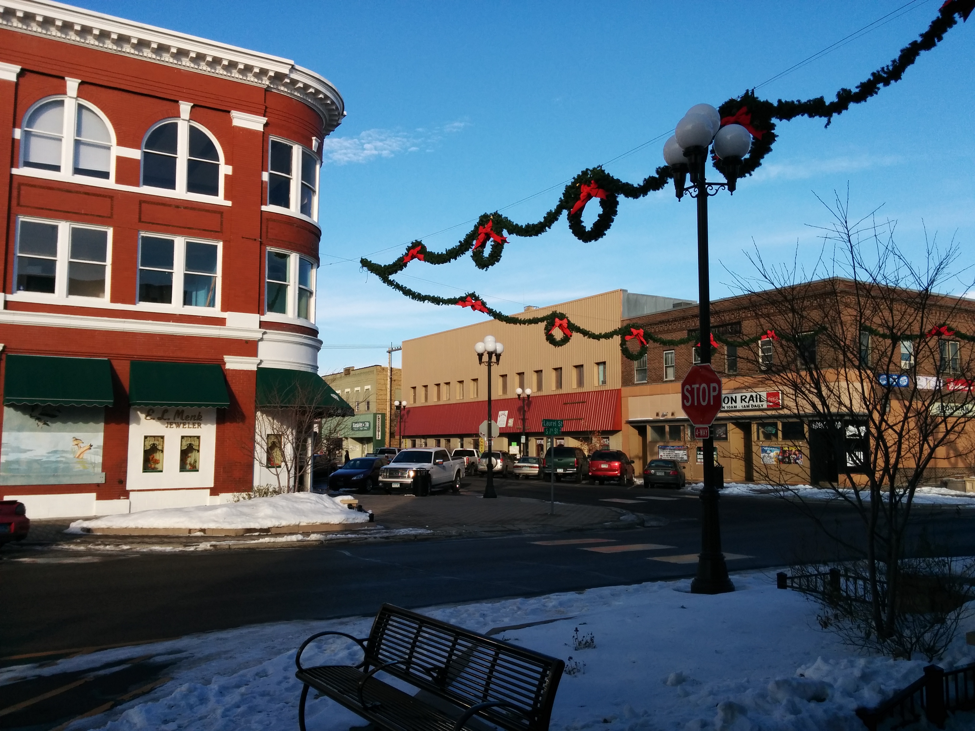
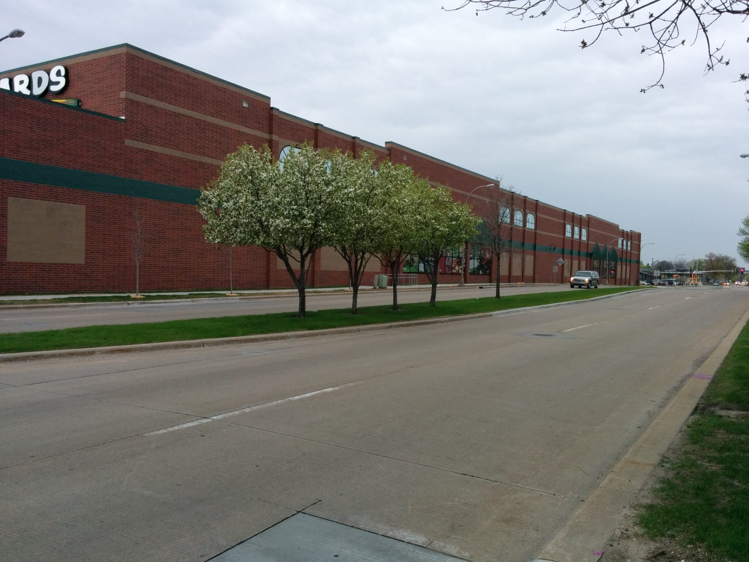
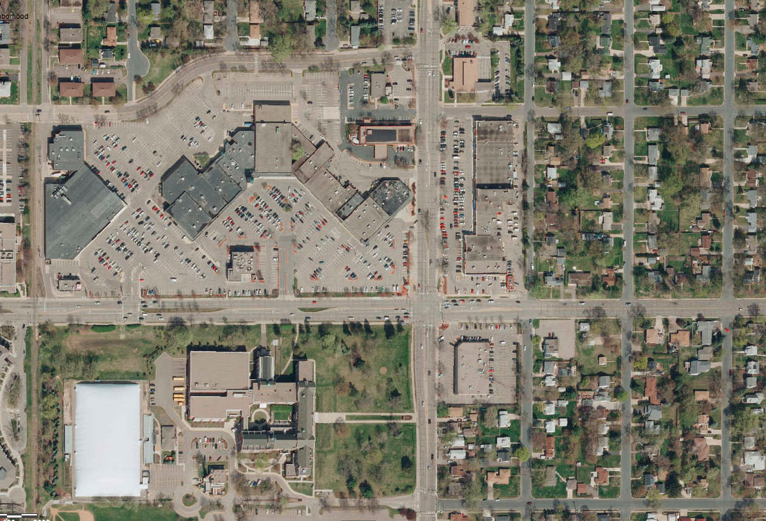
    Immediately south of Crosstown Highway, Penn Avenue is true mix of styles and types of businesses. The massive parking lot of the Lunds store is the first thing you’ll see on the west, while the east side is littered with independent small businesses, ranging from Woof Central doggy daycare to Johnston’s Vac and Sew to one of only two classic barber shops in the city. Around the corner at 66th, you’ll find Aida, one of my favorite restaurants in the city.

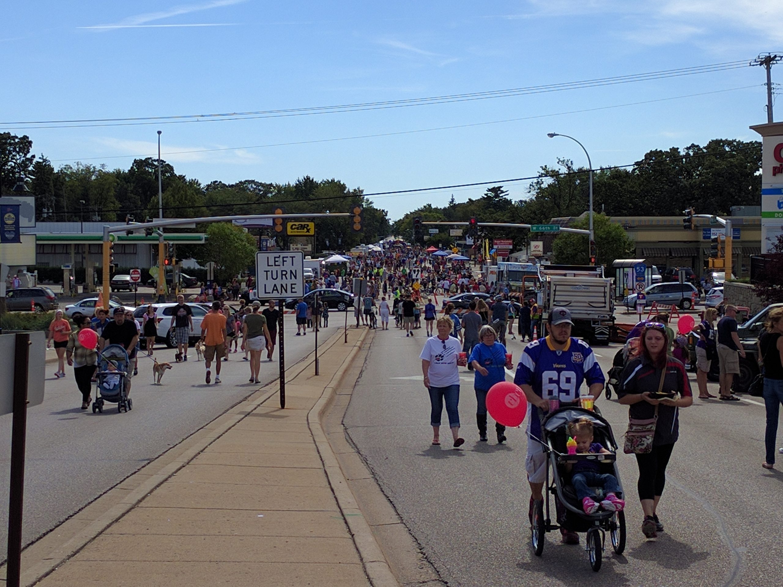
    The distinctive small business district has an informal business association, and has branded their neighborhood as Penn Central. This organization, together with the City, hosts Richfield’s annual Open Streets festival, PennFest.

    Open Streets at PennFest
    Open Streets at PennFest

    The fact that small business is concentrated on Penn is no accident: these “tired” buildings on small lots are affordable and accessible to small businesses. As a planning commissioner, I have often heard residents share concerns that new development only brings more chains to the community. This, also, is no accident: chains can afford higher rent, and have more specific requirements for their building that are easier to do with new construction.

    Cities do not have the right to control if a chain or small business is allowed to occupy a building — but we do make a choice in terms of what environment we want to create. Replacing affordable older buildings with brand-new buildings will have the effect of displacing small business and attracting more national chains. That may be inevitable, but it does not have to be a process we help accelerate.

    The Penn Avenue Guidelines are the wrong solution to a problem that doesn’t exist

    In 2008, in response to ongoing desires to improve the Penn corridor, the City contracted with an outside consultant to create a new master plan for the area. This process was valuable, and has given us a rigorous, high-quality zoning code for the area, that includes important features to improve the pedestrian environment, ensure high-quality development, and to limit uses that detract from the neighboring properties, like auto sales and drive-thrus.

    Penn Avenue corridor plan, north end

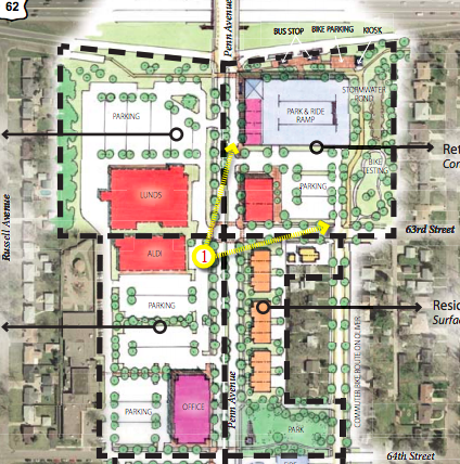
    However, the big picture proposed by the plan is disturbing. In a hypothetical redevelopment scenario, the plan envisions every single unit of small, affordable space for small business being eliminated — replaced by larger, mixed-use buildings. Even worse: the plan envisions every single piece of existing naturally occurring affordable housing being replaced.

    This is not a good end-goal to have — if we were “successful”, we would eliminate important parts of our local economy, and the exciting, interesting businesses that help make Richfield a great place to live.

    With no problem to solve, we don’t need to be desperate

    The first project proposed after the Penn Avenue plan was a CVS Pharmacy. This project went against many of the principles of the plan: it was large, single-use retail. Facing the sidewalk, it didn’t offer the customer entrances, display windows, and awnings envisioned — instead it had a large, blank retaining wall, which allowed the parking lot to loom over Penn Avenue. But it was approved, feeling that demonstrating some sign of life would help inspire additional redevelopment.

    Since that building was built six years ago, there has been no new construction on the corridor, although most existing businesses continue to thrive. Now, the City is considering an application for the first new development proposed in years: a fast food restaurant. Like CVS, this would be another single-use chain, this time with half the required density, and with a drive-thru speaker that is half the required distance to housing.

    Proposed fast-food restaurant space at Penn and 66th
    Proposed fast-food restaurant space

    The Planning Commission, on which I serve, voted against the variances that would allow this fast-food restaurant to build — although it remains to be seen if the City Council will accept or overrule that recommendation. The problems with the development are significant, and it was clear to me as a planning commissioner that they did not meet the specific standards for the variances they were seeking.

    In the bigger picture, developments like this fast food restaurant offer little to the community. They are certainly not the high-intensity development that the Penn Avenue Guidelines envision. Occupying a tiny portion of the site, they do not offer much improvement to the tax base. They have significant externalities in terms of noise, air pollution, and traffic. And they replace more-affordable commercial property with less-affordable new development.

    How to fix Penn Avenue? Fix Penn Avenue.

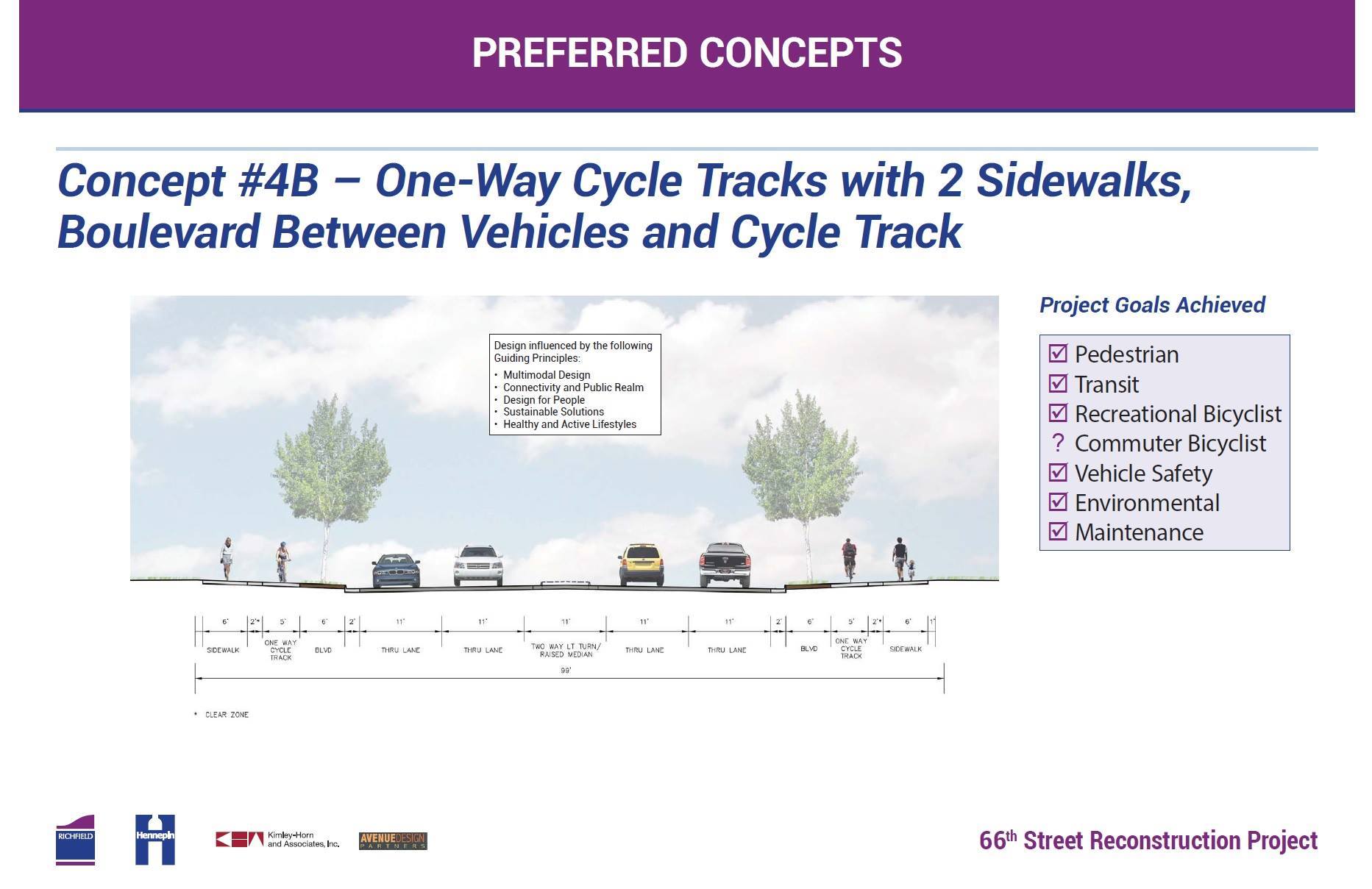
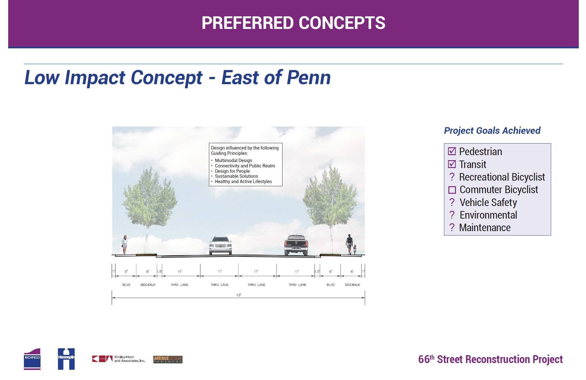
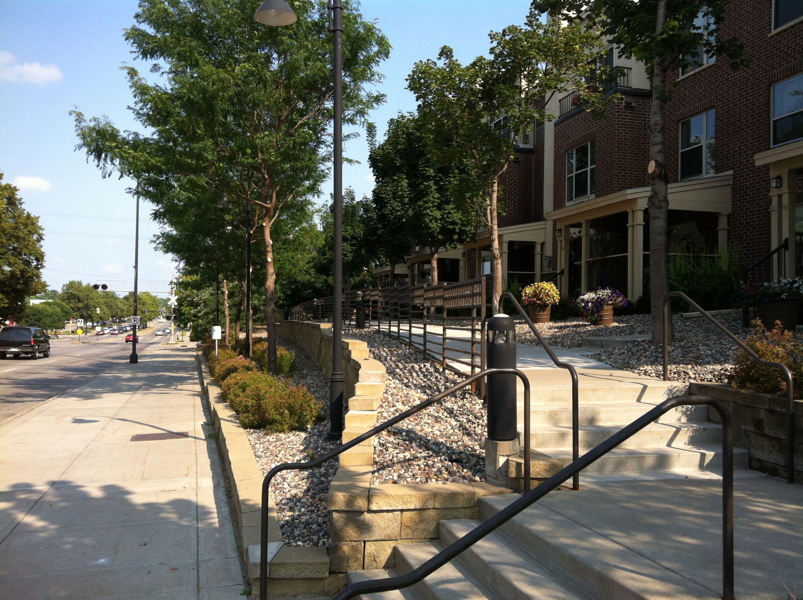
    Although it offers a lot to the community, there are admittedly problems on Penn: some spaces remain persistently vacant, and the cosmetic appearance of the corridor is poor. If we want to improve the appearance of the corridor, let’s start with something that doesn’t have to cost businesses a dime, and something that we can do right away: rebuild Penn Avenue.

    Penn Avenue sidewalk
    The sidewalk by the Fireside Foundry parking lot is simply an unstriped portion of the lot, made inaccessible by the driveway apron. Image: Google Street View.

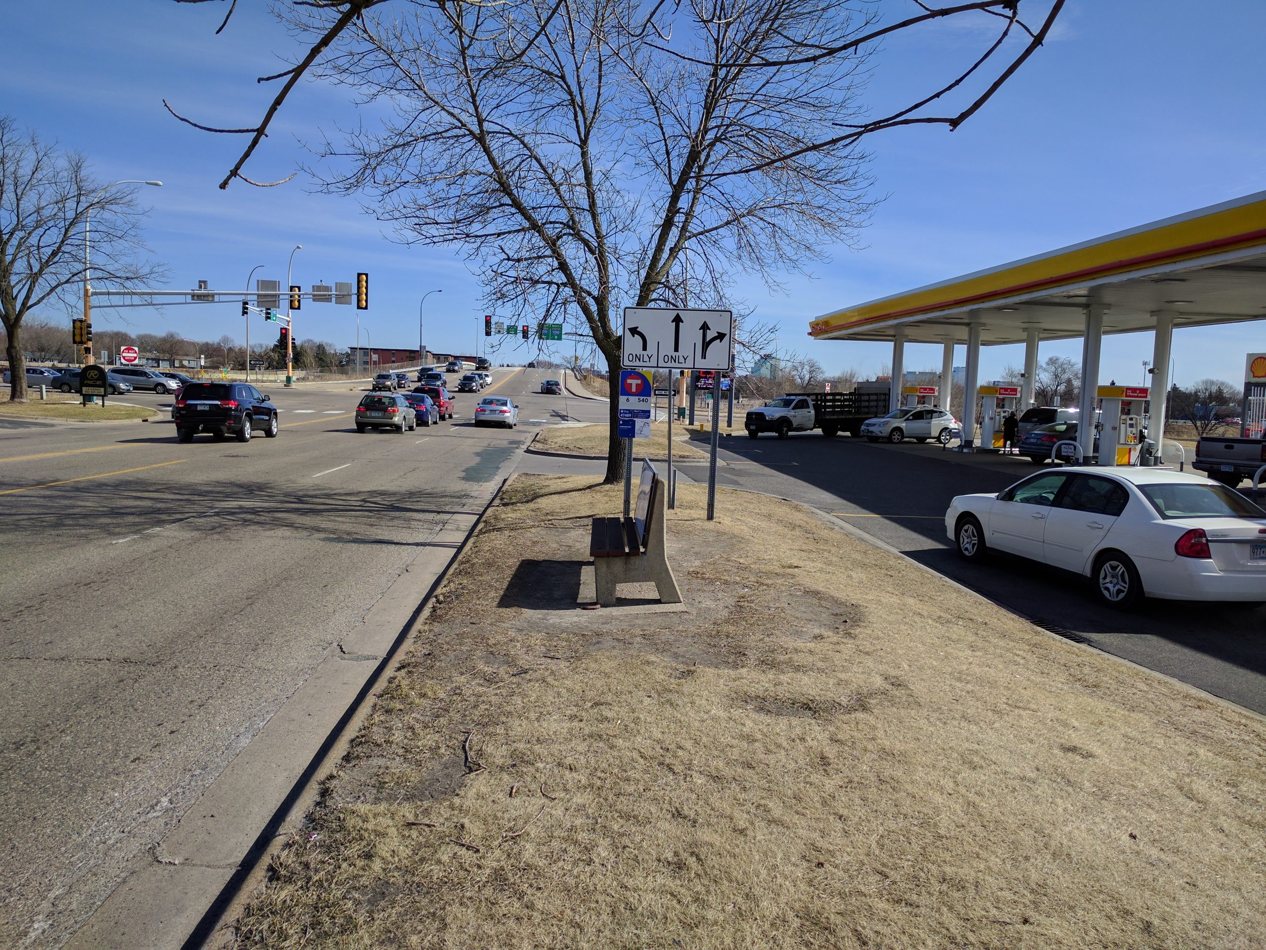
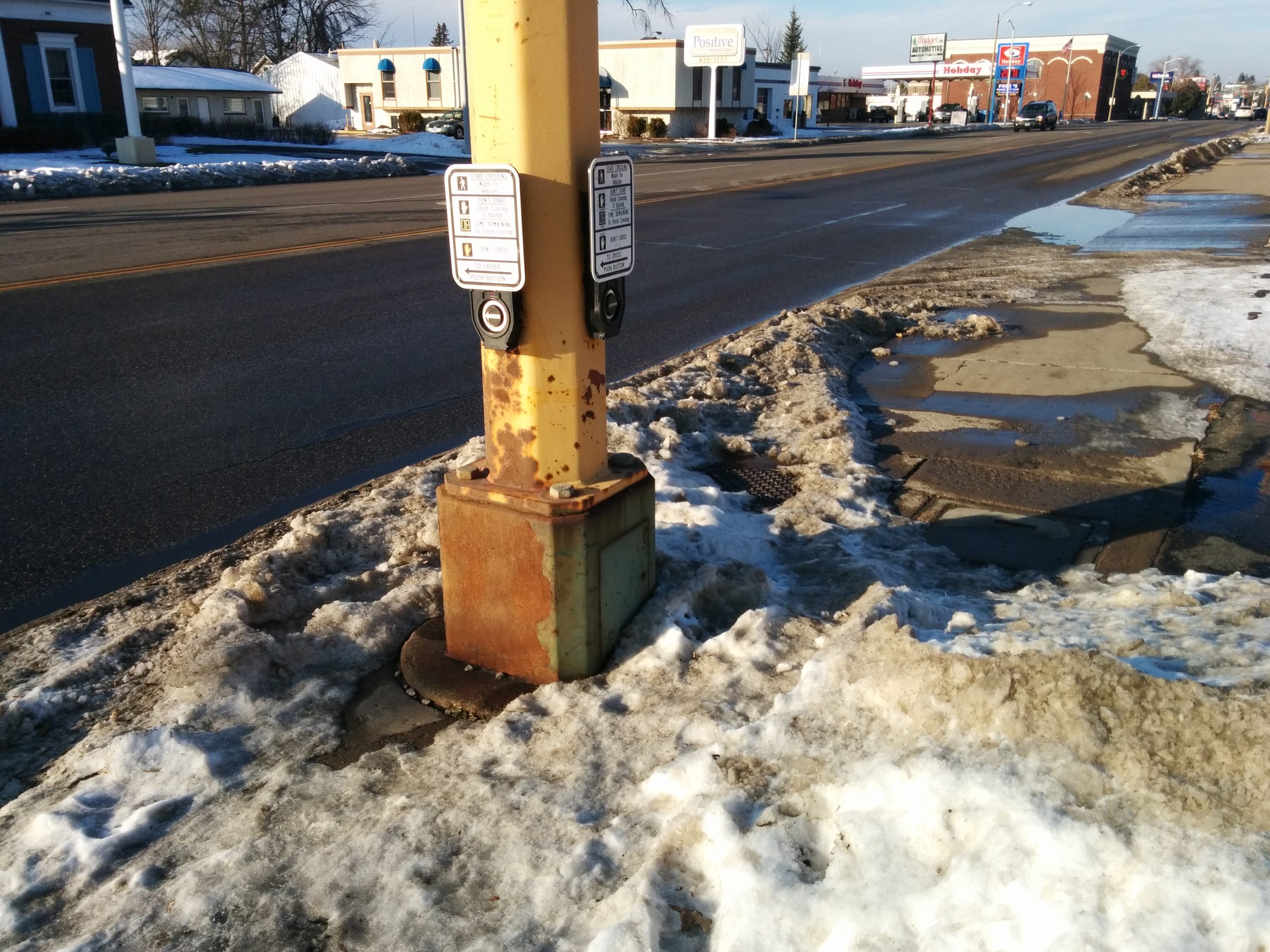
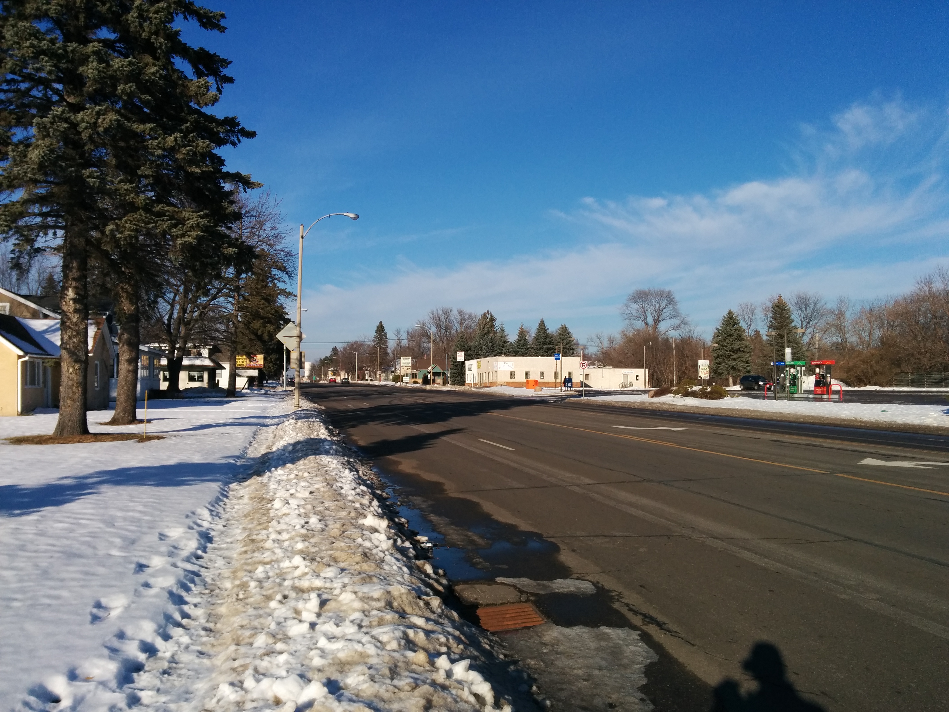
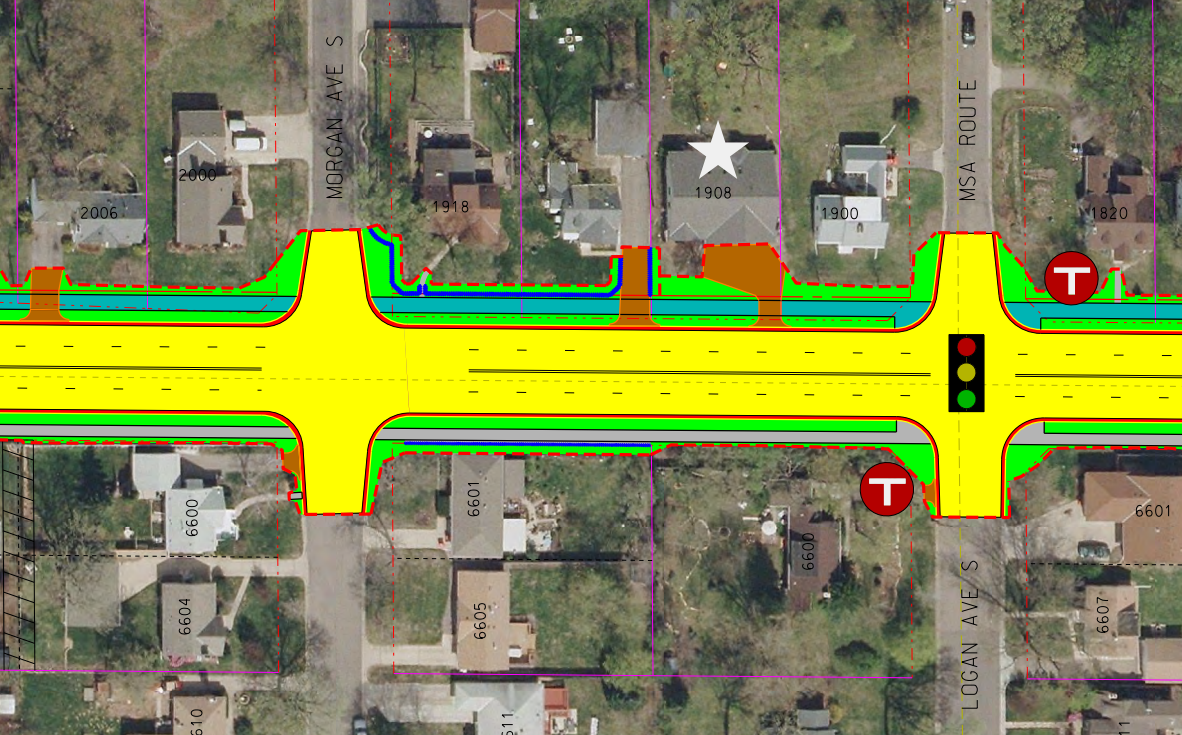
    The four-lane death road, owned by Hennepin County, is a grim relic of yesterday’s engineering. Sidewalks are completely inaccessible. Speeding is common. On-street parking that could serve businesses exists for only a single block. Crossing from one side of the street to another — a key component of a walkable business district — is all but impossible.

    Let’s not eliminate our small business corridor. Let’s help it thrive, by giving businesses an attractive home, and giving their customers and our residents a safe place to walk, shop, and live.

  • Cars (Alone) Can’t Sustain Interstate 494

    Cars (Alone) Can’t Sustain Interstate 494

    I spend a lot of time thinking about the 494 strip. I work out of a coworking space near 494 and 100, and live less than a mile north of the highway in Richfield. As a Richfield planning commissioner, I have seen many projects revolve around 494 visibility and access.  On a broader level, Richfield has ambitious goals for high-intensity development along the strip.

    Richfield isn’t alone. The 494/5 commons between the airport and Eden Prairie has one of the highest concentrations of destinations in the region, having been classified as an “edge city” in the planning book by the same name. The Southdale District is a particularly large concentration of development just north of 494. And all three of Bloomington’s “development districts” center around 494.

    South Loop

    Congestion

    If you talk to the average car commuter about this section of I-494, the first thing they’re likely to talk about isn’t the concentration of destinations. They’re likely to talk about the congestion. The area immediately around 35W experiences over six hours of congestion per day. The only solution to this problem? More lanes, and better interchanges.

    Building more lanes will kick the can down the road for another few years, but it doesn’t address the fundamental problem: each city wants to build high-intensity, auto-oriented destinations along a highway that will only get more congested.

    After decades of drawing attention to the matter, we have made no serious progress on expanding 494 or the the 35W interchange. If we’re lucky, we’ll get $75 million for a partial improvement to westbound 494. But what then? 494 will hardly become uncongested — even on day 1 of an improved interchange. And if the cities along the strip achieve their goals, much more traffic will continue to pour onto the freeway.

    Pentagon Park

    To get a sense of just how intensely new development wants to add to traffic congestion on 494, check out this staff report on Edina’s Pentagon Park, which includes a consultant’s report describing the local street improvements needed for the development to move forward. Among the changes needed:

    • Additional southbound lane on France Ave
    • Double-left turn lanes at nearly every signal within a mile’s drive of the development
    • Upgrading the existing 5-lane 77th Street Bridge over TH 100 to a minimum of 8 lanes.

    Despite the detailed, comprehensive vision on the auto improvements needed, this is the entirety of what they describe for bicycles, pedestrians, and transit:

    Screen Shot 2017-03-10 at 10.43.52Edina Pentagon Park transit recommendations part 2

    This lacks the rigor of the auto analysis, and fundamentally assumes one thing: nobody walks.

    They key problem with this section of France Avenue? Not enough lanes.
    They key problem with this section of France Avenue? Not enough lanes. Image: Google Maps.

    Transit viability

    For an auto-oriented strip, 494 has reasonably good transit options. In addition to express routes to downtown and the future Orange Line near 35W, 77th/76th St and American Blvd both have all-day local bus options. But the streets are not set up for the walking and biking needed to actually use transit. And development often turns a blind eye to people walking or arriving from transit. As a result, even achieving the live-work mixes we hope to add in the strip, few would choose to use transit if they have the option to drive their own car.

    Crosswalk at Lyndale Avenue and I-494
    Even the new Lyndale Ave interchange provides a noisy, stressful pedestrian experience.

    Including walking, biking, and transit

    To grow the 494 strip to cities’ goals, we need to rethink our approach to development and the streets in the corridor. I fully expect that developers’ main interest in 494 will be driven by its high auto traffic. But cities need to channel that interest into something that works for a multi-modal future. Cars are a big part of that future — but they can’t sustain 494 alone.

  • In Brainerd, Business 371 is for Business

    In Brainerd, Business 371 is for Business

    I was up in Brainerd this weekend, visiting my sister. I’ve been up there several times since she bought a house just south of downtown a year and a half ago.

    Downtown Brainerd in November 2014
    Downtown Brainerd in November 2014. Photo by author.

    Brainerd has a nice, walkable downtown. It has wide sidewalks, trees and benches, and active storefronts. Compared to the neighboring Baxter strip, it’s a breath of fresh air. But how to get downtown?

    Meet 6th Street

    The main north-south spine of Brainerd is South 6th Street, which formerly carried Highway 371 (and still marked as “Business 371”). And it’s by far the most direct option to get downtown for anyone living in the south-central section of Brainerd:

    6th Street Brainerd in November 2014. Death road with snow on sidewalk
    November 2014. Technically, there was a sidewalk underneath that snow. Photo by author.

    It’s a wide, five-lane stroad, with no parking, few trees, little lighting, and narrow sidewalks. It skimps on everything but number of lanes and width of those lanes. Currently, the four travel lanes are 12′ wide and the center turn lane is about 14′. All this for traffic volumes that barely scrape 10,000:

    MnDOT Traffic volumes on S 6th St
    MnDOT traffic volumes on South 6th St., Brainerd

    A new opportunity

    The good news is that Brainerd had an opportunity to have the street reconstructed by MnDOT in 2017. MnDOT offered the community the choice of a 3-lane section or simply rebuilding, as is, in a 5-lane section. Local advocate and Strong Towns founder Chuck Marohn pushed for designs similar to the three-lane, with a more context-sensitive approach in the different sections.

    The bad news is Marohn’s efforts didn’t seem to be in line with the Brainerd City Council’s actions. For the most part, Brainerd chose the 5-lane section — widening the street out to 5 lanes and making it more pedestrian-hostile as it approaches downtown. Even the 3-lane section that is being built (south of Quince St) is shockingly unambitious. Despite many indications that 10-11′ lanes are the safest for calming traffic (and even very car-oriented engineers preferring 11′ lanes), MnDOT’s plan offered the community 12′ travel lanes and a thirteen foot center turn area.

    6th Street 3-lane section
    6th Street 3-lane section

    Opportunities for planting along the corridor appear to be unseized, but that could change. However, since the sidewalk narrows to 9′ north of Quince, trees likely could not be sustained near downtown.

    Why would a city do this –throwing away an opportunity to transform one of its most important streets, all for nonexistent traffic?

    I wrote the Brainerd City Council in November asking them to support a 3-lane design. The only response I received is revealing. After expressing concern about possible cut-through traffic from a calmed 6th Street, this Councilman went on to explain:

    Business 371 is named for that very reason. For business.

    We also have a lot of future growth to deal with. For a example [sic] there are 640 acres own by the Mills family for residential housing just southwest of Brainerd that will have high traffic counts when it gets developed.

    Business 371 needs to be five lanes.

    I won’t opine too much on the Councilman’s response, since just about everything I could say has been expressed many times by Strong Towns. But, in short: we should sacrifice the town we have today, in the hope that we will one day be able to encourage more traffic to serve new greenfield development. A symbolic gesture that I’m sure was intentional, he did not once refer to 6th Street by its local name — only as “Business 371”.

    A larger failure

    Wasting an opportunity to seriously improve 6th Street is disappointing for Brainerd, but I find it even more troubling about what it says for MnDOT.

    Ostensibly, Minnesota has a Complete Streets policy. So does Brainerd (adopted slightly after the decision to support an incomplete 6th Street). So why would MnDOT even offer such a bloated option to a local community? And why would even the “road diet” version offer proportions that are dangerously wide and encourage speeding?

    Unfortunately, I don’t know the answers. But I do know that this project represents nothing good about MnDOT’s ability to implement Complete Streets.


  • Rethinking 66th Street

    Rethinking 66th Street

    Note: I chair the Richfield Bike Advocates, and represent that group as a non-voting liaison to the Richfield Transportation Commission. However, I am not speaking on behalf of either group.

    Tonight, the Richfield City Council will make a major design decision that will affect more than 20,000 people every day. The City Council will consider whether or not to approve Concept 4B for 66th Street between Penn Avenue and 35W (already approved from 35W to 16th Avenue). The design features wider sidewalks, boulevards, protected bike lanes, and (likely) planted medians.

    This concept represents community consensus of how our major streets should work, and also meets Hennepin County’s demands for auto capacity (four through lanes). But there’s a catch: it doesn’t fit. The new street would be about 100 feet from the the outside edges of the sidewalks, while the existing street fits tightly in the 66′ right-of-way. To make room for the new space, eighteen homes will have to come down on the south side of the street.

    There are a lot of obvious conflicts here: Hennepin County demanding 4/5 auto lanes, while Richfield might find three acceptable. Bicyclists asking for dedicated space on a roadway, requiring width that doesn’t exist currently. Homeowners adjacent to the street, some of whom strongly wish to stay in their homes, while other groups vie for the land. But there’s an underlying conflict: the old school of thought, who likes 66th Street the way it is, and perceives its future as solely a piece of automotive infrastructure. The new school of thought isn’t satisfied with the 1958 design, and sees it as having potential for something more, as a space that serves everyone, and as a symbol of community.

    Guiding Principles and a New Vision

    The Transportation Commission recommended approval of Concept 4B in their November meeting, but that was only the most recent decision in a public process that has lasted over two years. The first step was a task force that developed “Guiding Principles” for street reconstruction — the first of which was multimodal design.

    The Guiding Principles are a terrific vision, but they lack balance with the auto infrastructure concerns. Not a thing in the Guiding Principles document mentions automotive capacity. Is this because we’re designing it first as a public space, and only as the very last consideration taking cars into account? Probably not. Rather than addressing how the two might interact, the Guiding Principles seemed to have an implicit understanding that any and all of these community priorities may be overridden as needed for the flow of automobiles.

    Yet the Transportation Commission and city staff have stood behind the Guiding Principles throughout the project. There has also been a second set of goals they’ve stood behind, that the proposed street should be safe and practical for pedestrians, transit, recreational bicyclists, commuter (transportation) bicyclists, (motor) vehicles, environmental concerns, and roadway maintenance. Commissioners have repeatedly emphasized that the street built today will likely outlive most of the people making these decisions, and that we must see this as a 50-year-plus commitment.

    Practical, Cynical, or Barebones?

    Not everyone has been as eager to rebuild 66th as a complete street. Around last summer, criticism came in heavily toward the possibility of removing 18 homes to make way for a wider 66th. Homeowners west of Penn Avenue — who would have had right-of-way impacts, but would not have had any risk of their homes being taken — were particularly strongly organized against the widening. (They were ultimately successful, in that the proposed design does not include a bikeway west of Penn.) Homeowners whose homes were on the line between Penn and 35W were also concerned. One of those stories was even documented in the Star Tribune.

    City staff came up with a concept they called “low-impact”, which was essentially a copy-and-paste of the current street, plus some trees:

    Some city leaders initially praised the concept, as did local reporting. And city leadership’s support for keeping the street more-or-less the same didn’t stand alone. A homeowner who lives west of Penn on 66th Street — apparently not considering bike or pedestrian safety improvement to be safety improvements at all — said in a letter to the editor:

    The terms “safety,” “green space,” “maintenance” and “planning for the future” have been used to justify this $40 million project. Safety is a subject everyone is concerned with. […] Instead of addressing that problem we are going to reduce lane size, add cycle tracks, walking paths and biking paths.

    Another homeowner complained that increasing public space was not worth the impact on private homeowners:

    Since property has been taken from residents twice when the road was previously widened, further possession for bikes, boulevard and wider sidewalks would encroach upon the privacy of taxpaying residential owners.

    Yet not everyone stood in favor of rebuilding the existing street as is. One west-side homeowner wrote:

    I’m disappointed that Mayor Goettel and Councilmember Elliott are supporting a plan for the reconstruction of 66th Street west of Nicollet [sic] with no option for bicycles. This isn’t a frivolous extra for a few people to get exercise; 66th is a vital corridor for the north half of Richfield. It’s the only place to cross 35W north of 76th Street, and right now it might as well be a stream of lava as far as bike safety is concerned. I don’t see anything in the “scaled-back” plan to fix that.

    After five open houses, comments solicited from the general public seem to follow similar trends. Many wanting major improvements to change the way the street works for all users, while some truly believe the best approach is to fix what’s in place. One resident writes:

    I support the proposed concept to bring the best for all modes – pedestrians, motorists, bicyclists and think this is a very forward looking plan which will serve Richfield for many years into the future.

    Is Tearing Down Homes Consistent With Goals?

    One of the criticisms of the project that seems the most profound and simple is this:

    I agree that a 66th Street for All at the expense of your neighbors is baffling and wrong.

    Is it? It certainly could be. But if it is baffling and wrong, who’s to blame? The 20,000 cars, many of whom use 66th as a reliever for the Crosstown Highway? The engineers who say that there is no way the cars can function in three lanes? The bicyclists who want to be able to ride along the sides? The pedestrians who require sidewalks?

    Despite going into the 66th Street project knowing that homes would have to be torn down to make improvements, this issue was never addressed in the goal-setting. Nor was the more general issue about balancing automotive demands and community demands.

    So for now, we’re left between two camps. One who sees the purpose of the street only to move cars, and who thinks it basically works well today. And the other that sees the street as drastically deficient, a relic of a bygone time that will not serve a multimodal future.

    Tonight, for at least this one segment of one street, we will see with which camp Richfield’s leaders most align.

    If you are interested in attending:

    Richfield City Council Meeting — December 9th, 7:00pm
    Richfield City Hall
    6700 Portland Ave S
    Richfield MN 55423

  • 77th Street: The Stroad, the People, and the Lost Urban Village

    77th Street: The Stroad, the People, and the Lost Urban Village

    Streets.mn Editor’s Note September 2020: The article below has been referenced in a political flyer in a Richfield city council race. The flyer has the headline of “Tear down the 77th Street Sound Wall?” The article does not propose tearing down the 77th Street sound wall. Questions can be directed to either candidate.

    If there were tenets of belief of urbanists, renunciation of stroads would surely be one of them. As transportation facilities, stroads are ugly, dangerous, and create incentives to drive a car, with disincentives to do anything else. As a tool of development, they fail to create value in their corridor in the same way a street would.

    One block north of the I-494/MN-5 commons, Richfield’s 77th Street is a stroad unlike many others. On the one hand, the stroad is quite aesthetic, and provides a relatively good pedestrian experience. On the other, it’s further divided the community it runs through, and failed to promote desired development along the corridor.

    The Stroad

    The roadway itself is unremarkable. It’s a 35-40 mph 5-lane divided stroad. But just beyond the curbs, there are some important differences  The north side has a tall, freeway-style sound wall (behind which lies single-family homes). The south side has a conventional sidewalk and business frontage, as well as Richfield’s largest concentration of low-income, high-density housing.

    The other major difference is that this stroad was built in a traditionally developed context. To the north, the Minneapolis grid runs almost intact. This means at least 12 intersections per mile — and more conflict points if you consider possible alleys or driveways. To create a safe and pleasant environment for cars, this had to be addressed. Richfield’s Director of Public Works Mike Eastling, who was also with the City at the time of the 77th Street project, gave me background on the project. In the 1980s and early 90s, the City of Richfield purchased more than 50 properties along the north side of 77th, to create room to widen the street and a loop system of frontage roads. The actual road construction occurred in 1993.

    The road has a nicely planted median, and is ornately planted on the roadway side of the sound wall. These plantings are maintained by the city, paid for by special assessments to businesses along the corridor.

    Flowering trees in bloom by Menards
    The view from the bus stop. Flowering trees in bloom by Menards.

    Along the north side of the sound wall, sidewalks connect between the “loop” frontage roads, so there is a continuous path for pedestrians. Unfortunately, pedestrians must walk in the roadway where the frontage road is present — and pedestrians go down to roadway level, rather than creating a more obvious shared space. Pedestrians are considered, but the experience is discontinuous, at best. There is also a conventional sidewalk with a 6′ boulevard on the south side of the street.

    The People

    According to Eastling, the sound wall and removal of access for minor north-south streets were necessary to balance a city pursuing large, highway-scale development and resident concerns.  Unfortunately, the only resident concerns accounted for were those of longer-term, single-family-home residents on the north side of the street. No attempt was made to manage sound or other impacts on the multi-family housing, either from I-494 or 77th.

    This isn’t troubling just to consider the differences in the types of housing, but also the types of residents. Richfield’s median household income overall was $50,000 in 2011 — with one census tract as high as $105,000. In the main residential area south of 77th Street, the median income is $27,000 — half the city’s median. While Richfield is about 60% white, this area represents about 70% persons of color.

    The wall is not an absolute divide between these worlds. There are periodic crosswalks, in addition to the major through streets. (One can cross at about every third or fouth block.) But it is a troubling symbol of divide between two very different communities.

    The Lost Urban Village

    77th was designed to serve freeway-oriented business, and it does a good job of this. Eastling actually made a good argument on this point, arguing that — while Richfield is a generally urban community — this is a very suburban, freeway-oriented corridor. And it needs a suburban, car-oriented street to serve it well.

    Other issues with 77th notwithstanding, this is a reasonable way to approach the question. Maybe 77th Street does work. Maybe it keeps traffic off of 76th, a recognized new Complete Street. And maybe the value it creates is enabling highway-oriented business to efficiently transfer auto-driving customers.

    Unfortunately, this is not the official vision of the community. Enter the I-494 Corridor Land Use Plan, a part of the adopted Richfield Comprehensive Plan, and probably the most universally ignored planning document in the city’s history. The plan strives to promote high-density, mixed-use development, that both serves cars but also creates a “pedestrian-friendly environment” in a “vibrant urban village.”

    The closest development to the plan is Kensington Park and Mainstreet Village at Lyndale and 77th. On their face, they do a pretty good job. Kensington Park in particular has well-concealed parking, a mix of different housing types, and excellent frontage along Lyndale Ave and 77th.

    However, the details show something else:


    Even when the planning and orientation are done well, the businesses occupying the space still focus almost exclusively on cars and parking entrances.

    On the other hand, sometimes the planning and orientation are also terrible:

    The Menards at 77th and Nicollet — constructed several years after adoption of the 494 plan — contributes nothing to the goal of the “vibrant urban village”. It is a single land use that occupies nearly three full blocks, including a block of parking at the one of 77th’s most important corners. In deference to the 494 Corridor Plan, Menards did install some (now-dead) trees along the edges of the parking lot, and some billboards along 77th to avoid a blank wall.

    Eastling may be right — the 494 corridor is inherently suburban and auto-oriented. In this case, 77th Street is doing a fine job, and the development along the corridor is acceptable. On the other hand, if we are to believe in the vision of a “vibrant urban village”, development along the corridor has failed dramatically, and 77th Street is contributing the failure. Either way, the street creates a distinctive divide — between different demographic groups, between different street grids, and between different eras of the way we build our cities.

  • On 66th Street, Frontage Matters

    On 66th Street, Frontage Matters

    66th Street is Richfield’s main street, and with a planned reconstruction of 3.5 miles in 2016-17, it has the power to transform this first-ring city. It also has an enormous influence on adjacent South Minneapolis: 66th Street is the longest east-west street south of Lake Street, as well as home to the only major bus line south of Lake. (That bus line also happens to be the only Hi Frequency bus line that does not enter Minneapolis or St. Paul.) Although these transportation aspects are important, the most important aspect in terms of Richfield’s future success is not a question of how many cars, bikes, or buses move on 66th Street. Rather, the most important aspect is something that’s been overlooked in the street planning process so far: the quality of the frontage along it.

    Before I go any further, I will note that you have a major opportunity to help create a vital, urban 66th Street by attending the upcoming open house, which will help determine bicycle facilities for the new roadway:

    Thursday, May 1, 2014
    4:30p-6:30p
    Woodlake Nature Center
    6710 Lakeshore Dr
    (walking distance from buses 4 and 515, and only 3 blocks away from the Bryant Avenue bikeway)

    A Postwar World

    Although Richfield is laid out on a prewar grid, the majority of its development came after 1950. Remarkably, some areas haven’t changed since. Behold, 66th and Nicollet, home to the Hub:

    The roadway has changed slightly, but you’ll notice the basic function of it has not changed. New turn lanes were added, and some additional trees were planted, but the basic function to move users (mostly cars) from A to B remains. Large parking lots flank all three corners (and may soon cover the fourth). Despite being a major transit node, no development at the intersection actively appeals to transit users.

    Newer Attempts

    Although 66th and Nicollet remains stagnant, other portions of 66th have seen redevelopment of varying quality. One of the better redevelopments is Woodlake Center and the adjacent Oaks on Pleasant apartments, which have townhome-style frontage on 66th:

    It’s unclear how useful these entrances are to residents, as most appear to access the units from structured parking behind the buildings. While it’s pleasantly built, the public-facing spaces appear underutilized.

    One of the largest redevelopment projects along 66th is Cedar Point Commons, home to Target and Home Depot. This complex is also one of the worst in terms of frontage. This small, far-eastern portion of 66th was reconstructed more recently, and is much more attractive than older portions. It includes boulevard trees, pedestrian-scale lighting, wider sidewalks, and landscaped medians. If you don’t think very hard about it, it’s a pleasant street.

    Unfortunately, if you do think hard about it — or turn your head slightly to the left — you see the problem: the frontage is made up of fire exit doors and gas meters.

    Why would a business do this — place its most unpleasant features on permanent display to the public realm? For a simple reason: from the developer’s perspective, customers come from the parking lot. When the street exists only to move people (cars) from A to B, minimal cost and effort should be expended on creating appealing frontage or entrances from that street. The developer made a rational choice, and the city planning code failed to prevent the negative consequences of that choice.

    Overcoming the choice

    So what is one to do, when the rational choice — to favor cars — comes at the expense of pedestrians, cyclists, and transit users? The long-term answer is to increase the popularity of other modes, by building high-quality bikeways and improving transit along the corridor. But there is an important step to help achieve that long-term goal: align the interests of motorists with those of other street users. Or, put more simply, install on-street parking.

    Thus far, on-street parking has been treated like a difficult burden on the 66th Street project. Small areas are being considered for it, but engineers have focused on the ways in which it complicates accesses (driveways) and requires more land acquisition. The influence on future redevelopment has been largely ignored, at least as presented to the public.

    In other projects, on-street parking is often touted for other urban benefits, including calming traffic and providing a pedestrian buffer from moving cars. But perhaps the most important benefit is that it promotes meaningful frontage. This can be clearly seen on Excelsior Boulevard in St. Louis Park, a similar county road with development of a similar age as Cedar Point Commons. For the businesses — including “small-box” chain Trader Joe’s — the most convenient location to park a car is also the best entrance for pedestrians, cyclists, and transit users.

    This serves as an immediate benefit to motorists, and it also makes walking and biking more viable, by providing more destinations that are bike/walk-friendly. In the long term, it also helps us reduce our need for low-value off-street parking.

    Excelsior Boulevard has an attractive streetscape. But the decorative lighting and patterned concrete are insignificant compared to the roadway feature of on-street parking. This parking has helped to bring the most important street feature of all: meaningful frontage, and destinations that serve all users well. We must strive for the same result in planning for a new 66th Street.