Category: Humor

  • Minneapolis Declared New Capital City, Former Capitol Building Reborn as “thrive75”

    Minneapolis Declared New Capital City, Former Capitol Building Reborn as “thrive75”

    (April 1, 2025) Minneapolis, Minn. — Governor Tim Walz and Mayor Jacob Frey announced the designation of Minneapolis as Minnesota’s capital city this morning. A vibrant redevelopment plan has also been announced for the former State Capitol building in St. Paul.

    Facing backlash from an abruptly announced return to work policy last week, Gov. Walz shared his hope that this would allay workers’ concerns at a press conference this morning. “Look, I get it, a commute to the east metro isn’t easy. We need our state employees back in the office — but we’re bringing that office to the central city of our region, Minneapolis,” Walz stated this morning.

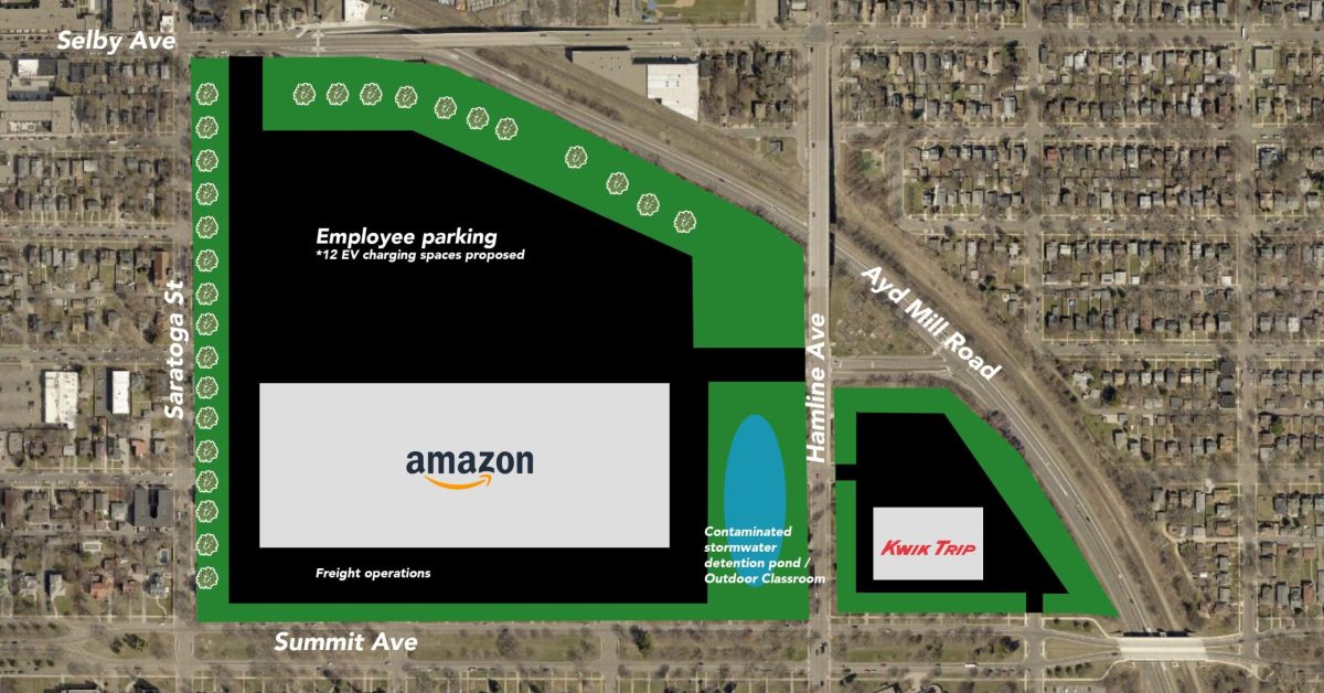
    City Center (33 South Sixth) as new Capitol

    The new State Capitol will be located at 33 S 6th Street, in one of Minneapolis’s most beloved and architecturally admired skyscrapers — City Center.

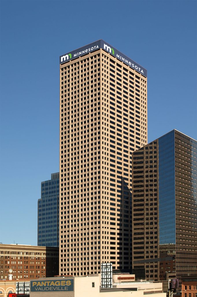
    Originally built as the International Multifoods Tower, City Center has long been noted for its sense of liveliness and civic inspiration. The tower presents far better branding opportunities than the outdated Cass Gilbert-designed facility in St. Paul.

    “When I think of the distinctive style of our new unified Minnesota brand, I just think of City Center!” said Walz excitedly admiring the state’s lower-case “mn” logo.

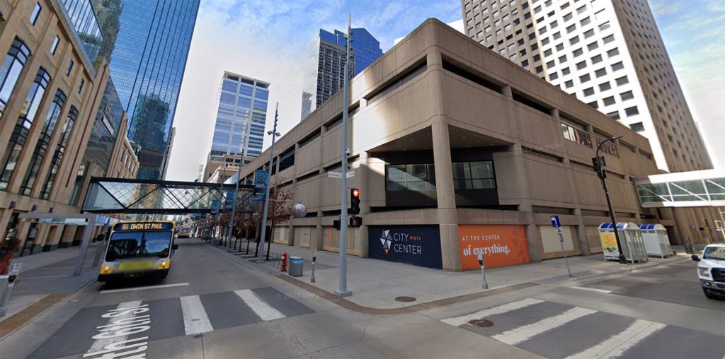
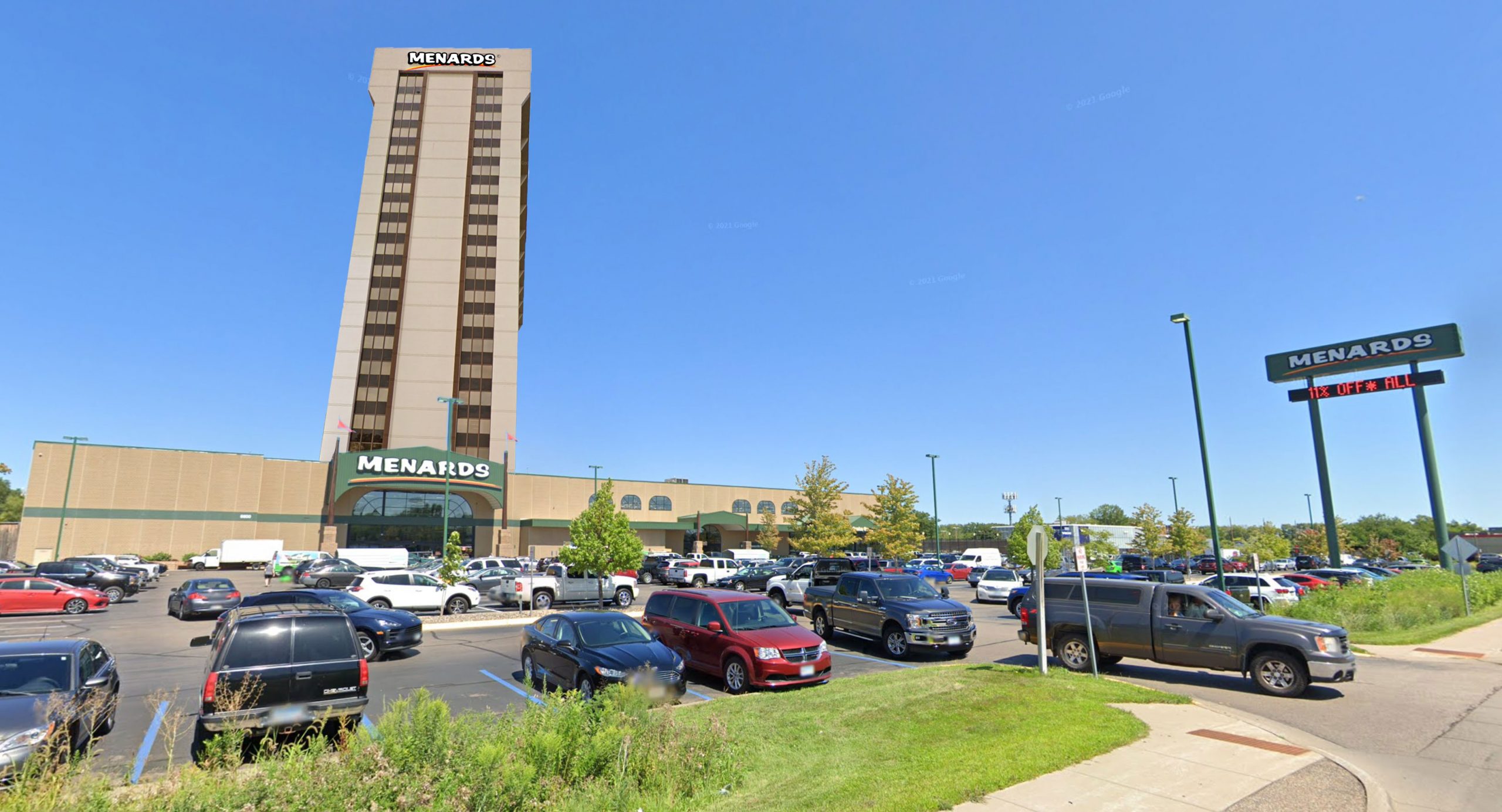
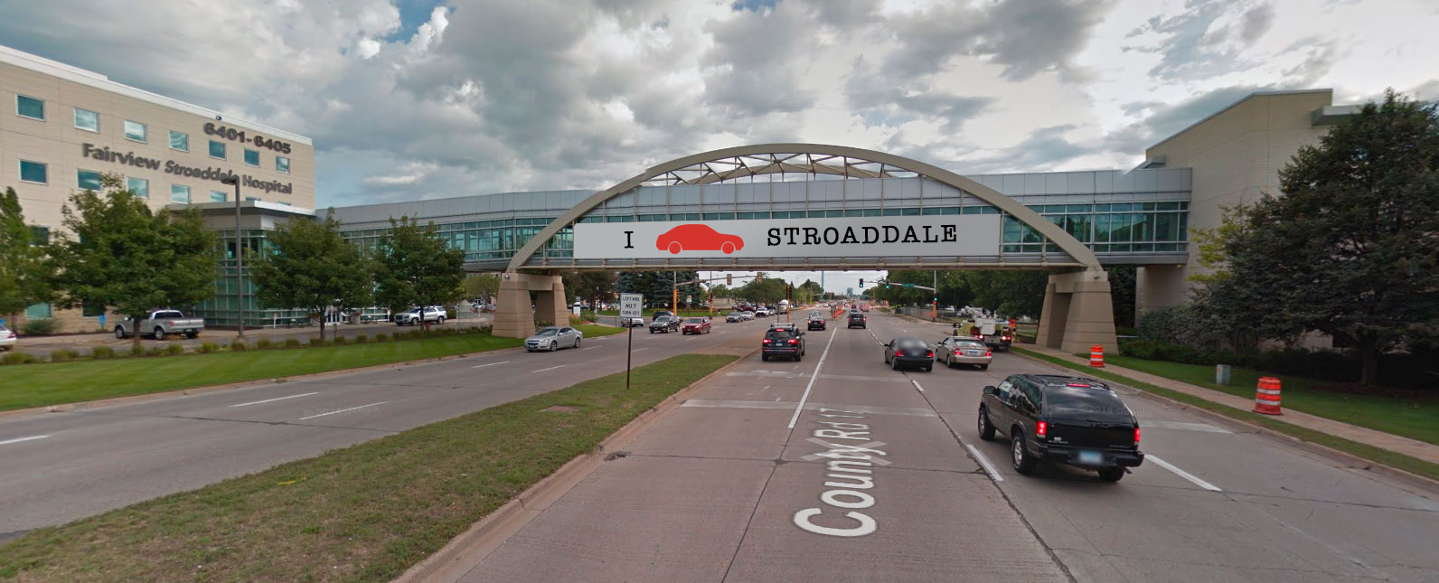
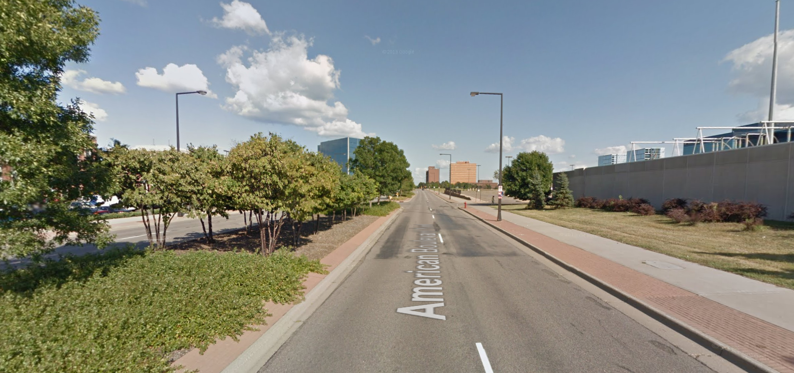
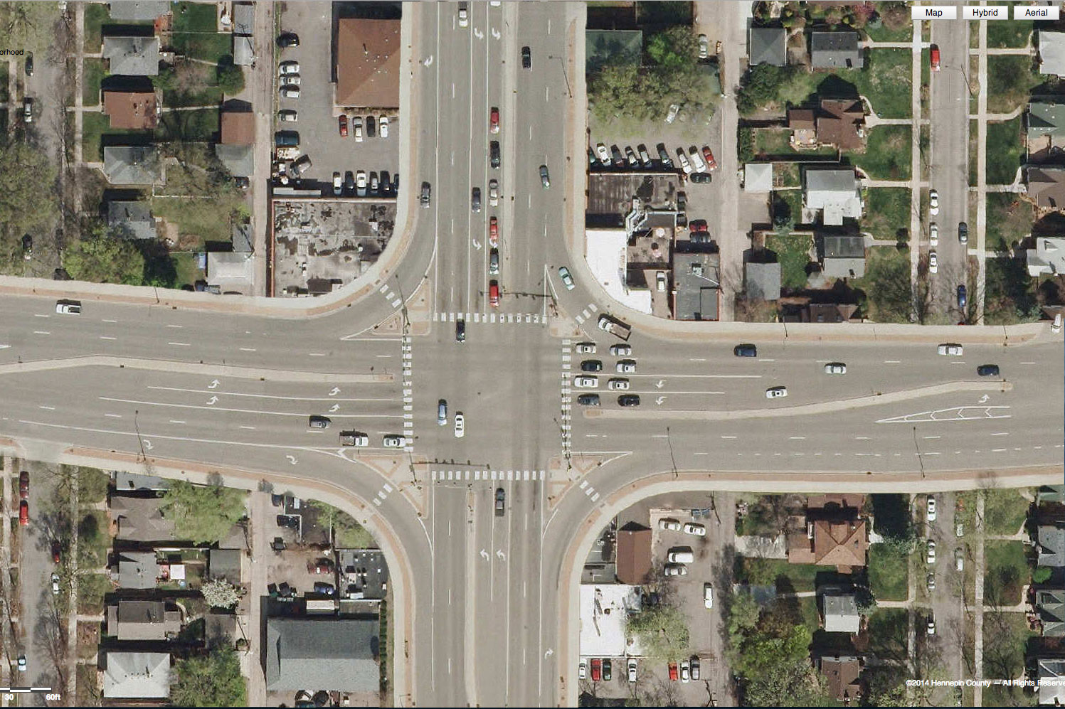
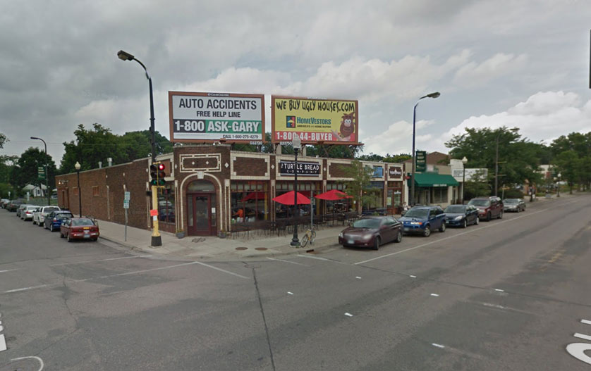
    While Minneapolis Mayor Jacob Frey was excited to welcome the seat of government, he acknowledged that serious help was needed to facilitate the connection between the new State Capitol and Nicollet Mall.

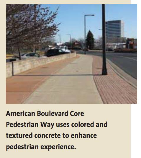
    Referencing the image above, Frey explained in an interview with Streets.mn: “Look, I see what you see: plain concrete panels, no storefronts, covered-over windows. I think we can all agree that something needs to be done, which is why I am committing to addressing the worst part of this image: the bus currently running on the Mall will be eliminated.”

    The new State Capitol location was praised across the political spectrum.

    “Removing 33 South Sixth’s $5 million a year from the tax rolls will help reduce the nefarious role capitalism plays in our government. It’s just one small step, but we are committed to ensuring no private profit will be used to fund our government,” the Twin Cities DSA central committee said in a statement.

    Although Republican leaders preferred the Andover alternative for relocation, they have embraced the opportunity to divest from costly civic landmarks and promote private profit. “It’s no Andover, but the move to Minneapolis is meaningful progress for our state,” said MN House Speaker Lisa Demuth (R – Duluth). “Our caucus is particularly excited about the private equity buyout of the dated, costly former State Capitol.”

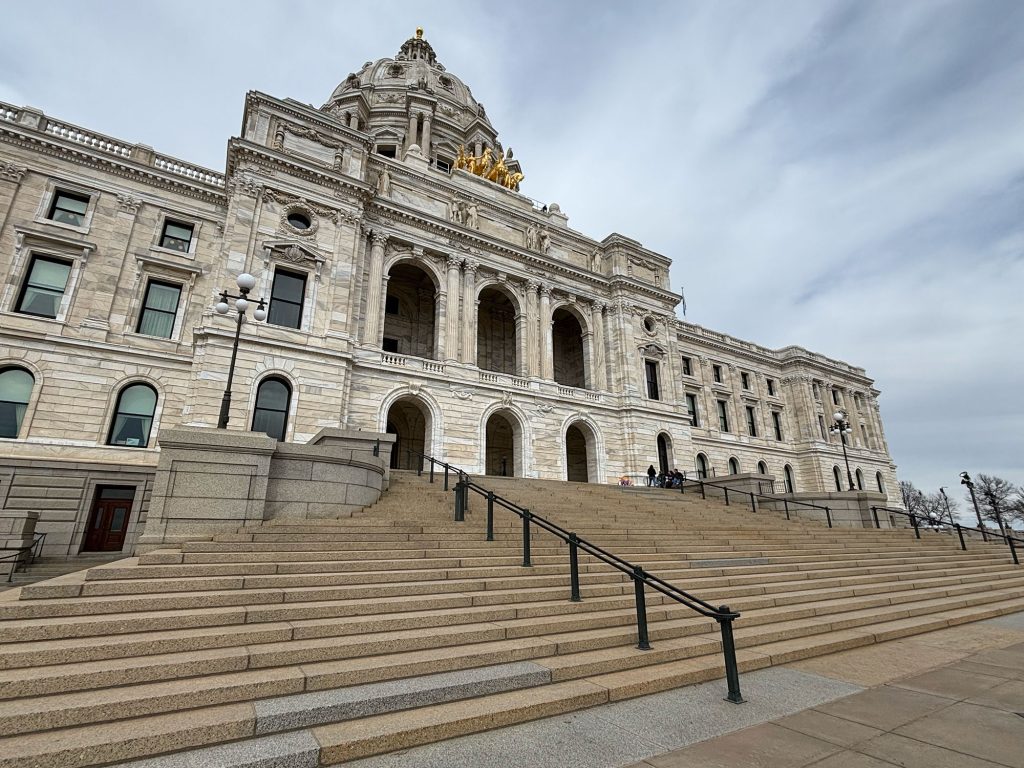
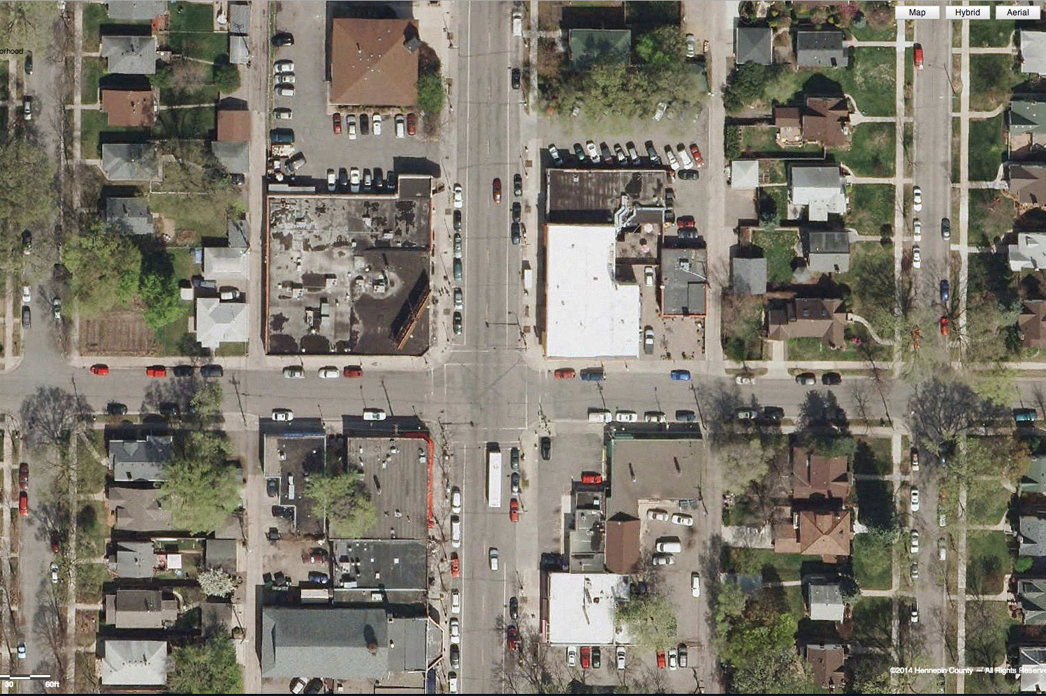
    Former State Capitol as “Work Play Thrive” Redevelopment

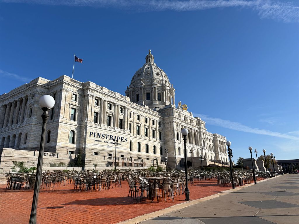
    While impractical as a seat of government, the outdated former State Capitol is expected to be transformed into a vibrant, “Work Play Thrive” redevelopment called thrive75, a reference to its street address at 75 Martin Luther King Jr Blvd.

    (April Fools) thrive75 logo

    Key anchors Pinstripes, Dave & Buster’s, and Buffalo Wild Wings were announced Tuesday.

    Pinstripes Bocce and Bowling will occupy much of the west wing of the former capitol, activating the capitol grounds and providing a lively destination to the region.

    The second floor will be largely occupied by a flagship Buffalo Wild Wings.

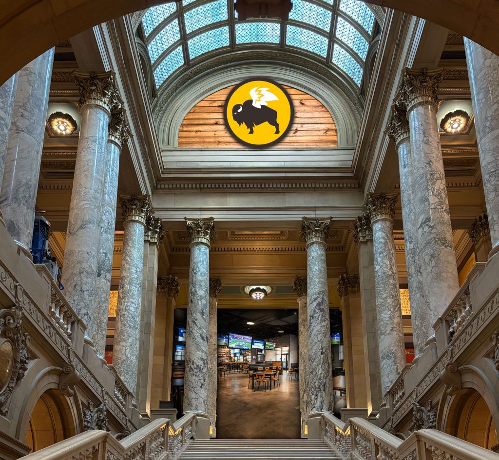
    Finally, the third floor is scheduled to reopen as a Dave & Buster’s, opening early 2026. The Quadriga Cornhole Toss is expected to be a popular feature.

    St. Paul Redesignated as Suburban Community

    At press time, Metropolitan Council officials were working to redesignate the City of St. Paul as a suburban community in their forthcoming Imagine 2050 plan.

    Suburban activists with the Save our Street and Neighbors for a Livable St. Paul coalitions expressed excitement for the new classification, including the opportunity to block additional bike lanes and apartments.

  • (April Fools) St. Paul Port Authority Announces ‘Ayd Mill Stroad’ Redevelopment Plan

    (April Fools) St. Paul Port Authority Announces ‘Ayd Mill Stroad’ Redevelopment Plan

    St. Paul, Minn. — The St. Paul Port Authority (SPPA), the city’s redevelopment agency, announced an exciting initiative to bring much-needed investment and redevelopment to the struggling Ayd Mill Road corridor. The plan is called the Ayd Mill Stroad Opportunity Corridor.

    “Ayd Mill has long suffered an identity crisis,” acknowledged St. Paul Port Authority spokesman Jeffrey Industrielle. “Is it a road to connect to 35E? Is it a street or parkway for the neighborhood? Our answer: It’s neither. It’s a stroad of opportunity.”

    (April Fools image) St. Paul Port Authority Ayd Mill Stroad Opportunity Corridor logo

    Ayd Mill History

    Ayd Mill Road is a short connector from Interstate 35E to Selby Avenue. Although it was originally envisioned as connecting to I-94 slightly farther north, the road has long ended at its current terminus, with only the south end connecting to the freeway system.

    The road was originally called “Short Line Road,” a storied history reflected in SPPA’s slogan for the project, “The Short Line to Prosperity.”

    Ayd Mill Road
    Ayd Mill Stroad prior to proposed Opportunity Corridor improvements (photo: Bill Lindeke)

    SPPA Brings Unique Expertise

    The St. Paul Port Authority has long eschewed the traditional redevelopment approach of other agencies working in established central cities. Rather than being confined by ideas of “dense tax base,” “pedestrian-friendliness” or “transit-orientation,” SPPA has sought visionary alternatives — such as light industrial at the Hillcrest site, light industrial on Arlington Avenue and light industrial at the Great Northern Business Center.

    “The Great Northern Business Center is one of our greatest successes,” said spokesman Industrielle. “Walk score of 71, a 10-minute walk to the Green Line? I can’t think of a better place to put semi-trucks and a low-density warehouse.”

    New Vision Shows Strategic Public-Private Partnership

    Although the St. Paul Port Authority often begins land work prior to new businesses being identified, the Ayd Mill Stroad Opportunity Corridor is being announced with private partners at the ready.

    Respected national businesses such as Walmart, Amazon.com and Kwik Trip are already committed to invest in St. Paul.

    Walmart to Revitalize Grand (Bargains) Avenue

    The first project is unusual for the St. Paul Port Authority: While typically partnering to build warehouses, SPPA will instead be building a discount shopping warehouse, in the form of a Walmart Super Center. The exciting new development will anchor the corner of Grand Avenue and Ayd Mill Stroad.

    To recognize the investment in the community, Grand Avenue will be renamed Grand Bargains Avenue.

    “We’ve heard a lot about Grand Avenue businesses struggling in recent years, but if we know there’s one thing that fixes a flagging main street, it’s a new Walmart,” beamed Industrielle.

    “The name Grand Bargains Avenue was chosen after an extensive focus group of guys from Arden Hills and Eagan who we believe will be optimally positioned to shop at this new Walmart.”

    Amazon Fulfillment Center to Provide High-Quality, Living-Wage Jobs

    The second project will improve approximately 350 homes into an Amazon fulfillment center, with ample green space and quasi-public stormwater features. Kwik Trip will be occupying the eastern outlot, providing convenience to the regional motorist and up to two-dozen minimum wage jobs. Selby Avenue will be renamed Amazon Parkway.

    Local Summit Avenue advocacy group Save our Street (SOS) was quick to embrace the proposal, telling Streets.mn in a statement, “By providing ample parking, the proposed Amazon–Kwik Trip campus will preserve the most important historical features of Summit Avenue: widely available on-street parking lanes. As long as there’s no bike trail, the integrity of this iconic street will be preserved for future generations.”

    At press time, the Minnesota Department of Transportation announced that it was seeking funding to study conversion of the Hamline Avenue–I-94 interchange into a Diverging Diamond to help support this critical economic development initiative.

    Editor’s note: April Fools’! The longstanding tradition at Streets.mn continues.

  • (April Fools) MnDOT Completes Rethinking I-94 Process, Announces Spot Mobility Improvements for 23 Miles

    (April Fools) MnDOT Completes Rethinking I-94 Process, Announces Spot Mobility Improvements for 23 Miles

    St. Paul, Minn — The Minnesota Department of Transportation (MnDOT) announced today the results of the Rethinking I-94 process — a comprehensive evaluation of the needs and opportunities of the Interstate 94 corridor in Minneapolis and St. Paul.

    As a result of the study, MnDOT will be moving forward with an improvement project on the corridor — a strategic spot mobility improvement to 23 miles of freeway.

    April Fools: Gov Tim Walz poses with Nancy Daubenberger
    Gov. Tim Walz and MnDOT Nancy Daubenberger admire the scenic Interstate 94 corridor before today’s press conference.

    “We know we can’t build our way out of congestion,” said Transportation Commissioner Nancy Daubenberger at today’s press conference. “Which is exactly why we’ve put the rethinking in Rethinking 94 — instead of trying to build our way out of congestion with more lanes, we’ll address congestion with comprehensive, multimodal solutions — such as building more lanes.”

    MnDOT has long eschewed expansion, in an effort to lead the state in financially sustainable, environmentally sound infrastructure. Instead, the department has focused on spot mobility improvements, auxiliary lanes, safety and mobility improvements, and strategic improvements.

    April Fools MnDOT plan for 94 at Snelling
    Graphic highlighting the improvements from the spot mobility improvement, as well as the properties identified for community reinvestment.

    Locally preferred alternative presented, historical context noted

    The locally preferred alternative for the I-94 corridor will not be an expansion, but merely a spot mobility improvement to the interstate, spanning from Brooklyn Center to Maplewood.

    The plan will add two lanes in each direction for the 23 miles of interstate affected. “This will be a multimodal facility,” Daubenberger stated today. “One of those two new mobility-improved lanes will be a managed facility on the EZ Pass network. This means that for four hours a day, this lane will be reserved for transit, carpools, and EZ Pass users.”

    “That’s right,” Daubenberger said with pause to let the significance set in among the crowd. “Twenty of the 168 hours of the week, one of those lanes will be dedicated to transit and carpooling. It is hard to imagine a greater investment in transportation alternatives.”

    “It’s important to put this in context,” said Dave Johnson, MnDOT Metro Area Manager for Expansion Euphemism. “We know that this process is centered in an ugly legacy of building and widening highways through disadvantaged neighborhoods. We’ve learned our lessons, and now we approach this with an equity lens.”

    “Today, we don’t bulldoze homes and businesses at the expense of neighborhoods. We invest in disadvantaged neighborhoods — by bulldozing homes and businesses.”

    Johnson pointed to a recent small-scale example of this strategy: the interchange of I-94 and Dale Street, which included improvement of a small-business site into a vacant lot.

    April Fools: Comparison of 94 at Dale Street
    Undoctored pic — actual MnDOT improvement

    Boulevard alternatives dismissed

    Although local advocacy organization Our Streets Minneapolis advocated for consideration of a boulevard conversion of the mainline 94 corridor, MnDOT found it unviable to study the matter.

    “Rethinking the use, function, and form of Interstate 94 was not within the scope of the ‘Rethinking I-94’ project,” Johnson clarified. “But our plan to add a strategic spot mobility improvement to 23 miles of the corridor shows that no idea is too original or ‘out of the box’ to be considered.”

    Committed to green infrastructure

    Although congestion relief alone is considered one of the greenest things an agency can do, MnDOT isn’t stopping there. “This will be green infrastructure, we’ll be planting over 500 trees in the corridor,” announced Governor Tim Walz, who also presented at today’s press conference.

    When mature, 500 trees are expected to absorb 24,000 pounds of carbon dioxide each year. This is the equivalent of 1,200 gallons of gasoline — or about two drivers’ worth, each and every year.

    “With 135,000 drivers on 94 each day, we’re proud to erase the emissions of nearly 0.0015% of those cars,” pronounced Walz proudly.

    The Rethinking I-94 improvements are expected to begin in 2023. At press time, Streets.mn was awaiting a response as to how the improvements will help facilitate MnDOT’s goals of reducing vehicle miles traveled by 20%.

    And if you believe any of this, consider yourself pranked. April Fools!

  • (April Fools) Menards Announces New “Live. Work. Save Big Money” Concept

    (April Fools) Menards Announces New “Live. Work. Save Big Money” Concept

    Golden Valley, Minn — following in the footsteps of other lifestyle brands, Wisconsin-based Menard, Inc. has announced ambitious plans to expand its home improvement stores into mixed-use lifestyle centers.

    “Live. Work. Save Big Money.” is the co-living concept to integrate luxury apartments with everyday low prices on popular brands.

    Following market trends

    Although Menards Living promises to be the first home improvement-themed lifestyle apartments, it follows the lead of Lifetime Living, an apartment concept by Chanhassen-based Life Time Fitness.

    Similar concepts have also been explored by workplace brand WeWork, and in the forms of national living concepts like City Club.

    April Fools - Menards common space
    Common spaces will feature beloved Menards advertising on loop, and will be enhanced by Patriot Lighting

    “Our customers are at least as enthusiastic about meeting their home improvement needs as Life Time customers are about going to the gym,” observed Henry Menard, director of Menards Living Division.

    “This expands our previous ventures in commercial real estate, and it just makes sense. Live and breathe Menards!” said Menard enthusiastically.

    First site chosen in Golden Valley

    April Fools - Menards Living in Golden Valley, Minn
    Menards Living Golden Valley, as rendered

    The Golden Valley Menards store will be the first site of a Menards Living tower, approximately 20 stories atop the retail store — promising views of 394, downtown Minneapolis, and the Menards parking lot. Apartments with a view of the lumber yard are expected to rent at a premium.

    April Fools - Menards tower caldding
    Only the highest-quality materials, such as Timbercrest vinyl siding, will be used on the tower

    All exterior windows will be Mastercraft vinyl sliders, and the the tower will be clad in Timbercrest vinyl siding.

    Amenities will include a thoughtfully branded rooftop deck, and TVs throughout common spaces playing Menards television commercials on loop.

    A Menards jingle — “plumbing, electric, appliances too” — will play in all corridors and the parking garage at all times.

    Future expansion plans

    Menard reports that Menards Living won’t be stopping in Golden Valley, planning apartment towers of twenty or more stories at their at West St. Paul, Eden Prairie, Richfield, and Midway St. Paul locations next.

    “No matter your preferred Menards, we want you to know: you never have to leave!” reassured Menard.

    April Fools - Menards Living pool deck
    The rooftop pool deck will feature a subtle homage to Menards branding

    Committed to affordability

    Menards Big Card
    To simplify the customer experience, rent will only be payable on BIG cards

    Although the market price of apartments will start at $1600/mo, Menards has shown a commitment to affordable housing by offering tenants the opportunity to receive an 11% rebate each month.

    They will need to submit rent receipts each month to a PO Box in Elk Mound, Wisc. with a hand-written rebate form. Rent rebates will be returned in 6 to 8 weeks, in the form of store credit.

    All tenants will be able to pay rent monthly on their BIG Card. Tenants who lease in advance of the grand opening will receive a complimentary 35 oz jar of Cheese Balls.

    Streets.mn reached out to Hobby Lobby, Cost Plus World Market, and Pamida regarding rumors of similar projects, but calls had not been returned at press time.

  • (April Fools) MnDOT to Combat Dangerous Scourge of ‘Distracted Walking’ at Mall of America

    (April Fools) MnDOT to Combat Dangerous Scourge of ‘Distracted Walking’ at Mall of America

    April 1, Bloomington — The Minnesota Department of Transportation (MnDOT) has announced an exciting new effort in its campaign to fight the dangerous epidemic of distracted walking, by targeting one of the metro area’s most dangerous areas for distracted pedestrians: the Mall of America.

    “Distracted driving claims thousands of lives each year,” noted MnDOT Commissioner Margaret Anderson Kelliher at a press conference in front of the third floor Shake Shack. “Exactly why it’s time to do something about the truly dangerous activity of distracted walking.”

    “Mall safety is a two-way street,” added the commissioner.

    April Fools - Margaret Anderson Kelliher in front of Shake Shack
    Commissioner Margaret Anderson Kelliher announced the campaign in front of Shake Shack. The photographer was required to pull over prior to taking the photo for safety.

    Carnage from distracted walking

    Commissioner Anderson Kelliher sat down with Streets.mn to give the inside scoop on the problem. As MnDOT’s Share the Road website noted, “Pedestrians and motorists are equally responsible for pedestrian safety. Motorist behaviors cause about half of all pedestrian-vehicle crashes and pedestrian behaviors cause the other half.”

    Commissioner Anderson Kelliher further explained: “Since pedestrians are responsible for half of all crashes, we expect that half of those crashes still occur in an environment completely free of cars, such as inside the Mall of America. Halving fatalities sounds like a big improvement, but the extreme congestion at the Mall of America makes it one of the deadliest pedestrian environments in Minnesota.”

    Mall-goers frequently are glued to their phones, causing hundreds of deadly collisions between pedestrians each year. Property damage has also occurred at the hands of 3 mph bipeds, including hundreds of upturned mall carts each year.

    New campaign to promote awareness

    April Fools Pedestrian safety campaign visible to motorists
    New signs encourage safety at the Mall north entrance

    A large banner will be installed over the new north entrance to the Mall. To encourage safety, patrons are encouraged to read the banner while driving, not walking.

    Inside the mall, a new banner will remind pedestrians that “Mall safety is a two-way street.” Volunteers will be handing out tips to visitors. A safe reading area will be provided for pedestrians to pull over and absorb the information prior to beginning their shopping.

    The following information will be distributed to each pedestrian entering the mall:

    Mndot Look
    Look before you cross store entrances

    • Most crashes occur at intersections of two pedestrians.
    • Stop and make eye contact with all pedestrians who might be in your path.
    • Look at ALL lanes that enter and exit the store before crossing.

    Mndot Visible
    Make yourself visible

    • Stand clear of plants, benches and other objects before attempting to cross a store entrance.
    • Cross only near well-lit doors.
    • Wear bright-colored clothing.
    • Mount a safety flag on a wheelchair, motorized cart or stroller.

    Mndot Behaviors
    Avoid dangerous and distracted behaviors

    • Cross store entrances only at designated points.
    • Remove headphones before each entrance, and stay off mobile phones.
    • Don’t rely on signals. Remember, even if you have the right-of-way, you probably shouldn’t expect to have the right-of-way.
    • If intoxicated, don’t walk without assistance.

    Bloomington partnering to provide engineering improvements to the Mall

    The City of Bloomington is also committed to engineering changes to improve safety of pedestrians inside the mall. “With enough money, we can make the inside of the Mall of America as safe and enjoyable for pedestrians as the rest of the City of Bloomington,” said Julie Long, Bloomington’s city engineer, noting that the following images from the City’s Alternative Transportation Plan would guide the city’s approach to making a vibrant and safe mall walking environment:

    American Blvd Bloomington Alternative Pedestrian Plan Bloomington 2008 APT language on American Blvd

    To help facilitate the financing of these improvements, the city will be waiving the Mall of America’s property taxes for an additional 25 years.

  • (April Fools) Neighbors Embrace New Oil Refinery for Ford Site

    (April Fools) Neighbors Embrace New Oil Refinery for Ford Site

    ford-aerial-aprilfools
    streets.mn-exclusive aerial rendering of improved Ford site

    St. Paul, Minnesota — residents of the Highland Park neighborhood have been struggling for months against an outrageous proposal to redevelop the Ford Site with business, homes, and public green space. Today, Neighbors for a Livable St. Paul announced the results of their successful campaign to preserve neighborhood character. Instead of unsightly urban apartment homes, the industrial legacy of the site will be preserved, through the construction of a new oil refinery.

    “We have long treasured the pristine open space afforded to us by the Ford plant,” neighborhood activist Gertrude Lowerthan wrote in a letter to the Highland Villager. “Other than the smoke stacks, the new Highland Park Refinery will afford neighbors uninterrupted views of the Mississippi.”

    Site Plan Changes

    The original site plan called for an unattractive mix of various forms of “pack and stack” housing, and an almost dizzying array of streets matching the surrounding grid. The new site plan is considered “context-sensitive” by the neighborhood, by preserving the existing vibrant mix of uses provided by the Ford plant.

    The original designations proposed by planners would bring business, residents, and attractive public spaces to the neighborhood, ruining the surrounding character.

    April Fool's Ford Site Plan
    The revised site plan will preserve the neighborhood character of the historic Ford Plant.

    “Now that’s a refined site plan,” grinned Scott Bensin, president of the Highland District Council. “Maybe in some places, they might like to have families, kids, dogs, and green space next door. But our residents are holding firm in Highland Park against this Minneapolification of St. Paul. Why have people living across the street when you can have something less impactful — like heavy industrial?”

    Keeping the River Pristine

    One particular sticking point for the previous plans for the Ford site was the changes to the feel for Mississippi River Blvd. Planners proposed buildings up to 48′ high front Mississippi River Blvd. Neighbors for a Livable St. Paul noted that this would ruin views from the parkway, spoiling the natural surrounding.

    The new refinery will rebuild the historic Ford concrete wall, preserving the decades-old view from River Blvd for years to come.

    Ford site view from Mississippi River Blv
    The scenic views of the site from Mississippi River Blvd, pictured here from 2011, will be left unscathed by the new refinery. Image: Google Maps

  • (April Fools) Hennepin County To Relocate Central Library to Geographic Center of Hennepin County

    (April Fools) Hennepin County To Relocate Central Library to Geographic Center of Hennepin County

    Medina, Minn — The Hennepin County Board of Commissioners has announced a strategic relocation of the Hennepin County Central Library, to join the ideal location of Hennepin County Public Works in Medina, near the exact geographic center of the County. Since the Minneapolis Library Board merged with Hennepin County eight years ago, Central Library has sat at an extreme southeastern location in congested downtown Minneapolis

    “There’s nothing ‘Central’ about downtown Minneapolis for the County,” observed Commissioner Jeff Johnson, who led the charge to move Central Library to his own District 7. “It’s really about equity. All square feet of all parcels of Hennepin County deserve equal access to all services. I’m tired of this Minneapolis-centric mindset.”

    Johnson noted that Hennepin County Public Works has functioned well at its Medina site, and says he expects similar results and “exciting synergies” from the Central Library relocation.

    The Library site plan was presented on April 1, 2016 The Library site plan was presented on April 1, 2016

    A Library for All Modes

    Like Hennepin County Public Works, the new Central Library will benefit from Medina’s excellent public transportation options. At any time between 3:29 pm and 5:59 pm, Minneapolis residents may take the 776 or 777 bus a short 51-minute ride from downtown Minneapolis to the Peonie Lane bus stop. From there, patrons need only walk 3.4 miles along the the shoulder of the Olson Memorial Highway to access the site. Those who catch the 3:29 pm bus are expected to be able to make the 2-hour journey with at least 30 minutes to spare before the Central Library closes at 6pm.

    Buses will be available to return to downtown Minneapolis starting at 5:43 am the next morning.

    Transit to the site will be multimodal in nature
    Transit access to the site will be multimodal in nature

    Jim Grube, Hennepin County Engineer, stressed the importance of safe, dignified access to county facilities for people using all modes of transportation. “We felt that providing a sidewalk along the Olson Highway might give patrons a false sense of security. To improve pedestrian safety, we’ll be recommending they walk along the shoulder, with appropriate attire. Safety is a shared responsibility.” Noting concerns about access to the library

    APS Box MnDOT
    Accessible Pedestrian Signals will make a hostile pedestrian environment equally accessible to persons with disabilities

    for persons with disabilities, Grube described the installation of Accessible Pedestrian Signals at the intersection of the Olson Memorial Highway and Arrowhead Drive. “TH 55 is going to be a whole different place with those new beeping buttons,” Grube added.

    Additional Parking

    One of the greatest critiques of the current Central Library is its inadequate and overpriced parking. “Government takes my income tax through the state, my property tax from the county, and then they ask me to pay for parking when I’ve already paid twice?” questioned Johnson. “Hennepin County residents deserve to get what they paid for, the first time.”

    The new library will feature at least 30 acres of surface parking, with additional space to expand as demand increases. Access to the lot will be provided by 7-lane Library Parkway.

    Users Critique

    Some existing library users were dissatisfied with the relocation, claiming that — despite ample transit options — access to the new library would be inconvenient without a car. However, County officials note that the main benefit will be the expansion of library services to more patrons. Bessie, a 4-year-old dairy cow from Greenfield, agreed. “Too long have I endured the tyranny of having to travel downtown for basic services,” Bessie said while chewing her cud. “I deserve to have as convenient access to the library as I do to Public Works.”

    Timeline and Future Projects

    Hennepin County Library, Medina Central is expected to be complete by summer 2018. The former Minneapolis site will be razed to make way for luxury rentals, to be anchored by a Target Express.

    At their next meeting, County Commissioners will discuss timeline and funding for relocating Government Center to the new Medina campus by 2020.

    Commissioners Mike Opat and Peter McLaughlin toast to the announcement from the median of the Olson Memorial Highway.
    Commissioners Mike Opat and Peter McLaughlin toast to the announcement of the new Central Library from the median of the Olson Memorial Highway.

  • (April Fools) Southdale to Rebrand, Establish Stroaddale Preservation District

    (April Fools) Southdale to Rebrand, Establish Stroaddale Preservation District

    Edina logo stroadEdina, Minn — The City of Edina today announced ambitious plans to rebrand the aging Southdale District as “Stroaddale”, and to establish strict historic preservation guidelines to ensure that its low-density, stroad-oriented development is cherished for future generations. Stroaddale District is named for Stroaddale Center, and is roughly bounded by Crosstown to the north, Valley View Stroad to the west, 494/5 to the south, and Xerxes Avenue to the east.

    “If there’s one thing we’ve heard loud and clear from residents, it’s that they want lower density of housing, and higher density of cars,” mayor Jim Hovland said at a press conference Wednesday. “Edina’s density is about 3,000 folks per square mile, roughly half that of our first-ring neighbor Richfield and a solid 25% less than St. Louis Park,” Hovland acknowledged when asked by Streets.mn. “But it’s just not low enough. Preserving stroad character is one of the best things we can do to keep these dangerous numbers down.”

    Early Beginnings

    The beginnings of the Stroaddale District in 1956
    The beginnings of the Stroaddale District in 1956. Image: MHAPO

    The Stroaddale District began with Stroaddale Center, built in the late 1950s. At the time, Stroaddale was a radical departure from the form of surrounding built areas. The only immediate neighbor at the time was to the east, Richfield’s Lincoln Hills, which was built with small blocks, narrow lots, and alleys. But the new Stroaddale super-block was seven blocks wide and three blocks high. Big blocks meant big stroads, built with all the grandeur of rural expressways.

    Stroaddale was a quick success, and set the stage for future stroads throughout the Twin Cities. Engineers and landscape architects responsible for Hiawatha Avenue, Virginia Triangle, and the Olson Memorial Stroad in Minneapolis — as well as Richfield’s 77th Street — have acknowledged that they drew inspiration from the seas of pavement in the Stroaddale District.

    New Competition and Loss of Stroad Character

    Despite initial success, interest in Edina’s stroads waned in the decades that followed. The 1990s in particular was a difficult decade for the Stroaddale District. 1990 saw the opening of the Mall of America, one of the most ambitious stroad projects the Twin Cities has ever seen. Stroads were built as seamless extensions of the regional freeways, with none of the bordering streets under seven lanes. “When it comes to creating a pedestrian-repellant urban form, it’s tough to beat Bloomington,” acknowledged Cary Teague, Edina’s director of Community Development. “I mean, they made it illegal to cross the street! By comparison, meager 5-lane York Avenue might as well be a dirt path in the countryside.”

    Porkchop covered in snow
    Porkchops were a popular pedestrian amenity

    Unrest came from within, too. Centennial Lakes was a large public-private project that developed gravel pits to the south of Stroaddale Center. Although the design was careful to preserve roadway character on France Avenue — with parking garages and surface lots facing the stroad — the interior design posed serious risk to the character of the District. A spectacular public park surrounded recreational ponds, including many public amenities. “Centennial Lakes was a big risk, and I think we’ve learned our lesson,” said Teague, acknowledging that the creation of attractive, actually public space was not in-line with the vision for the area.

    Recent Assaults on Stroadiness

    Unfortunately, Centennial Lakes wasn’t the end to decisions that would jeopardize the Stroaddale District. In recent years, neighbors to the west have consistently fought against attractive, mixed-use buildings along France Avenue.

    “7200 France is really a bellwether project,” said Wilford Nimbybotham III, chairman of Cornelia Residents Uninterested in Density (CRUD). “If we have people living in apartments, going to a corner shop on the first floor… what will become of our neighborhood?” Despite not being asked about the matter, Nimbybotham further volunteered that the presence of Section 42 workforce housing in the project was not a factor in CRUD’s opposition. “I have many workforce friends,” he said.

    Even more contentious was a proposal for a homeless youth shelter to the north of Stroaddale Center. The project plans to turn a small site of an old TCF Bank into 39 studio apartments for homeless youth. An group of unnamed citizens sued in an attempt to block the project, but ultimately failed. The leader of this group agreed to speak only under the condition of keeping their identity totally anonymous.

    One of the biggest concerns was the proximity to a Montessouri school. “Criminal activity and children are not compatible,” said the group’s leader, using homelessness and criminal activity synonymously. “Safety is an issue for the female employees of the school.”

    “But really, this is about what’s best for the community as a whole. We even funded our own detailed parcel-by-parcel analysis determining where a homeless youth site might be better located.” The results of that study were provided to Streets.mn:

    Detailed analysis of suitable sites for homeless youth shelter
    Detailed analysis of suitable sites for homeless youth shelter provided by group suing to prevent 66 West. Base map: Hennepin County

    A New Plan Forward

    New standards will be drafted by Edina city planners to ensure adequate parking visibility, single-use zoning, and sufficiently low Floor Area Ratio (FAR), and are expected to be adopted by the City Council in late 2015. But public improvements to the Stroaddale District have already begun, starting with a pedestrian improvement project last summer along France Avenue.

    “The key with the France Avenue project was to make it safer for pedestrians, while still making sure it was an environment no one would ever choose to walk in.” said Chad Millner, Edina’s city engineer. “We took a lot of flak from national stroadscape architects for removing all those free right turns, but they miss some of the finer details — we removed crosswalks, left the boulevard barren of trees. We’re dedicated to making sure the character of France is preserved.”

    Gateway signage will be installed in early May, and will be modally specific. The welcome message for motorists will be displayed across the Fairview Stroaddale skyway, while pedestrians will be greeted by orange construction barrels, located in roughly the middle of the sidewalk.

    Stroaddale gateway signage
    Rendering of proposed gateway signage. Base image: Google Street View

  • (April Fools) Minneapolis Announces Adoption of Bloomington Pedestrian Plan

    (April Fools) Minneapolis Announces Adoption of Bloomington Pedestrian Plan

    Minneapolis announced today that they will be adopting the City of Bloomington Alternative Transportation Plan, as well as many engineering practices of Bloomington, to enhance pedestrian safety and comfort along Minneapolis roadways. Bloomington has long been known as a regional leader in pedestrian-friendly roadway design and planning.

    “Ever since the opening of the Hiawatha Line, we’ve watched scores of Minneapolitans drive to their nearest park-and-ride and take the train down to East Bloomington’s distinctive urban center, just to experience the sublime pedestrian environment of 8-lane, 40+ mph roadways,” mayor Betsy Hodges said in a press conference Tuesday. “It’s time to bring that kind of distinctiveness to Minneapolis.”

    New Campaign Launched, 48th and Chicago Selected as Pilot

    The new campaign will be called, “Yesterday’s Stroads, Tomorrow’s Innovation.” It will begin with a pilot project at 48th and Chicago, an intersection that the Star Tribune once called a “pedestrian hellscape.” On-street parking will be eliminated, and additional right-of-way will be acquired at all four corners of the intersection.

    The improvements will include one of Bloomington’s most treasured features: the free right turn. Rather than simply crossing the street at a right angle, pedestrians will detour slightly out of their way to cross at a 45° angle. After reaching the porkchop-shaped refuge island, they can press a beg button and eventually receive a walk signal. After making it across eight lanes, they’re just another 45° detour and free flow of traffic away from their destination.

    “Finally, we were able to answer the age-old question: Why did the pedestrian cross the stroad?” chuckled Gene Winstead, Bloomington mayor, explaining the pedestrian enhancement to Streets.mn. “So they could cross it two more times!”

    Artists' rendering of NW corner after proposed improvements
    Artist’s rendering of NW corner after proposed improvements


    Boulevard Trees Removed

    Plantings will also be reworked along most streets in Minneapolis. “It’s never made much sense, but someone somewhere in our history thought that it made sense to plant trees between the sidewalk and the street. Now we know that pedestrians far prefer stamped concrete. Trees belong in the median, where they can be appreciated by cars,” explained Hodges. Starting in 2015, city crews will begin removing boulevard trees and widening Minneapolis roadways to accommodate planted medians.

    American Boulevard's innovative pedestrian treatment
    Actual, unphotoshopped image of American Boulevard’s innovative pedestrian treatment


    Residential Improvements, Too

    Pedestrian improvements won’t be limited to major streets, either. Over the next five years, most residential sidewalks will be removed, except in select areas where there are no possible walkable destinations. “If there’s one thing we’ve learned as an older suburb,” Winstead said, “it’s that people really like walking in the gutter. Sidewalks, boulevard trees, outdoor dining… no, none of it compares to that authentic feeling of mashed-up leaves stuck to your shoe, or of pulling your 5-year-old out of the way of a fast-moving car. Our pedestrian innovations help people feel truly alive.”

    The remaining sidewalks will be cleared at city expense, since homeowners’ ability to clear snow has suddenly been limited to their own driveway and walks.