Category: Walking

  • Views before and after: building a 66th Street for All

    Views before and after: building a 66th Street for All

    Note: this is from my personal perspective as a Richfielder and a supporter of the new 66th. It is not City of Richfield communication.

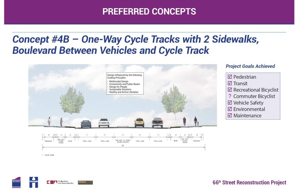
    From 2016 to 2018, Richfield and Hennepin County rebuilt 66th Street, Richfield’s main street. The project was the most ambitious rebuild of an arterial Richfield had ever undertaken, and set precedent for the region — the first example of an extensive use of a sidewalk-level, one-way protected bikeway.

    This design has been used in other cities since, and a similar design was selected for the 2026 rebuild of Nicollet Avenue in Richfield.

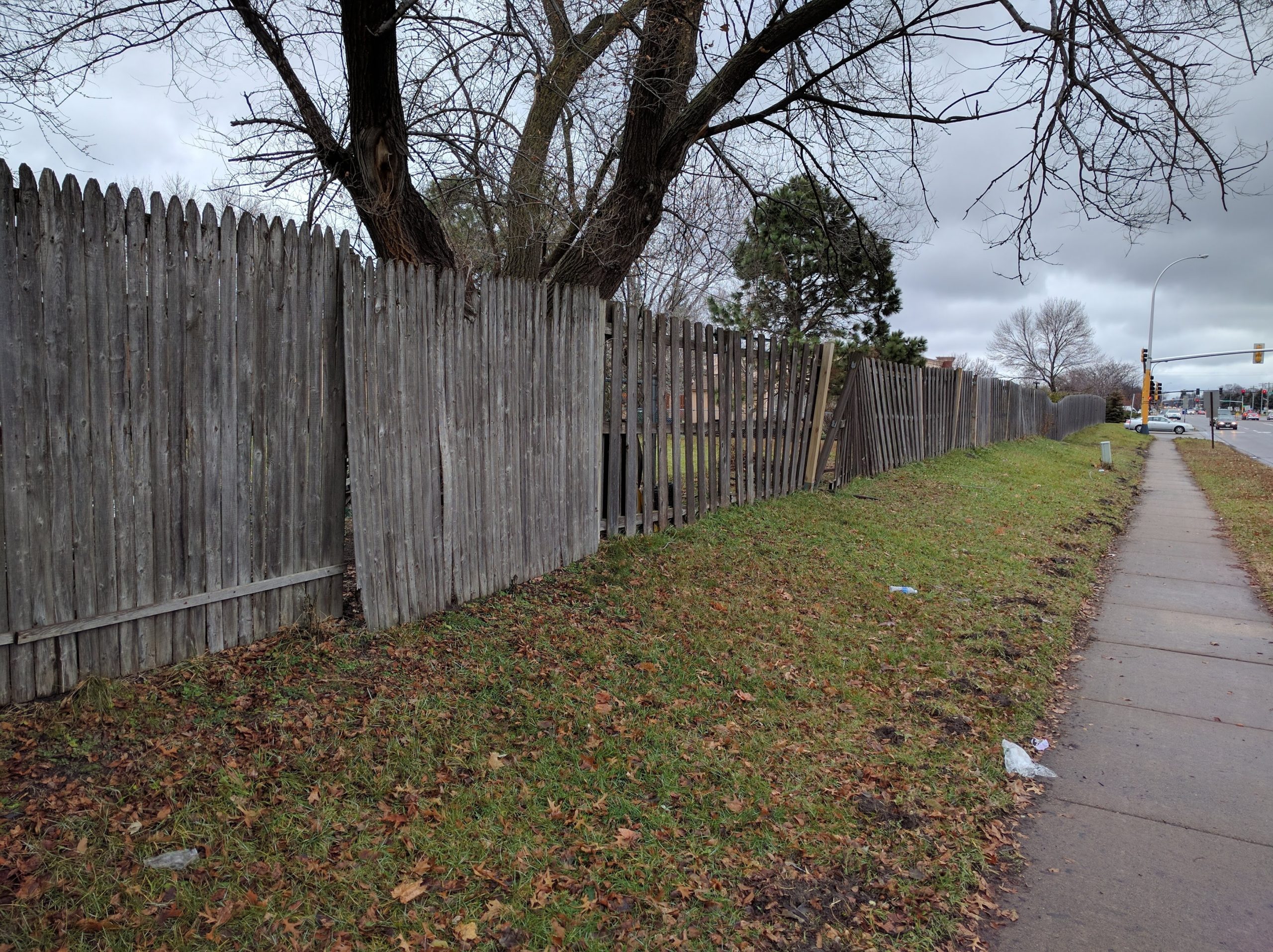
    The project rebuilt 66th from Xerxes Avenue to 16th Avenue (near Cedar). Unfortunately, a small gap area around Portland Avenue was omitted from the project, creating a discontinuity for cyclists and pedestrians.

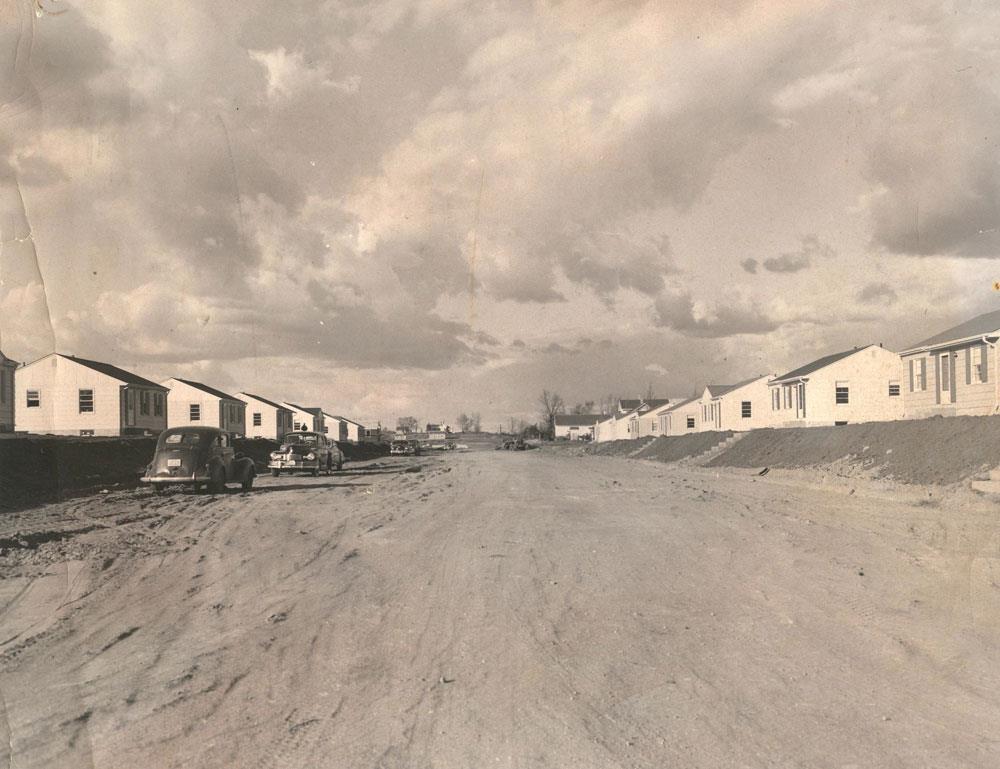
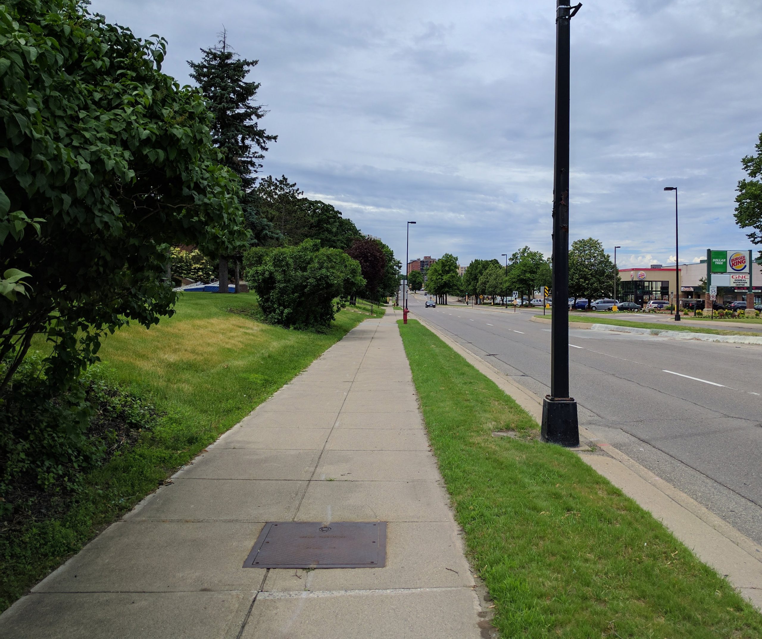
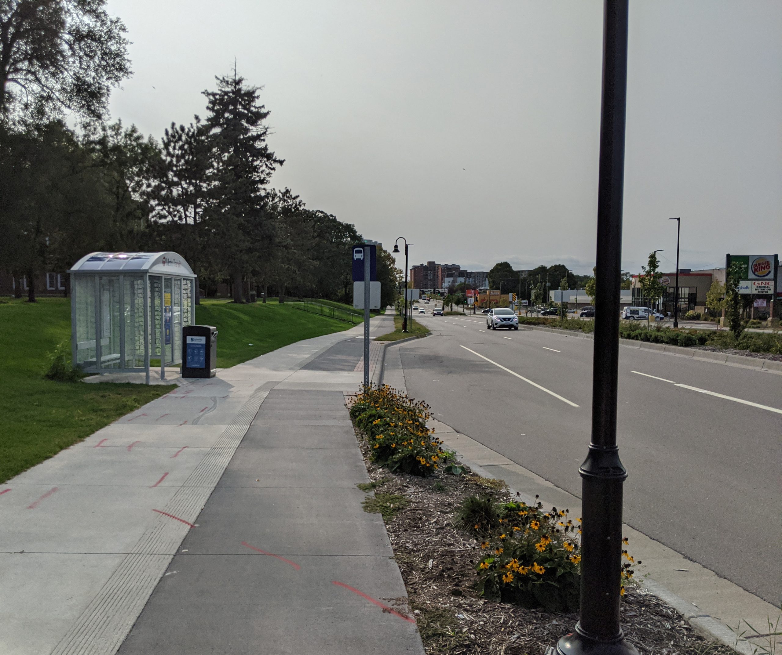
    Before and after the rebuild, I took dozens of pictures of the conditions of the street, which I’m sharing now for easy comparison.

    Before and After

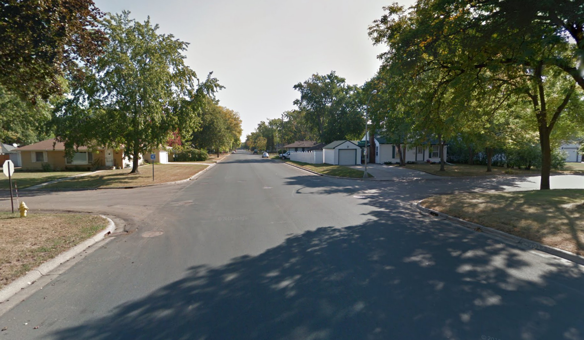
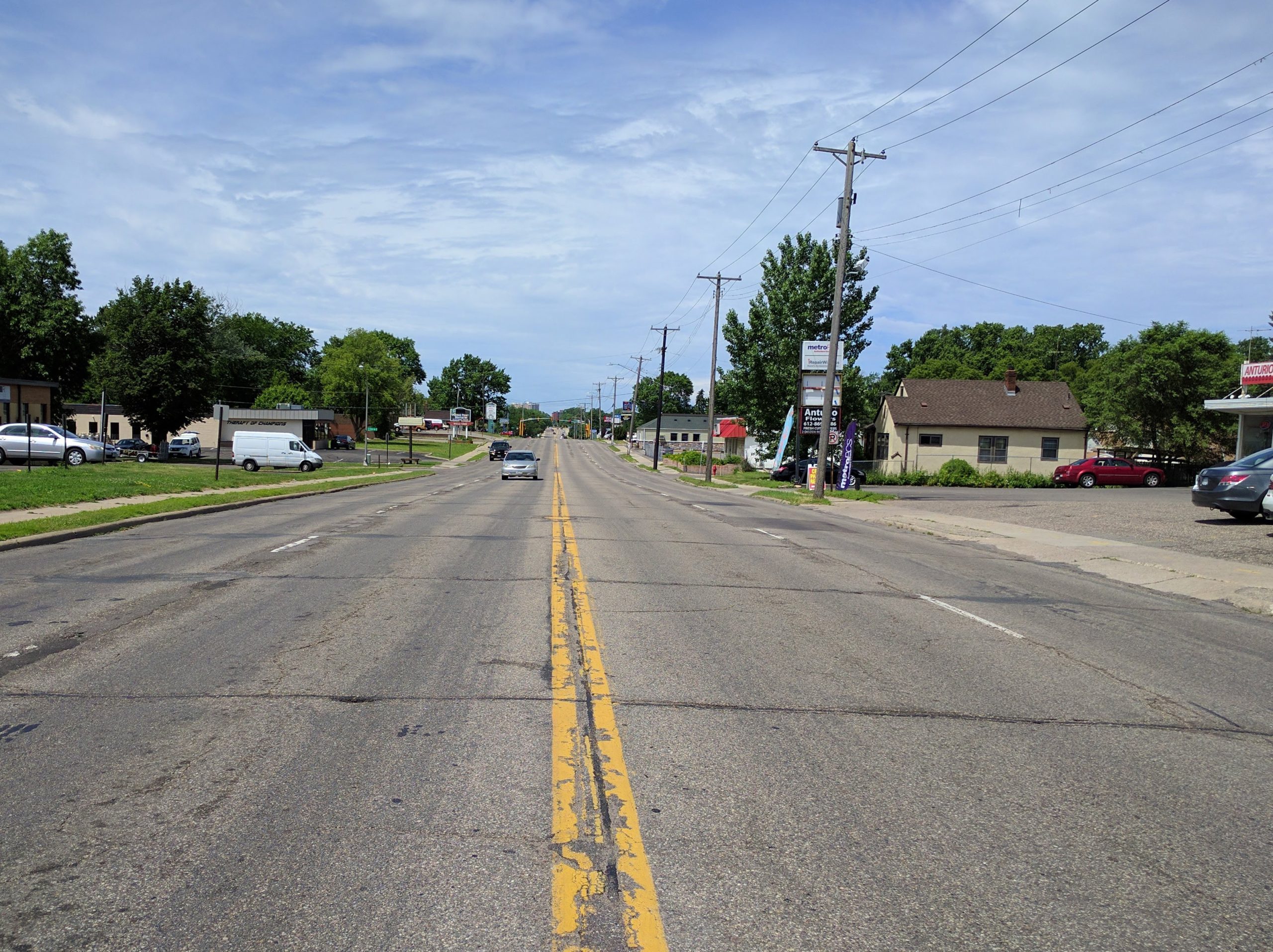
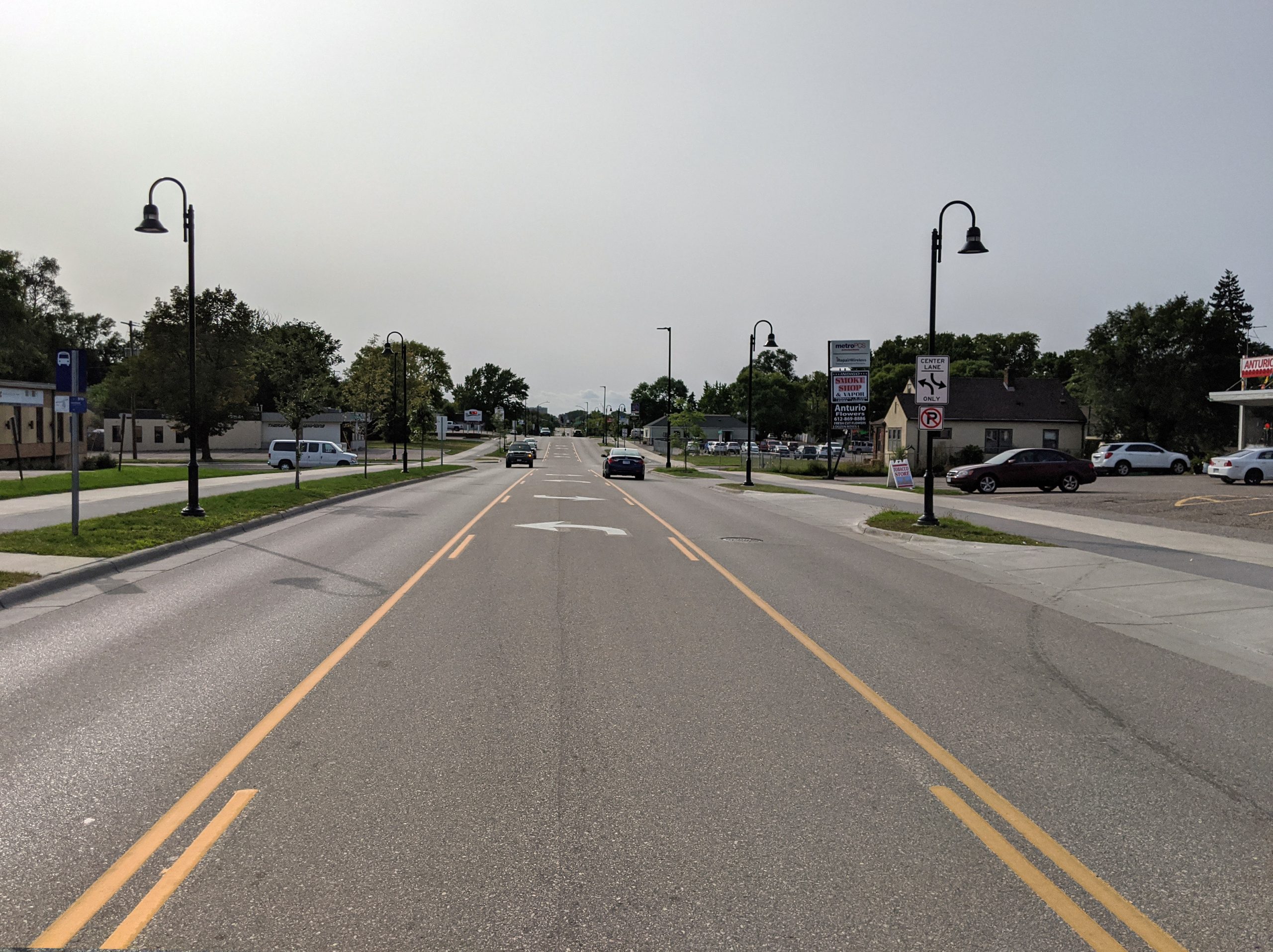
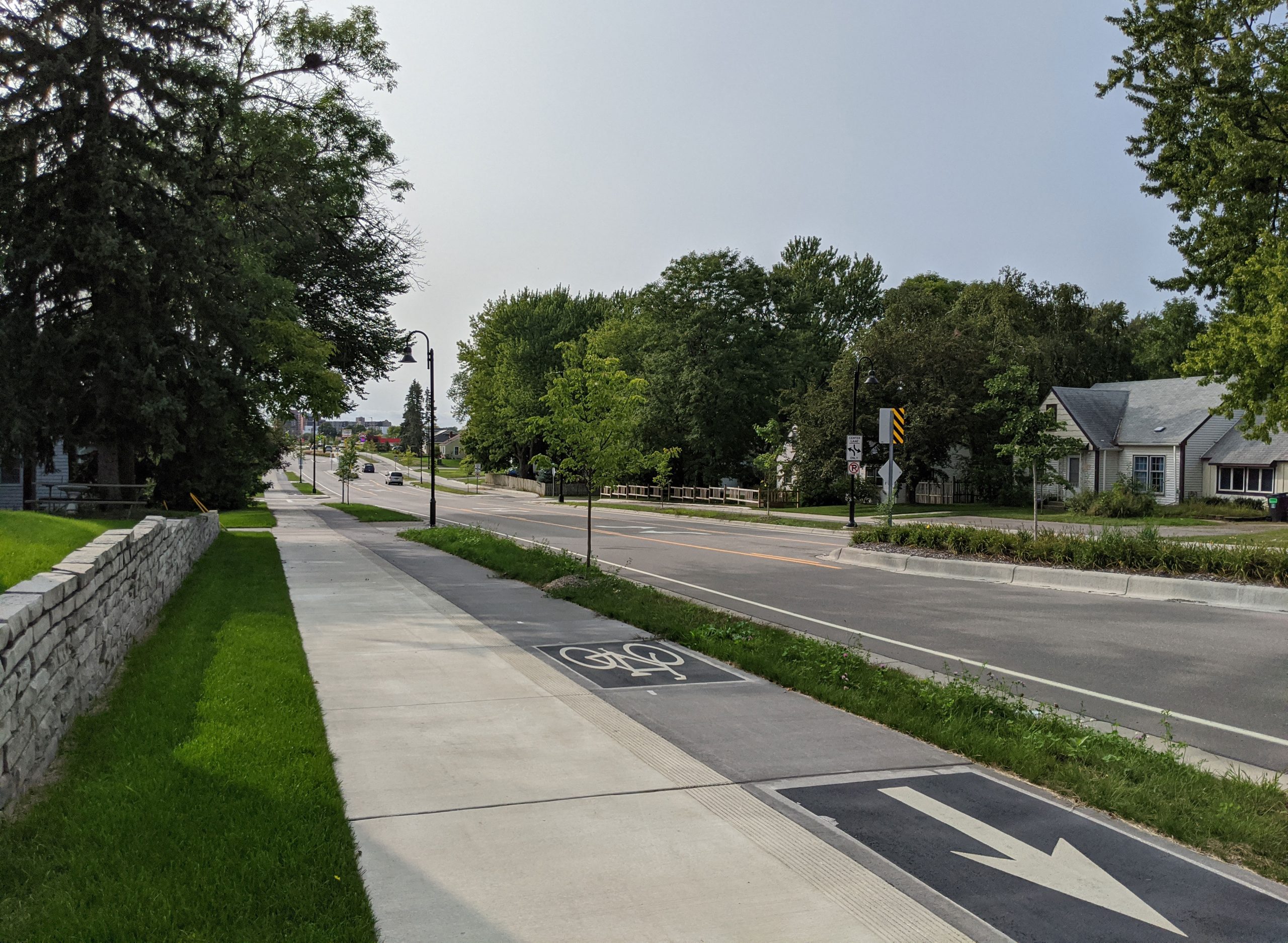
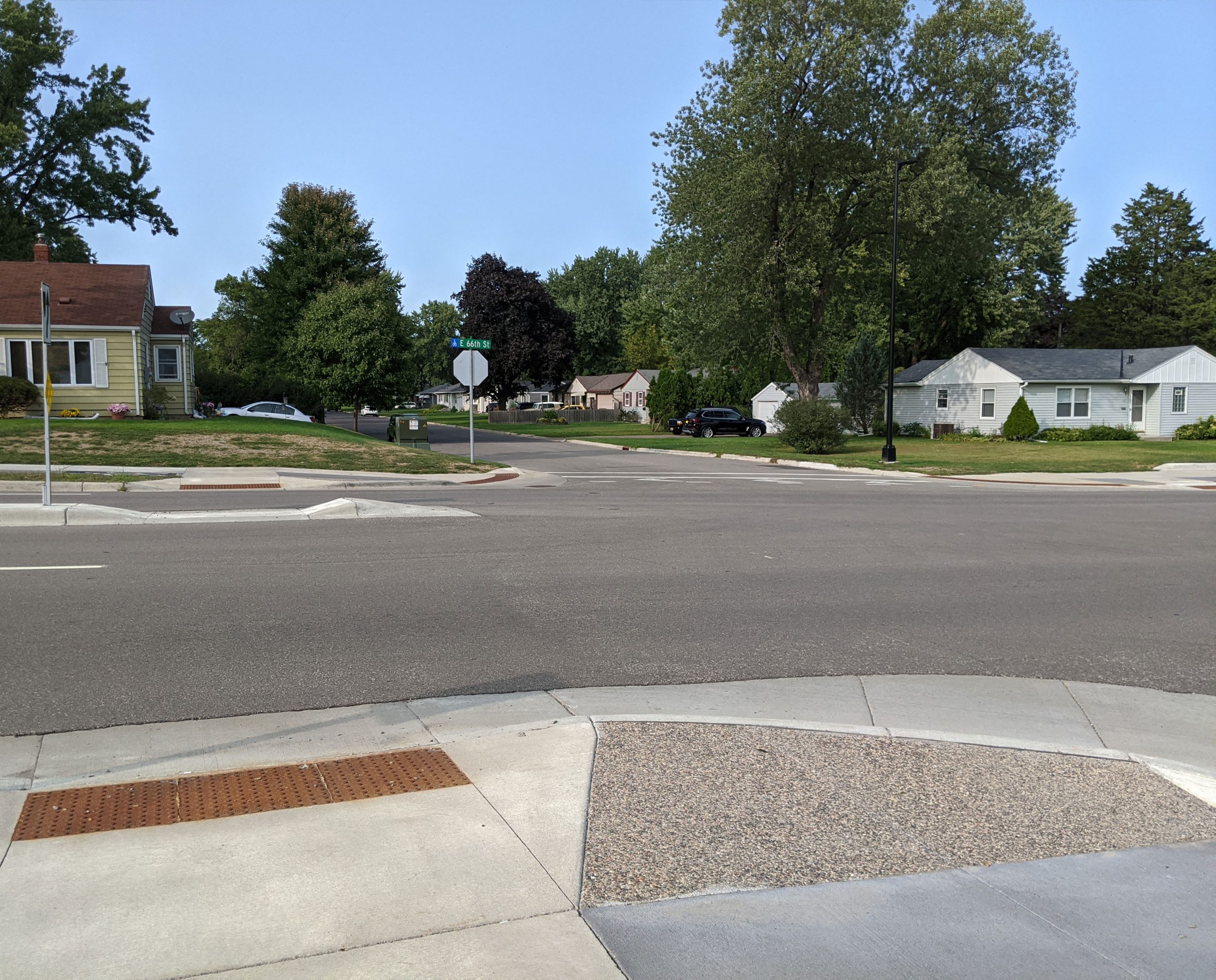
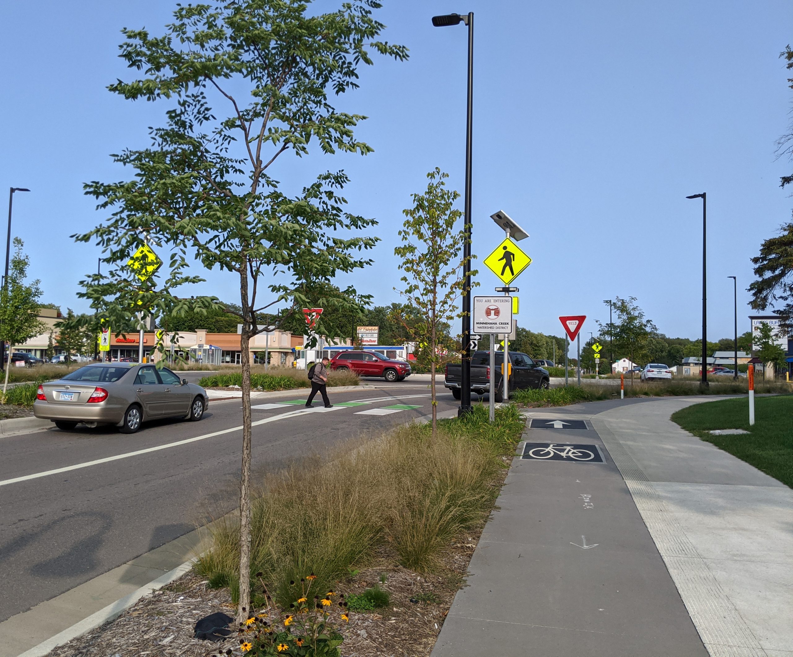
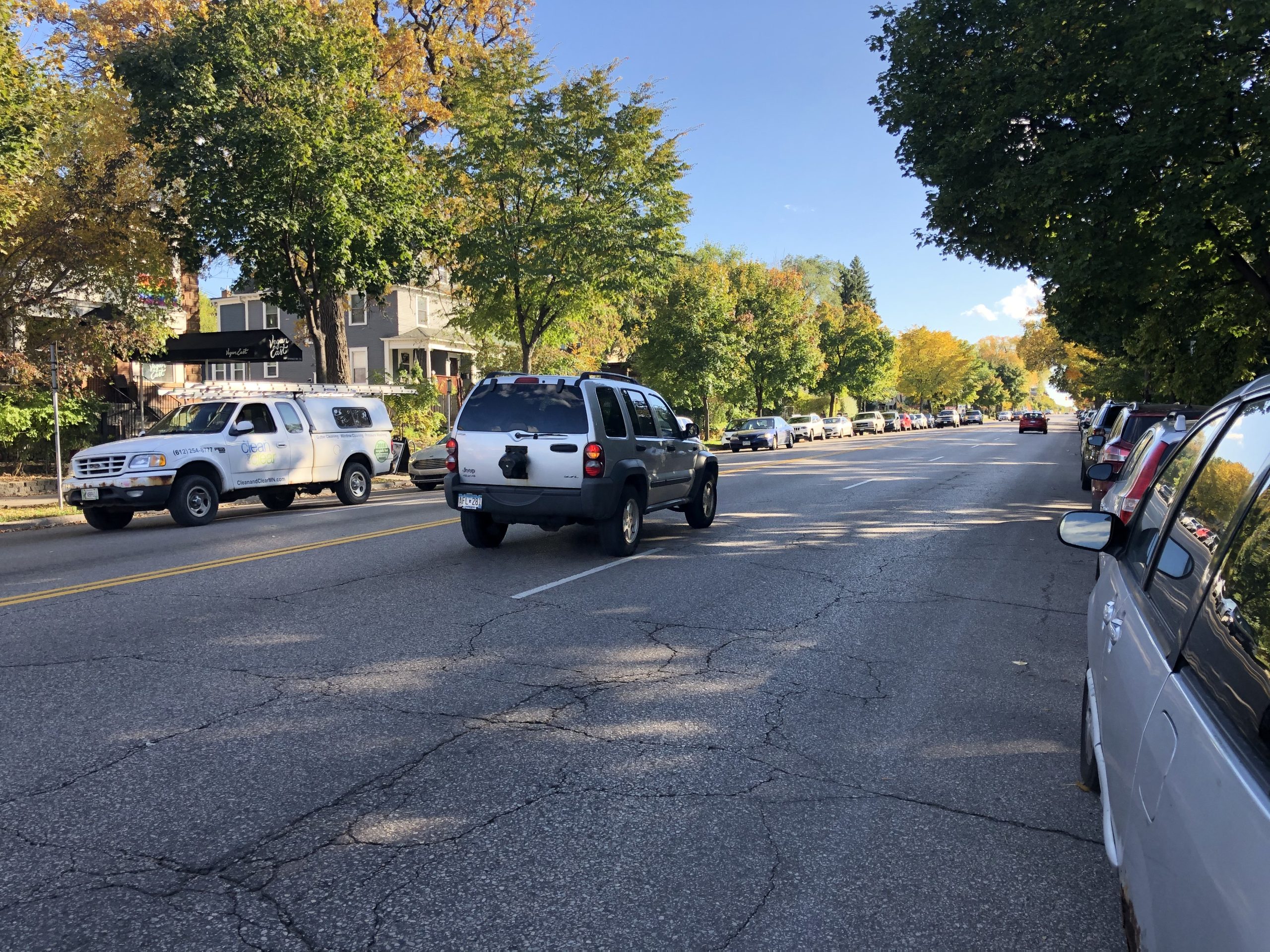
    16th Avenue to Nicollet Avenue

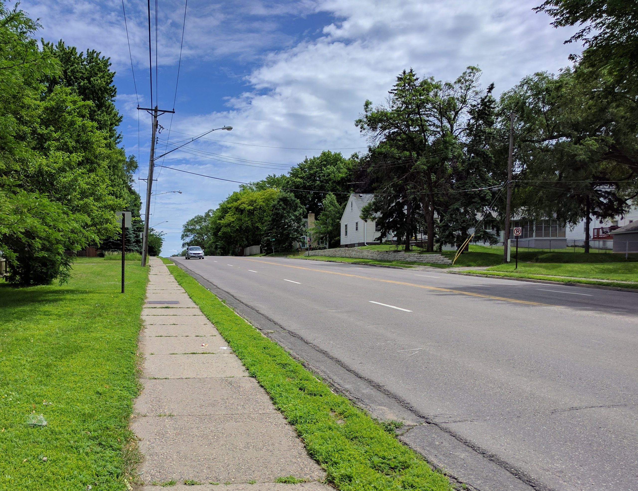
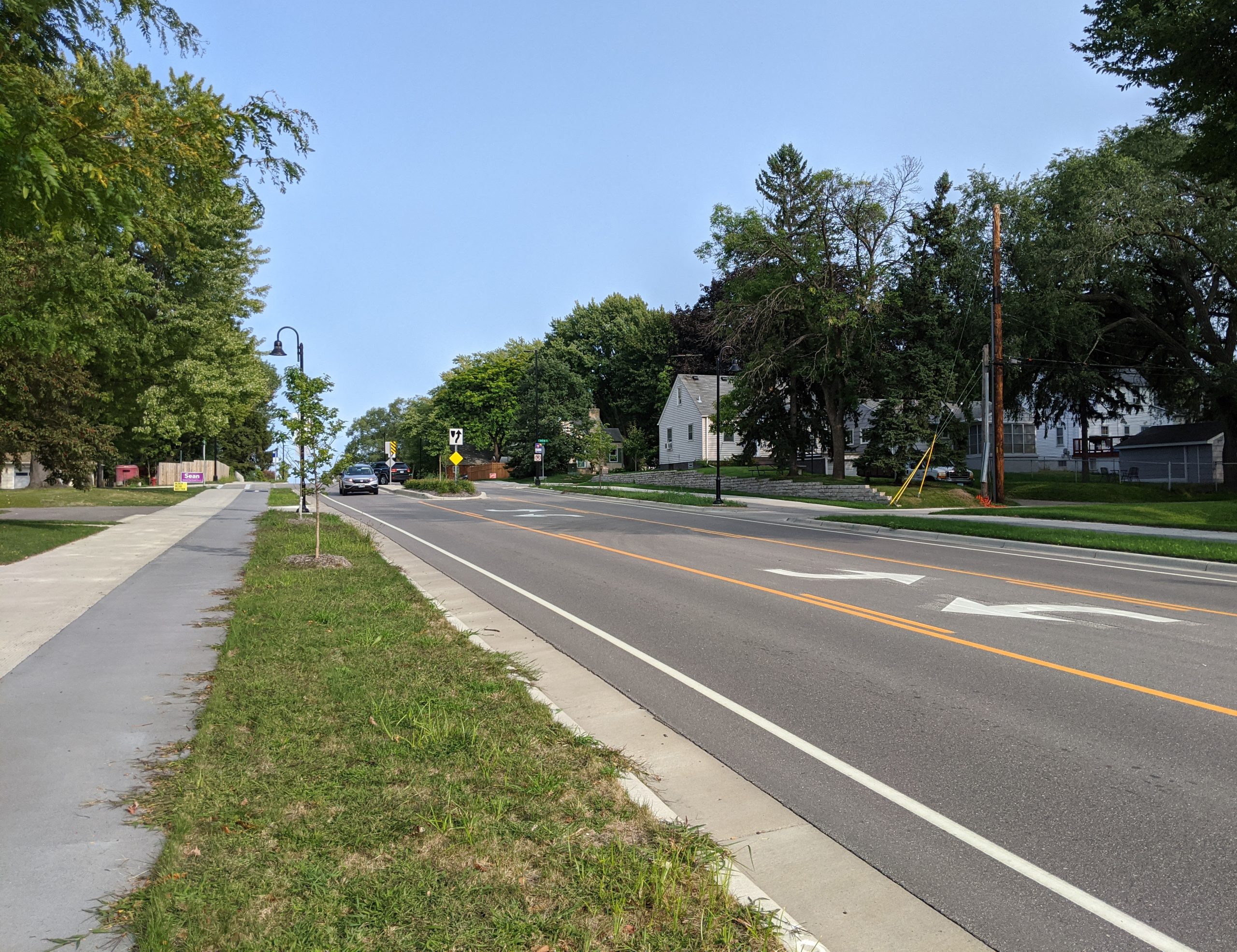
    East of Nicollet Avenue, a 2/3-lane design was used. Medians were prioritized in the area of Veterans Park and the neighborhood to the west.

    This area previously had a lot of unimproved right-of-way, which was better-utilized after the rebuild. Some additional right-of-way was also acquired.

    66th St & 15th Avenue: looking west (2017, before reconstruction)66th St & 15th Avenue: looking west (2021, after reconstruction)

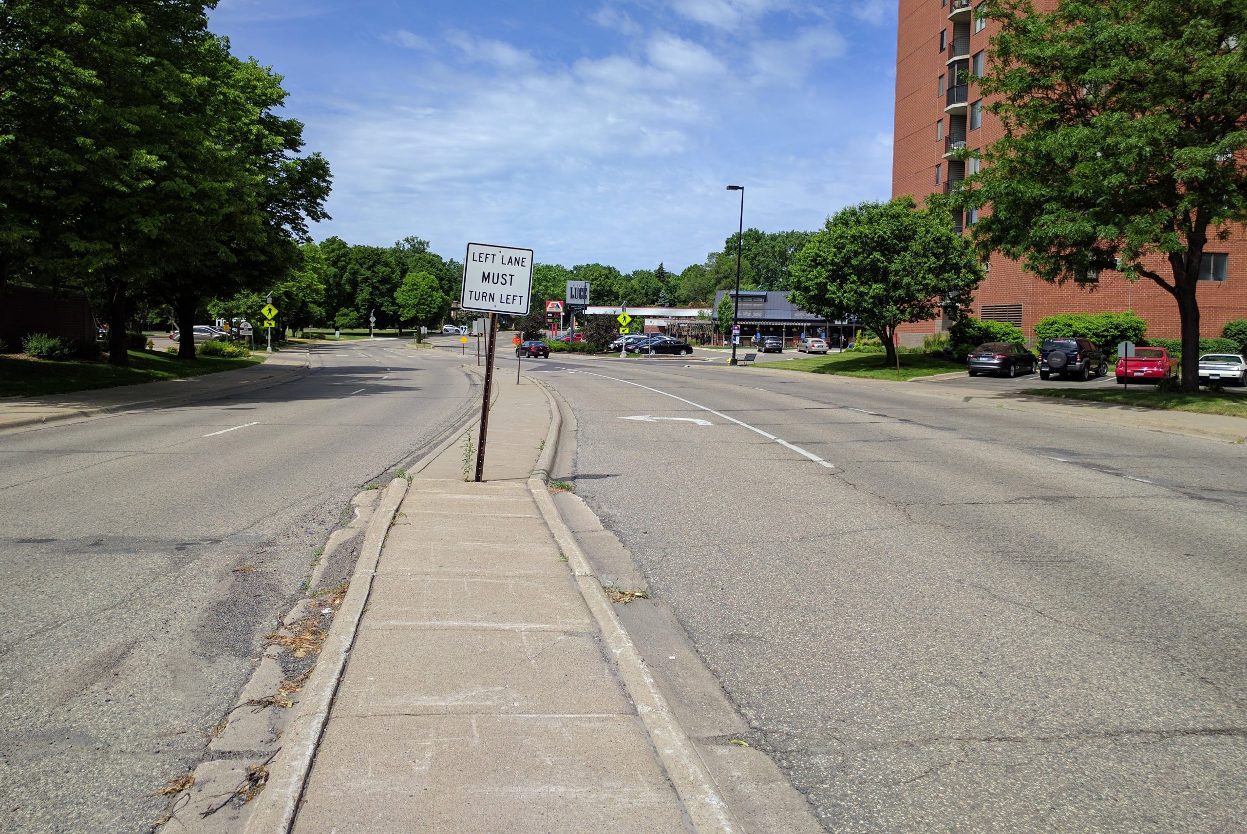
    66th Street and 15th Ave: Looking west from the center line.

    66th and 10th Ave S (2017 before reconstruction)66th and 10th Ave S (2020 after reconstruction)

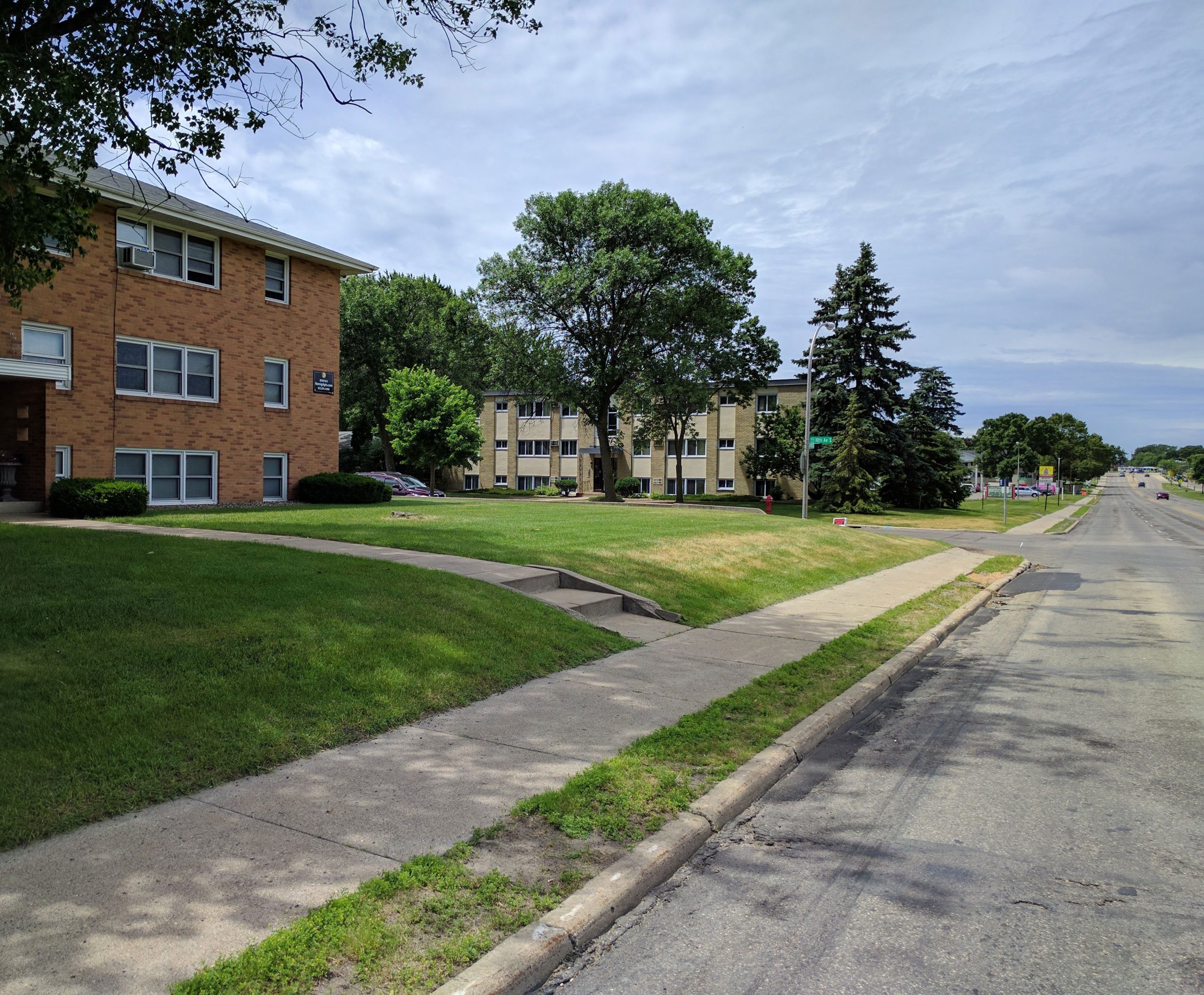
    66th Street and 10th Ave: Looking west

    66th and 3rd Ave (2017, before reconstruction)66th and 3rd Ave (2020, after reconstruction)

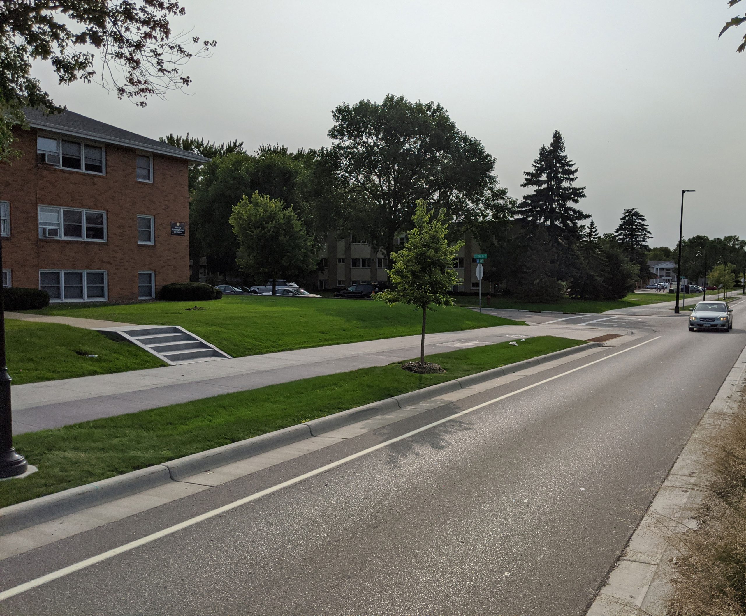
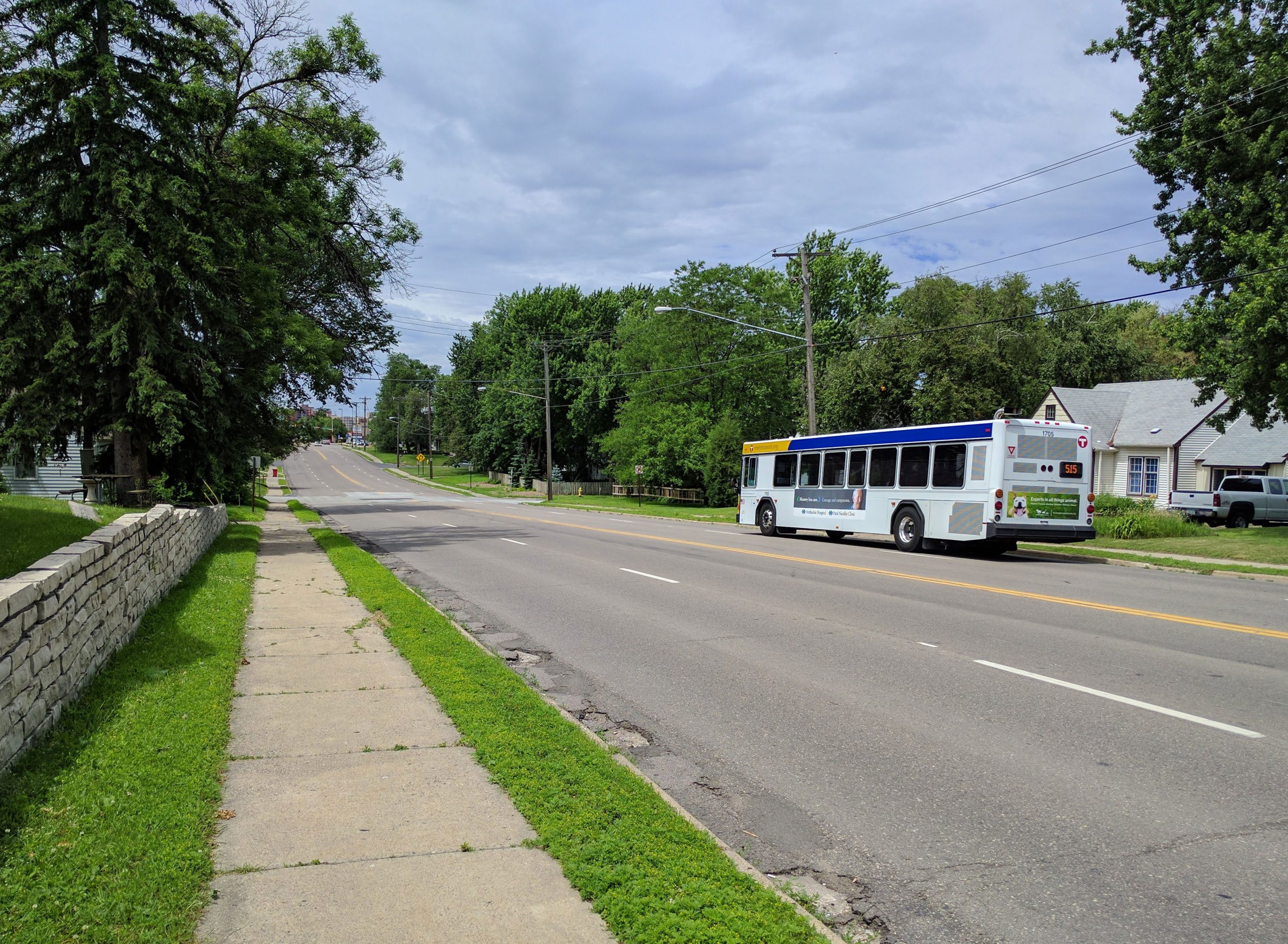
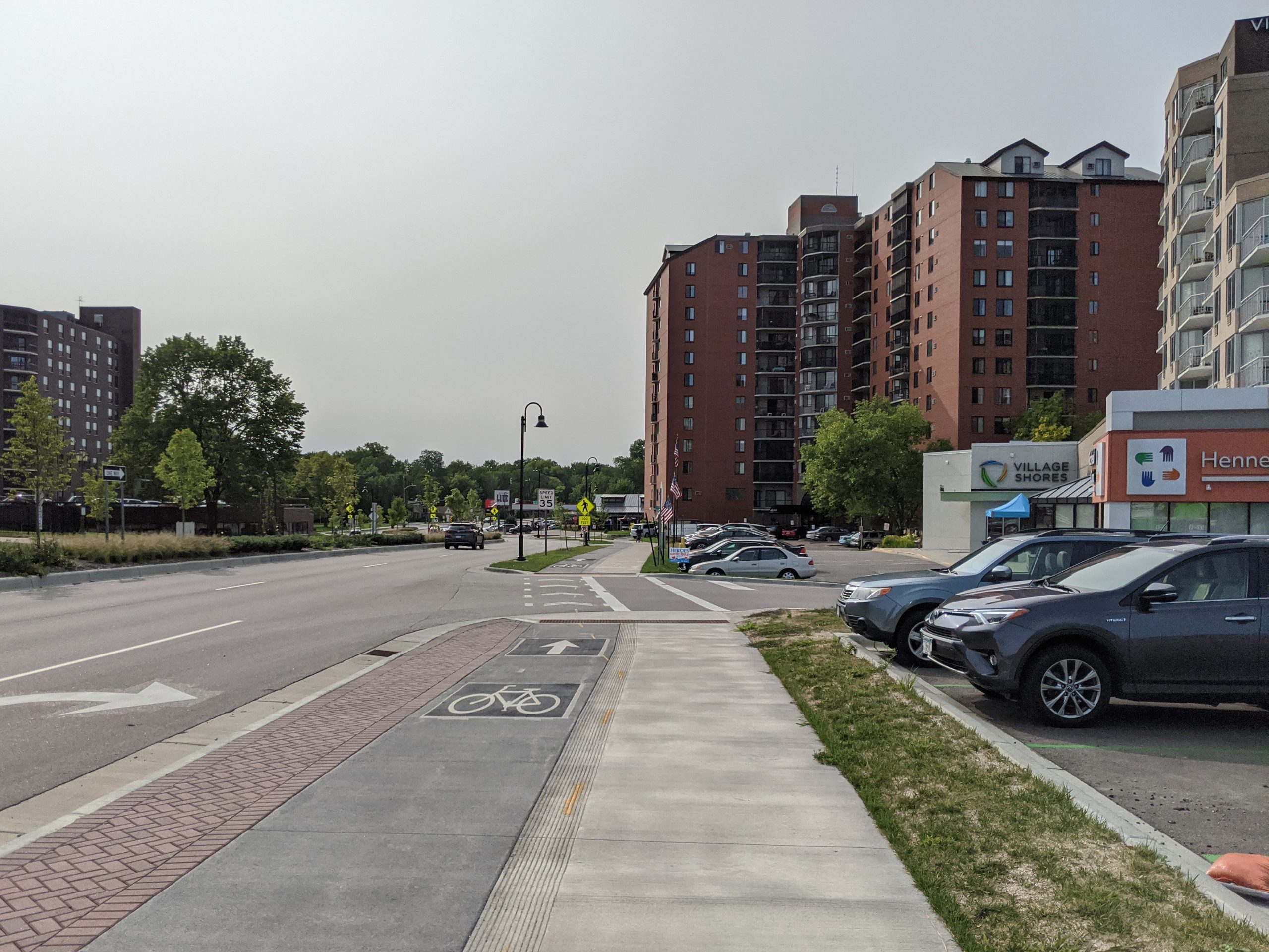
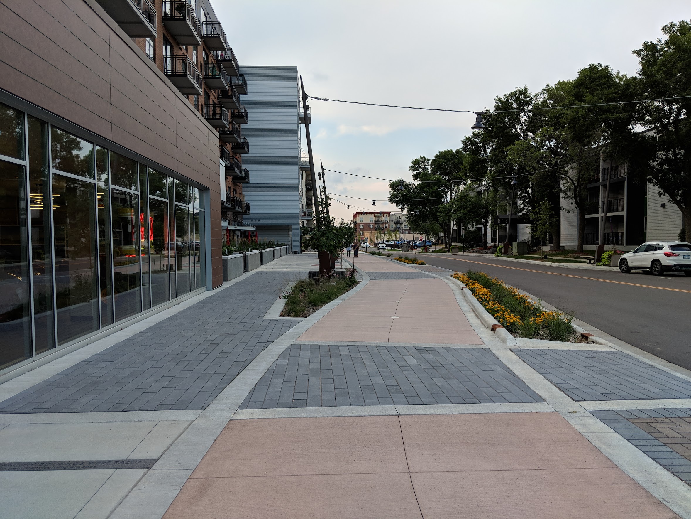
    66th Street and 3rd Ave S, as seen from the sidewalk. Utility lines running along 66th were buried as part of the project.

    66th and 2nd Ave as seen from centerline (2017, before reconstruction)66th and 2nd Ave as seen from centerline (2020, after reconstruction)

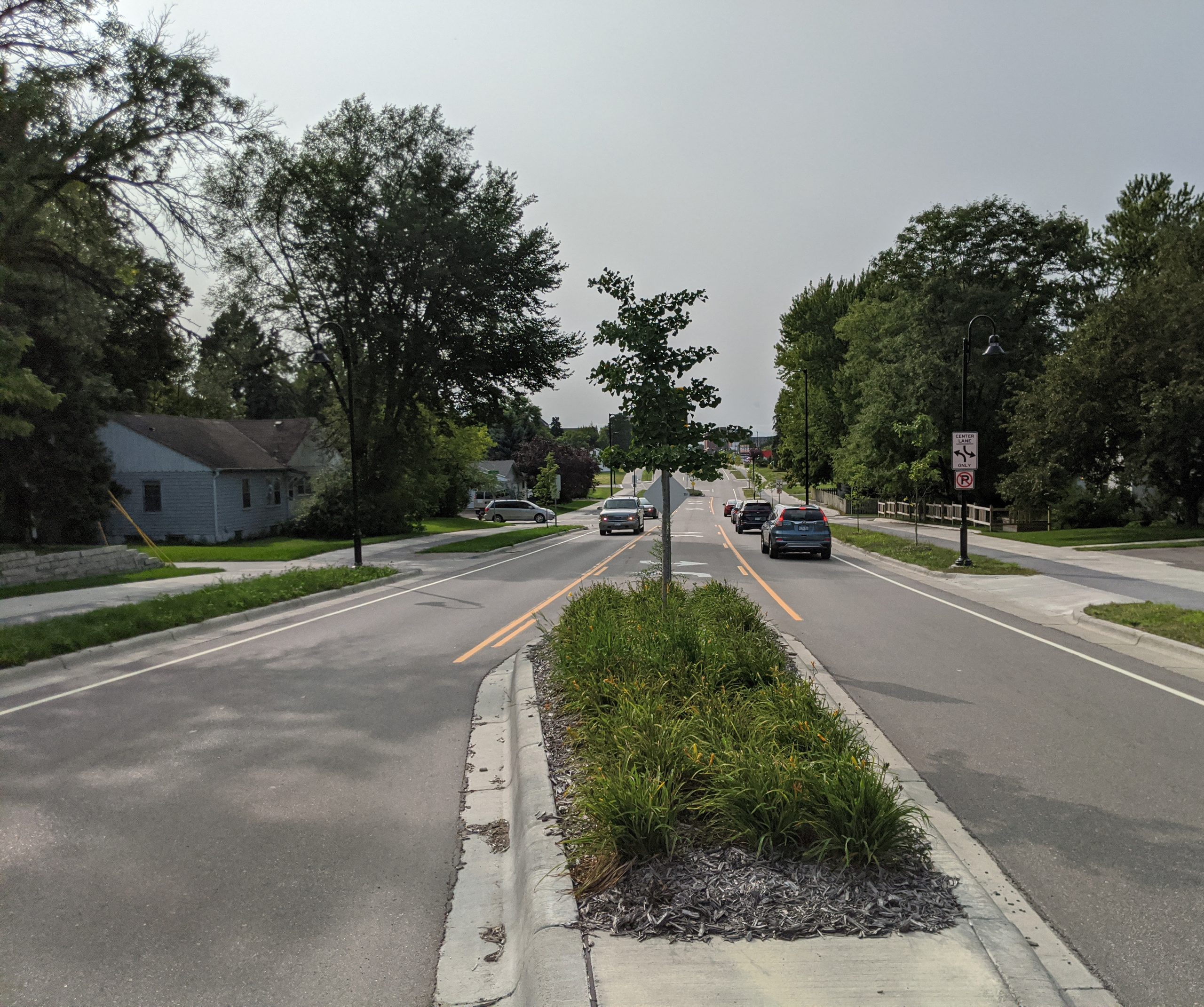
    66th Street and 2nd Ave S, as seen from the center line. A mix of center turn lanes and medians were used in this section.

    66th and 2nd Ave as seen from sidewalk (2017, before reconstruction)66th and 2nd Ave as seen from sidewalk (2020, after reconstruction)

    66th Street and 2nd Ave S, as seen from the sidewalk. The center line shifted north to use previously unimproved right-of-way.

    Pedestrians crossing at 66th and Stevens Ave (2017, before reconstruction)66th and Stevens Ave (2020, after reconstruction)

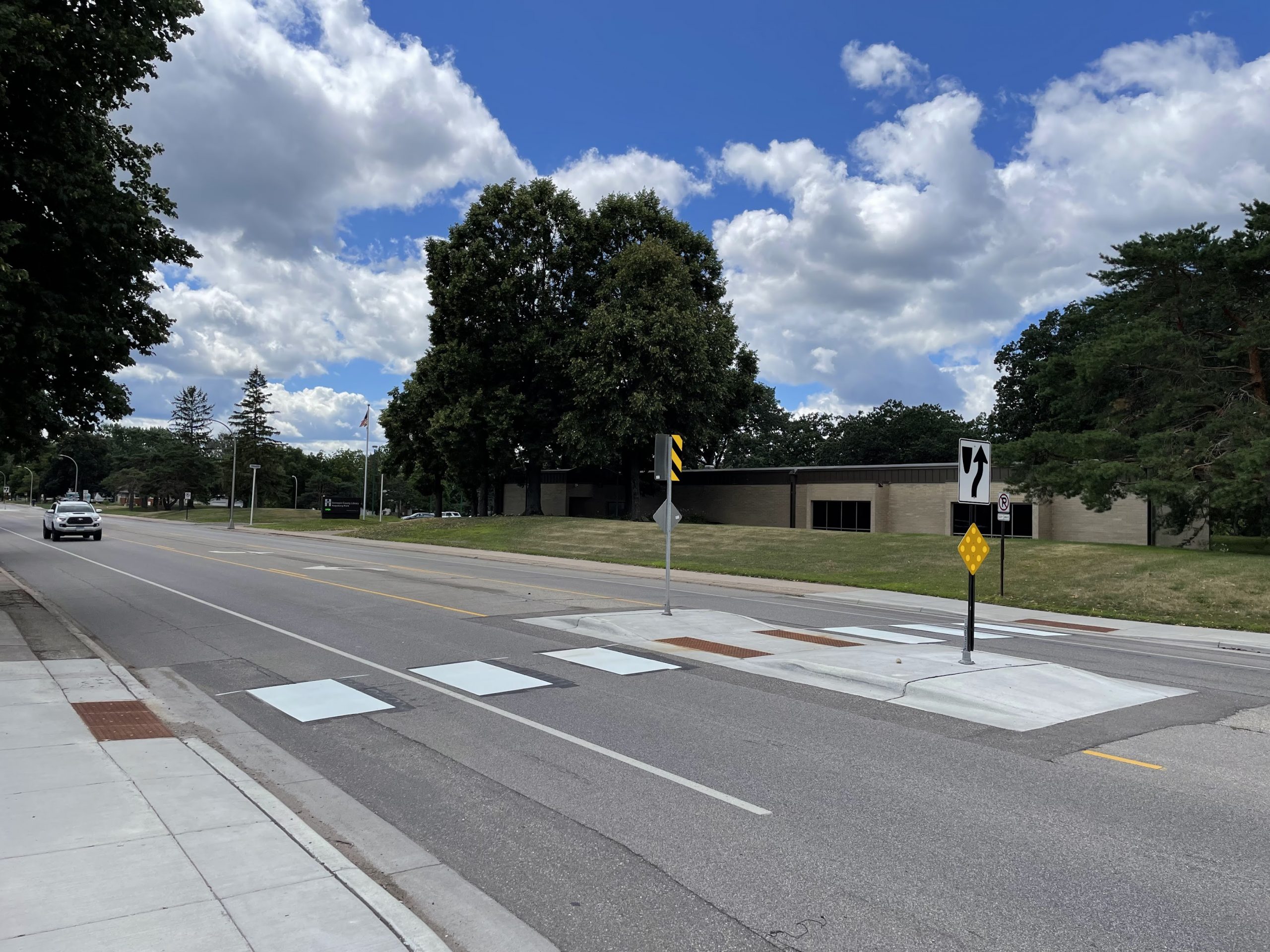
    66th Street and Stevens Avenue. Although crossing conditions have improved, this intersection like most lacks marked crosswalks.

    66th and 1st Ave S (2017, before reconstruction)66th and 1st Ave S (2020 after reconstruction)

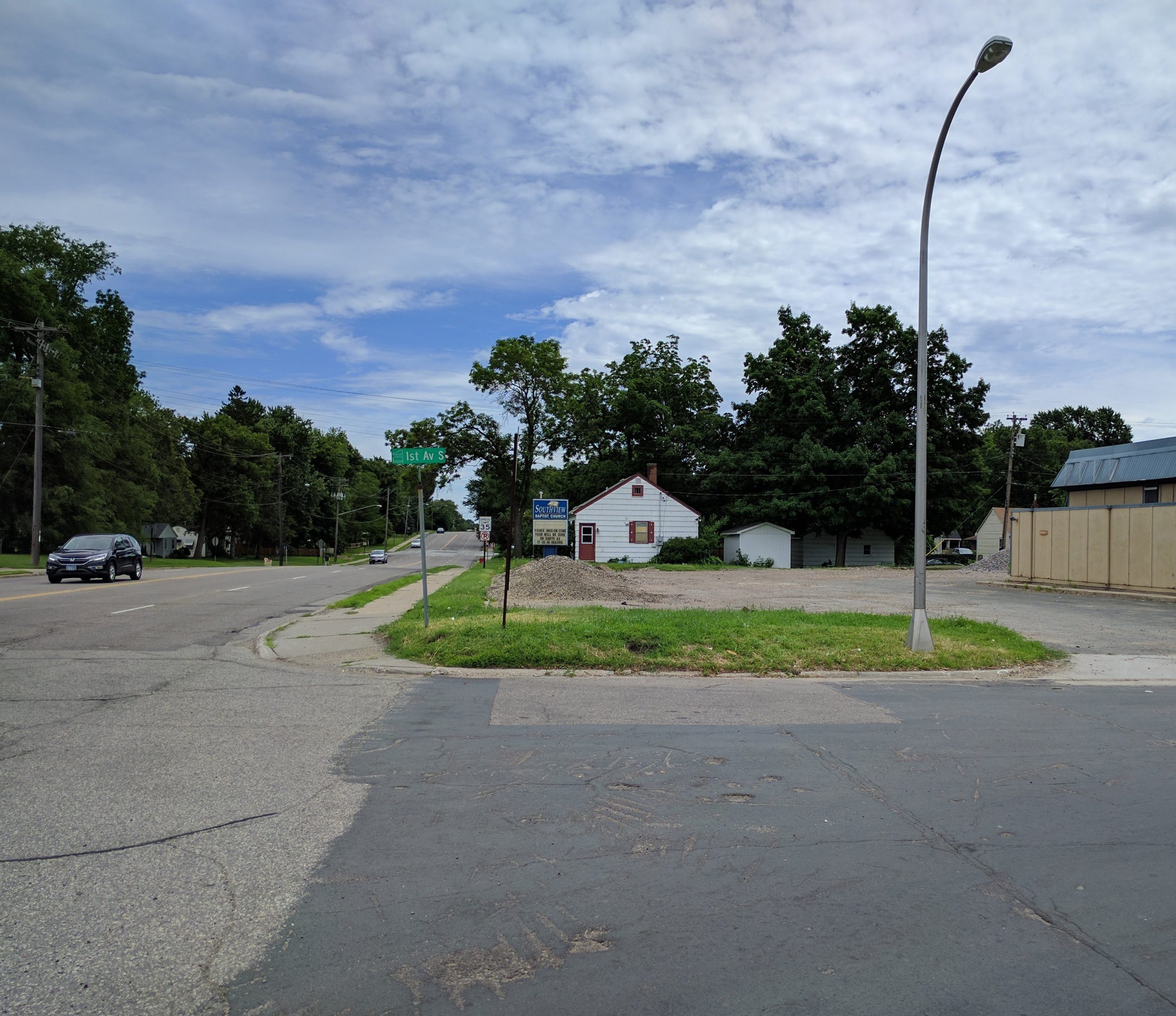
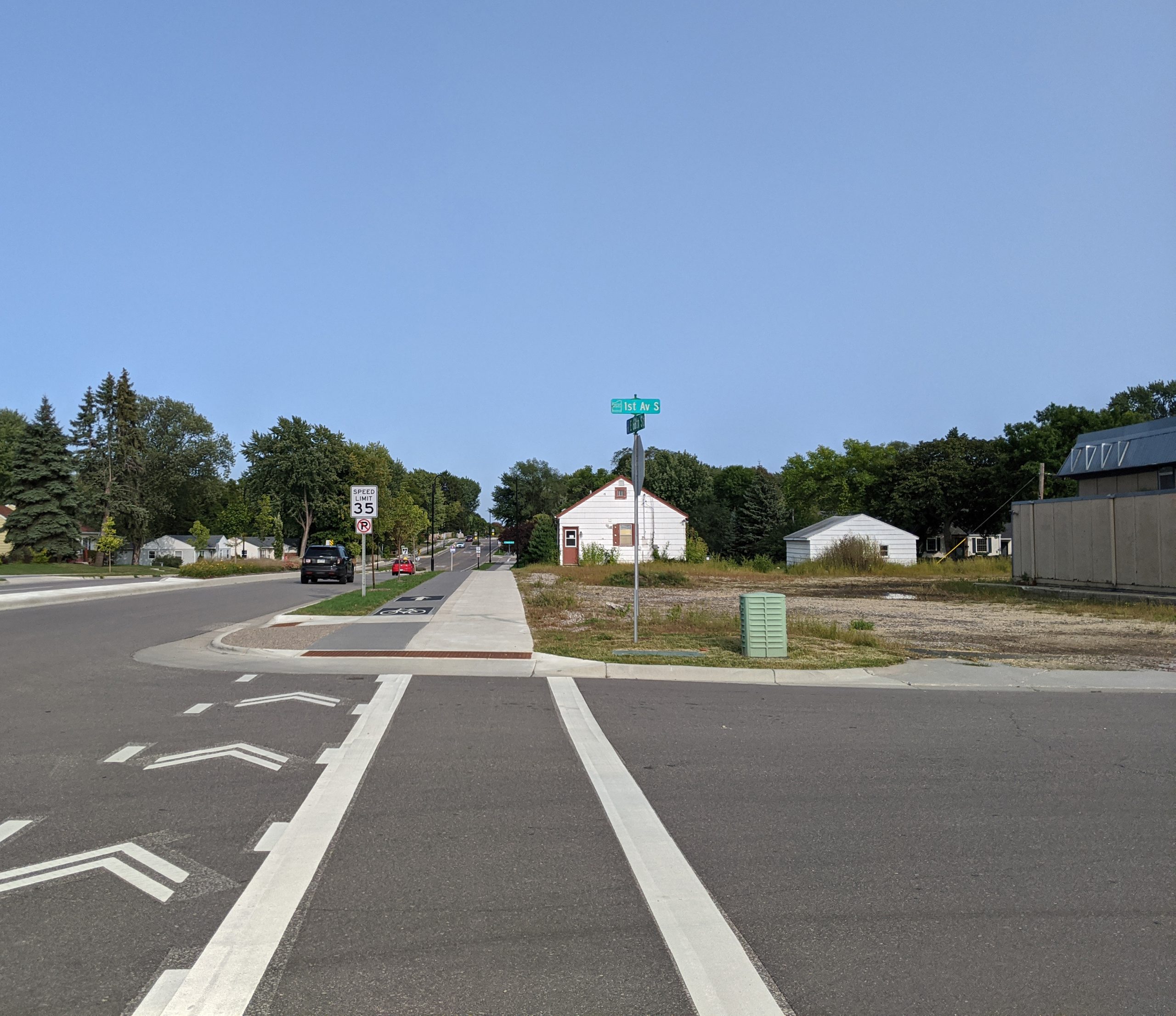
    66th Street and 1st Ave

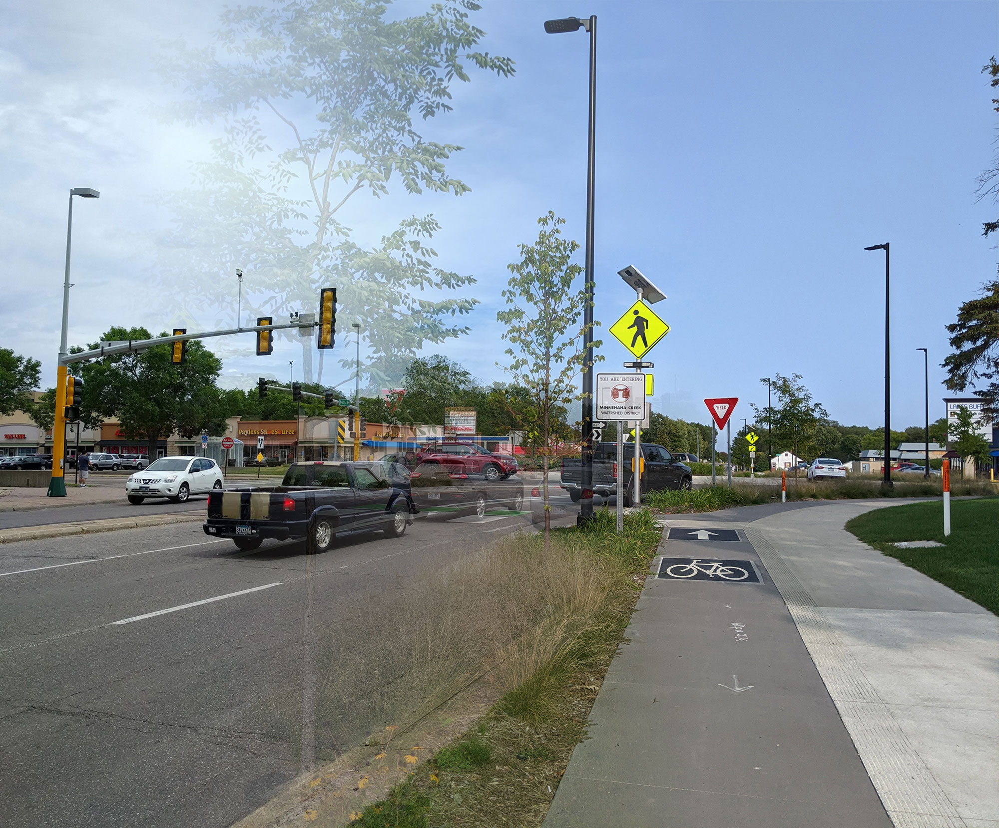
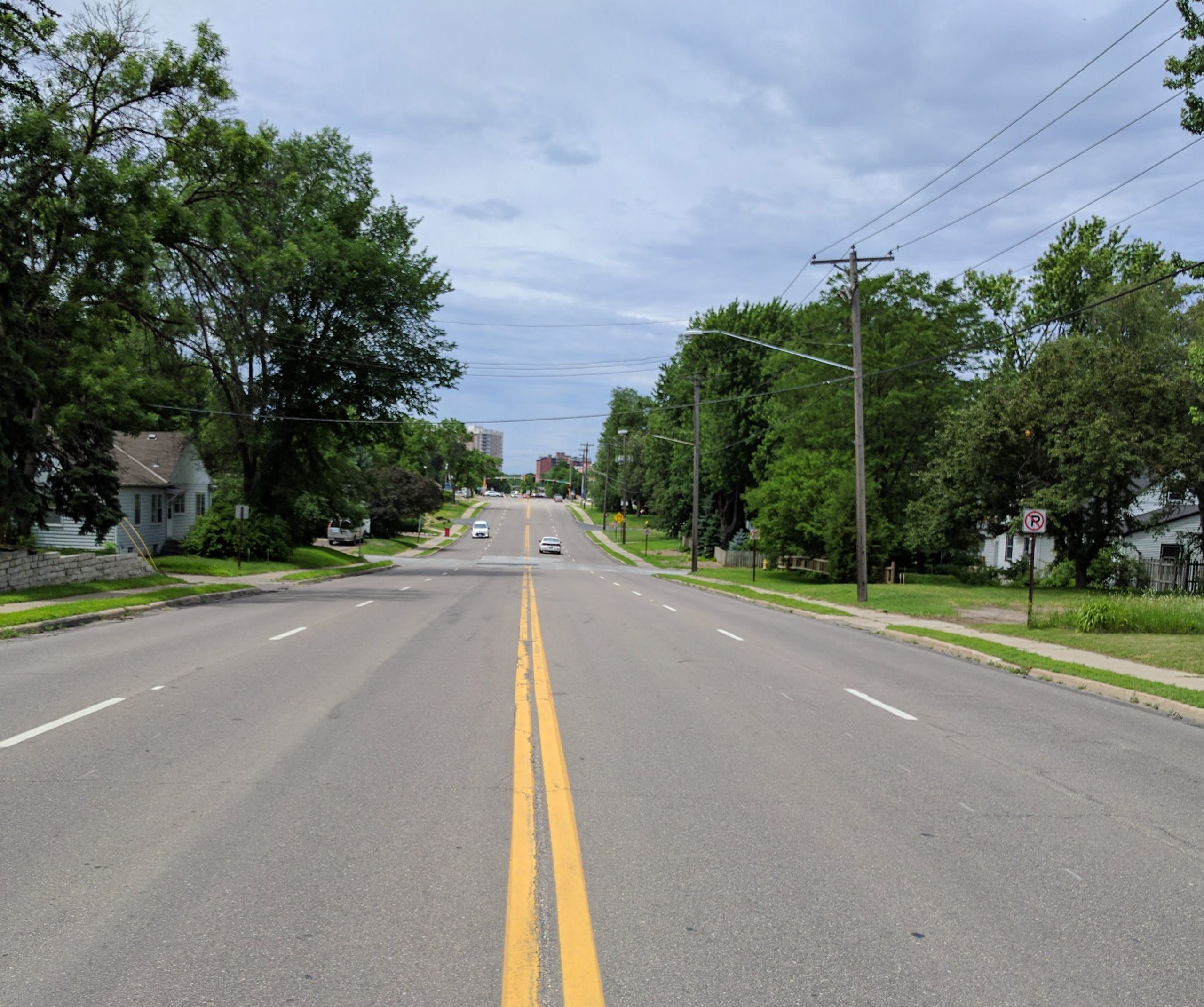
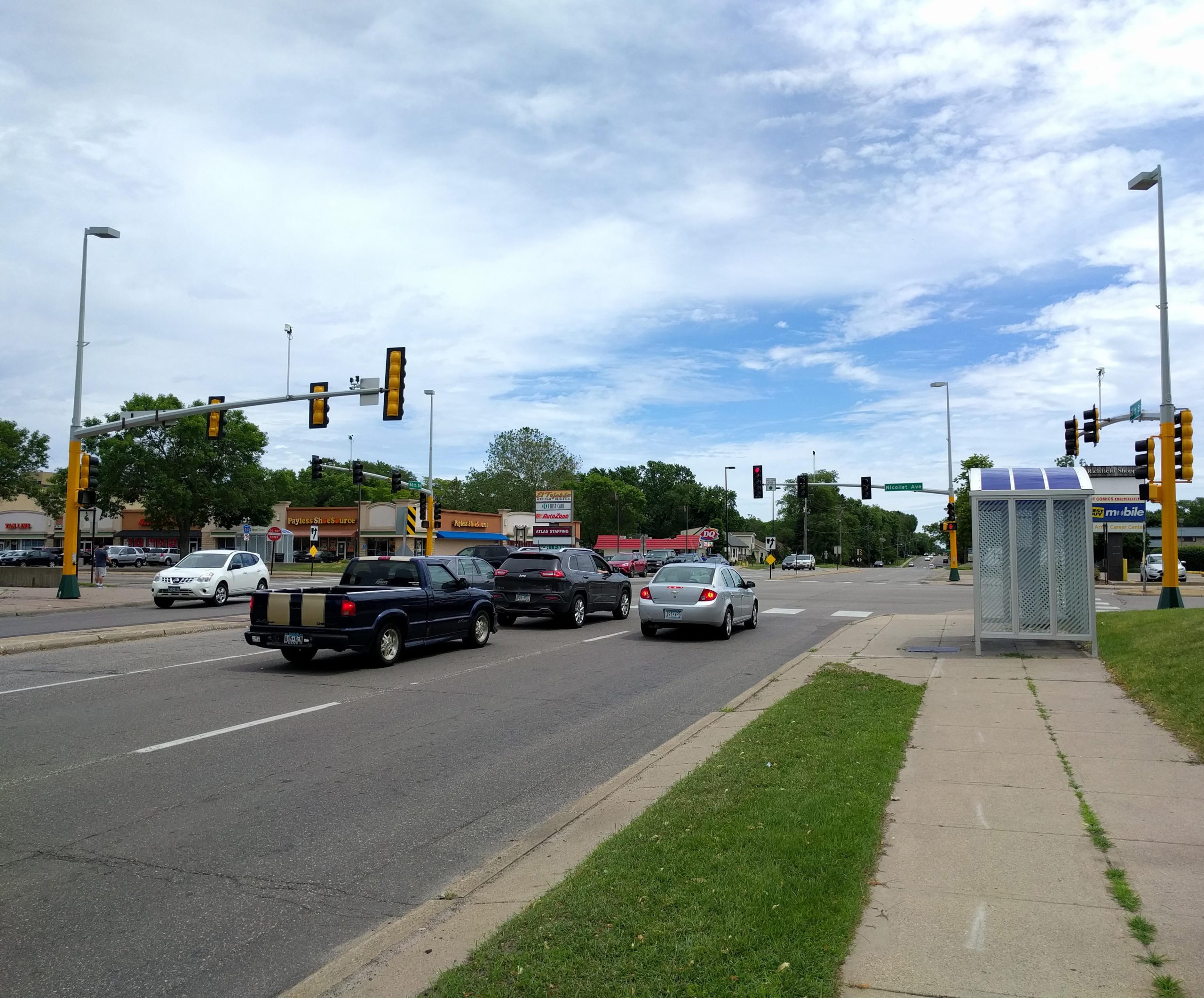
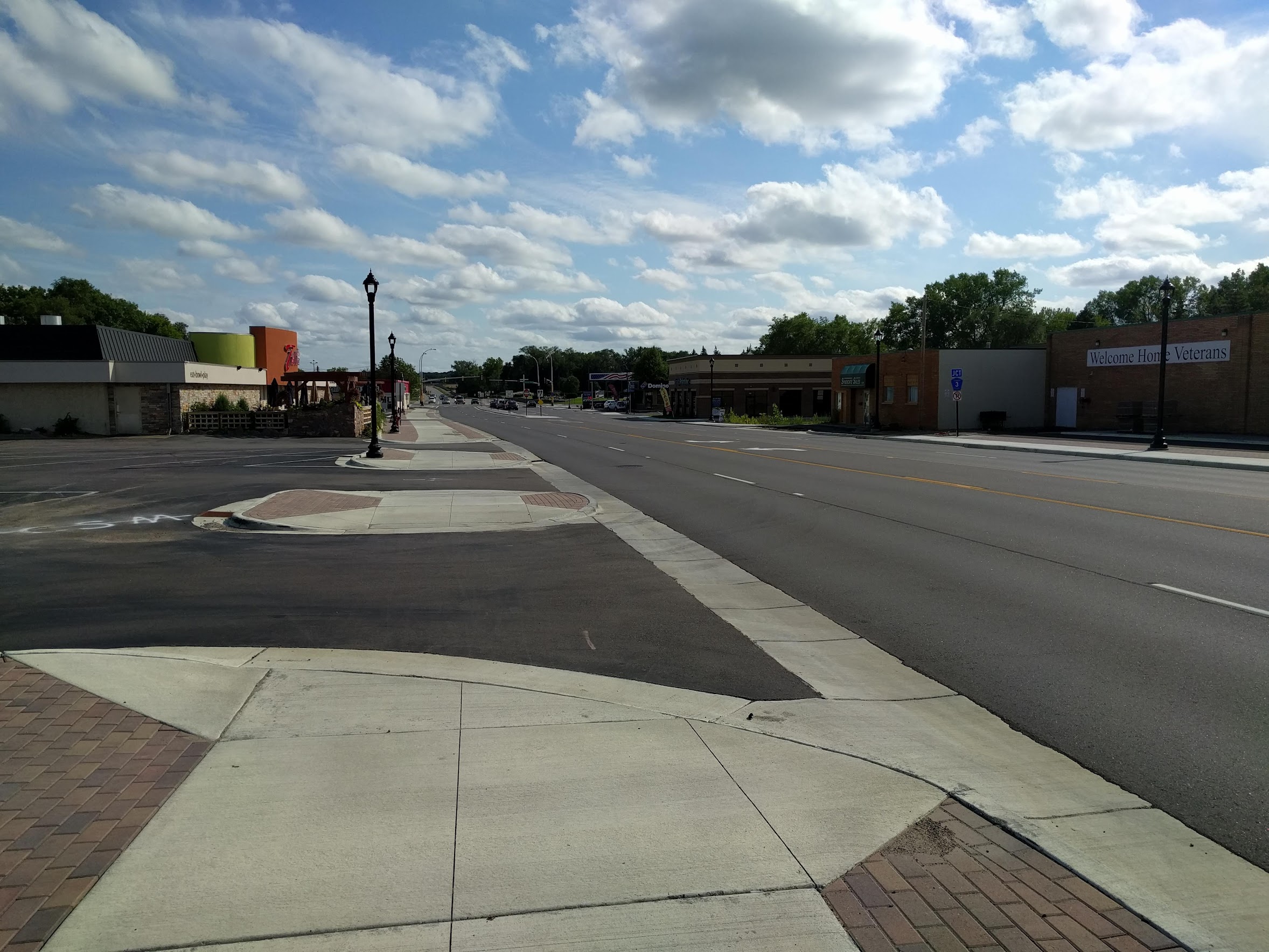
    Downtown Richfield — Nicollet Avenue to I-35W

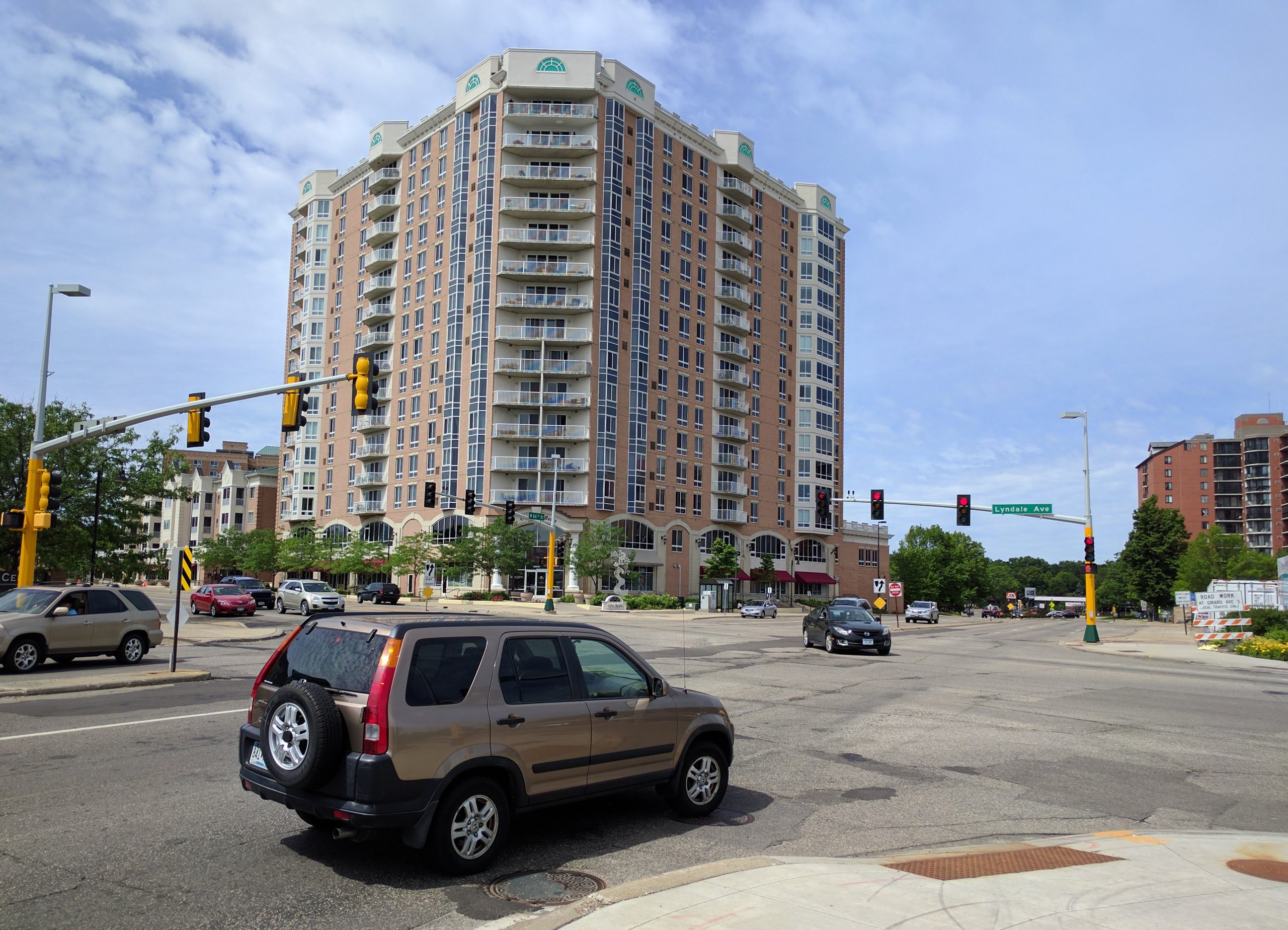
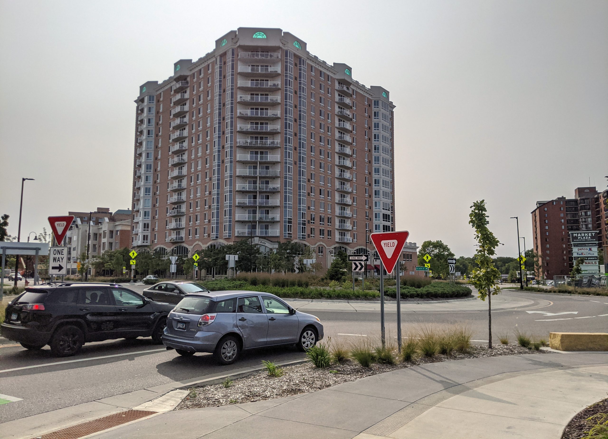
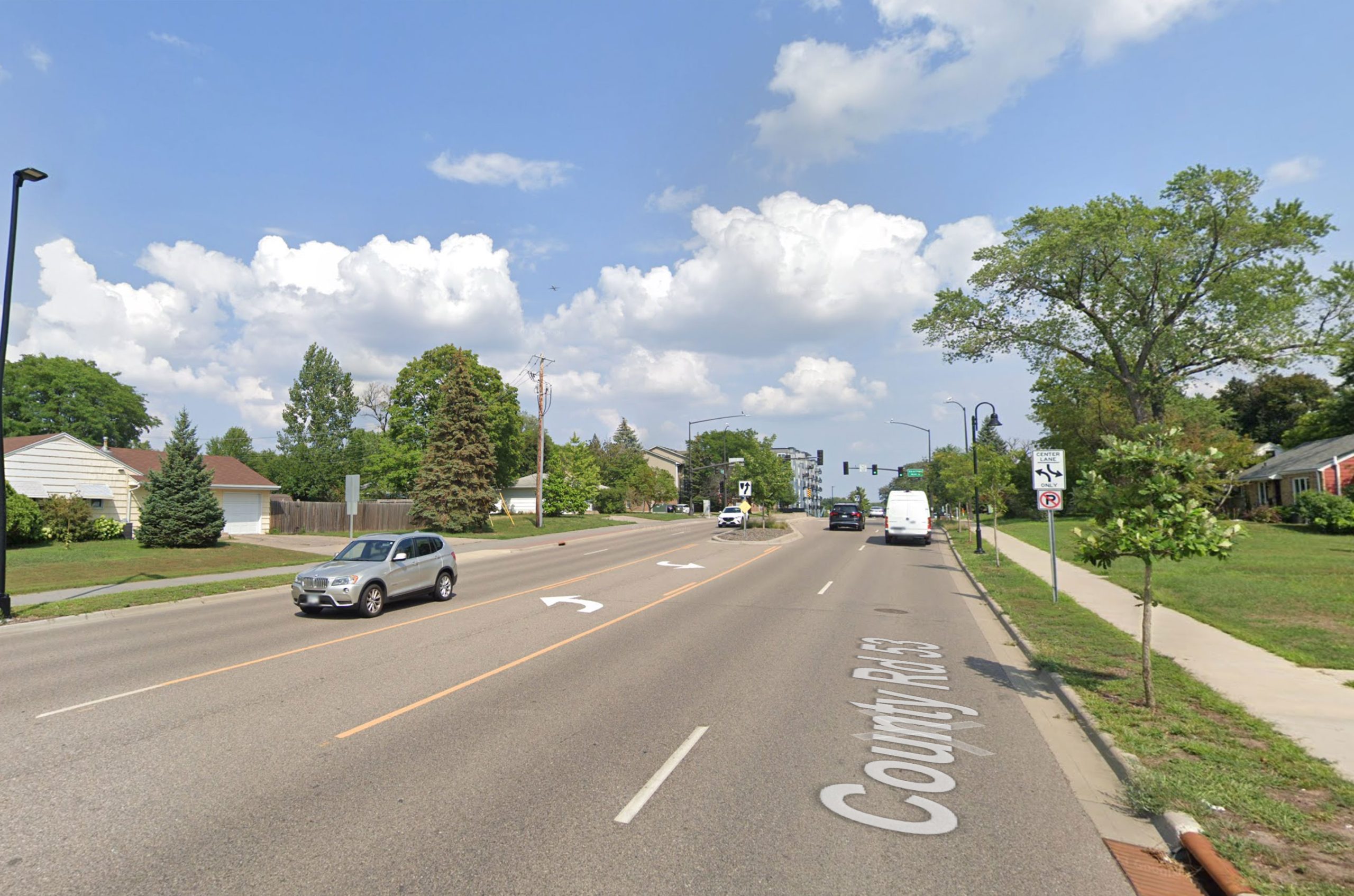
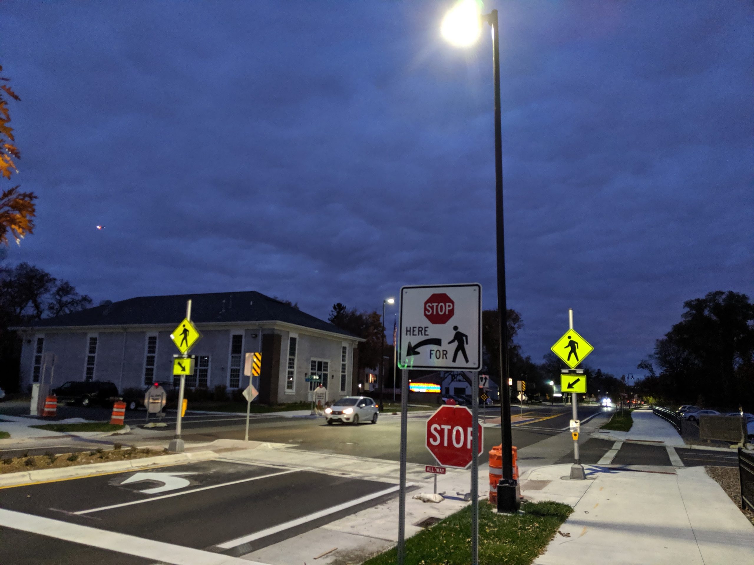
    West of Nicollet Avenue, a divided 4/5-lane design was used. Note the significant change at Nicollet and Lyndale, where signals were replaced with roundabouts.

    66th and Nicollet Ave signal looking east (2017, before reconstruction)66th and Nicollet Ave roundabout looking east (2020, after reconstruction)

    66th and Nicollet roundabout

    66th and Nicollet Ave looking west (2017, after reconstruction)66th and Nicollet Ave looking west (2020, after reconstruction)

    66th and Nicollet looking west by Academy of Holy Angels.

    66th St and Lyndale avenue, looking west (2017, before reconstruction)66th St and Lyndale avenue, looking west (2021, after reconstruction)

    66th and Lyndale looking west: Signal replaced with roundabout, and protected bikeway and green space added.

    66th St and Lyndale avenue, looking east (2021, after reconstruction)66th St and Lyndale avenue, looking east (2021, after reconstruction)

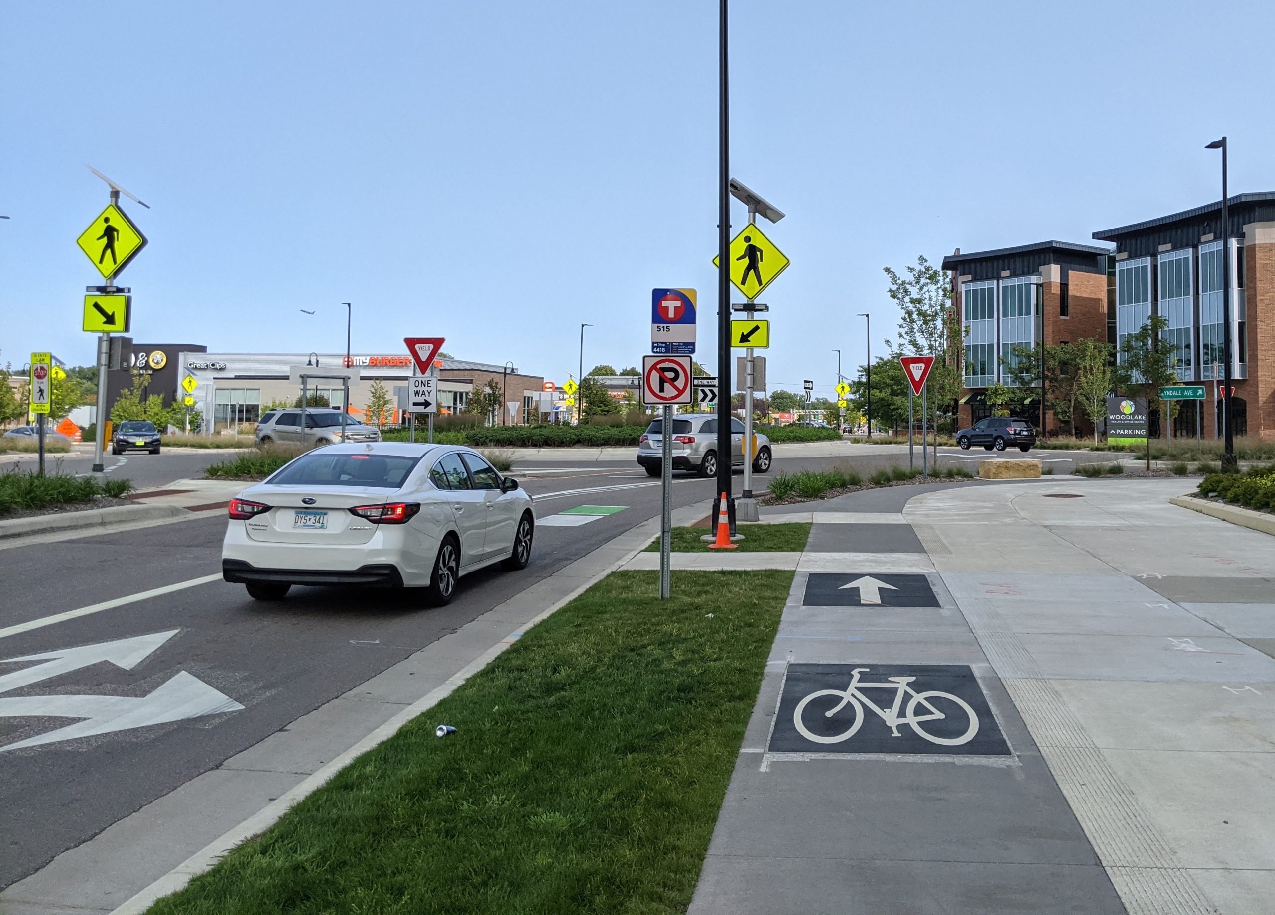
    66th and Lyndale looking east: Signal replaced with roundabout, and protected bikeway and green space added.

    66th St just west of Lyndale (2017, before reconstruction)66th St just west of Lyndale (2021, after reconstruction)

    66th just west of Lyndale: Looking west from the sidewalk.

    66th St near Woodlake Dr (2017, before reconstruction)66th St near Woodlake Dr (2021, after reconstruction)

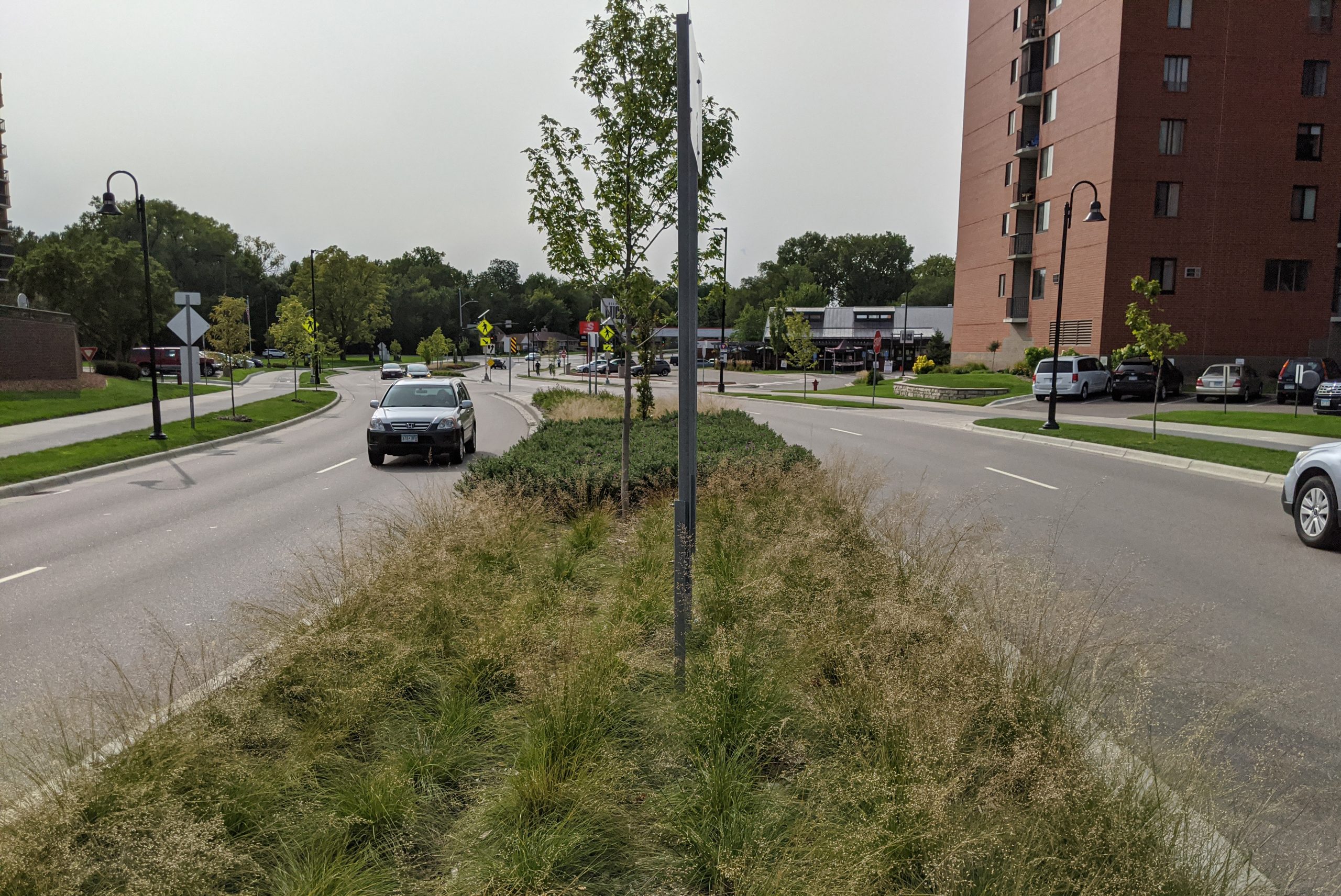
    66th near Woodlake Drive: Looking west from middle of the roadway. Note the increased green space behind the curbs, as well as the median.

    66th St & Emerson Avenue: looking west (2017, before reconstruction)66th St & Emerson Avenue: looking west (2021, after reconstruction)

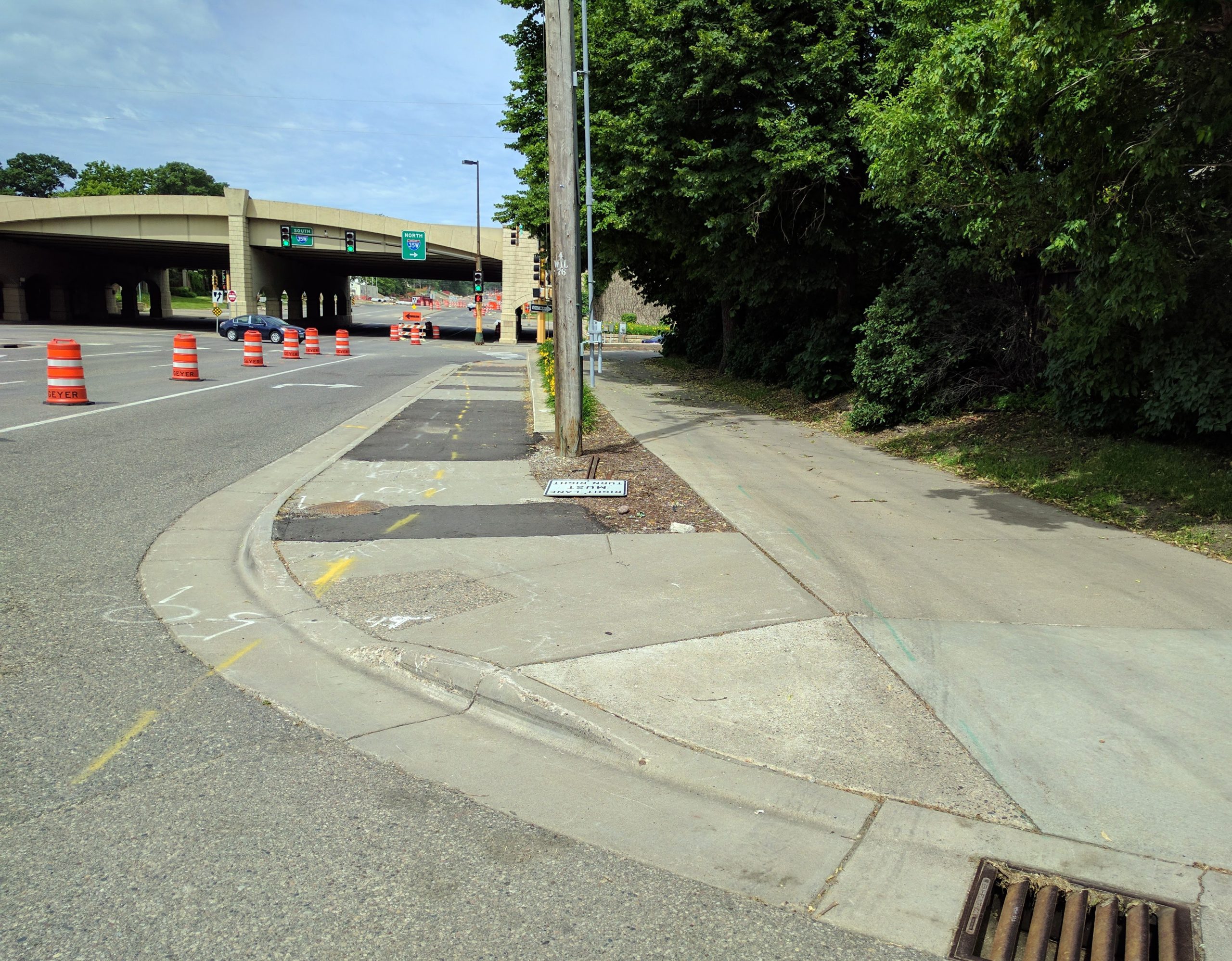
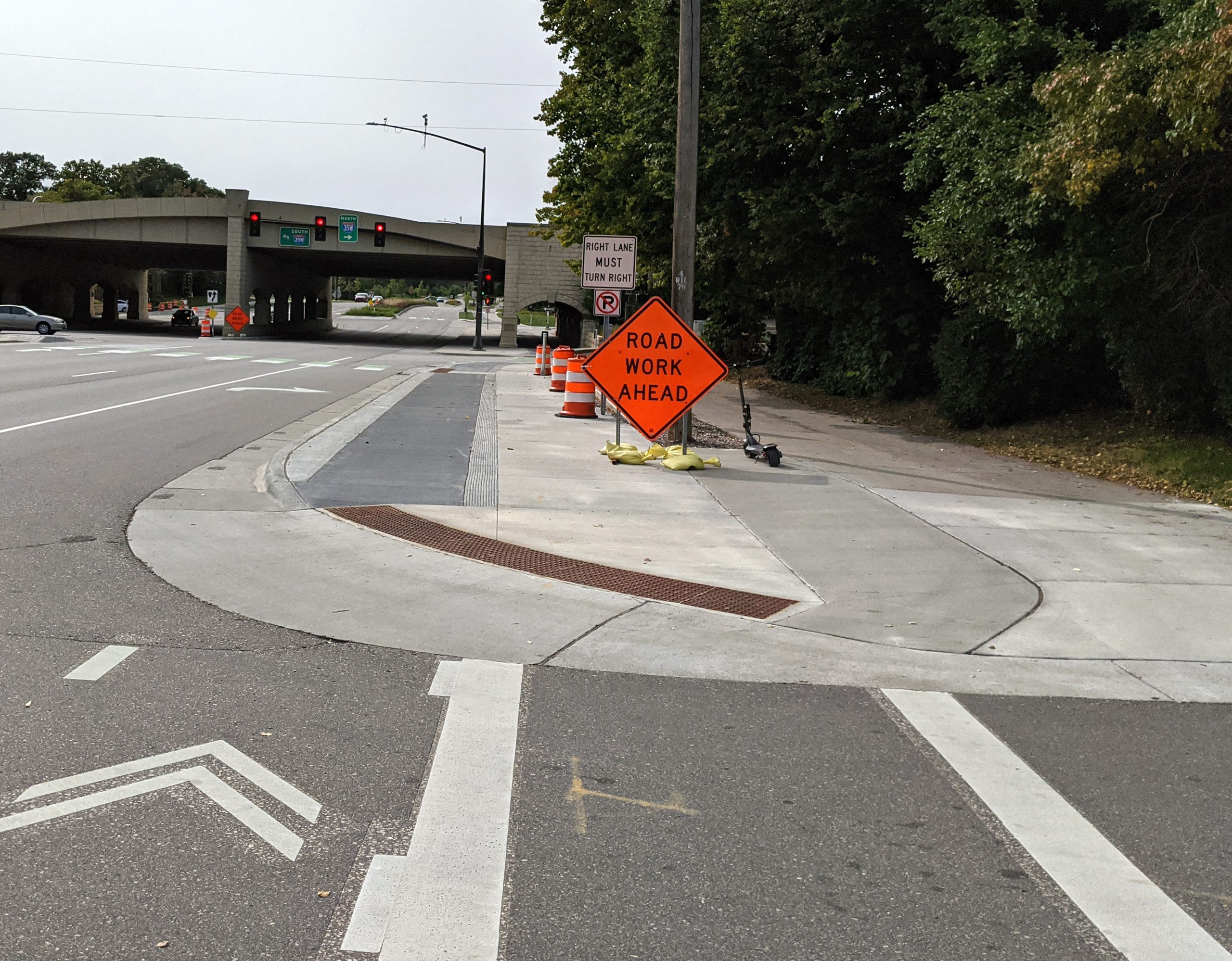
    66th & 35W: Looking west on the north side sidewalk. Unfortunately, the right-turn lane was retained, which makes this transit location less pedestrian-friendly.

    66th St & I35W: looking west toward underpass on south side (2017, before reconstruction)66th St & I35W: looking west toward underpass on south side (2021, after reconstruction)

    66th & 35W: Looking west on the south side sidewalk

    66th St & I35W: under the bridge (2017, before reconstruction)66th St & I35W: under the bridge (2021, after reconstruction)

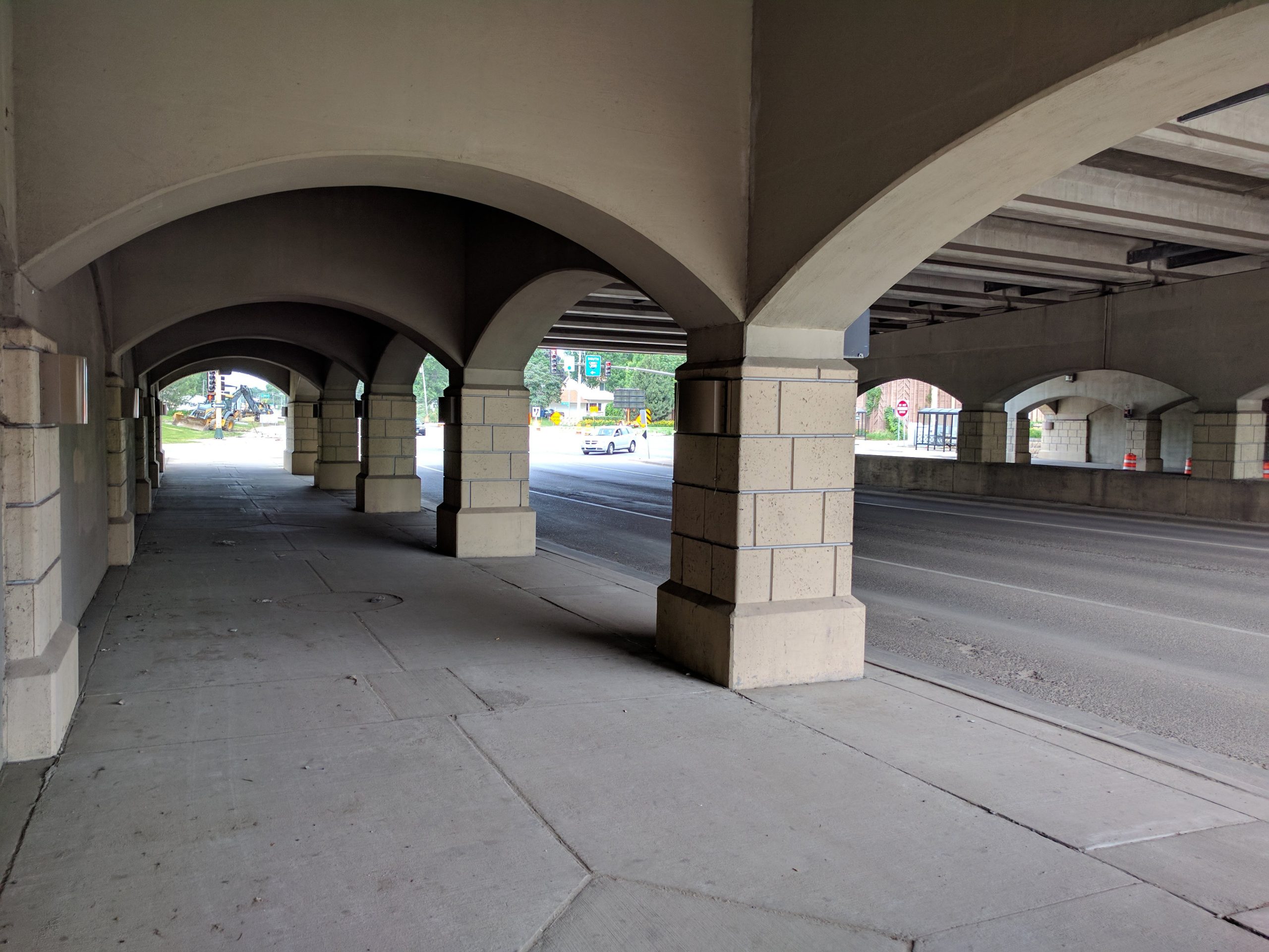
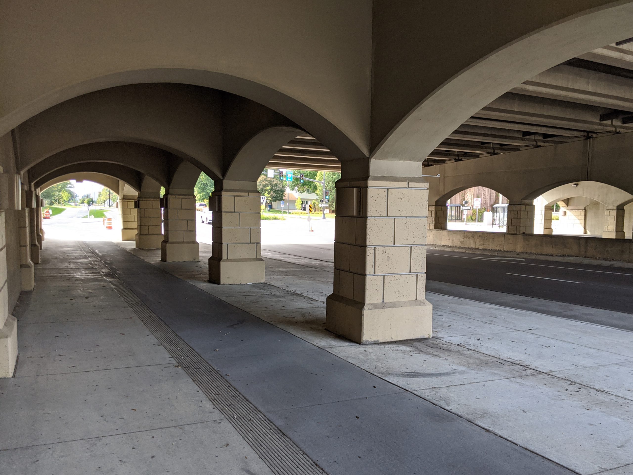
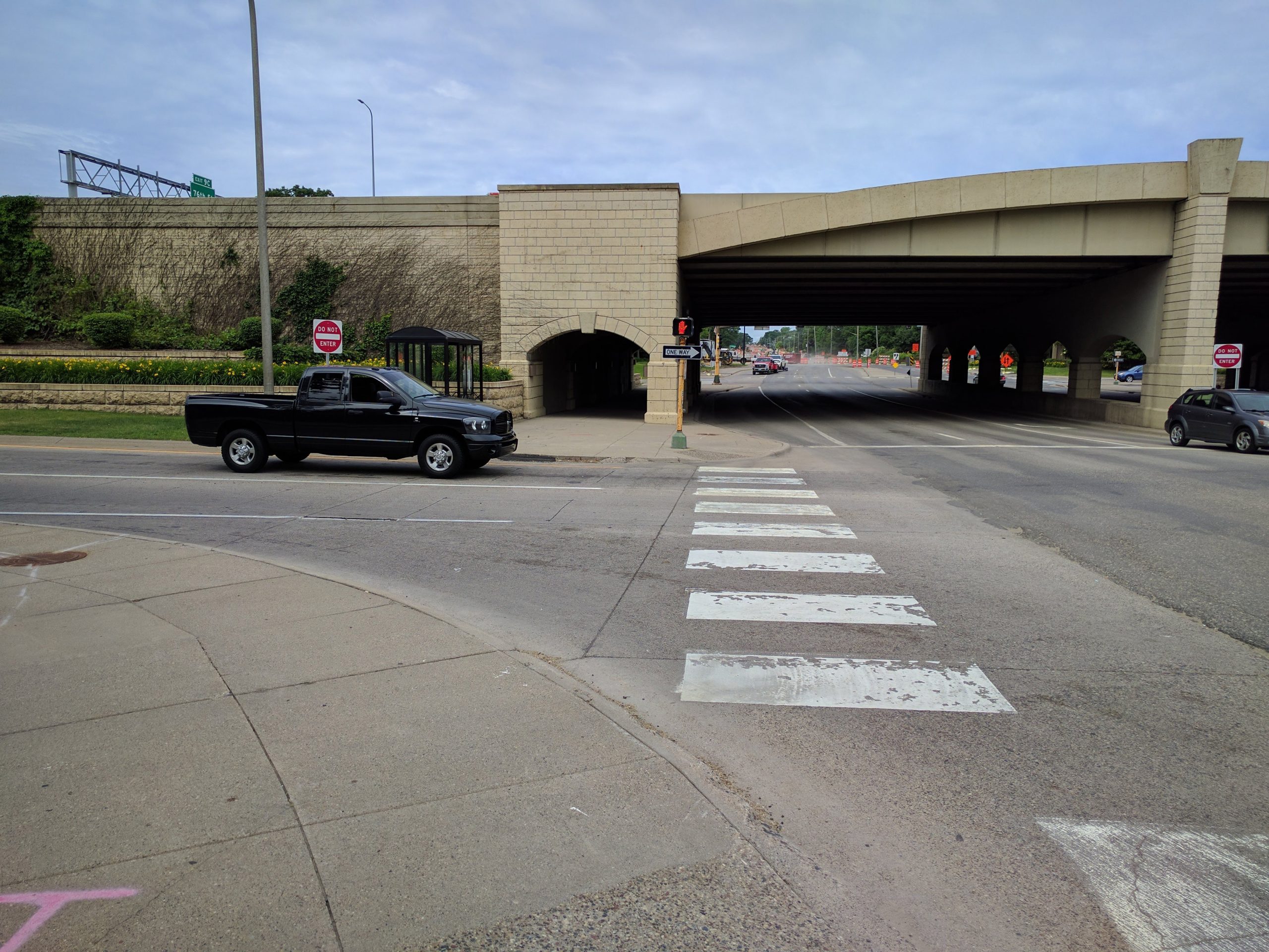
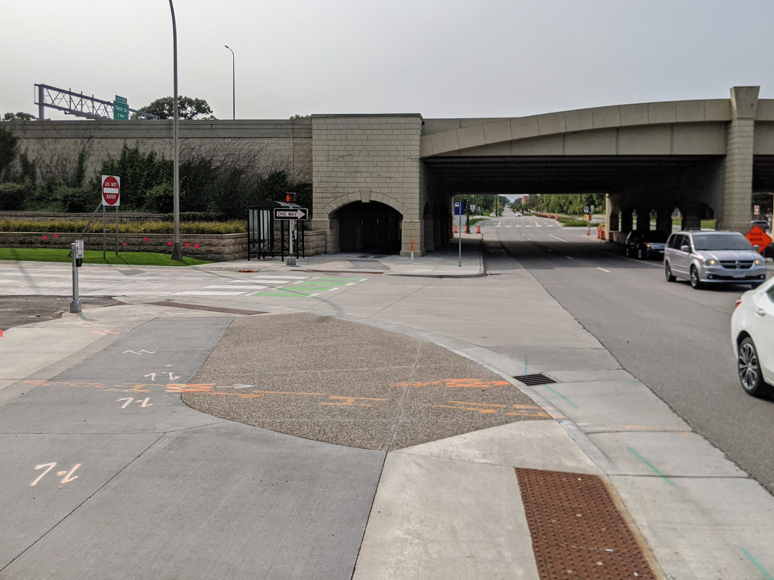
    66th & 35W: Under the bridge. The bridge was not rebuilt as part of this project, but the sidewalks were reconstructed to widen them and add the protected bike lane.

    West of 35W

    A divided 4/5 lane was used from 35W to Penn. In this section, 18 homes had to be removed to provide adequate right-of-way for the new street. This was by far the most controversial decision of the rebuild of 66th.

    West of Penn, because the road had already been widened in the 1980s, a compromise with the neighborhood agreed to contain the new street within the existing right-of-way.

    Unfortunately, the county prioritized maximizing car capacity over providing a dedicated bicycle facility in this section. As a result, the bicycle facility ends at Penn/Oliver Avenue. (West of Penn, the north side sidewalk is widened slightly from standard and serves as an 8′ sidepath to provide a limited off-street option for bikes.)

    I took my before pictures in 2017, and so I did not capture this section personally before construction began. Instead, I am providing Google Street View imagery of a few key locations.

    Google Street View imagery: 66th and James Ave S (2014 before reconstruction)Google Street View imagery: 66th and James Ave S (2023 after reconstruction)

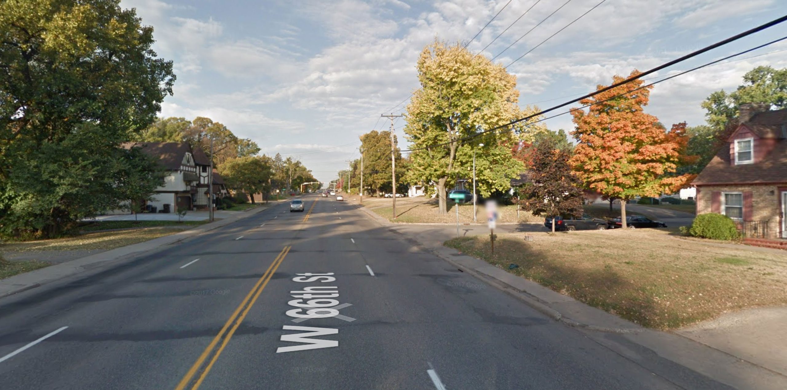
    66th and James Avenue in 2014 and 2023. Note the homes that were removed to the left, on the south side. One benefit at this particular intersection was providing much better access to Monroe Park, which was previously hidden behind the houses. Imagery: Google Street View.

    Google Street View imagery: 66th and Logan Ave S (2014 before reconstruction)Google Street View imagery: 66th and Logan Ave S (2023 after reconstruction)

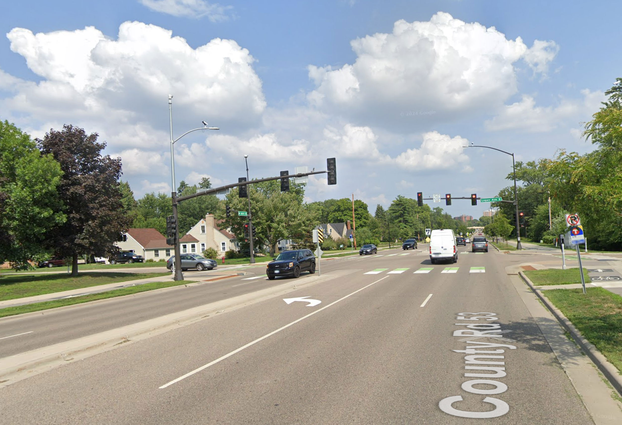
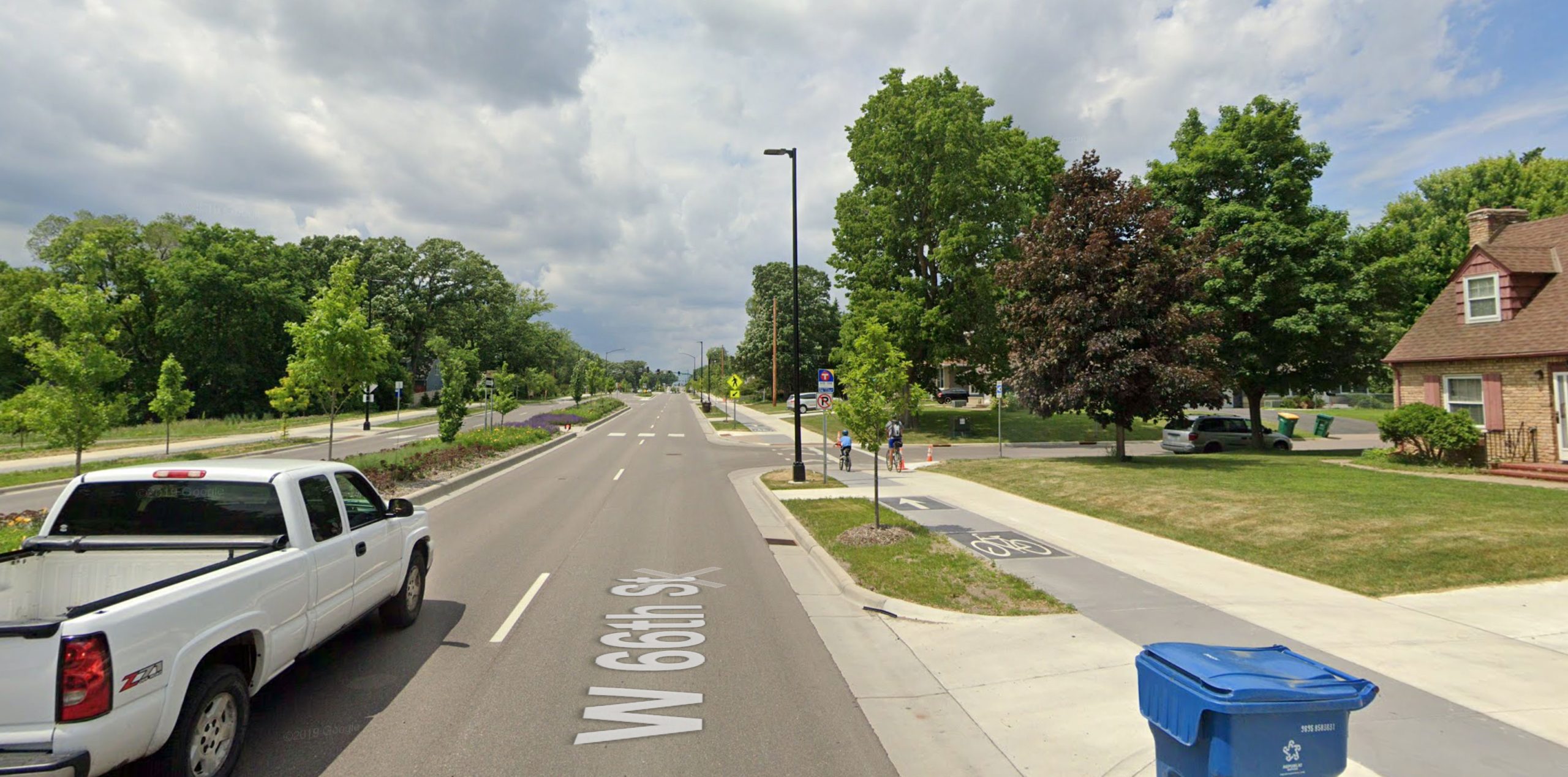
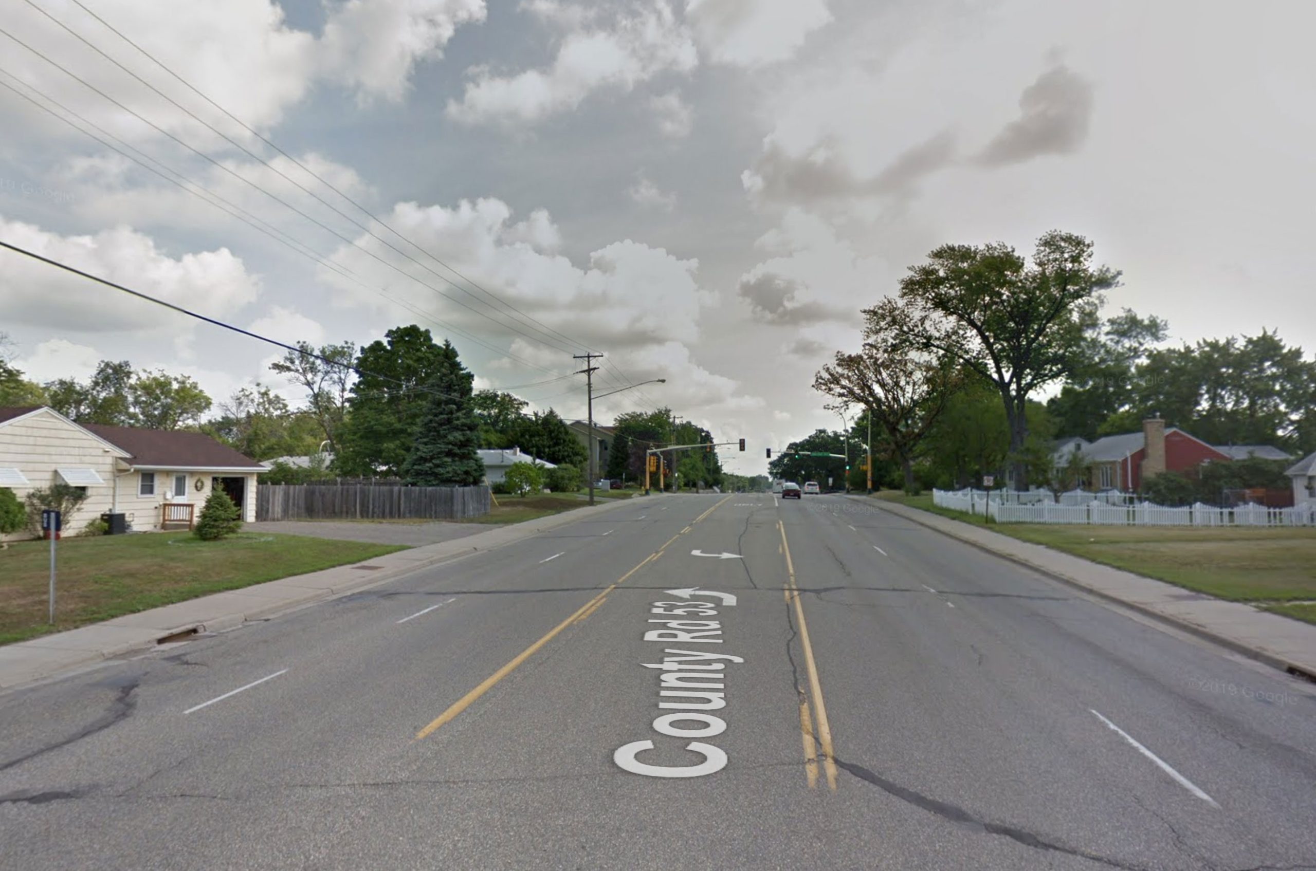
    66th and Logan Avenue in 2014 and 2023. Signals along 66th attempted to use the protected intersection concept, although in an effort to reduce right-of-way needs, the intended effect wasn’t really achieved. For example, bicycles aren’t detected going north-south here, so a cyclist must go over to the sidewalk and press the pedestrian push button anyway. Imagery: Google Street View.

    Google Street View imagery: 66th and Sheridan Ave S (2014 before reconstruction)Google Street View imagery: 66th and Sheridan Ave S (2023 after reconstruction)

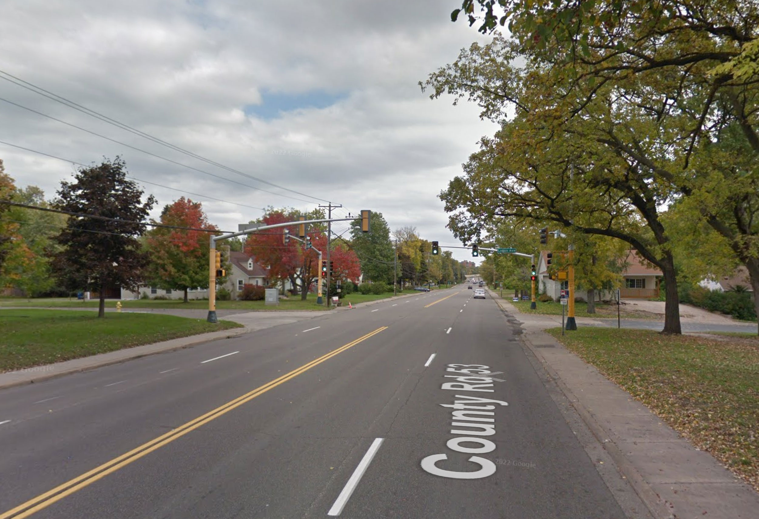
    66th and Sheridan Avenue in 2014 and 2023. This was the section where right-of-way was limited, and the county prioritized additional car capacity over continuing the bicycle facility. Still, a boulevard was added, as well as improved lighting. Imagery: Google Street View.

  • If We Want a Shift to Walking, We Need to Prioritize Dignity

    If We Want a Shift to Walking, We Need to Prioritize Dignity

    This article also appeared on Strong Towns.

    Have you ever had a friend return from a vacation and gush about how great it was to walk in the place they’d visited? “You can walk everywhere! To a café, to the store. It was amazing!” Immediately after saying that, your friend hops in their car and drives across the parking lot to the Starbucks to which they could easily have walked.

    Why does walking feel so intuitive when we’re in a city built before cars, yet as soon as we return home, walking feels like an unpleasant chore that immediately drives us into a car?

    A lot contributes to this dilemma, like the density of the city, or relative cheapness and convenience of driving. But there’s a bigger factor here: We don’t design the pedestrian experience for dignity.

    This is a national problem, but certainly one we can see throughout our own Twin Cities metro: Even where pedestrian facilities are built, brand-new, ADA-compliant and everything else — using them feels like a chore, or even stressful and unpleasant.

    Dignity is a really important concept in active transportation, but one that we often miss in the conversation about making streets better for walking and biking. I’ve been delighted to see the term appear on a social media account advocating for pedestrians. But as we plan and design better streets for active transportation, we need to consider the dignity of the pedestrian experience.

    A Hierarchy of Needs

    Three related concepts exist in designing great pedestrian spaces, and they can be arranged similarly to Maslow’s hierarchy of needs. The base of the pyramid is the most essential, but having a complete and delightful pedestrian experience requires all three layers. The layers are: compliance, safety and dignity.

    A pyramid showing a base layer of the word "Compliance", a middle layer showing "Safety", and a top layer showing "Dignity"

    Compliance: Often Not Enough

    Shady Oak Road in Hopkins and Minnetonka (Google Street View)
    Shady Oak Road in Hopkins is ADA-compliant, but crossing here could be unsafe for any user. Photo by Google Street View

    At the bottom of the pyramid you have compliance — for pedestrian facilities, that mainly means complying with ADA rules. This requirement is non-negotiable for agencies because failure to obey exposes them to legal challenges. The ADA has done a great deal to make pedestrian facilities better for all — certainly wheelchair users, but also those who walk, use strollers, ride bicycles on sidewalks, etc.

    Unfortunately, compliance with ADA rules alone often does not yield good pedestrian facilities.

    Map showing the crossing movement at Parklawn Ave & France Ave in Edina
    As part of an ADA upgrade project, Edina and Hennepin County removed the north leg crosswalk, requiring pedestrians to cross this busy intersection three times to proceed on the north-side sidewalk.

    For example, many agencies will simply remove pedestrian facilities to reduce the cost of compliance. A good example is the intersection of France and Parklawn avenues in Edina. If you were on the west side of France and wanted to walk to the Allina clinic in 2013, you could simply have crossed on the north crosswalk. But to improve ADA compliance, Edina removed the north crosswalk in 2014. Now, you would have to cross the busy signalized intersection three times just to continue on the north sidewalk.

    Showing location of removed pedestrian button in Edin
    The crosswalk at France and Parklawn, showing the rusted outline of the former pedestrian push button. Image: Google Street View

    In other cases, compliance is in good faith but not enough to make a pedestrian facility really usable — because complete compliance would entail a much larger project. This can be found when a broken-down sidewalk, or one with obstructions in the way, gets brand-new corner curb ramps but no other improvements. A wheelchair user can easily get up off the street at the corner, but can’t go farther than 10 feet without hitting another impediment.

    Safety: A Step Further, But What Is Still Lacking?

    In the middle of the pyramid you have safety — both perceived and actual. It is possible to create a facility that is compliant but does not seem very safe. Picture sparkling new curb ramps to cross a 45-mph surface street with no marked crosswalk. In other cases, facilities are well-designed and safe, but may still not be dignified.

    An example of this is in my own backyard, on Hennepin County’s Nicollet Avenue. A very-welcome project last year installed new crosswalks to popular Augsburg Park. These have durable crosswalk markings, excellent signage and refuge medians. But crossing still feels like a negotiation with drivers. And the overall sidewalk experience on the 1950s street is still lacking, with sidewalks at the back-of-curb and little to no shade.

    Dignity: Making Walking Feel Right

    Finally, we have dignity. To determine whether a facility is dignified, I propose a simple test:

    If you were driving past and saw a friend walking or rolling there, what would your first thought be:

    1. “Oh, no, Henry’s car must have broken down! I better offer him a ride.”

    2. “Oh, looks like Henry’s out for a walk! I should text him later.”

    This is a surprisingly good test. Picture seeing your friend on a leafy sidewalk versus walking along a 45 mph suburban arterial. What would you think intuitively?

    But to get more specific, these are the key factors in making a pedestrian experience dignified:

    • Shade and light
    • Convenience
    • Enclosure and proportions
    • Engagement

    Shade and Light

    A dignified facility needs consistent shade during hot summer months. At night, shadows should be minimal and the route should be clear. Especially when a tree canopy is present, this is best achieved with more individual fixtures installed lower to the ground and at a lower light output. However, a fairly consistent light level can be achieved even with basic cobraheads, as long as there are enough to light the corridor fully.

    A sidewalk with relatively little street lightingA well-lit crosswalk in Richfield

    The flowers are beautiful, but a dark street at night is less dignified than a well-lit one. Left is 70th Street near Garfield Avenue; right is Lyndale and 75th.

    Convenience

    Routes should be intuitive, easy, and not feel tedious to navigate. Having to make sharp, 90° turns or go out of your way feel awkward and make you feel like your time and effort is wasted — even if the detour is relatively minor.

    Enclosure and Proportions

    Shady Oak Road in Hopkins, showing a sidewalk exposed on both sides.8th Avenue in Hopkins, showing a clear street wall on left

    Compare these two streets in Hopkins: Shady Oak Road, which is wide open with sense of enclosure, and Eighth Avenue, which is better-proportioned with a clear street wall.

    It’s a very uncomfortable experience to walk along a wide-open corridor with no walls or edge definition — and it’s a common experience along suburban arterials, where you may have a wide road on one side and a wide-open parking lot on the other. You feel exposed and vulnerable. At the same time, overgrown sidewalks or ones that encroach on pedestrian space can feel claustrophobic and inconvenient. The right balance is needed.

    Engagement

    Blank frontage showing privacy fences in bad repair
    This sidewalk in Brooklyn Park has only the frontage of dilapidated privacy fences.

    Finally, engaging frontage is always more appealing than blank frontage. The extreme of this principle is obvious: Walking down a traditional main street is more pleasurable than walking through an industrial park. But even where land uses are similar, engagement of frontage can vary a lot: picture the difference between walking past front doors of houses in a traditional neighborhood, and walking past privacy fences and back yards in cul-de-sac suburban neighborhoods. The traditional neighborhood is more interesting and engaging to walk through.

    When I was visiting downtown Northfield, I noted a new building along Water Street (MN-3), which had similar materials to the older downtown buildings on Division: windows, brick, [cultured] stone base. Yet the back was turned to the street, and the experience walking past was undignified.

    A building with attractive materials but blank frontage, with a man taking a selfie in foreground.Downtown Northfield, Minn, showing active street frontage

    Consider the visual interest of these buildings in downtown Northfield. On the left, walking past tinted windows and blank walls on a new building along a concurrent section of Water St and Highway 3 on the west side of downtown. On the right, Division Street’s engaging storefronts.

    A Pedestrian Cannot Live on Compliance Alone

    Creating compliant sidewalks and trails is a high priority for agencies seeking to avoid litigation and serve pedestrians on the most basic level. Although that has some benefits, it isn’t enough. Whether actively undermining walkability (like removing crosswalks to achieve ADA compliance) to simply not doing enough (adding a new curb ramp to an otherwise wheelchair-hostile sidewalk), we need to go much further.

    To make walking and rolling a desirable, everyday activity, we need facilities that are compliant, safe and dignified. We have many examples in our communities of great pedestrian ways — but we have a long way to go to make it universal, and truly move the needle toward walking.

  • For Lyndale, The Time is Now

    For Lyndale, The Time is Now

    Last night, I attended a listening session for Lyndale Avenue in Minneapolis, focused on the serious safety issues between Lake Street and Franklin Avenue. The event was organized by the county commissioner for the area, Marion Greene. Dozens of neighbors spoke about their experiences walking, driving, and biking on Lyndale.

    Neighbors fill a community meeting to discuss Lyndale Avenue

    The neighbors covered a lot of issues: cars don’t stop, particularly at uncontrolled intersections (25th, 27th, 29th). Even at signals, driver behavior puts people walking at risk — one man was seriously injured after a crash at a light this past summer. Two others talked about the wearing emotional aspects of dealing with drivers harassing and threatening them for simply crossing the street.

    Carla Steuve After about an hour of testimony from residents, county engineer Carla Stueve gave some initial responses. Although she offered some welcome suggestions (bumpouts using plastic flex post delineators, turn restrictions), she immediately discounted the most significant tool that could improve Lyndale in the near term: a 4-to-3 conversion. This, she said, could only be done under a reconstruction but the county would “consider” this feedback at that time.

    This is unacceptable.

    Turning A Ship

    People who attended the meeting were clearly hoping for something better than “considering” feedback at a distant, undefined date. Although Commissioner Marion Greene was clearly sympathetic to the need for action, she defended a slow process as necessary given the structure and practices of the county. This, she said, was like turning a ship — and must happen slowly.

    Earlier in the same meeting, engineer Stueve noted that the street was constructed in 1954. From what I can tell, there have been no striping changes since that time. To me this demonstrated that the ship metaphor misses a key point: the nimbleness of the county isn’t the problem. The fact that the ship has been heading in the wrong direction on this street for 65 years is the problem. While the slow-turning ship may reflect past inaction on the street, it is not inevitable and should not confine a future vision for what this street can be.

    Precedent for immediate action

    Hennepin County is no stranger to 4-to-3 conversions. In fact, they created a handy map of 4-to-3s done on county roads:

    A map of 3-lane conversions in Hennepin County
    A map of 3-lane conversions in Hennepin County.

    The vast majority of these conversions were done with mill-and-overlay projects, where the top layer of road surface is replaced (much more quickly and cheaply than reconstructing). If the pavement were in good shape, they could simply grind out the old striping or seal coat over it and restripe without an overlay.

    Restriping now is the right answer for Lyndale

    Restriping Lyndale prior to a reconstruction would provide an immediate safety benefit, but it would also answer help key questions. We have seen this work in Richfield. In 2010, Hennepin County did an overlay and restripe of Portland Avenue — just five years before it would be fully reconstructed.

    Portland Avenue in 2010, just after initial restripe
    Portland Avenue in 2010, just after initial restripe

    In addition to providing improvements sooner, it also helped guide the final redesign. For example: speeds were more consistent after the conversion, but still too fast, so they narrowed the lanes on the final restripe. Pedestrians still had difficulty crossing, so a marked crosswalk with a refuge island was included on every block. Shoulders provided a welcome option for bicycling on Portland, but families still didn’t feel safe biking with 35 mph traffic, so a mixed-use path was included in the reconstruct.

    Portland Avenue after a reconstruction
    Portland Avenue after a reconstruction. Image: MnDOT and City of Richfield

    Had we not done a “temporary” restripe, we would never have learned those things, and our reconstructed street would be less effective.

    Lyndale would be the highest-volume 4-to-3 conversion Hennepin County has ever done. It’s no surprise that makes engineers more wary. But the precedent-setting nature of it is exactly why the County should act now, doing a 2020 test restripe and seeing actual results for people driving and walking alike.

    Among those key questions that I think need to be answered are:

    1. How does traffic respond to reduced capacity? Does some traffic shift to other streets?
    2. How do signals perform in real-life conditions?
    3. How are bus speeds impacted?
    4. Are there any new specific safety issues created (e.g., passing on shoulder, aggressive turns off side streets)

    I am not certain that a 3-lane layout will work for Lyndale. However, there a lot of variables to human behavior and I think these questions can best be answered in a real-life test of a 3-lane roadway. This would mirror Ramsey County’s highly successful effort on Maryland Avenue.

    Restripe Lyndale as soon as the pavement is above freezing. Collect data throughout the summer, and decide whether to put it back (and prioritize reconstruction) or leave it in fall 2020. The time is now.

    Lyndale at 25th

  • Completing Richfield’s Streets

    Completing Richfield’s Streets

    The City of Richfield has all the bones of a good place to walk. It has higher density than any other major suburb. It has a nearly intact urban grid. It has better transit service than any other suburb, and in some regards, better than most of South Minneapolis. But as almost anyone who has walked in Richfield knows, it certainly doesn’t always feel like a good place to walk. Sidewalks on major streets are disheveled and unbuffered, and there are virtually no sidewalks to be found on residential streets.

    The story behind this is a typical for a municipality caught between urban and suburban: Richfield expanded rapidly after World War II. There was not time nor money to build full streets at the time — the roads were mostly unpaved, and certainly had no curbing or sidewalks. In the 1970s, the City of Richfield embarked on an ambitious campaign, called “Richfield Permanent Streets,” in which almost all of today’s streets were built. Despite being relatively integrated with Minneapolis, the 1970s Richfield went for the same design that was being popularized in newer suburbs at the time: broad streets, and sidewalks only where there was a high volume of traffic.

    And that’s where we’ve been ever since. The 1970s was not all that long ago, and thanks to shade, low traffic, and routine maintenance, the streets haven’t even been repaved since. That initial lifecycle of those streets seems to be coming to a close, as the Public Works and Engineering departments now want to pursue a $20 million plan to mill-and-overlay all of Richfield’s residential streets. This is being wrapped into a larger campaign — “Better Roads, Better Richfield” — to promote both the mill-and-overlay project, as well as full reconstructions of Portland Avenue and 66th Street.

    I applaud Richfield for taking good care of their streets for four decades, and I don’t oppose spending the $20 million to repave them. But when we’re talking about “Better Roads, Better Richfield,” shouldn’t those roads be better for everyone?

    There is no doubt that Richfield’s 100 miles of sidewalk-less streets are leaving people out in the cold. As of the 2010 census, more than half of Richfield households have one car or no car at all — that’s more vehicle ownership than Minneapolis as a whole, but notably less car ownership than the Minneapolis zip codes immediately to the north. And simply looking at cars per household doesn’t begin to address those too young or too old to drive. In 2009, Richfield conducted a Safe Routes to School Study, and found that 64 of the 65 parents surveyed — 98% — felt that continuous sidewalks were “somewhat important” or “very important” in their decision to let their child walk to school or not.

    So why is Richfield in the situation that it’s in? As far as I’ve been able to tell, it’s simply inertia. I have talked to dozens of Richfielders, and I hear the same thing every time: “well I don’t really have a problem with sidewalks, but other people are really not going to like that.” I have no doubt that these feared sidewalk curmudgeons do exist, but they may not be nearly as pervasive as we might think.

    Yet this mill-and-overlay project is a unique opportunity for Richfield, easily the largest public works project since the original street construction in the 1970s. It will involve a $20 million bill being passed to the citizens. It involves extensive public outreach. And it will affect nearly every street in town.

    So my proposal is simple: we can’t completely undo a bad decision made 40 years ago, but we can make it much better for a fair cost. I want to see a sidewalk on at least one side of every residential street in Richfield. City staff have been receptive to the idea, and have assisted in rough cost estimates: the general ballpark is that it will cost $10 million to build the 100 miles of sidewalk that this would require. Sidewalks on both sides of the street would cost about double, $20 million. The idea of including sidewalks was first discussed with the Transportation Commission (a board to which I am a bike-ped liaison) last week. While it was not a ringing endorsement, the Commission did direct staff to continue to examine the viability of such a project, and begin to broach the subject with the City Council. Believe it or not, that may be the biggest progress toward sidewalks in Richfield in four decades.

    Creating a network of sidewalks on every street in Richfield will be an opportunity for us to attract more young homeowners and families. It would be an opportunity to be a leader in the first ring for pedestrian safety and walkability (as we already have for bicycling). And most important of all: it would be an opportunity to make walking safer and more comfortable in Richfield.