Category: Bicycling

  • Views before and after: building a 66th Street for All

    Views before and after: building a 66th Street for All

    Note: this is from my personal perspective as a Richfielder and a supporter of the new 66th. It is not City of Richfield communication.

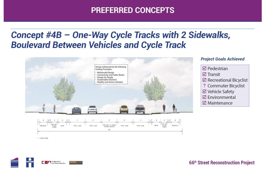
    From 2016 to 2018, Richfield and Hennepin County rebuilt 66th Street, Richfield’s main street. The project was the most ambitious rebuild of an arterial Richfield had ever undertaken, and set precedent for the region — the first example of an extensive use of a sidewalk-level, one-way protected bikeway.

    This design has been used in other cities since, and a similar design was selected for the 2026 rebuild of Nicollet Avenue in Richfield.

    The project rebuilt 66th from Xerxes Avenue to 16th Avenue (near Cedar). Unfortunately, a small gap area around Portland Avenue was omitted from the project, creating a discontinuity for cyclists and pedestrians.

    Before and after the rebuild, I took dozens of pictures of the conditions of the street, which I’m sharing now for easy comparison.
    Before and After

    16th Avenue to Nicollet Avenue

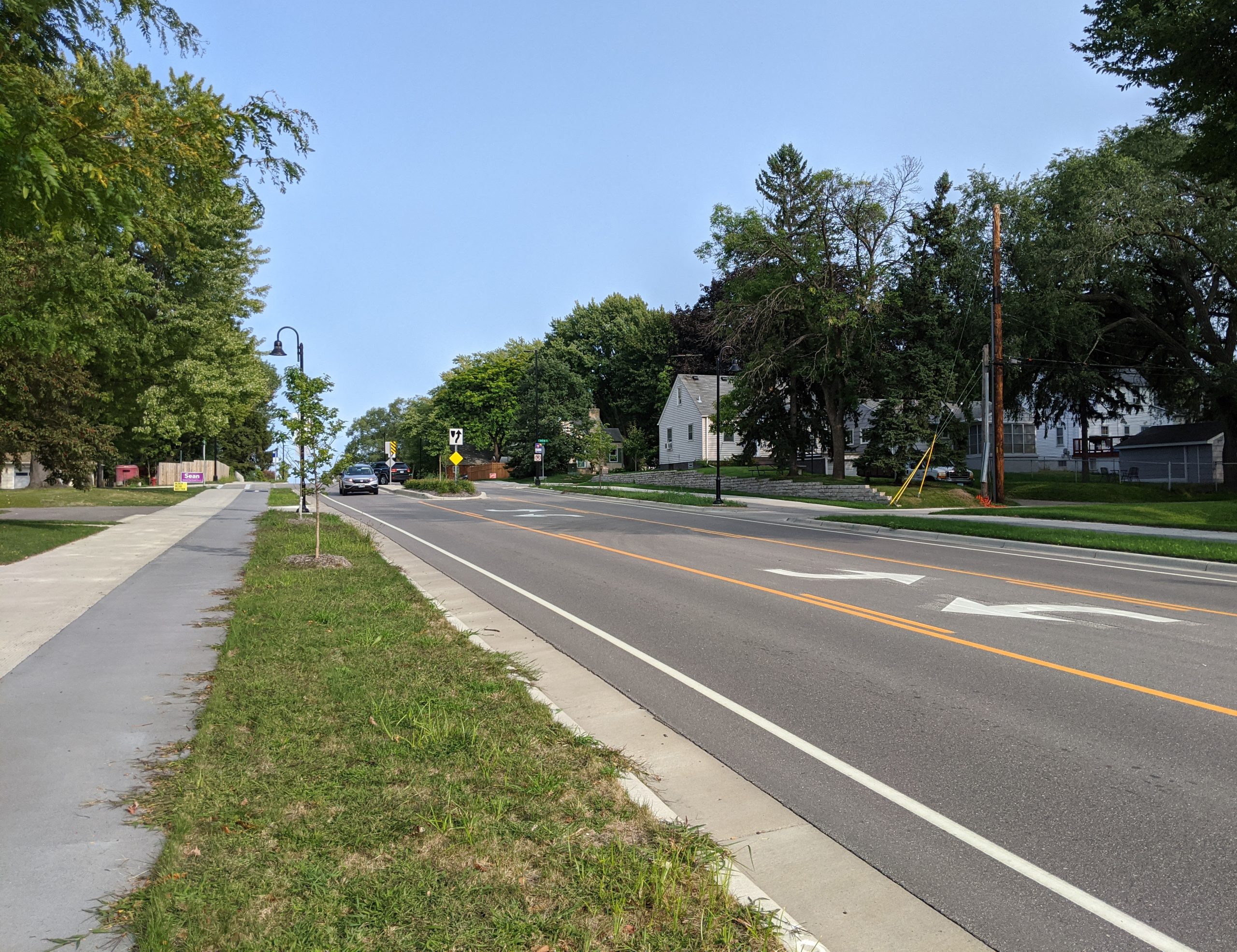
    East of Nicollet Avenue, a 2/3-lane design was used. Medians were prioritized in the area of Veterans Park and the neighborhood to the west.

    This area previously had a lot of unimproved right-of-way, which was better-utilized after the rebuild. Some additional right-of-way was also acquired.
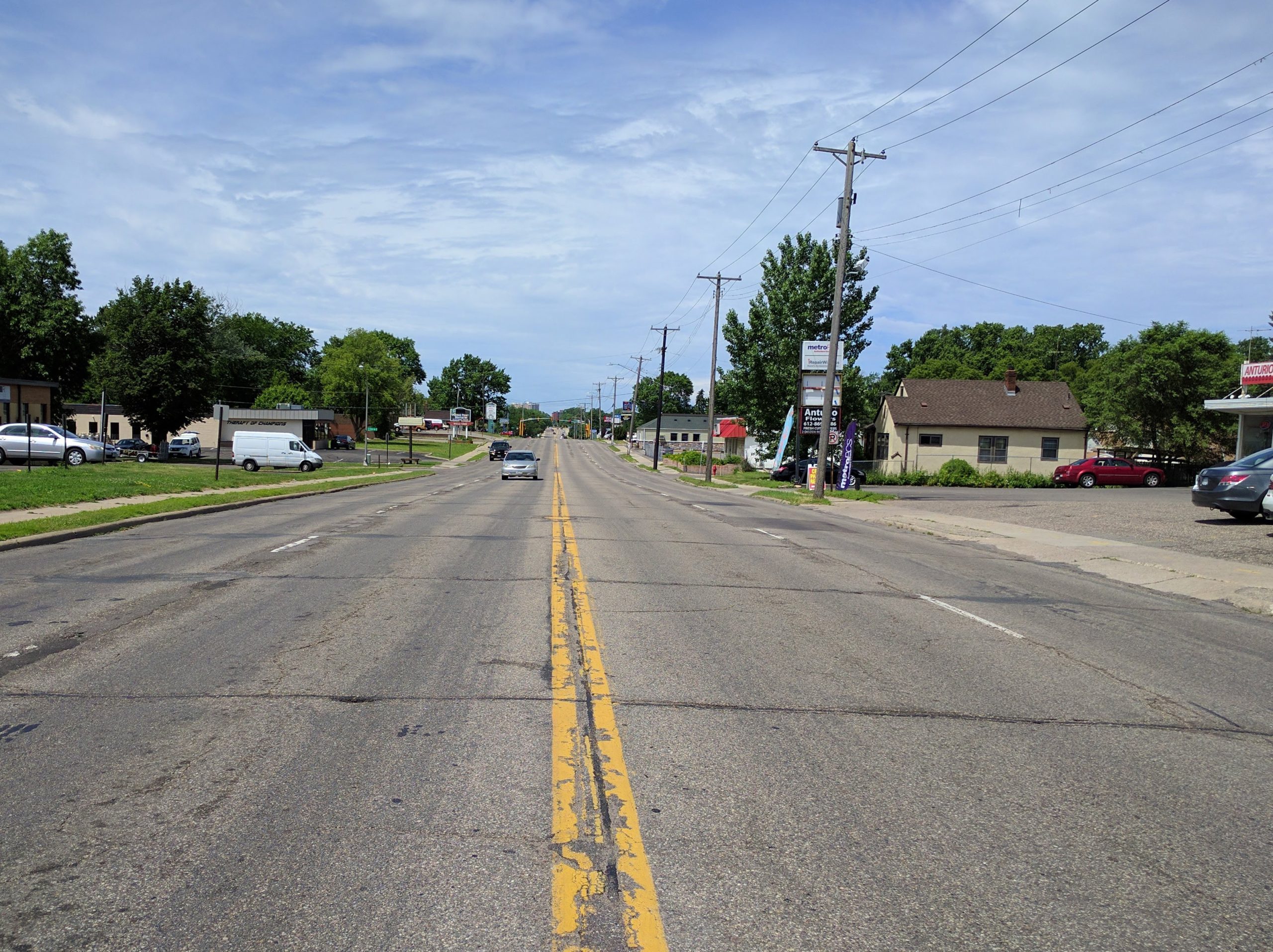
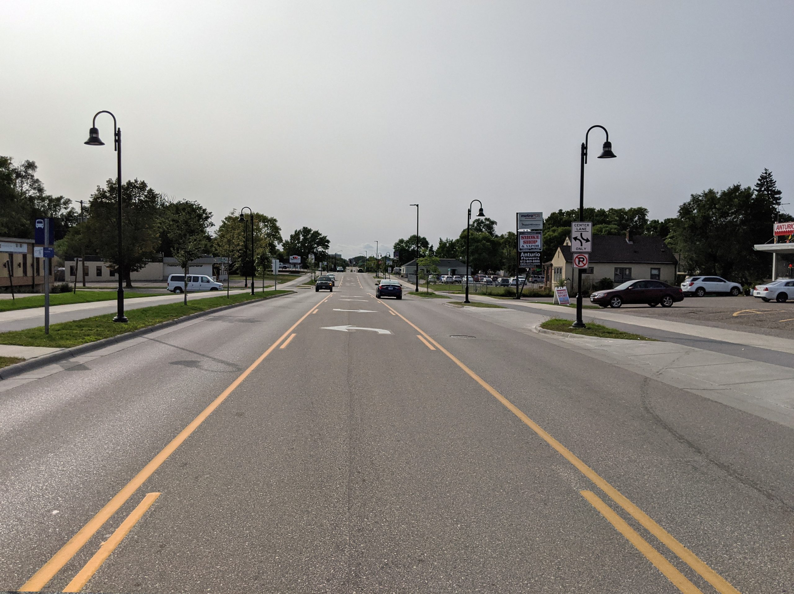
    66th St & 15th Avenue: looking west (2017, before reconstruction)66th St & 15th Avenue: looking west (2021, after reconstruction)

    66th Street and 15th Ave: Looking west from the center line.
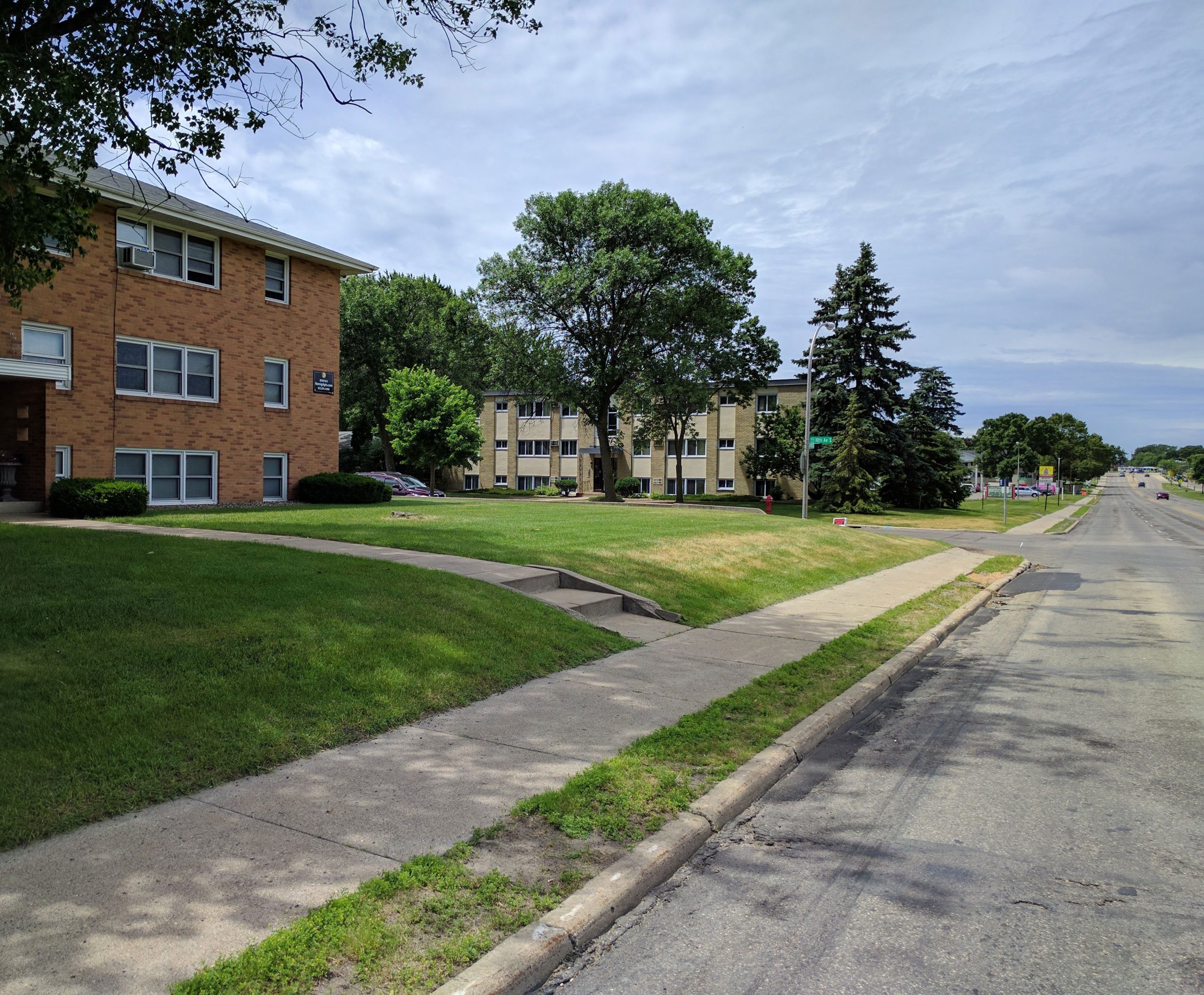
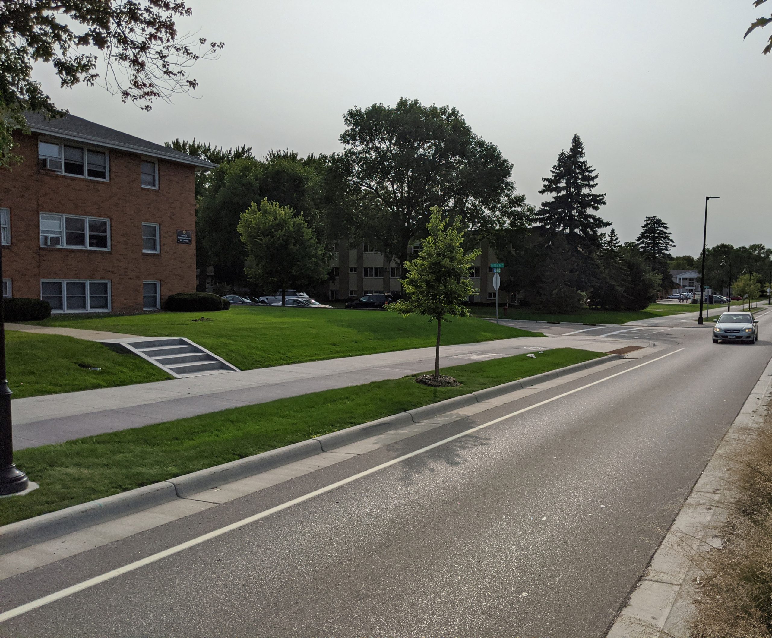
    66th and 10th Ave S (2017 before reconstruction)66th and 10th Ave S (2020 after reconstruction)

    66th Street and 10th Ave: Looking west
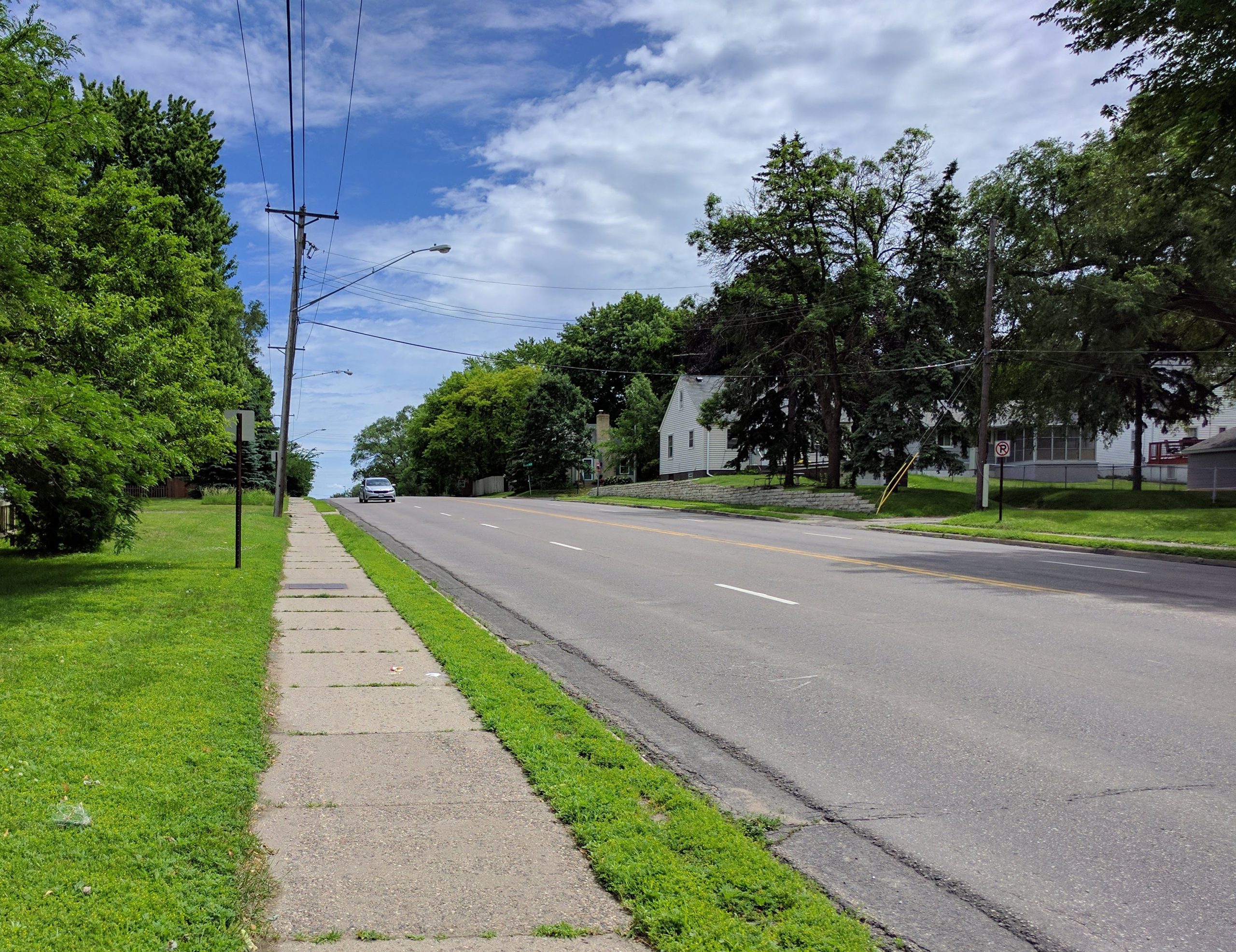
    66th and 3rd Ave (2017, before reconstruction)66th and 3rd Ave (2020, after reconstruction)

    66th Street and 3rd Ave S, as seen from the sidewalk. Utility lines running along 66th were buried as part of the project.
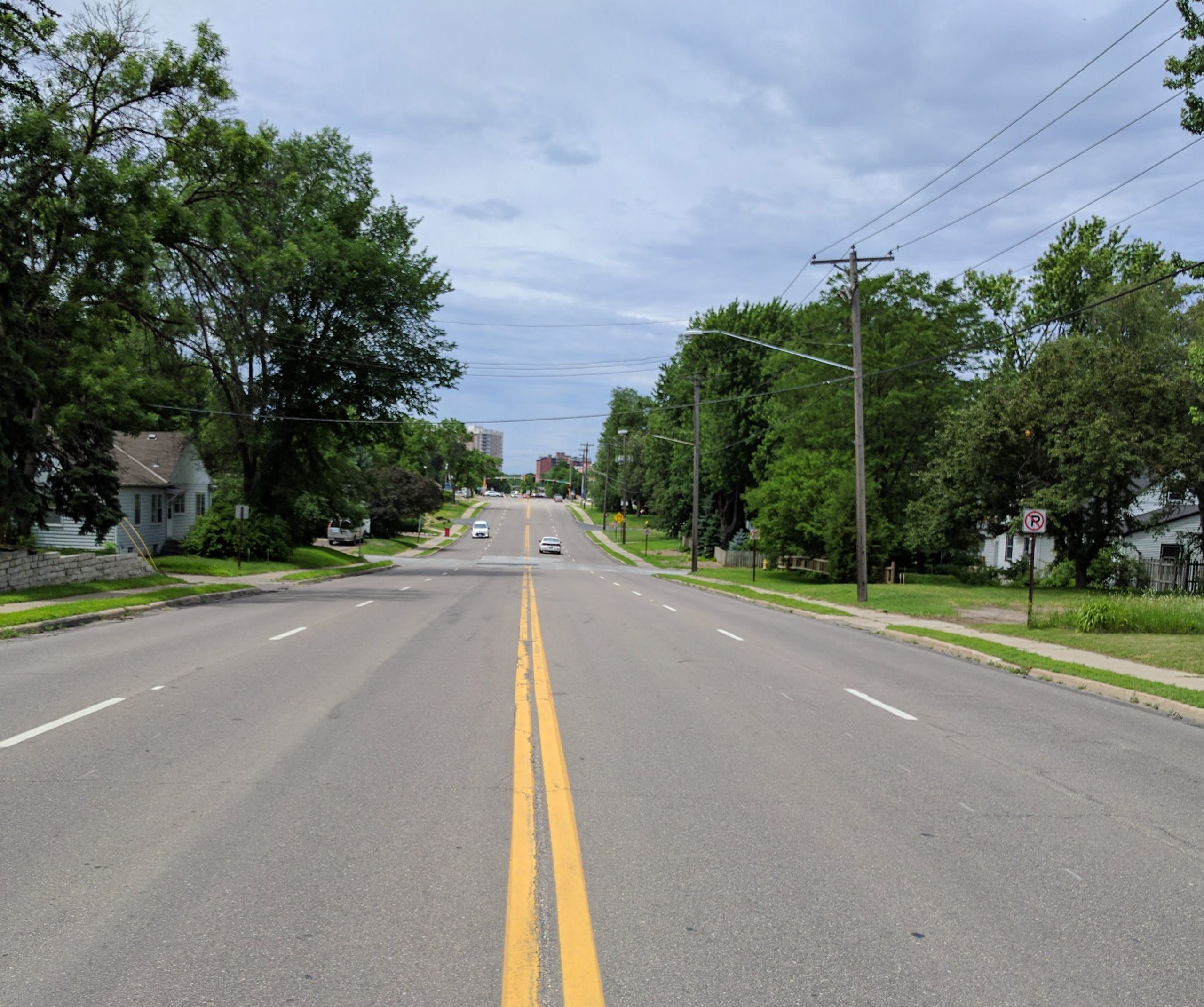
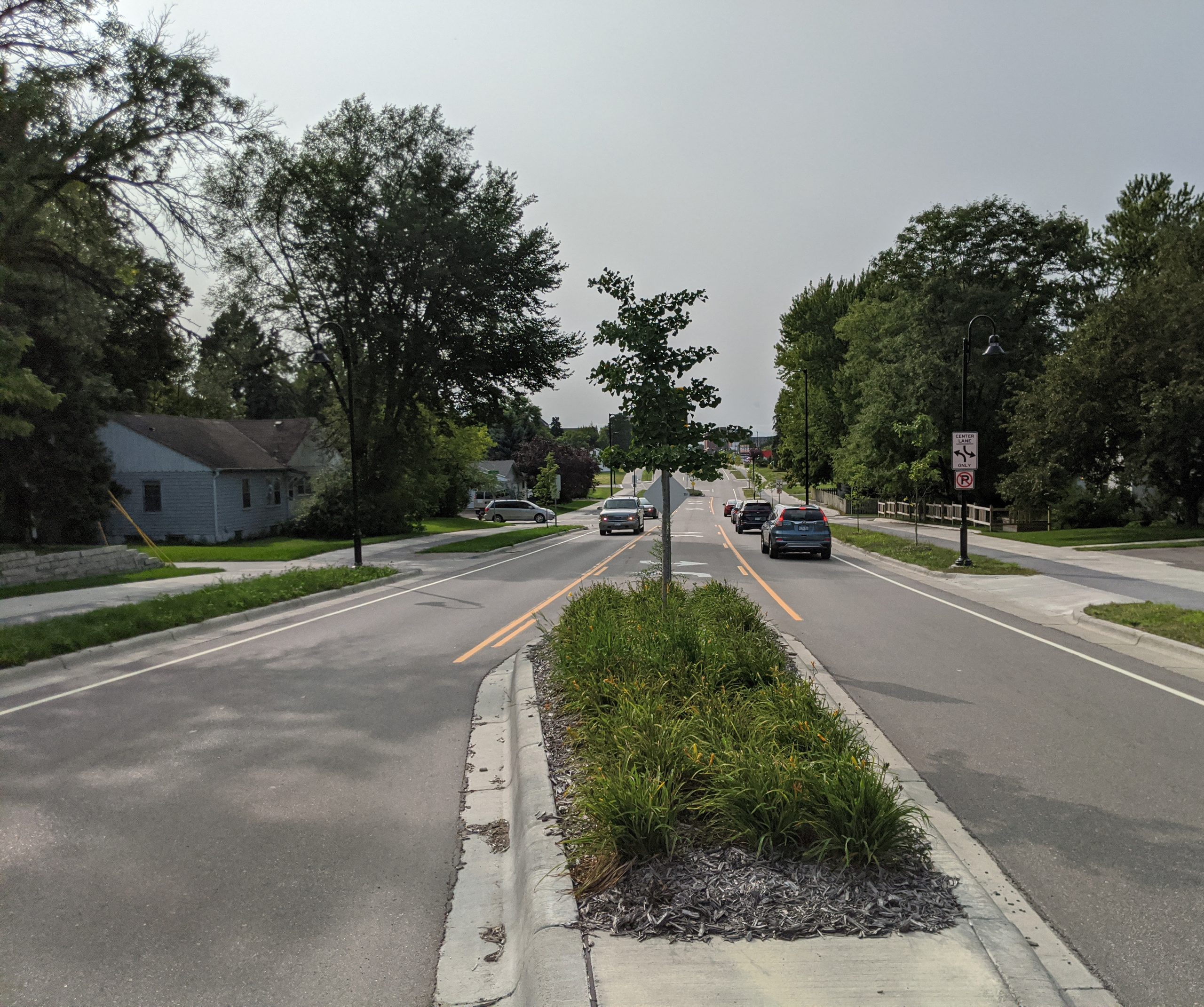
    66th and 2nd Ave as seen from centerline (2017, before reconstruction)66th and 2nd Ave as seen from centerline (2020, after reconstruction)

    66th Street and 2nd Ave S, as seen from the center line. A mix of center turn lanes and medians were used in this section.
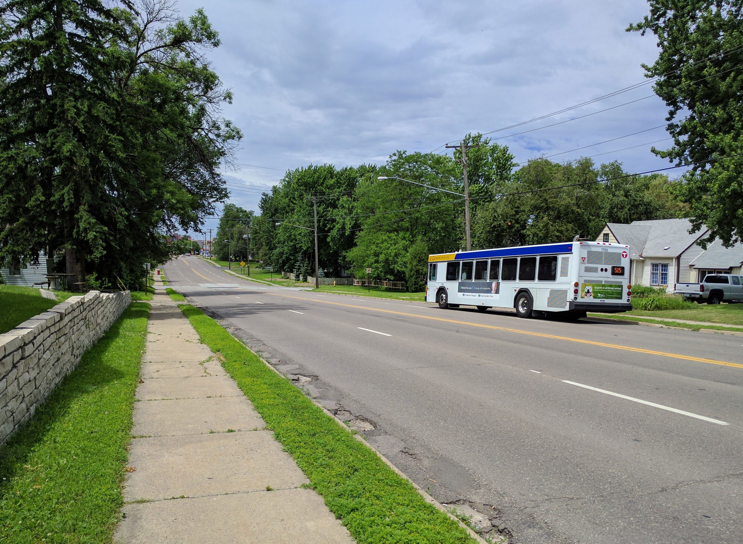
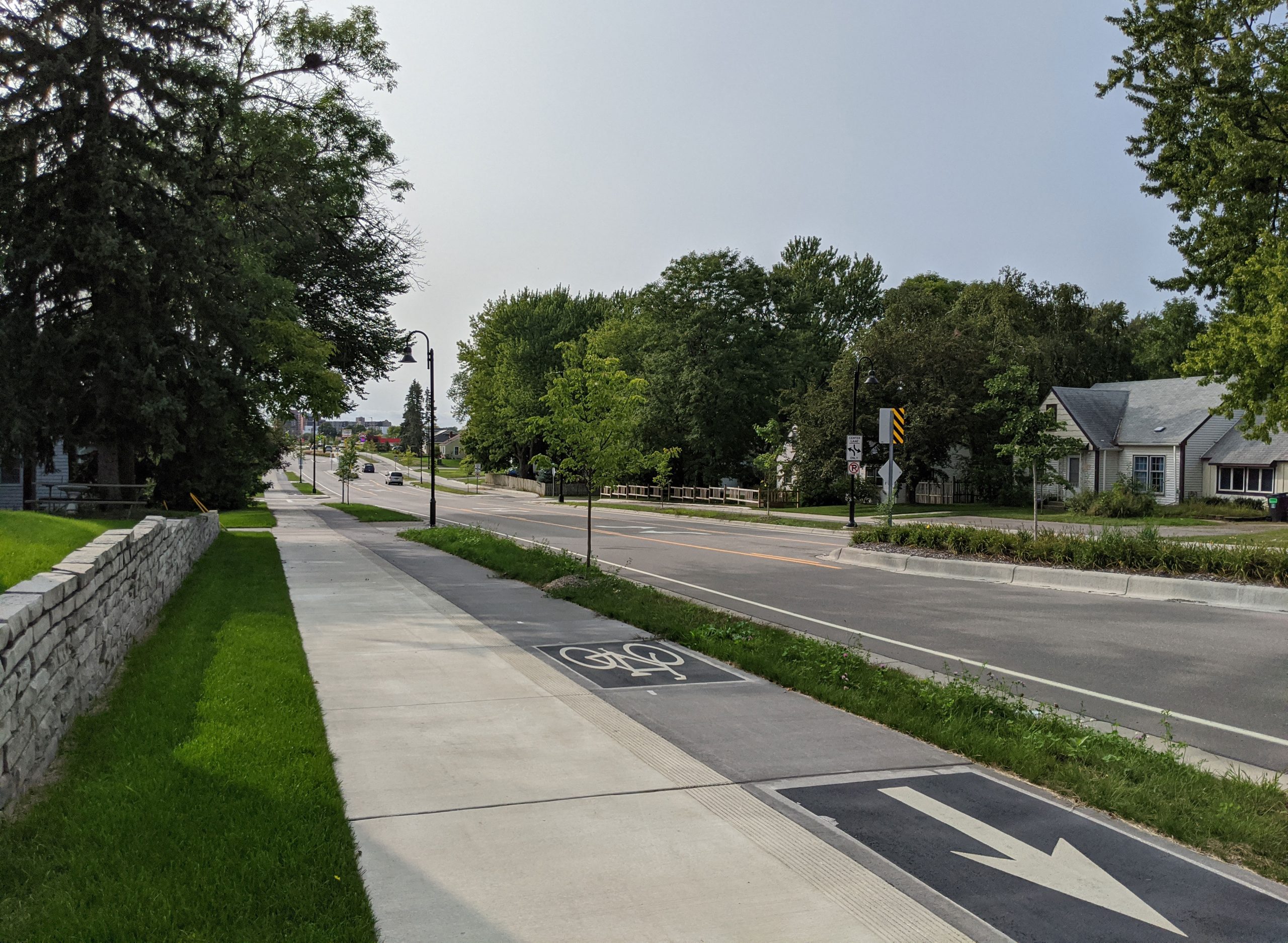
    66th and 2nd Ave as seen from sidewalk (2017, before reconstruction)66th and 2nd Ave as seen from sidewalk (2020, after reconstruction)

    66th Street and 2nd Ave S, as seen from the sidewalk. The center line shifted north to use previously unimproved right-of-way.
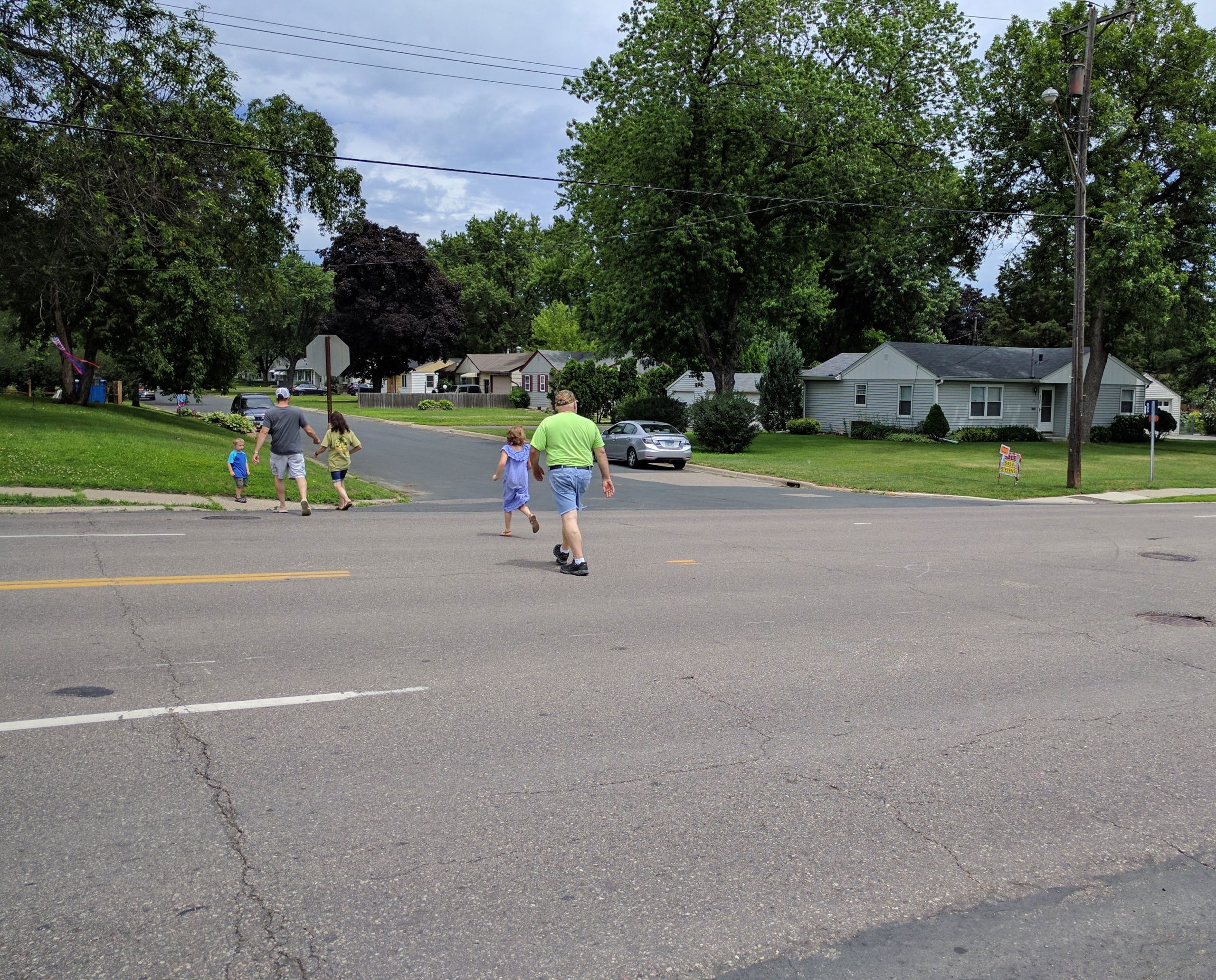
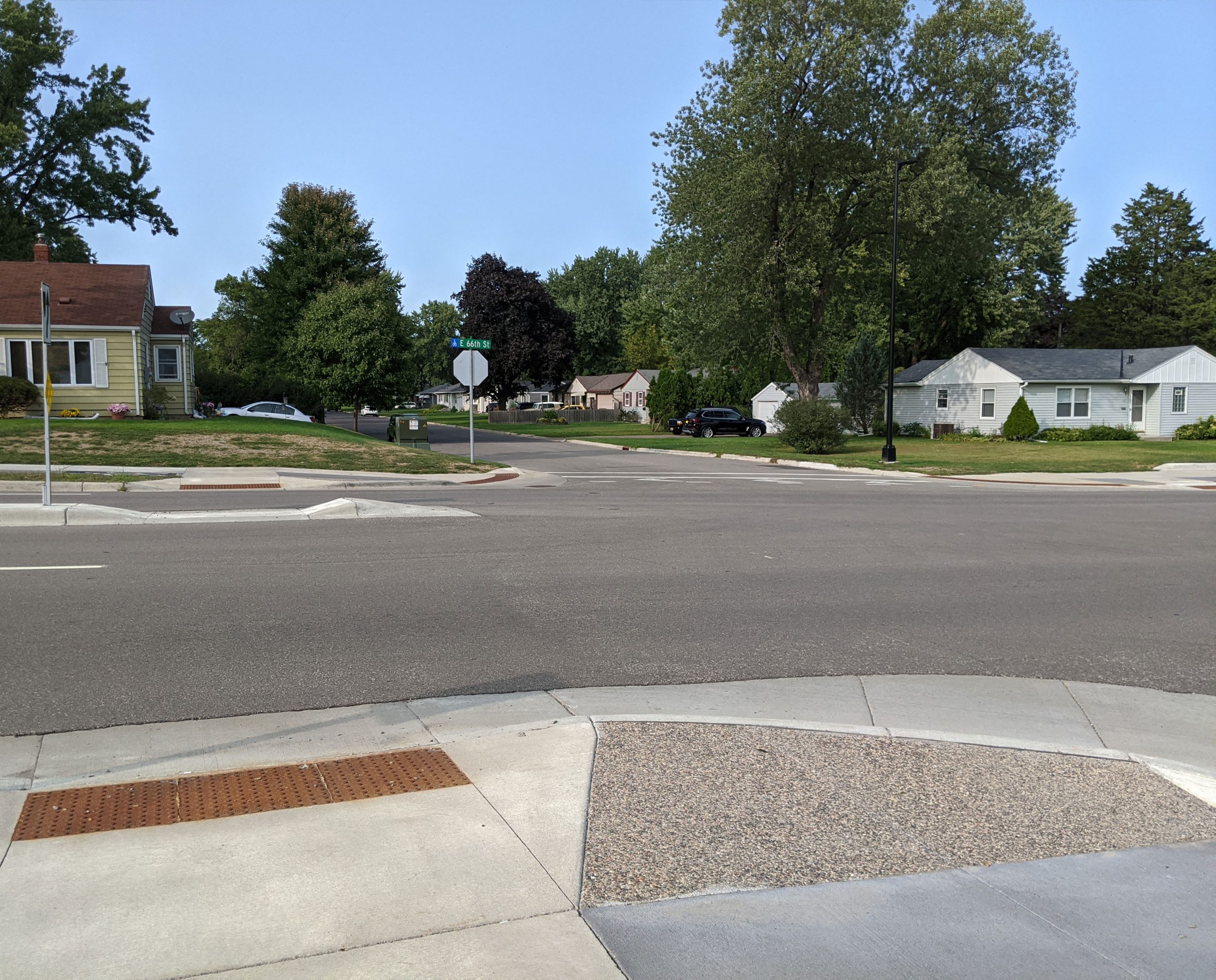
    Pedestrians crossing at 66th and Stevens Ave (2017, before reconstruction)66th and Stevens Ave (2020, after reconstruction)

    66th Street and Stevens Avenue. Although crossing conditions have improved, this intersection like most lacks marked crosswalks.
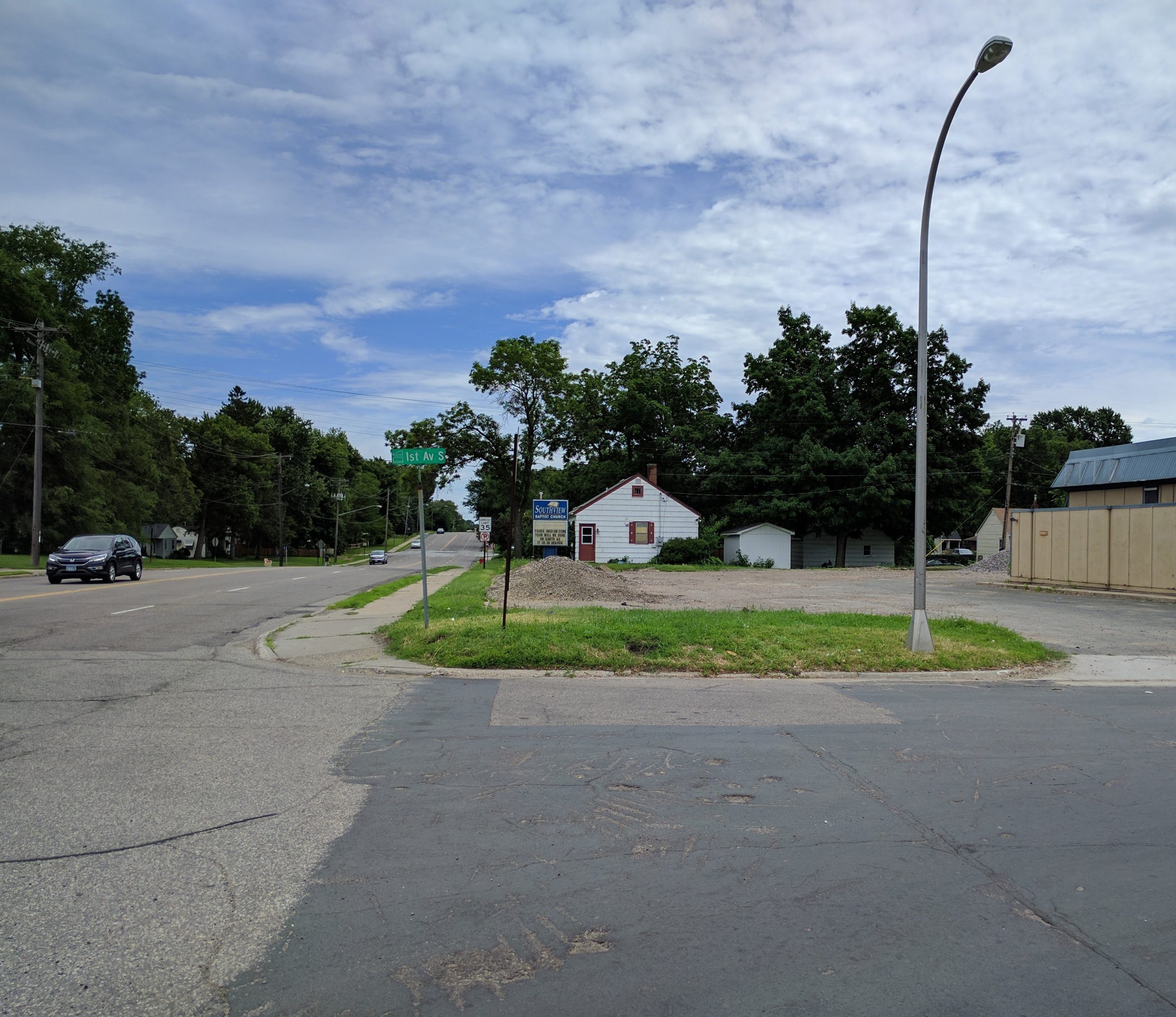
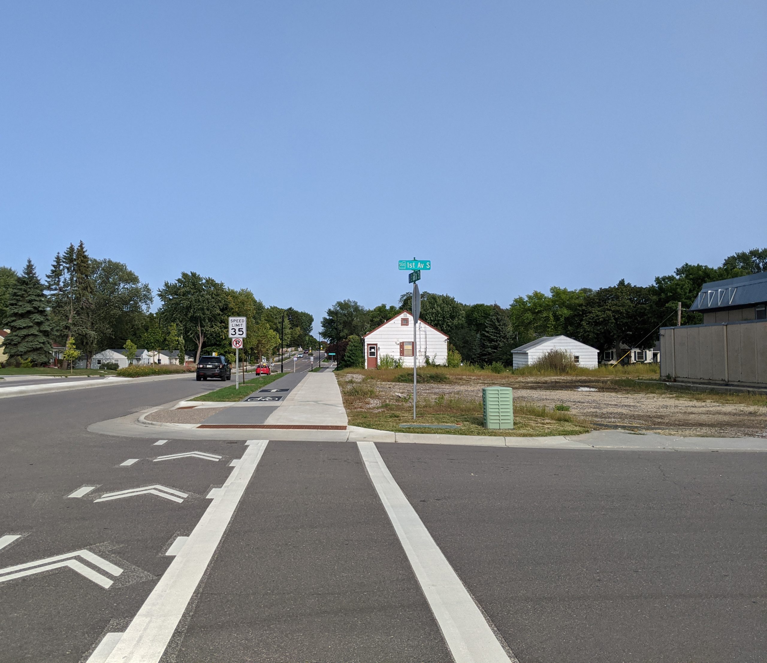
    66th and 1st Ave S (2017, before reconstruction)66th and 1st Ave S (2020 after reconstruction)

    66th Street and 1st Ave

    Downtown Richfield — Nicollet Avenue to I-35W

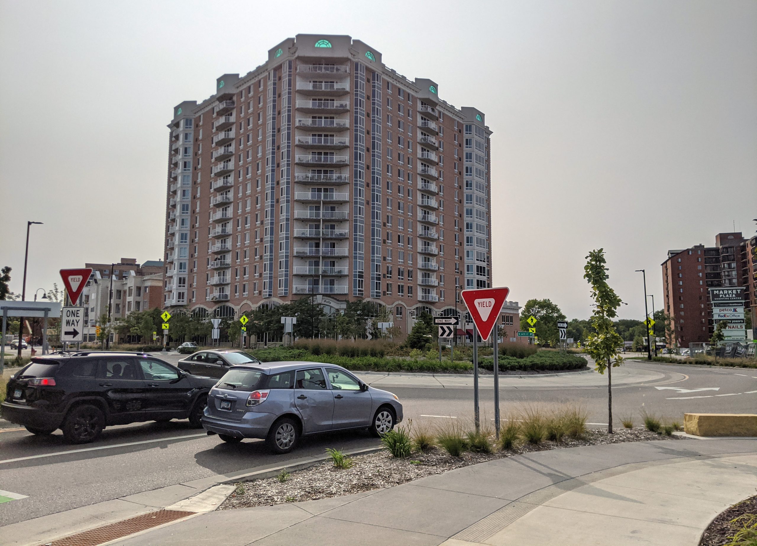
    West of Nicollet Avenue, a divided 4/5-lane design was used. Note the significant change at Nicollet and Lyndale, where signals were replaced with roundabouts.
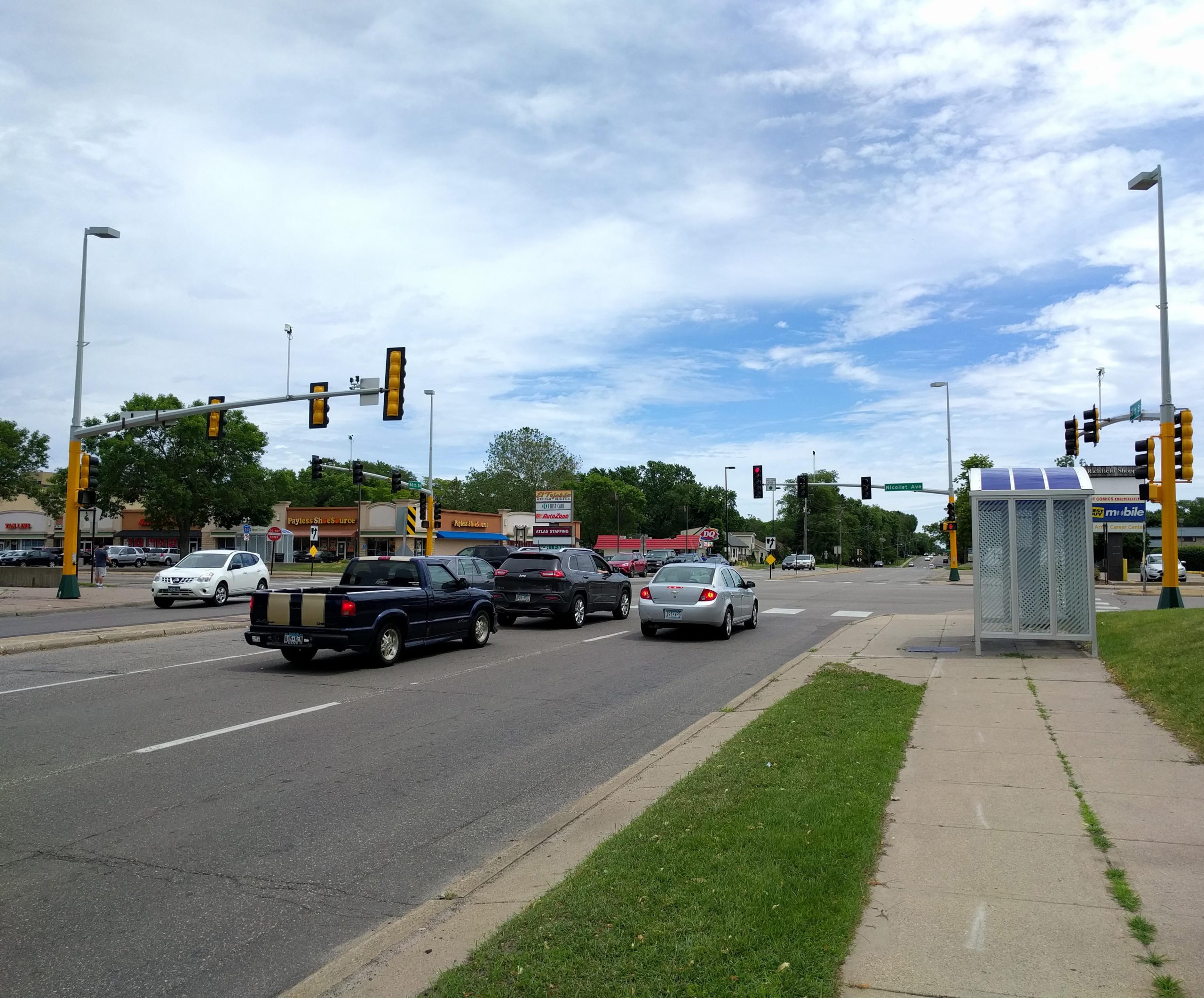
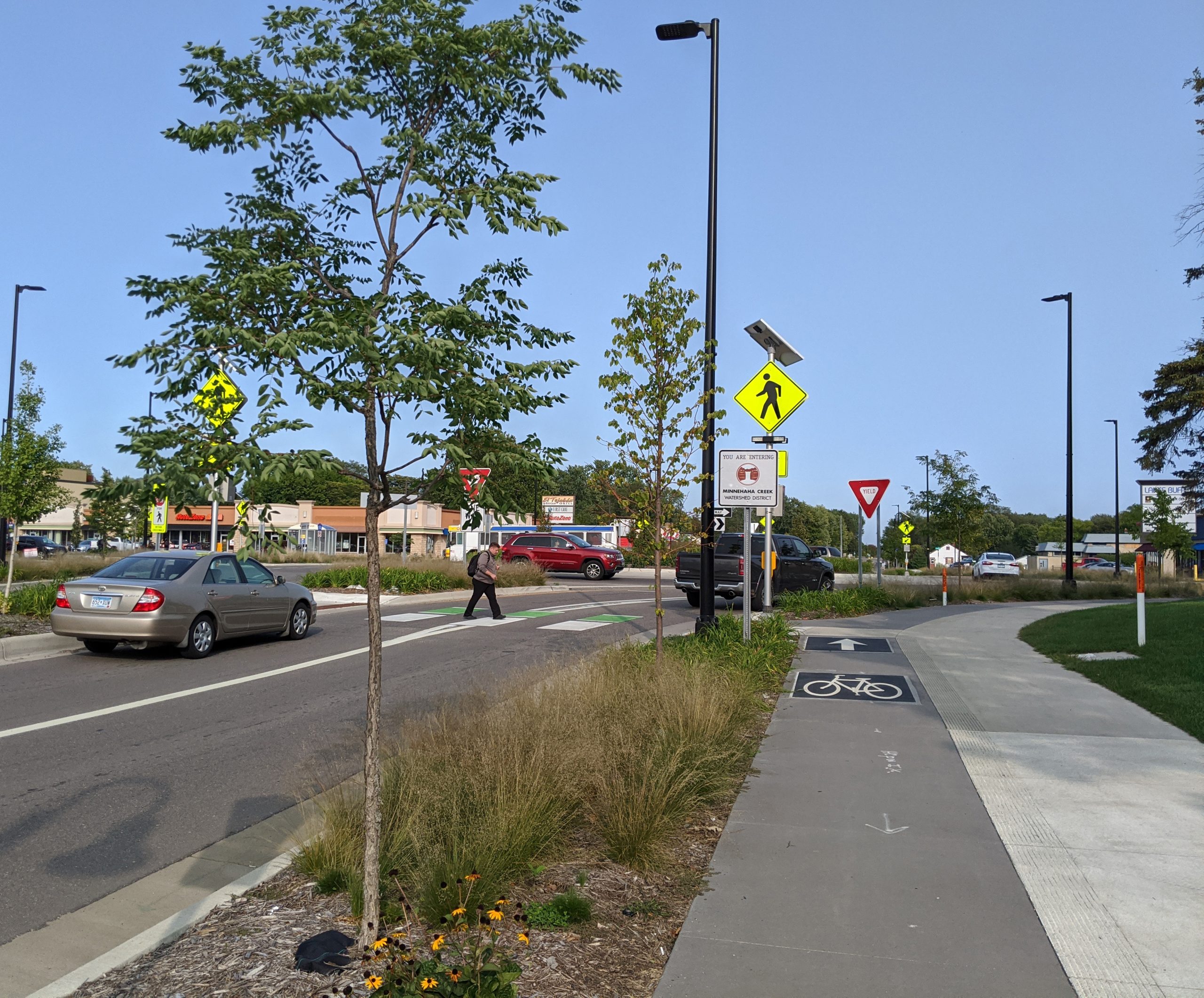
    66th and Nicollet Ave signal looking east (2017, before reconstruction)66th and Nicollet Ave roundabout looking east (2020, after reconstruction)

    66th and Nicollet roundabout

    66th and Nicollet Ave looking west (2017, after reconstruction)66th and Nicollet Ave looking west (2020, after reconstruction)

    66th and Nicollet looking west by Academy of Holy Angels.
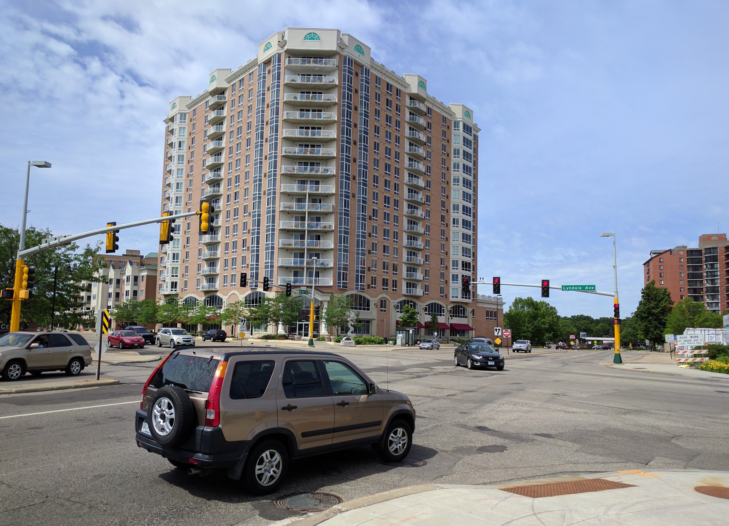
    66th St and Lyndale avenue, looking west (2017, before reconstruction)66th St and Lyndale avenue, looking west (2021, after reconstruction)

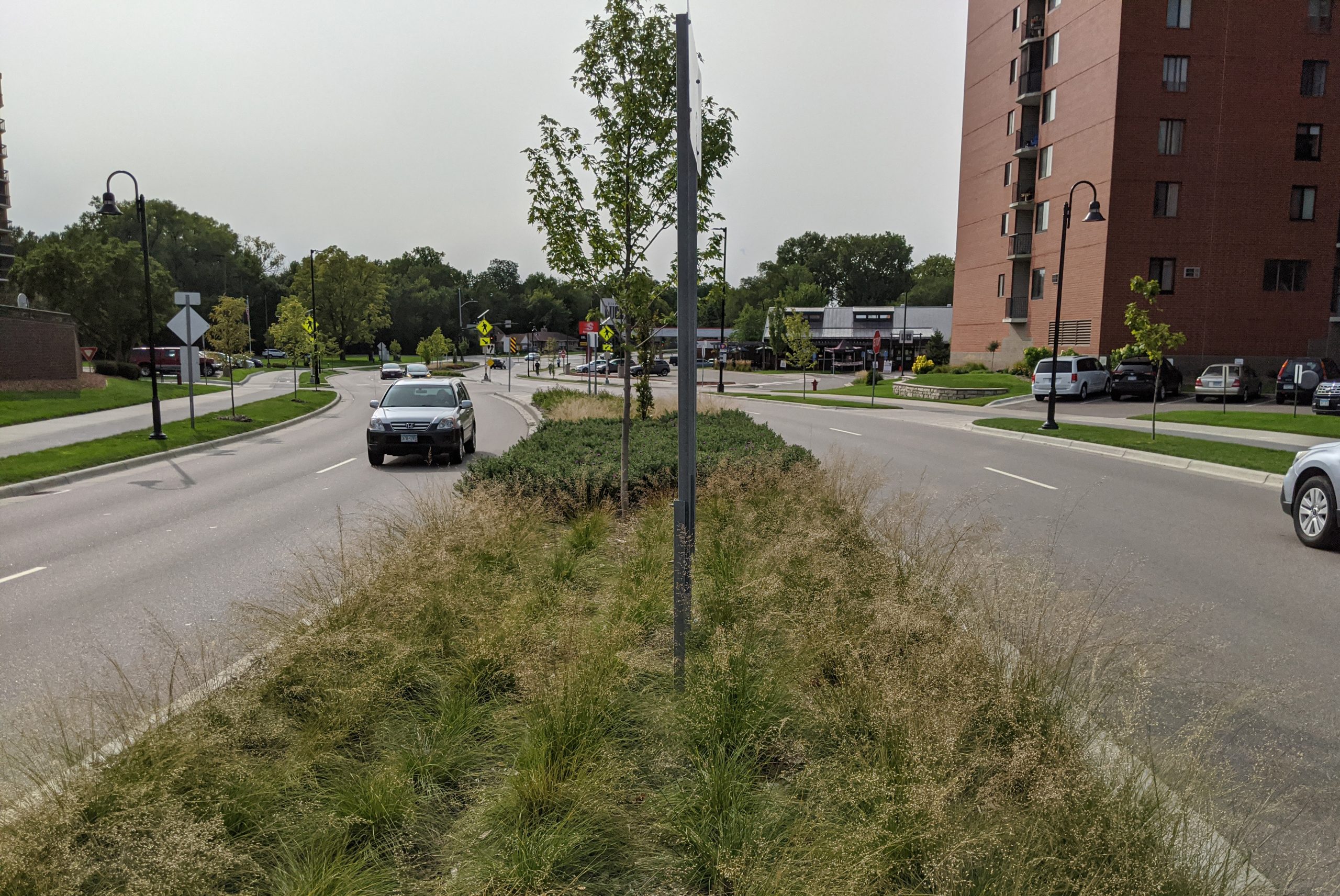
    66th and Lyndale looking west: Signal replaced with roundabout, and protected bikeway and green space added.
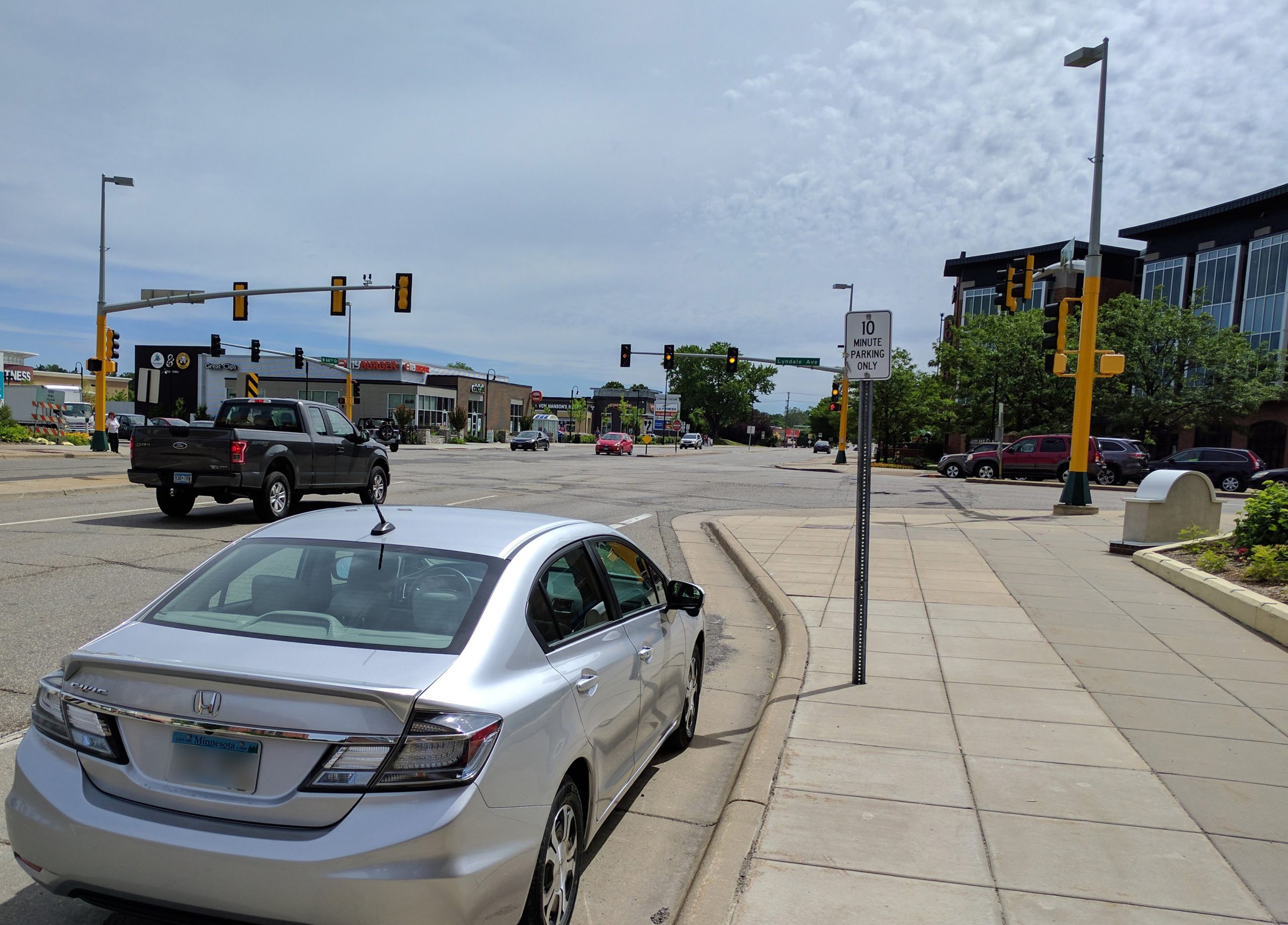
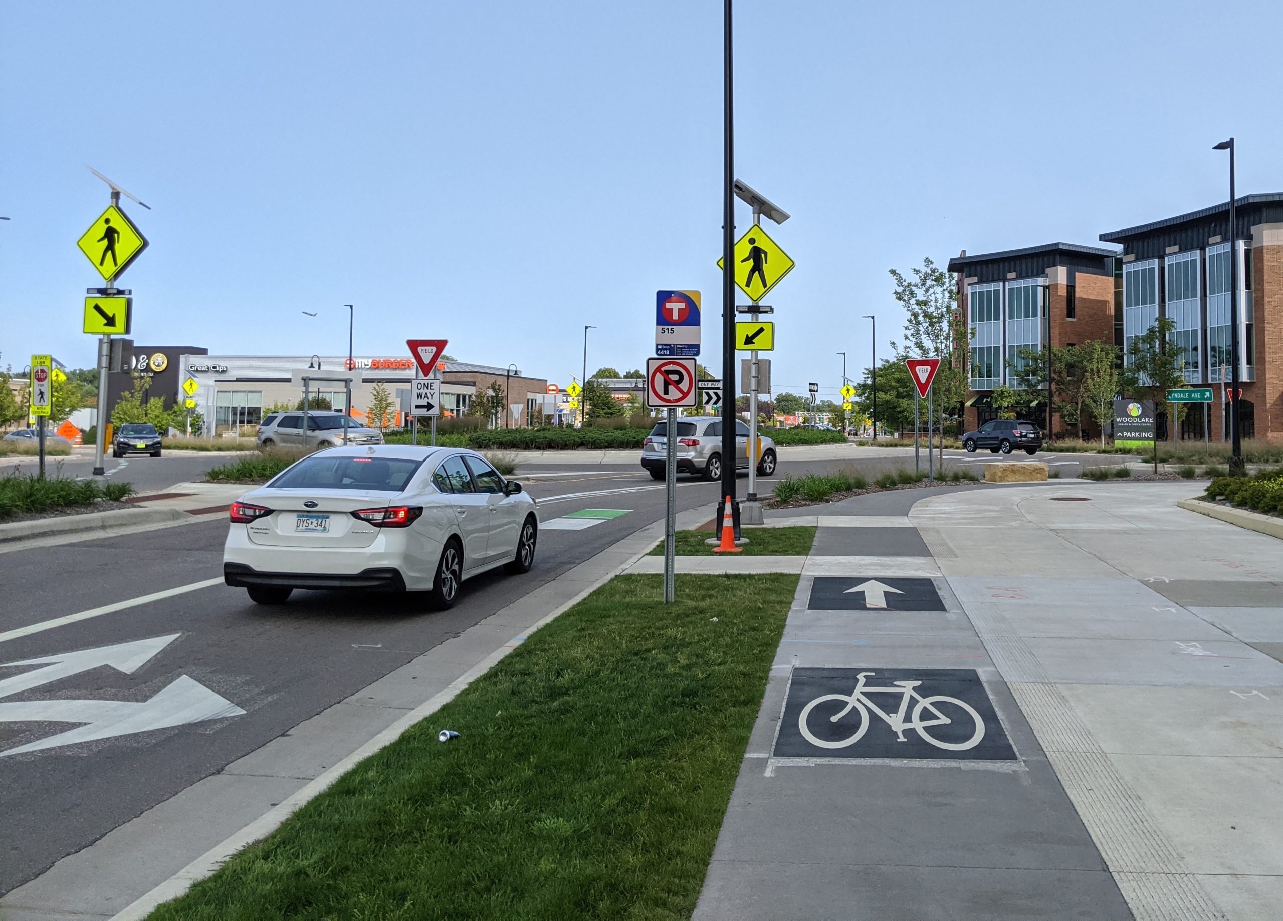
    66th St and Lyndale avenue, looking east (2021, after reconstruction)66th St and Lyndale avenue, looking east (2021, after reconstruction)

    66th and Lyndale looking east: Signal replaced with roundabout, and protected bikeway and green space added.
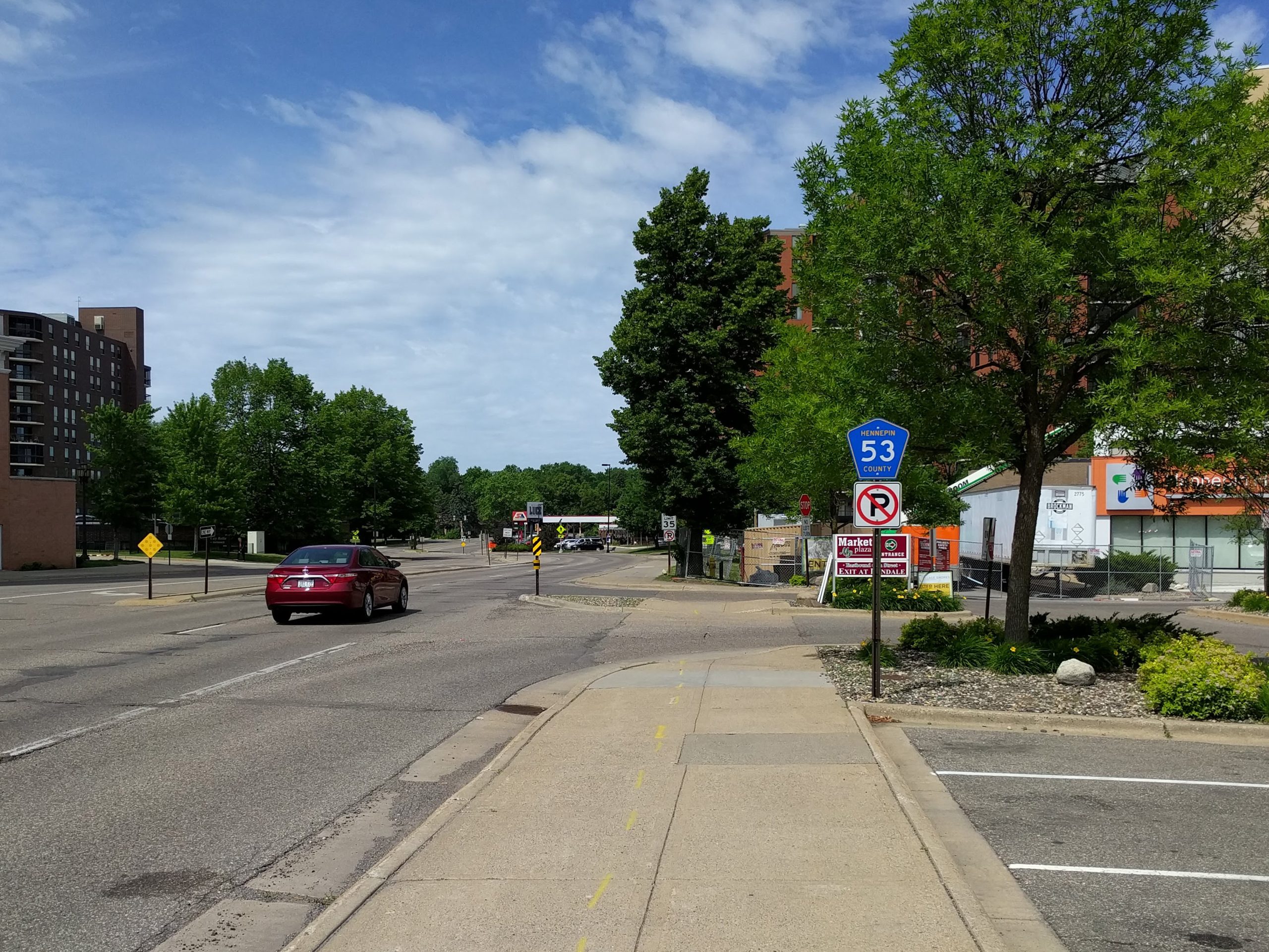
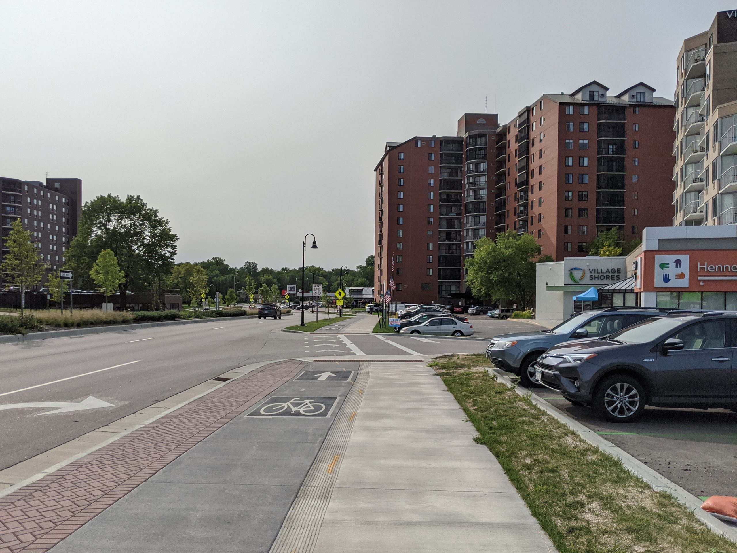
    66th St just west of Lyndale (2017, before reconstruction)66th St just west of Lyndale (2021, after reconstruction)

    66th just west of Lyndale: Looking west from the sidewalk.
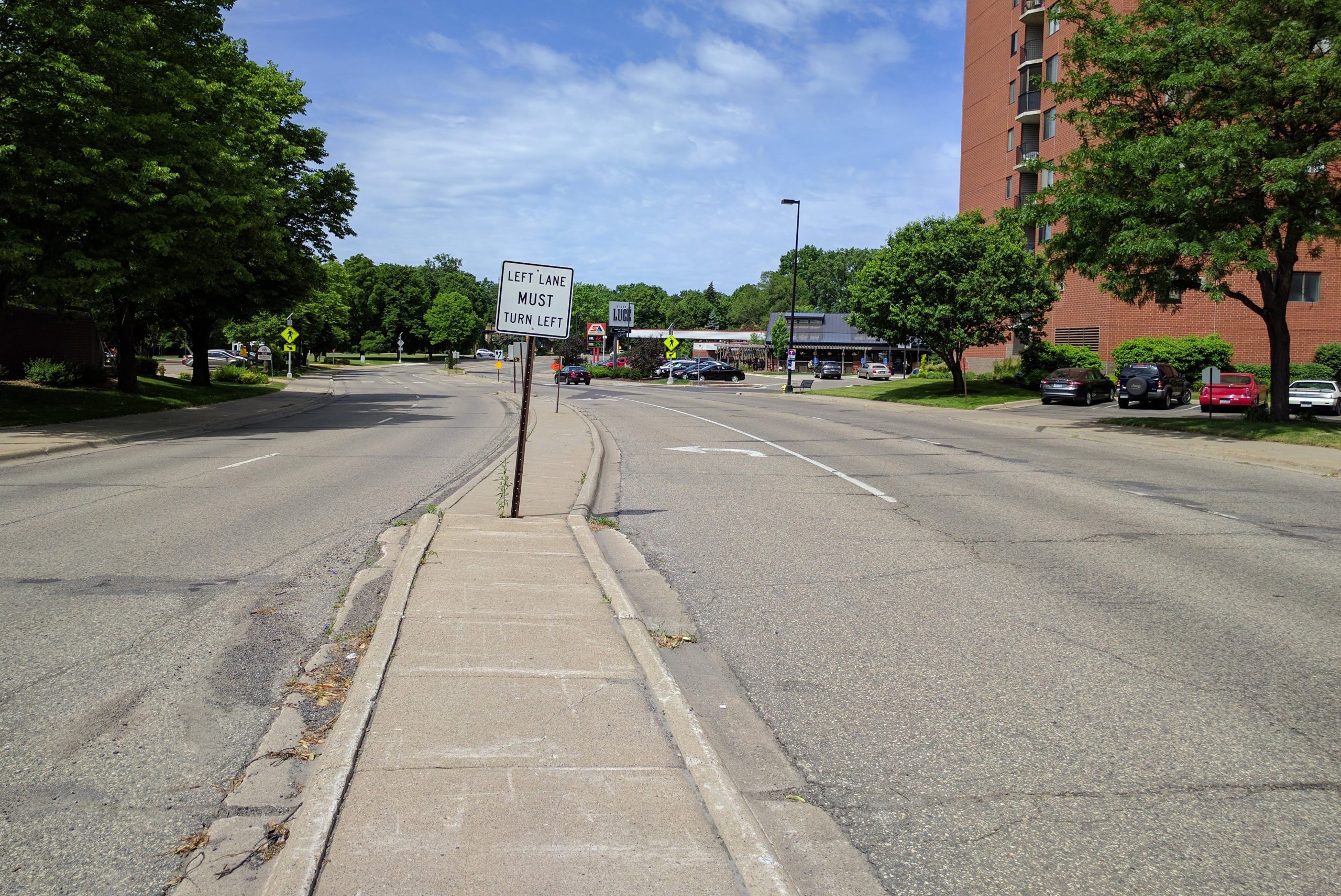
    66th St near Woodlake Dr (2017, before reconstruction)66th St near Woodlake Dr (2021, after reconstruction)

    66th near Woodlake Drive: Looking west from middle of the roadway. Note the increased green space behind the curbs, as well as the median.
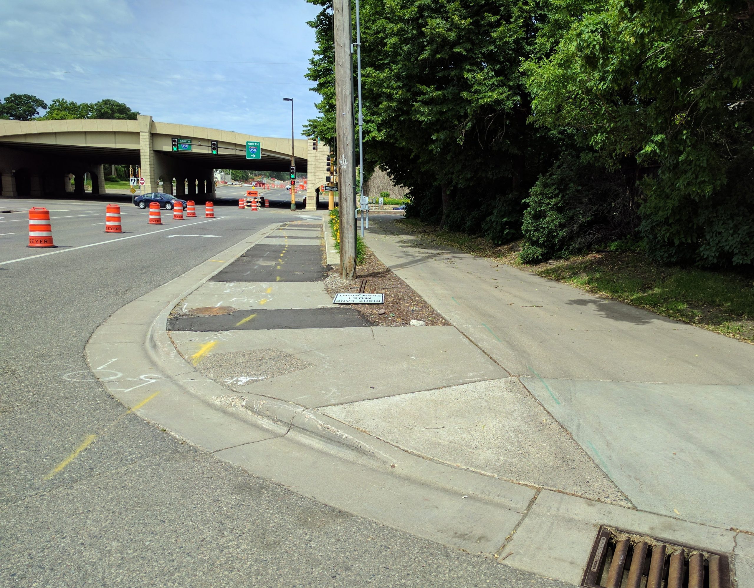
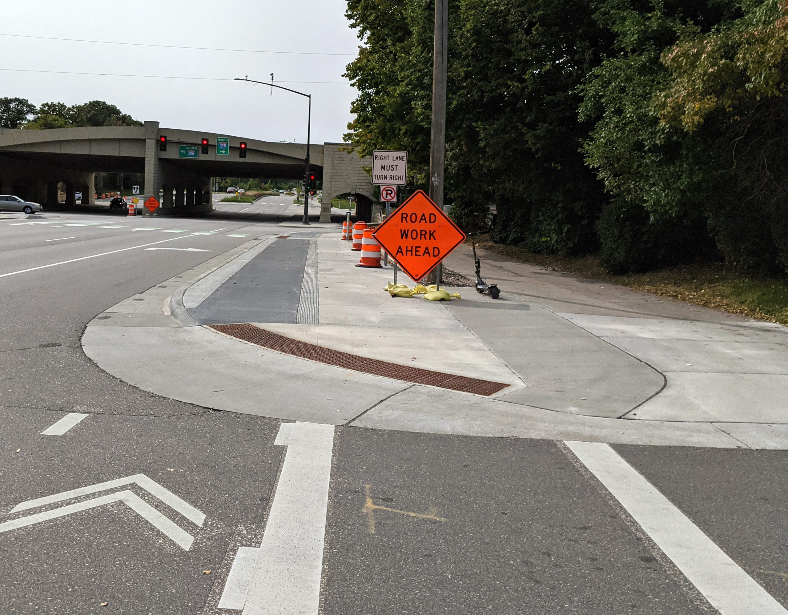
    66th St & Emerson Avenue: looking west (2017, before reconstruction)66th St & Emerson Avenue: looking west (2021, after reconstruction)

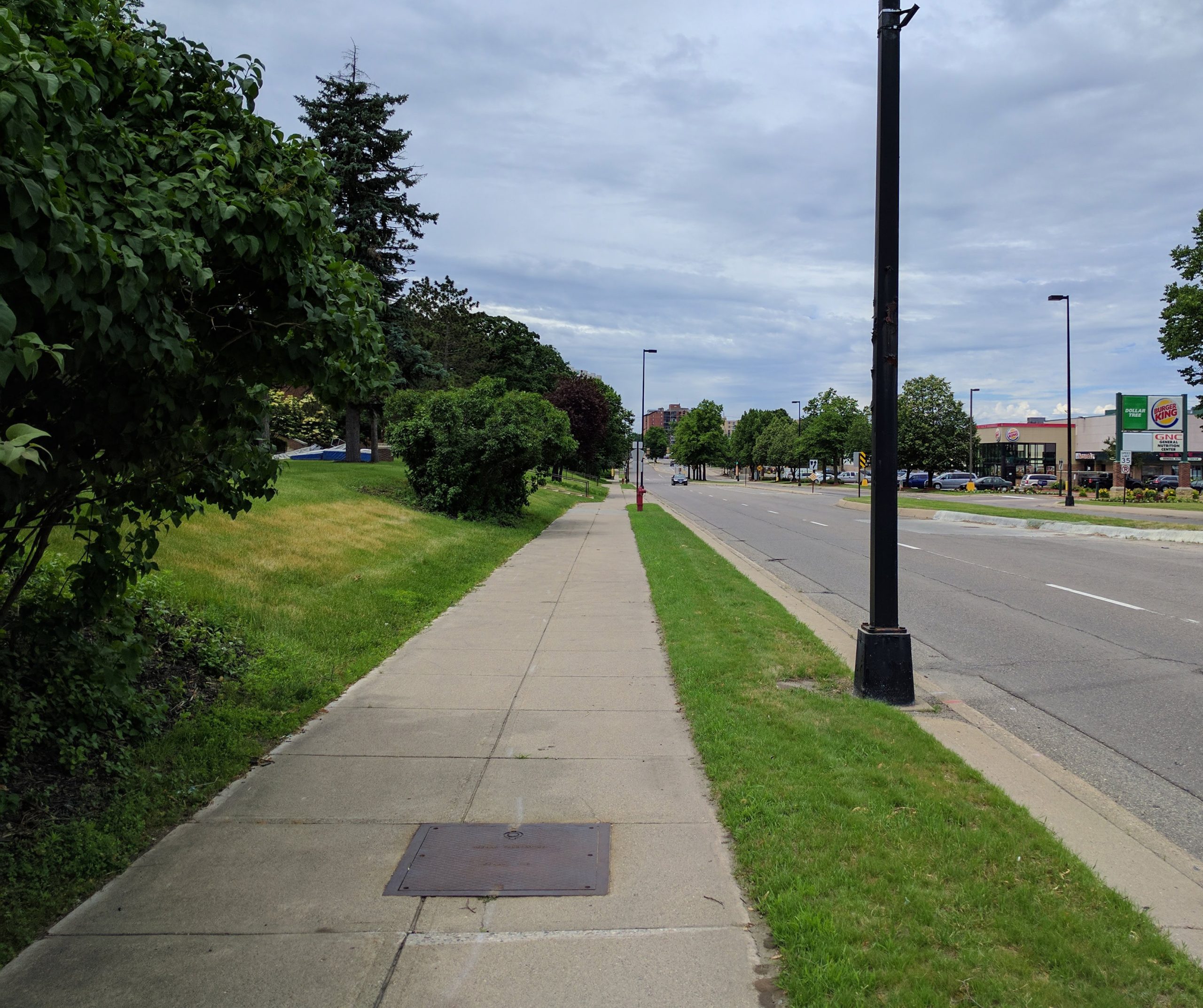
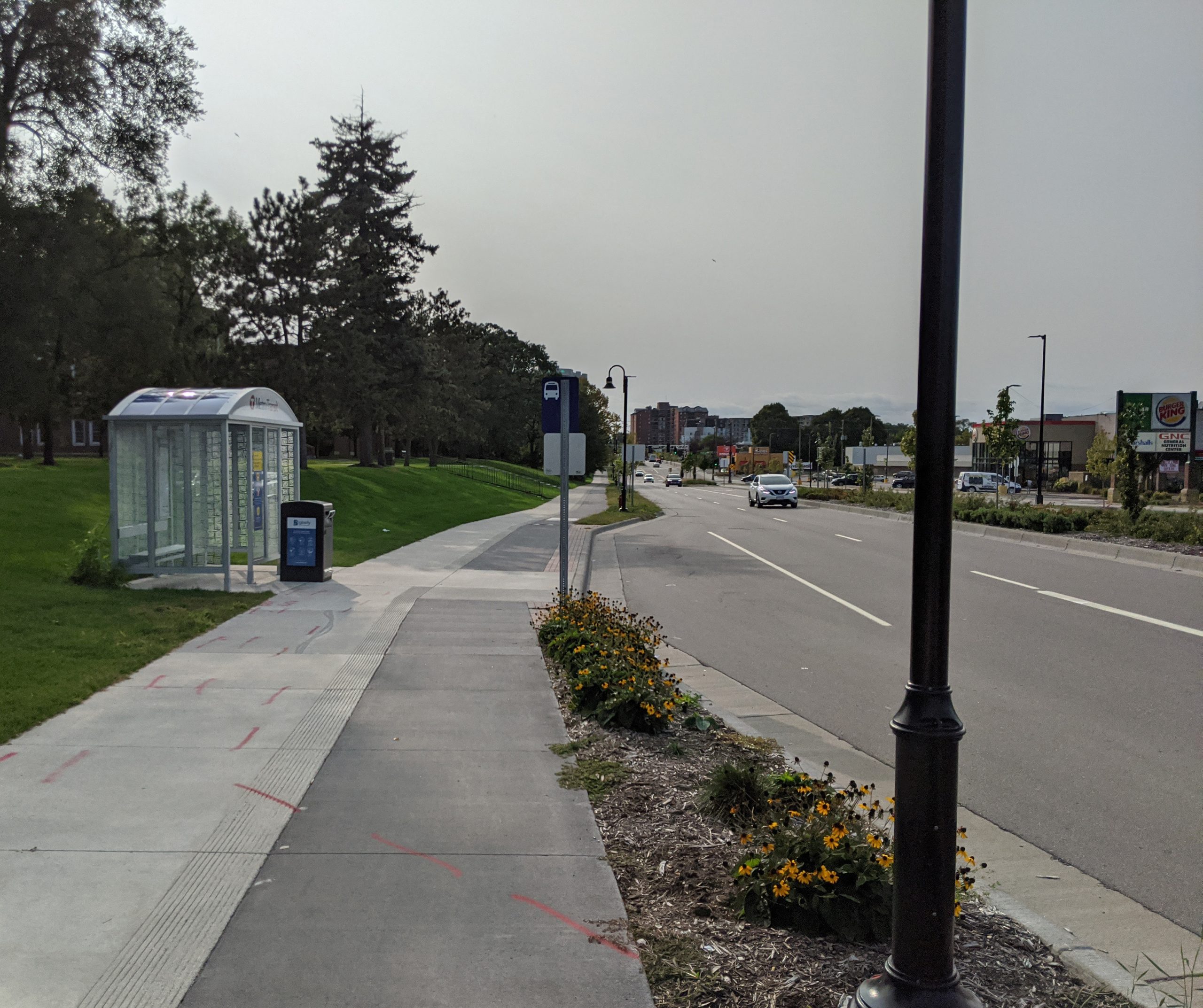
    66th & 35W: Looking west on the north side sidewalk. Unfortunately, the right-turn lane was retained, which makes this transit location less pedestrian-friendly.
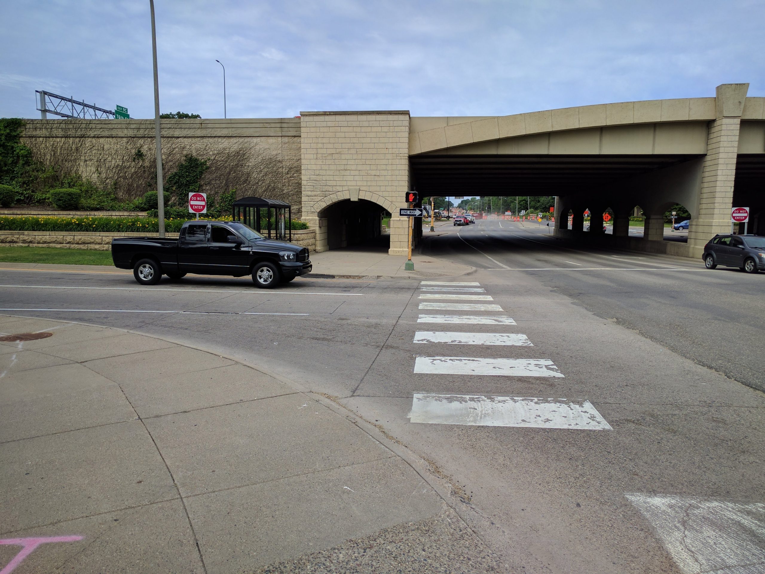
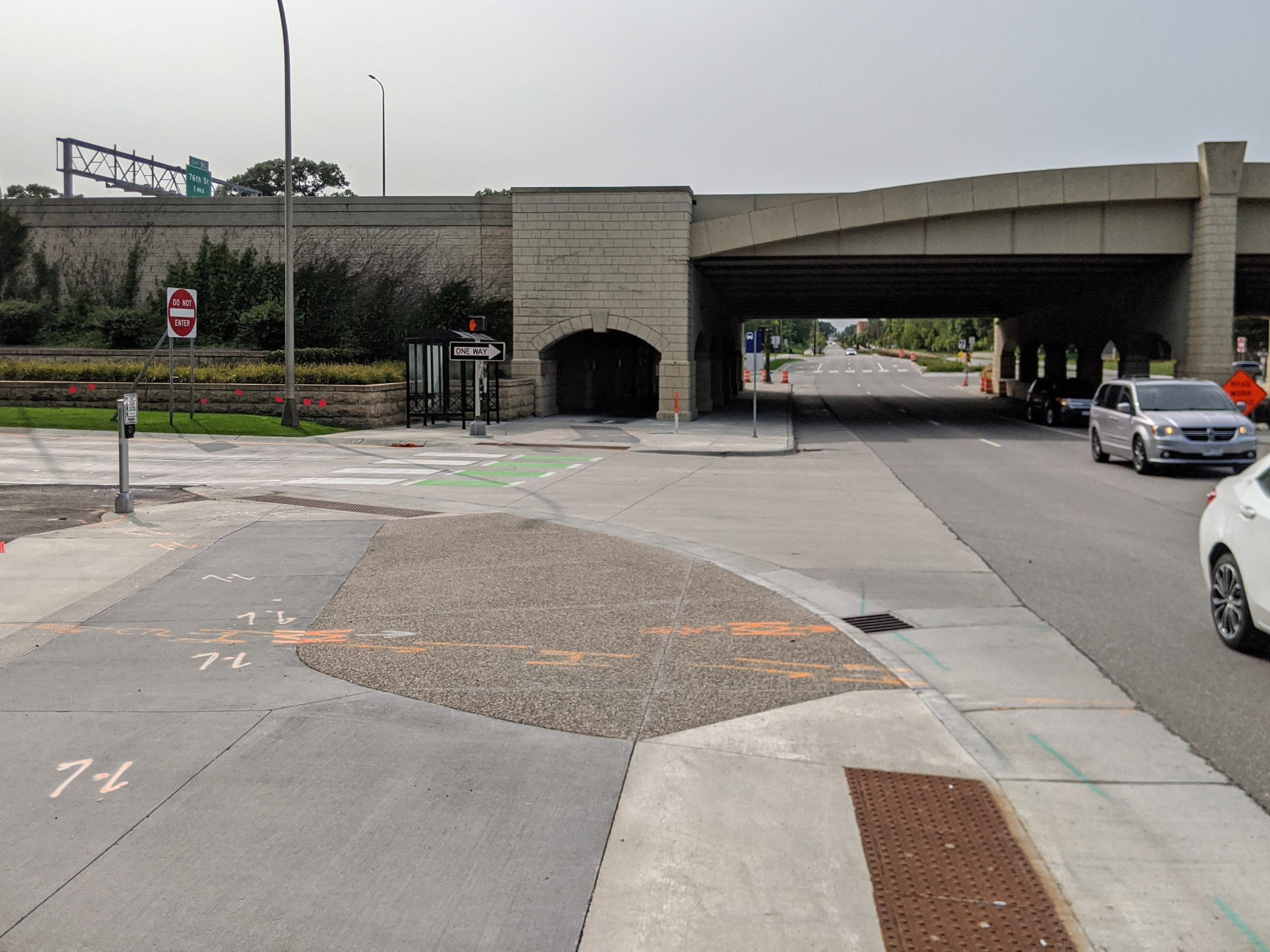
    66th St & I35W: looking west toward underpass on south side (2017, before reconstruction)66th St & I35W: looking west toward underpass on south side (2021, after reconstruction)

    66th & 35W: Looking west on the south side sidewalk
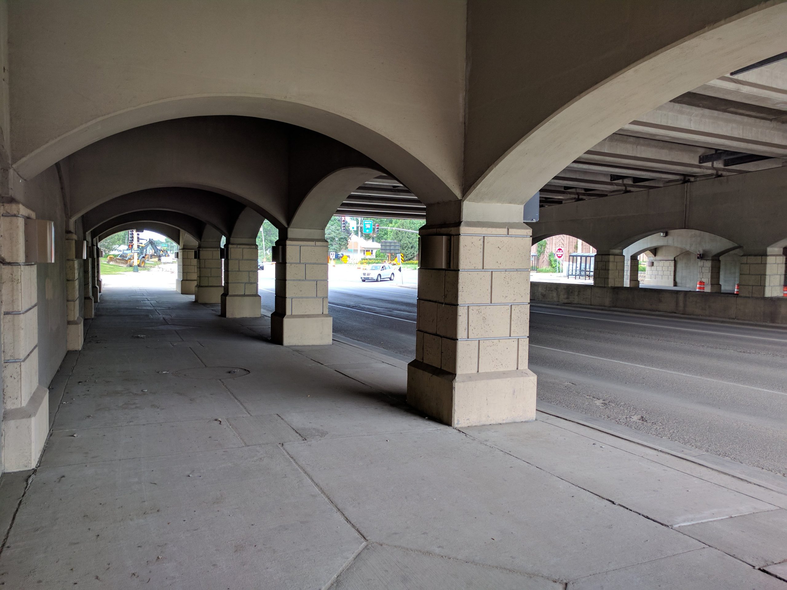
    66th St & I35W: under the bridge (2017, before reconstruction)66th St & I35W: under the bridge (2021, after reconstruction)

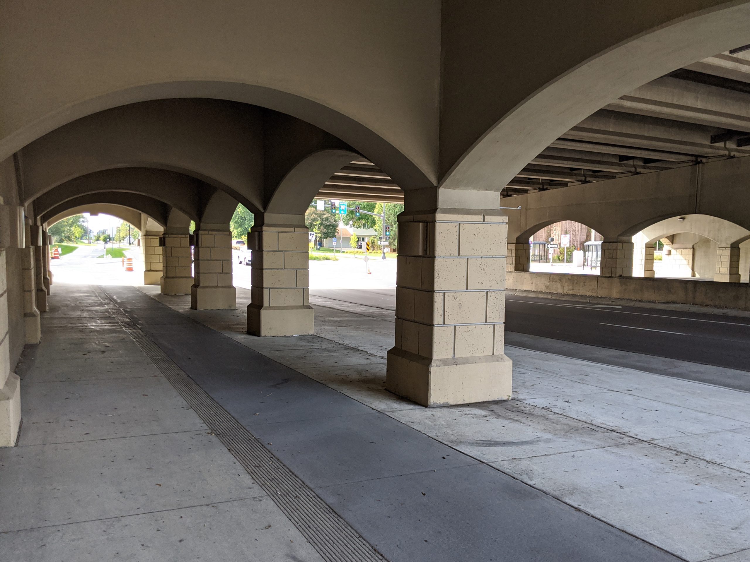
    66th & 35W: Under the bridge. The bridge was not rebuilt as part of this project, but the sidewalks were reconstructed to widen them and add the protected bike lane.

    West of 35W

    A divided 4/5 lane was used from 35W to Penn. In this section, 18 homes had to be removed to provide adequate right-of-way for the new street. This was by far the most controversial decision of the rebuild of 66th.

    West of Penn, because the road had already been widened in the 1980s, a compromise with the neighborhood agreed to contain the new street within the existing right-of-way.

    Unfortunately, the county prioritized maximizing car capacity over providing a dedicated bicycle facility in this section. As a result, the bicycle facility ends at Penn/Oliver Avenue. (West of Penn, the north side sidewalk is widened slightly from standard and serves as an 8′ sidepath to provide a limited off-street option for bikes.)

    I took my before pictures in 2017, and so I did not capture this section personally before construction began. Instead, I am providing Google Street View imagery of a few key locations.
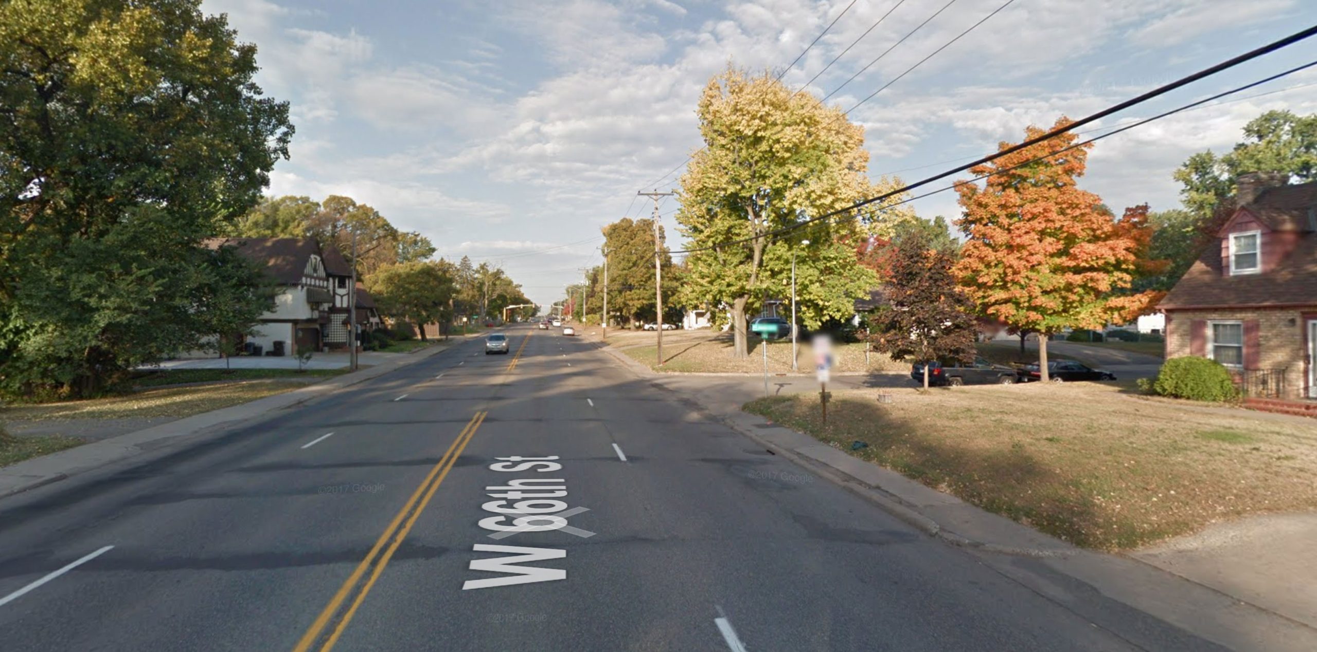
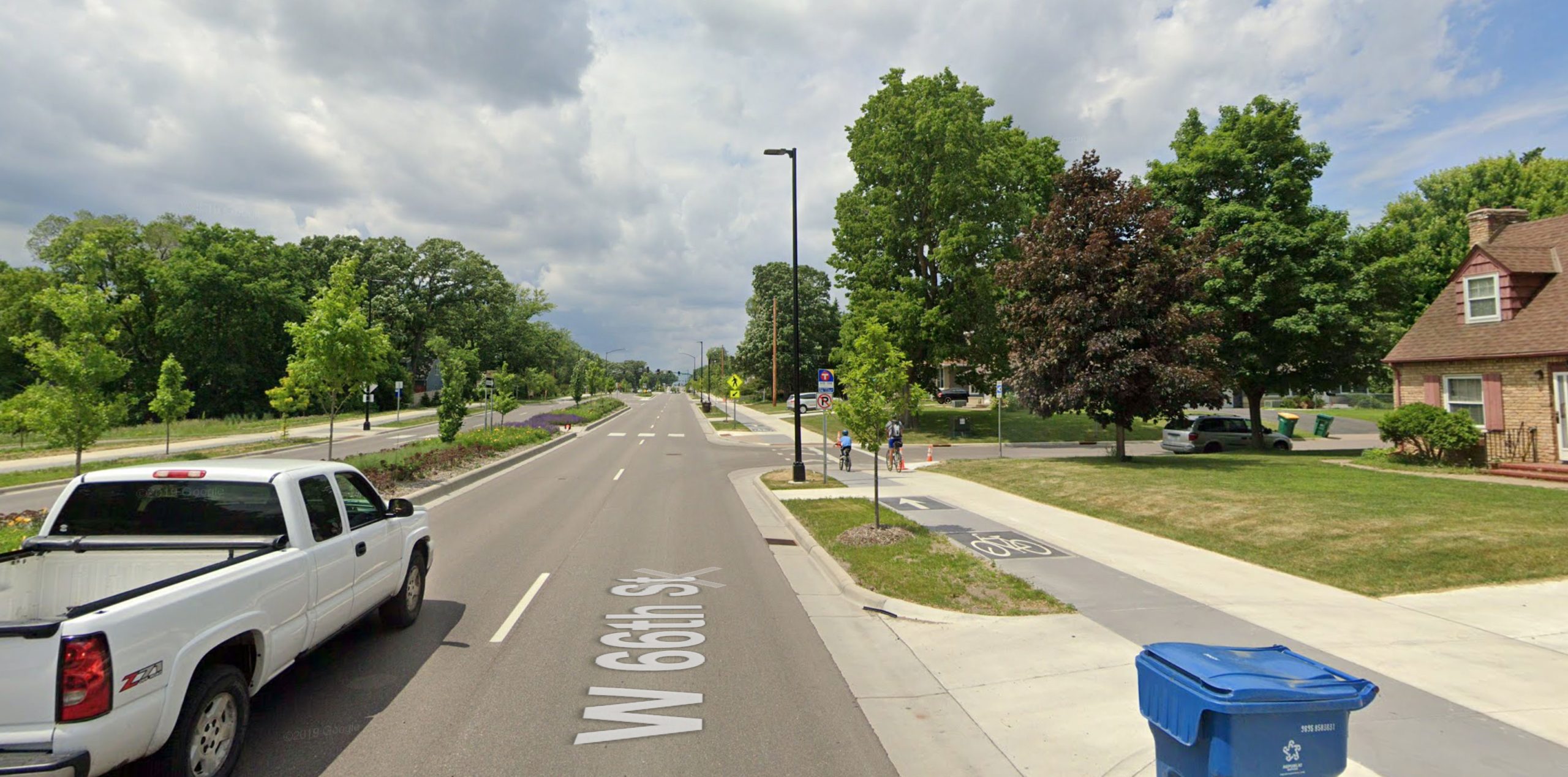
    Google Street View imagery: 66th and James Ave S (2014 before reconstruction)Google Street View imagery: 66th and James Ave S (2023 after reconstruction)

    66th and James Avenue in 2014 and 2023. Note the homes that were removed to the left, on the south side. One benefit at this particular intersection was providing much better access to Monroe Park, which was previously hidden behind the houses. Imagery: Google Street View.
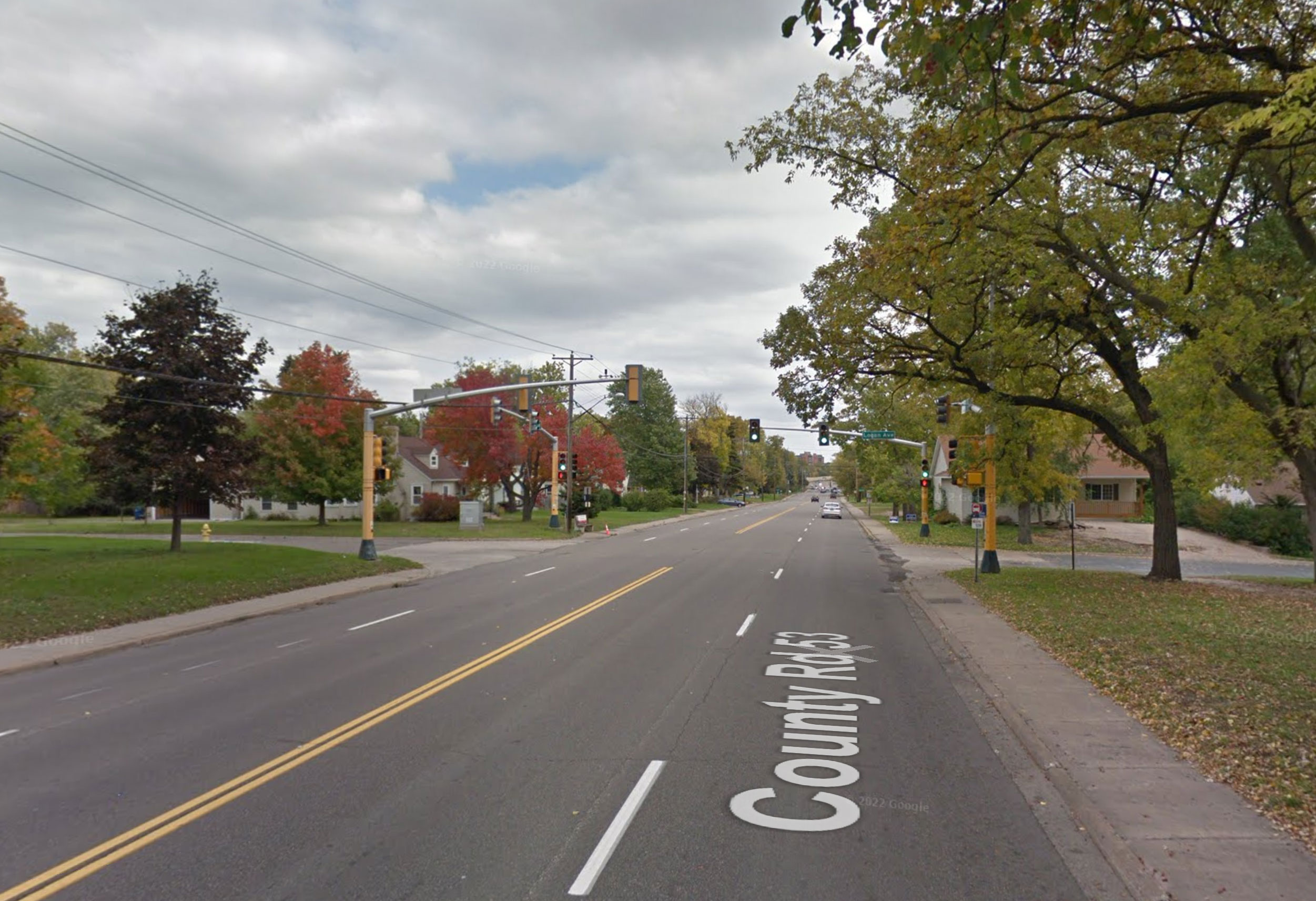
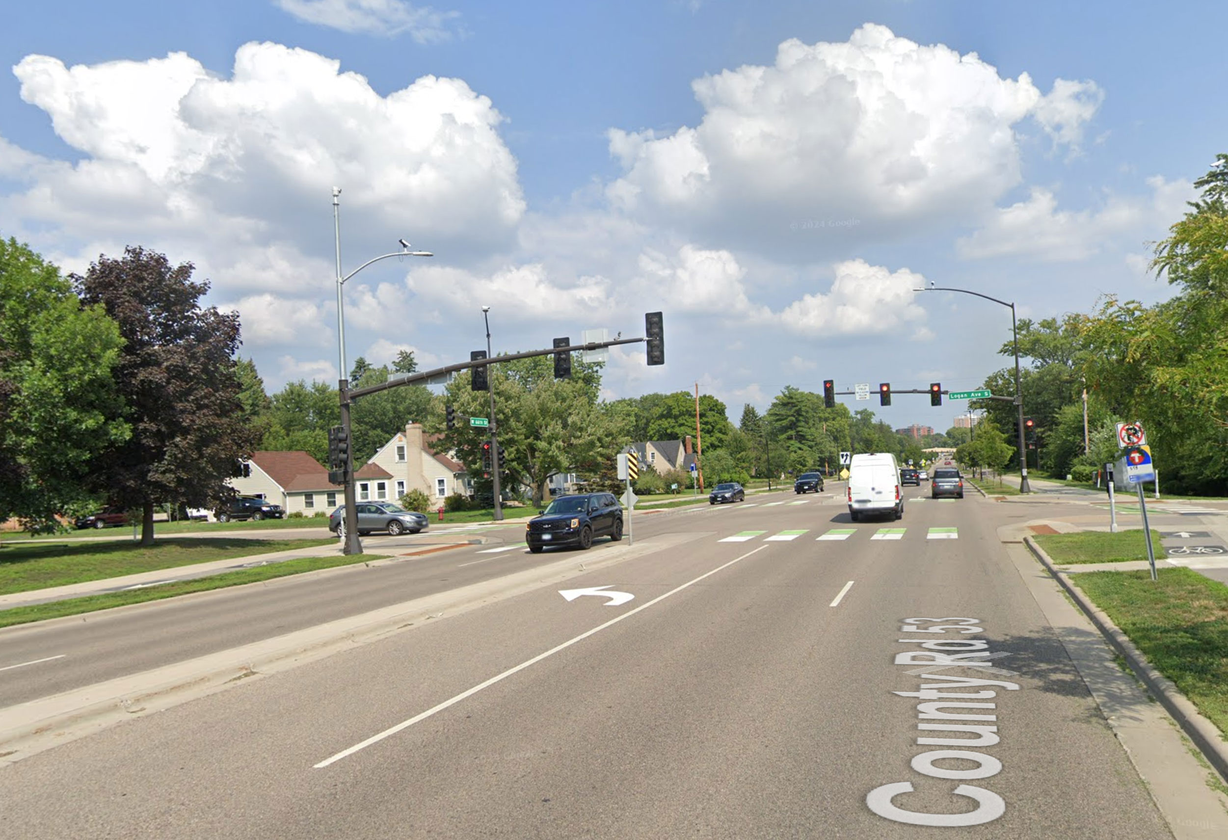
    Google Street View imagery: 66th and Logan Ave S (2014 before reconstruction)Google Street View imagery: 66th and Logan Ave S (2023 after reconstruction)

    66th and Logan Avenue in 2014 and 2023. Signals along 66th attempted to use the protected intersection concept, although in an effort to reduce right-of-way needs, the intended effect wasn’t really achieved. For example, bicycles aren’t detected going north-south here, so a cyclist must go over to the sidewalk and press the pedestrian push button anyway. Imagery: Google Street View.
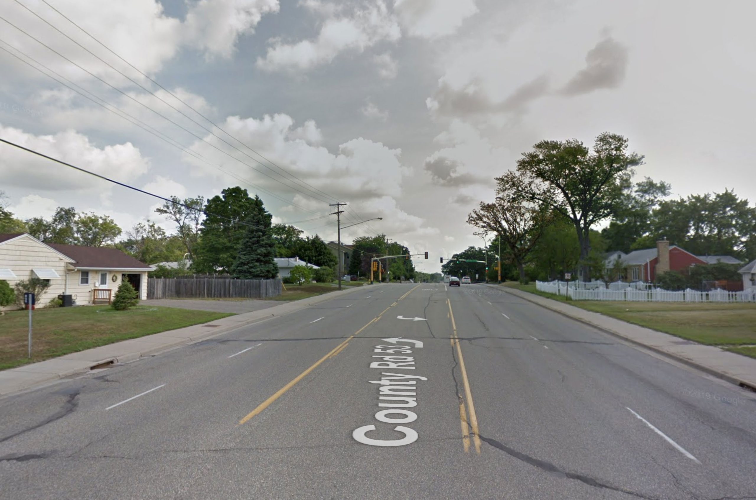
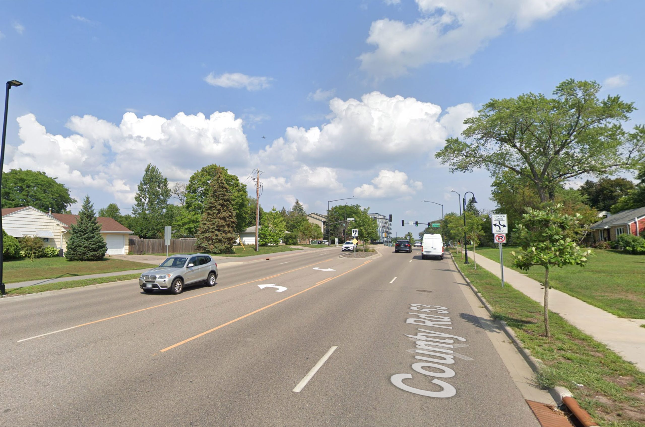
    Google Street View imagery: 66th and Sheridan Ave S (2014 before reconstruction)Google Street View imagery: 66th and Sheridan Ave S (2023 after reconstruction)

    66th and Sheridan Avenue in 2014 and 2023. This was the section where right-of-way was limited, and the county prioritized additional car capacity over continuing the bicycle facility. Still, a boulevard was added, as well as improved lighting. Imagery: Google Street View.
  • On the Cedar Lake Trail, St. Louis Park Rewrites the Law

    On the Cedar Lake Trail, St. Louis Park Rewrites the Law

    The City of St. Louis Park has a problem — a pretty good problem to have. They have two spectacular east-west trails, running through pleasant natural corridors, on their own rights-of-way. Those trails are the North Cedar Lake Regional Trail and the Cedar Lake Trail (this is often called the “Greenway”, since it becomes the Midtown Greenway at the Minneapolis city limits). But the real issue the City is having is that these trails intersect city streets and private drives at multiple points throughout the community. Unfortunately, these trail intersections have been home to serious crashes. Something had to be done.

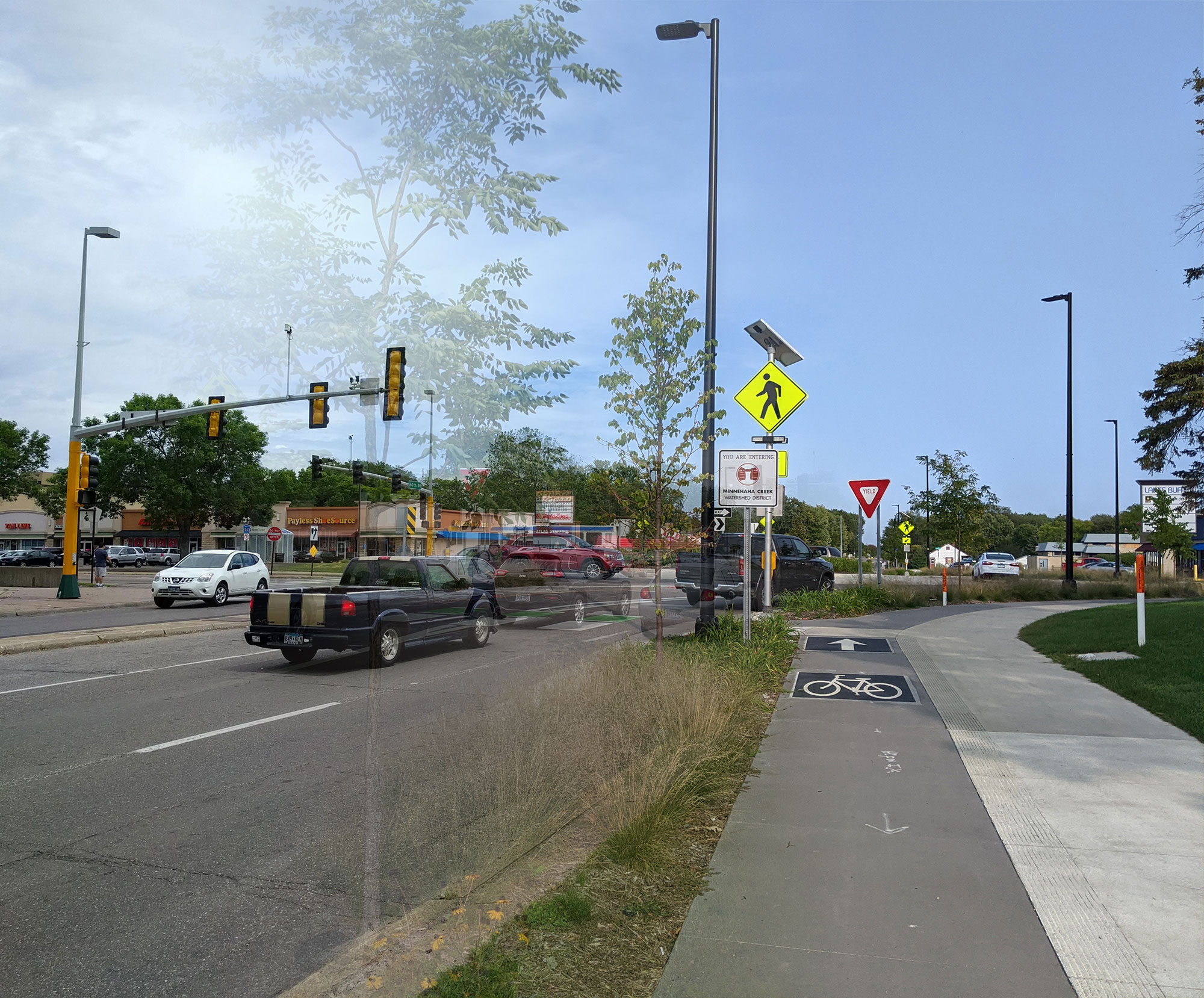
    How to make things safer? There are many solutions. You could install RRFBs or HAWK signals, to provide for safe crossing. You could install wide refuge islands, like Minneapolis did on E 28th St (below). More traditionally, you could just install crosswalk striping and signage to indicate that bikes and pedestrians may be crossing. Or, if you’re St. Louis Park, you could remove striping and demand even more emphatically that bikes and pedestrians yield to crossing traffic. And when that isn’t sufficient, you could make a video condescending to vulnerable users trying to cross legally.

    28th St and Midtown Greenway
    One approach: clearly demarcate that trail users have right-of-way, and offer physical protection. Permanent crosswalk striping has since been installed. Image: Google Street View.

    Crosswalk signage on Cedar Lake Trail
    A St. Louis Park approach: blame the more vulnerable user and try to deny their legal safe crossing.

    Callous, Ineffective Policy

    Bill Lindeke provided an excellent write-up of the issues in his MinnPost article earlier this week. From a local policy perspective, I think BikeMN’s Nick Mason hit the nail on the head:

    “If our answer to safety is that people with limited mobility have no right to cross a less-than-safe roadway, we need to pause and consider that it’s inherently problematic. By removing those crossings [St. Louis Park] didn’t increase safety; they decreased their liability.

    For anyone who’s ridden these trails, it’s clear that the methods aren’t just callous to the needs of pedestrians and cyclists — they’re completely ineffective. In my experiences, well over 90% of bicycles roll through the trail stop signs. Riding the N Cedar Lake Trail a few weekends ago, I did not see a single cyclist or pedestrian come to a complete stop at any of its many stop signs. So it’s clear that St. Louis Park’s methods to improve safety are questionable, and probably ineffective. But are they legally based? For cyclists, this is a sticky question I won’t get into at this point. But for pedestrians, the answer seems to be a resounding “No.”

    Looking at MN Traffic Law

    Most of the issues lie in the definitions in Chapter 169 of the state traffic code.

    The definition of vehicle is actually an important place to start. 169.011, subd. 92:

    Subd. 92.Vehicle. “Vehicle” means every device in, upon, or by which any person or property is or may be transported or drawn upon a highway, excepting devices used exclusively upon stationary rails or tracks.

    Street vs. Hwy
    I Am Traffic’s diagram showing a highway and its different (typical) components.

    This is in contrast to motor vehicle, which is defined as a special class of vehicle (self-propelled). “Vehicle” is a broader category that would include trailers, buggies, and bicycles.

    Next, let’s look at what makes something a “highway”. 169.011, subd. 81:

    Subd. 81. Street or highway. “Street or highway” means the entire width between boundary lines of any way or place when any part thereof is open to the use of the public, as a matter of right, for the purposes of vehicular traffic.

    Notably, “highway” is a much broader term in statute than it is in daily use. It refers to all types of streets or ways — and it refers to the entire area between the right-of-way lines, including the roadway, sidewalks, ditches, etc. Because we know bicycles are vehicles, and because we know regional trails are intended for their use, a trail in its own right-of-way is a “highway”.

    But what about an intersection? 169.011, subd. 36:

    Subd. 36. Intersection. (a) “Intersection” means the area embraced within the prolongation or connection of the lateral curb lines or, if none, then the lateral boundary lines of the roadways of two highways which join one another at, or approximately at, right angles or the area within which vehicles traveling upon different highways joining at any other angle may come in conflict.

    So, we know that bicycles are vehicles, and a trail intended for their vehicular use is a highway. A crossing of two such highways is an “intersection”. This all seems fairly straightforward. But what difference does that make for pedestrians crossing, without a crosswalk?

    169.21, subd. 2 (emphasis added):

    Subd. 2.Rights in absence of signal. (a) Where traffic-control signals are not in place or in operation, the driver of a vehicle shall stop to yield the right-of-way to a pedestrian crossing the roadway within a marked crosswalk or at an intersection with no marked crosswalk.

    Understanding the St. Louis Park Position

    So, knowing that the trail crossing is an intersection, and knowing that pedestrians have right-of-way at intersections with no marked crosswalk, I wanted to understand what the legal basis was for St. Louis Park claiming they did not have right-of-way. I wrote to Engineering Director Debra Heiser to ask these very questions. Heiser defended the video, and responded to me in some detail, but didn’t provide specific statutes on which she bases her understanding. She writes:

    The Cedar Lake Road Regional Trails are considered a Bicycle path intended for use by Bicycles and pedestrians.  It is designed for exclusive or preferential use by persons using bicycles and constructed or developed separately from the roadway or shoulder.    The Cedar Lake Regional trails are operated by Three Rivers Park District.

    Presumably, she is referring to 169.011, subd. 6, which defines “bicycle path”. But a bicycle path is clearly a component of a larger highway, the definition noting that it is “constructed or developed separately from the roadway or shoulder.” In fact, if you read the full chapter, “bicycle path” is not something that addresses right-of-way questions at all — most references refer to the right of people in motorized wheelchairs to use such paths. But being developed “for exclusive or preferential use of bicycles” (vehicles), it sure sounds like a highway, doesn’t it?

    Heiser referred me to a Three Rivers officer, to clarify the Park District’s position on these matters, but after two calls and a message left, I have not been able to reach him. Marketing manager Jacqueline Larson also reached out to me, to clarify that the video was not discouraging motorists from yielding to pedestrians when common sense dictated.

    In the end, though, I feel I need to let the video speak for itself:

    St. Louis Park "wrong" video